
|
|
Mountain/Rock |
|---|---|
|
|
43.90100°N / 71.4984°W |
|
|
3980 ft / 1213 m |
|
|
Overview
Sandwich Mountain is a beautiful mountain located just south of Waterville Valley, NH. If this peak was just twenty feet higher the mountain would be one of the most climbed peaks in the White Mountains. The mountain is easily accessible to I-93 and has a well maintained trailhead.Even though Sandwich Mountain is not one of the 4000 footers in New Hampshire, the mountain is still a popular hike in the White Mountains and definite is worth a trip.
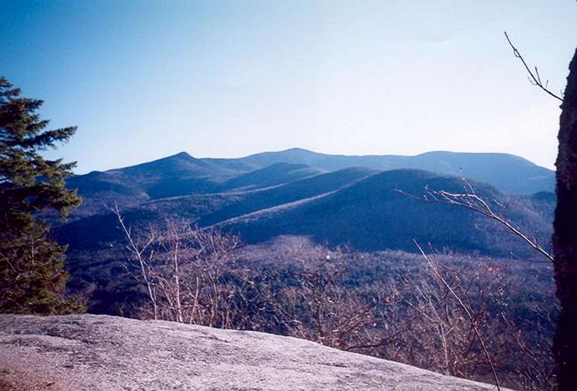
On a clear (which unfortunately I haven't had yet on the mountain) one can view the Tripyramids , Mt. Osceola and Mt. Tecumseh from the summit. There are also great views from the sub-summits of Noon Peak and Jennings Peak. Jennings Peak has often been viewed as having better views than Sandwich Mountain.
There are a number of routes up to the summit of Sandwich Mountain. The easiest route to the summit is the Drakes Brook Trail . This Class 1 trail climbs a moderate pitch to the Sandwich Mountain Trail intersection. From there it is any easy to moderate pitch hike to summit of Sandwich Mountain.
The Sandwich Mountain Trail (class 1-2 due to one very steep pitch) is much tougher and consist of the climbing steeply to the summit of Noon Peak before leveling out. The trail then climbs moderately to the summit of Sandwich Dome. Good views can be seen on Noon Peak as well as on top of Jennings Peak (class 1 but steep spur path).
The Algonquin Trail is the most difficult (class 2) route to the summit of Sandwich Mountain. It traverses the southwest shoulder of the mountain and class a number of Class 2 scrambles to the summit. Fine views though can be seen from this trail, making it very worthwhile.
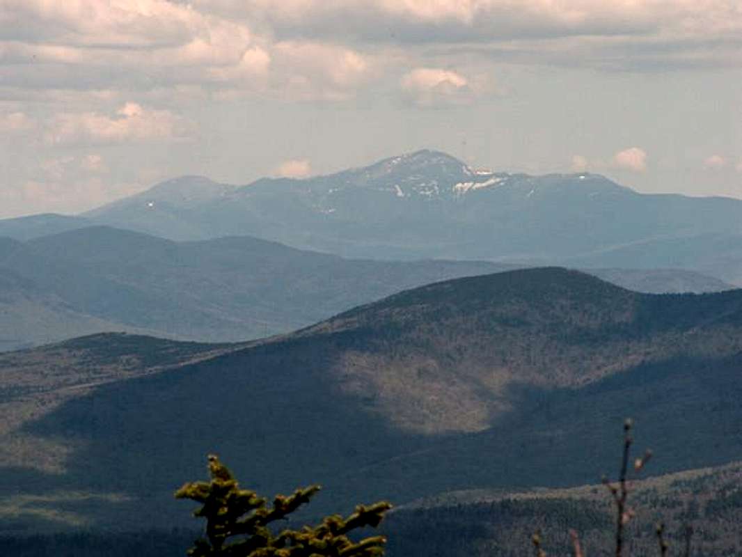
Great Close-Up of Mt. Washington
Getting There
VIA SANDWICH MOUNTAIN AND DRAKES BROOK TRAILHEAD: From I-93 get off onto Route 49 toward Waterville Valley. Stay on Route 49 past the town of Campton and up through the gap between Sandwich Mountain and Welch and Dickey Mountain. Continue up the road eleven mile to the trailhead which is on the right, just before the town of Waterville Valley.
VIA ALGONQUIN TRAIL: From I-93 get off onto Route 49 toward Waterville Valley. Stay on Route 49 past the town of Campton and up through the gap between Sandwich Mountain and Welch and Dickey Mountain. Pick up the Sandwich Notch Road on the right (seasonal, dirt road) six miles from I-93. The Algonquin Trailhead is located almost four miles on the left.
Red Tape
White Mountain Mandatory Usage Fee.
When To Climb
On the Sandwich Mountain Trail or Drakes Brook Trail, Sandwich Mountain can be climb at anytime without added a long trip. However the Algonquin Trail add 3.7 miles one way to the trail length (already 4.5 miles before adding Sandwich Notch Road) due to the closing of Sandwich Notch Road in winter.
On all of the trails proper winter gear as well as snowshoes, crampons and trekking poles are essential. An ice axe isn't nessessary but might be helpful on some of the steeper sections.
Camping
Sandwich Mountain can be easily done in day so there is little reason to camp while hiking the mountain. However if you like to do backcountry camping check out the Backcountry Camping Rules in the AMC White Mountain Guide (See Books).
There are also camping areas along Tripoli Road that only require a permit from Livermore Ranger Station and Livermore Camping Area about five miles north of Sandwich Mountain.
Mountain Conditions
Here are two websites that will provided you the best information on conditions on Sandwich Mountain.
Appalachian Mountain Club
Current Trail Conditions
Here is a link to the town of Waterville Valley.
Town of Waterville Valley
Weather
This is the best link to weather in Waterville Valley.

Weather in Nearby Waterville Valley
Summit Picture Log
Post all hero pictures here.