
|
|
Mountain/Rock |
|---|---|
|
|
37.94440°N / 105.5584°W |
|
|
13611 ft / 4149 m |
|
|
Access Update
Sadly, Pico Aislado can no longer legally be accessed via Cottonwood Creek. Your best access for this peak is now via South Colony Lakes and Broken Hand Pass.The message reproduced below comes courtesy of Steve Bonowski at the Colorado Mountain Club:
CMC has been notified by the Manitou Institute that they are no longer granting access across their property as of August 1, as directed to the staff by the Institute board. Access is available to the area through North Crestone trail; Willow Creek; and a temporary access via the Liberty Road gate to the south. There is access available to the peaks on the east side via either the South Colony Lakes drainage or the North Colony side.
The amount of requests has become too large to handle. In addition, there have been significant parking issues on the private property; people are camping on the private property without permission; and signs continue to be removed at the trailhead. Land management agencies will be posting their own no trespassing signs.
CMC is working with local interests, including some from the spiritual community, to find alternate access around the private property at the CC trailhead. One potential route was identified last month, but it can be accessed only via another entity's private property. Further meetings are expected over the next several months.
Sangre de Cristo Overview
The Colorado, Sangre de Cristo Mountains begin at North La Veta Pass and span 70 miles north to the small town of Salida, encompassing a quarter million acre of Colorado terrain. It is the most linear mountain range in Colorado. The narrowness of the Colorado Sangres -only 10-20 miles wide- makes for abrupt topography resulting in consistent 5000-6000-ft of prominence. The Colorado Sangres include 9 peaks above 14,000-ft including the massive profiles of Crestone Peak, Crestone Needle and Kit Carson, all visible from the small town of Westcliffe. Another 90 peaks above 13,000-ft reside here, including 6 more centennial thirteeners. The entire Sangre de Cristo Range stretches past our border another 130 miles south into New Mexico and terminates near Sante Fe, making this range the longest fault-block range in the world.
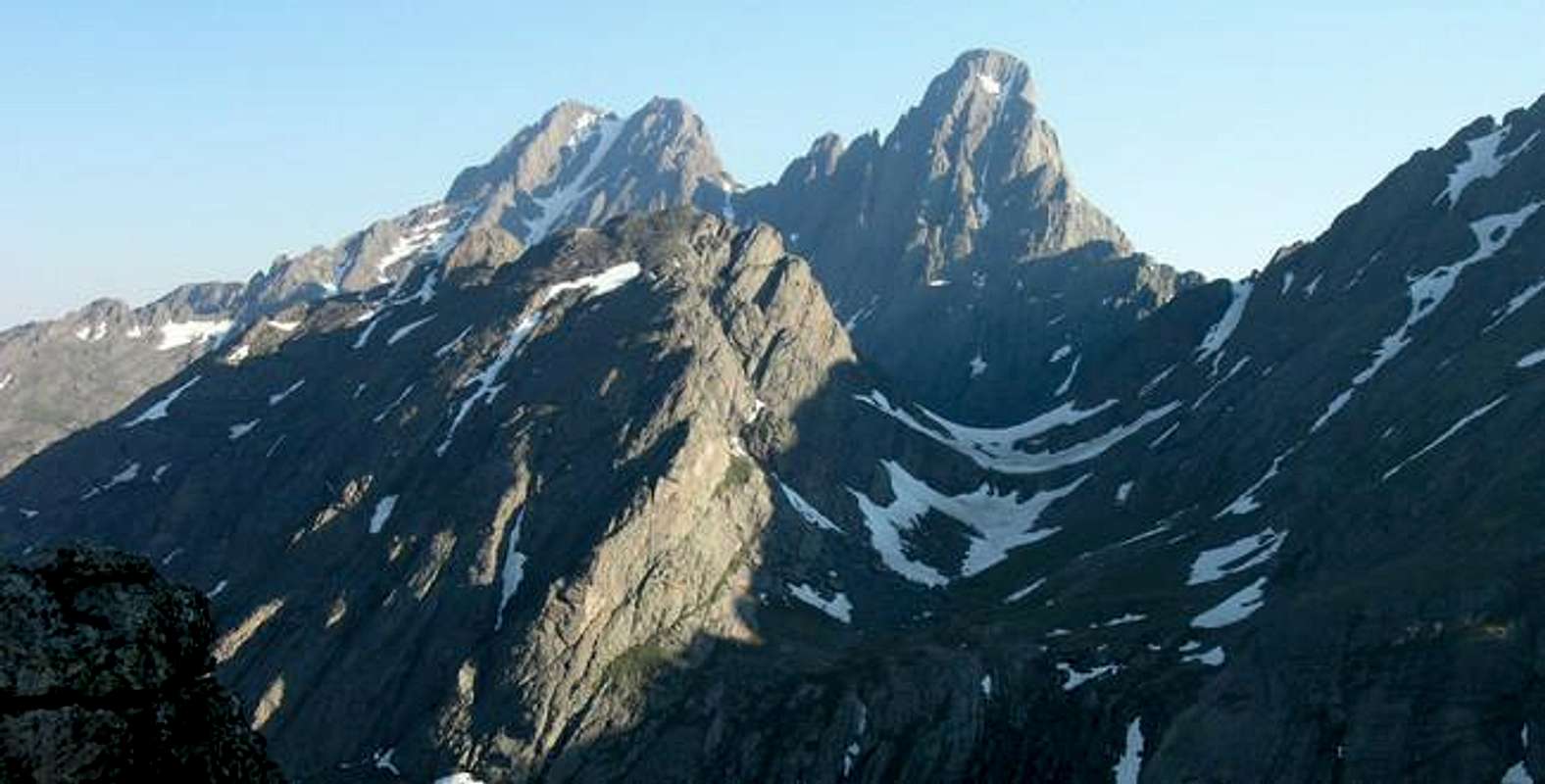
Pico Asilado Overview
It makes perfect sense to split the Colorado Sangres into three main groups: North, Central/Main and South/Sierra Blanca. Undoubtedly the most scenic and dramatic section of Sangres resides in the central portion of this range. The Crestone Group (The Needle, The Peak & Broken Hand) and the Milwaukee Massif (Milwaukee Peak, Tijeras Peak, Music Mountain and Pico Asilado) are bounded by high sweeping ridges, with no saddles under 12,000-ft except for Medano Pass and Hayden Pass. Access to the Crestone Group is generally good. Access to the Milwaukee Group is generally bad. Two of four mountains in this group are very remote, in fact, one of them is named for its remoteness; it’s called Pico Aislado (Colorado Mountains-Ormes &Jacobs.)
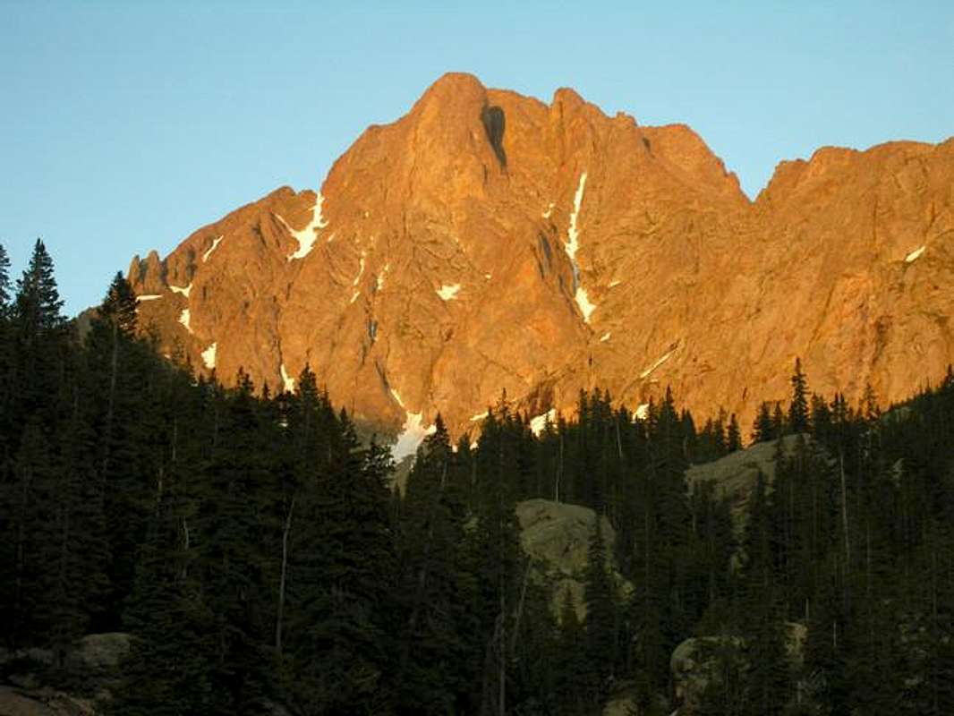
At 13,611-ft, Pico Aislado is Colorado’s 188th highest summit. Its luring and mystical summit block is protected by two of the areas most rugged drainages, the Cottonwood Creek Drainage and Deadman Creek Drainage. Both drainages reside on the west side of the range, leading to the rightfully earned reputation for annoying red tape, and long, difficult approaches. The Deadman Drainage is off limits; however, the Cottonwood approach is available for those that sign a waiver releasing the Manitou Foundation of any responsibility involving your safety after crossing their land (see Red Tape).
Cottonwood Creek Approach
The Cottonwood Creek approach to Pico Aislado, Crestolita, Broken Hand and the Crestones is not for everybody, especially when armed with a heavy pack. Typically, a climb involving mountains from this approach warrants a two day, one night stay. If you sport some bad knees you might want to think twice about this approach. Also, I would highly recommend attempting this route when there is a nice high-pressure weather system parked over the Sangres, any rain could make the upper portion dangerous, more on this later. Lastly, if attempting in early spring, bring a full bottle of DEET, the mosquitoes that frequent the terrain below 11,000-ft have been waiting for your blood patiently and are not shy.The initial 3 miles of trail is easy to follow and can be easily covered in the dark with a headlamp. After a nice 3 mile/2000-ft warm-up, the remaining mile/1000-ft will challenge anyone with a full pack. The trail will disappear and reappear about every 50-100-ft. so be prepared for tricky route finding up steep forested slopes riddled with even steeper 'boilerplate slabs'. Much of this last section of difficult trail is loaded with steep rugged, and sometimes smooth rock. When wet, these ‘boiler-slabby’ sections may be dangerous for a descent with a heavy pack, and certainly wouldn’t be much fun.
The West Face Route
The few that climb Pico Aislado usually climb it via the East Ridge Route from Milwaukee Peak with an approach from Upper Sand Creek Lake. This route seems to be the standard and premier route for Pico Aislado, however it is a challenging and exposed class 4/5 route. The excellent Garrett & Martin guidebook does not recommend going from Pico back to Milwaukee due to the danger factor of such an exposed down climb from the summit block of Pico. I have to agree with this recommendation. I got a real good look at the east face of Pico, and that down climb is way beyond my capabilities. If you try that route, bring a rope and some good weather.From the summit, Garrett and Martin recommend a descent of the west ridge and over UN 13,020 B. Obviously this route is a logical choice for an ascent as well. Given the easy class 3 nature of the route, it is not an easy summit to attain. The West Face Route from the Cottonwood TH makes sense for most with a 2-day commitment. Day one starts with a brutal approach of 4 miles & 3000-ft of v-gain to a high basin. Day two requires 2 miles/2,600-ft of v-gain and 6 miles/5,600-ft of descent, most of it with a heavy pack. Consider day two a day your knees may never be the same.
Getting There
(Per Ryan Schilling)Cottonwood Creek Trailhead: For this approach, first refer to the Red Tape section for information on private property at the trailhead. This route shares an approach with the Cottonwood Creek route up to the Crestones, which you may already be familiar with.
Drive on CO-17 to the small town of Moffat, 13.2 miles south of that highway's intersection with US-285 or 36 miles north of its intersection with US-160 in Alamosa. Turn east onto Saguache County Road T, drive 13.2 miles, and turn right onto Camino Baca Grande Road, which is just short of the town of Crestone. Take Camino Baca Grande Road for 5 miles as it passes through a rural residential development. Park near a large water tank on the east side of the road, but do so alongside the road and not on the private property adjacent to the water tank. Then locate the unmarked trail (it starts off as an old dirt road) on the west side of the road.
Red Tape
(Per Alan Ellis)Pico Asilado is located within the Sangre de Cristo Wilderness. Typical wilderness restrictions apply. Contacting the managing agencies is the surest way to get up-to-date information.
No permits required. Pico is located in the Sangre De Cristo Wilderness. Please observe wilderness protocols during your visit.
The Cottonwwod Creek TH is located within the private property of the Manitou Fondation. Please observe land owner's rights, obtain permission for entry and remain on designated trails.
IMPORTANT NOTE!
SP member Clyde Lovett submitted this entry concerning the western routes, but his message was not integrated until this page changed hands:
Author: ClydeLovett
Date: July 27, 2002 10:21 AM
The land we cross to hike along Cottonwood Creek on the way up to Crestone Peak and Crestone Needle belongs to the Manitou Foundation (spirit@manitou.org). I have spoken face to face with these folks about we hikers crossing their land. They request that all hikers check in with them and sign a release form before crossing their land. I have indicated their email address above. Their postal address is PO Box 118; Crestone, CO 81131.
Mountain Conditions
(Per Ryan Schilling & embellishments by Kane)The US Forest Service is your best bet for determining current snow conditions and gathering other such information. The San Carlos Ranger District (719-269-8500) of San Isabel National Forest is responsible for the Sangres east of the range crest. Another good contact number for the east side is the Westcliffe Ranger Station (719-783-2079). The Saguache Ranger District (719-655-2547) of Rio Grande National Forest is responsible for the Sangres west of the range crest.
Click image to enlarge
Click here to view a 7-day forecast for the immediate area of Pico Asilado at 12,395-ft

Credits
Colonelpyat-my climbing buddy-thanks for putting up with all of my "oohs and aahs" and all my thinking out loud-like usual.Ryan Schilling-thanks for allowing me to use some of your text from your excellent Sangre pages.
Alan Ellis-thanks for allowing me to use some of your text from your excellent Sangre pages. Oh ya, I'm not your base camp bunny!