
|
|
Mountain/Rock |
|---|---|
|
|
46.29601°N / 9.05563°E |
|
|
Hiking, Scrambling |
|
|
Spring, Summer |
|
|
8946 ft / 2727 m |
|
|
Dedication
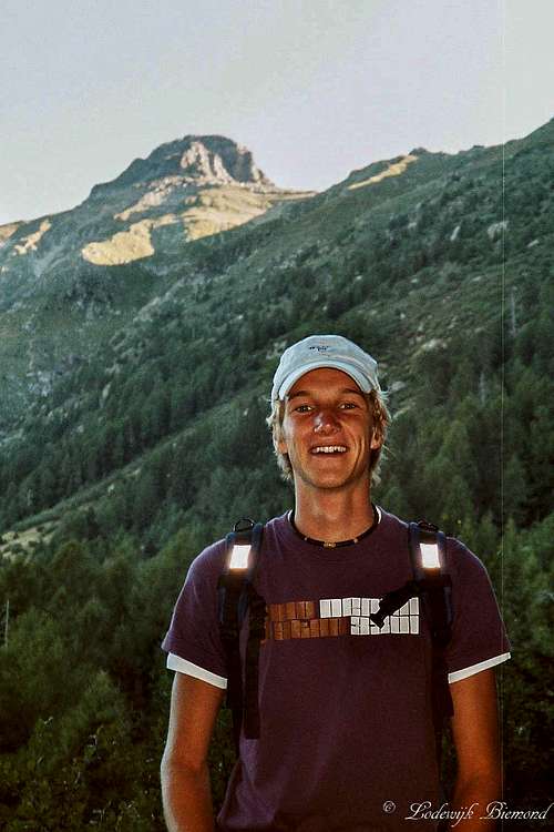
Coen in front of Pizzo di Claro
In the summer of 2003 we climbed our first "real" mountain together: Pizzo di Claro. A year later, in 2004, we climbed "the Pizzo" once again. This was supposed to be the start of many journeys to come, but sadly it did not turn out to be that way... I miss you Coen, Hakuna Matata!
Overview
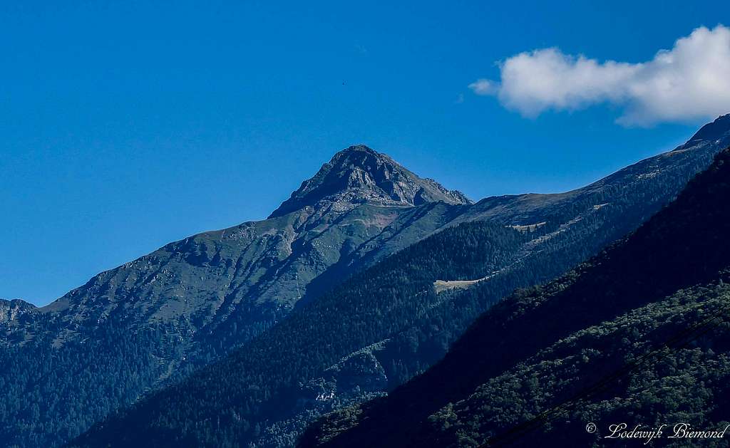
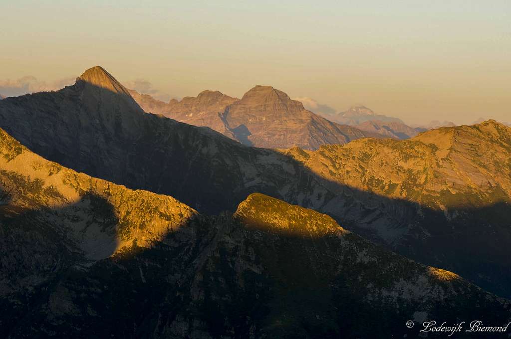
Pizzo di Claro as seen from Bellinzona
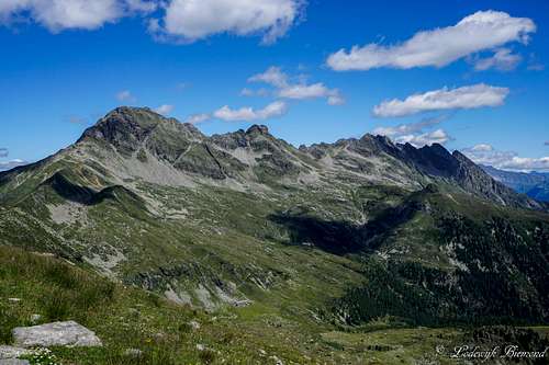
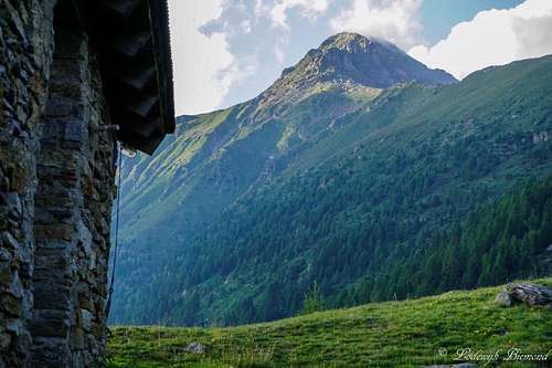
Pizzo di Claro is a fine pyramid shaped mountain towering high above the village of Claro as well as the city of Bellinzona. With an altitude of 2727 meters above sea level Pizzo di Claro is not particularly high, but because of the low elevation of the Leventina valley floor, Pizzo di Claro rises 2500 vertical meters above it, making it a true giant in the area. Pizzo di Claro, also referred to as Visagno, is often called the home mountain of the city of Bellinzona. The pyramid shaped form of Pizzo di Claro can be seen from everywhere within the city and poses as a backdrop for many postcards from the city as well, often with one of the historic castles in front of it. Besides the home mountain of Bellinzona, Pizzo di Claro is also the home mountain of Claro (250m) itself. A local once told me that most inhabitants have climbed it once or more in their lifetime.
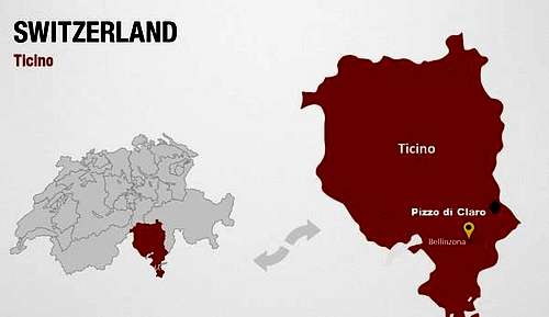
Pizzo di Claro is located in the heart of the Italian speaking Provence (Kanton) of Switzerland: Ticino (German: Tessin). The mountain is bordered by the Leventina valley in the west and by the lonesome Calanca valley in the east. Pizzo di Claro is separated from Piz de Molinera by the passo di Mem (2191m) and Piz de Molinera also marks the end of the Leventina west ridge making Pizzo di Claro the 2nd last (from N to S) summit of this ridge. To the north Pizzo di Claro is separated from Torrone Rosso (2670m) by the Bochetta di Simidi (2557m) saddle. The mountains summit block is a triangular shaped pyramid with a North, SE and West Face. The border between the Provences/Kantons Ticino and Graubunden follows the North-South oriented mountain ridge and goes exactly over Pizzo di Claro's summit. This makes Pizzo di Claro a mountain situated in both Ticino and Graubunden. The valley to the east of Pizzo di Claro, Val Calanca, is part of the region named Misox, the only Italian speaking part of Switzerland outside Ticino / Tessin.
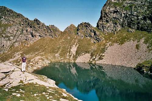 Lago di Canee 2190m | 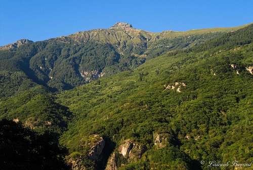 Pizzo di Claro (2727m) from Claro (267m) |
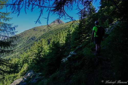
Climbing Pizzo di Claro is not for those without patience. The low elevation of the valley floors in the region create a big altitude difference with the mountain's summits, so when climbing Pizzo di Claro from Claro itself, one most overcome an altitude difference of 2500 (!) vertical meters. There is even an organized race which does exactly that: Starting from the central church in Claro one must climb/run up to the summit of Pizzo di Claro as fast as possible. This race, named "Pizzo di Claro: 2500+", is popular for those seeking an extreme challenge.
Apart from the long ascent routes from the west, there are shorter alternatives. From Lumino, just south of the mountain, a small cabelway brings climbers/hikers up to Monti di Savorú at 1325 meters. This shortens the ascent by at least a thousand vertical meters. From Arvigo in Val Calanca there is a paved road up to Alp di Stabveder at 1948 meters. At almost 2000 meters, starting your ascent from Stabveder is by far the fastest way to climb Pizzo di Claro. All routes up the mountain are provided with good hiking trails with a maximum gradation of T3. Only the upper part of the trail on the summit block is somewhat harder: T3+/T4- (marked by blue-white stripes). For more information about the routes on Pizzo di Claro see the section "Routes" below.
 South Face | 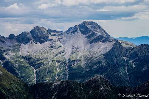 North Face |
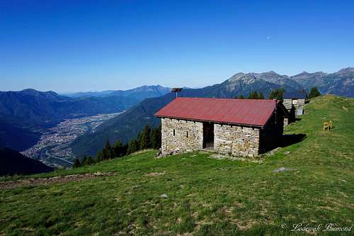
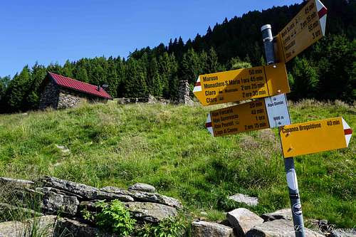
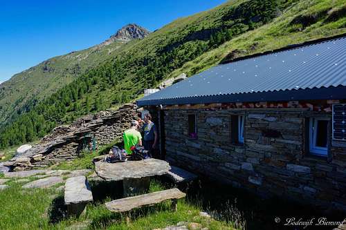
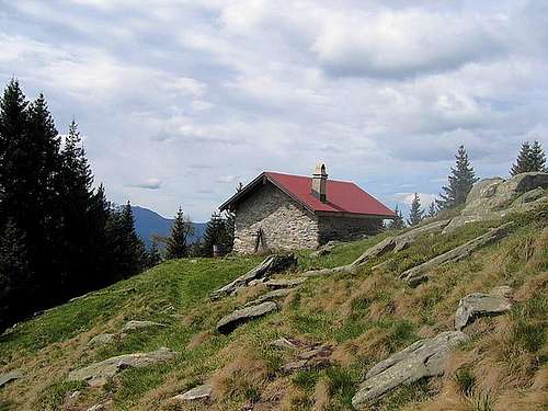
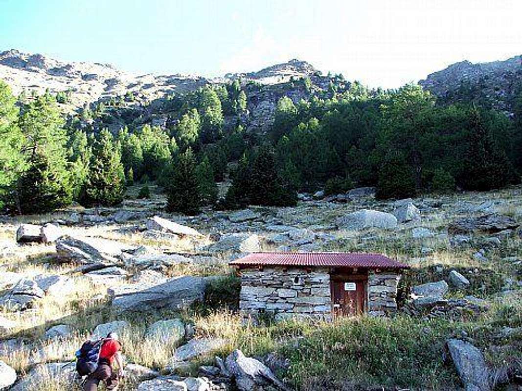
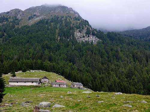
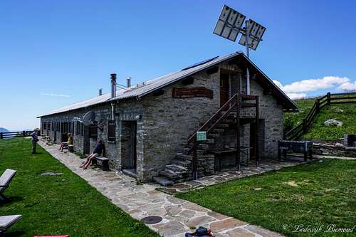
Pizzo di Claro is a famous mountain in Ticino, but lesser known outside of it. Still, the mountain is a popular objective for hikers/climbers and as mentioned above: hiking trails are present on all sides of the mountain. Besides an abundance of trails surrounding Pizzo di Claro, there is an abundance of mountain huts/refuges as well. The best known mountain hut is Capanna Brogoldone (1910m), which is also the only guarded hut, situated on a plateau looking over Bellinzona.
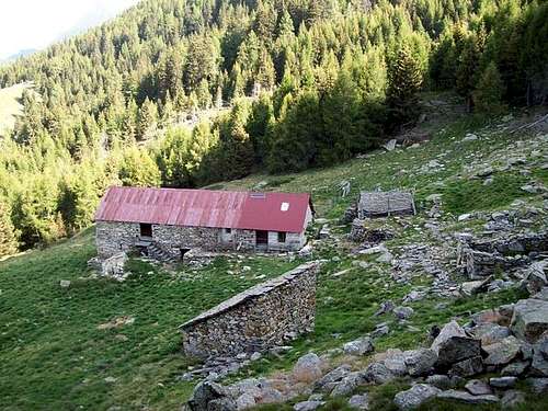
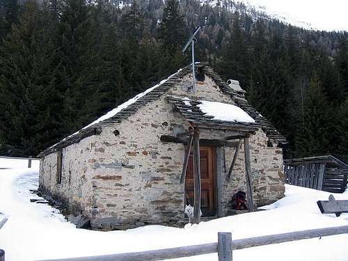
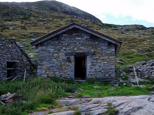
All other huts are unguarded (Alpe di Pèu, Alpe Domàs, Alpe di Motto, Alpe Martum and Alpe Carnac Bass to name a few) and most of them are somewhat spartanic. However, most of them provide all basis needs like blankets, matrasses, a stove with gas etc. Spending the night in these lonesome huts is a fantastic experience and a great way to climb Pizzo di Claro in 2 days from for example, Claro.
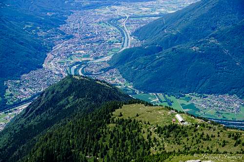
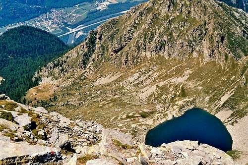 Summit view down to Leventina and Lago di Canee | 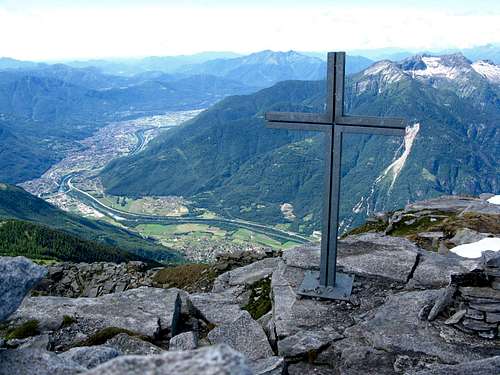 Summit Cross with Bellinzona |
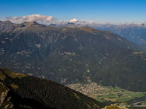
Pizzo di Claro offers fine views from its summit. To the north one can see Pizzo's neigbours like Torrone Rosso, Mottone, Piz de Campedell, Cima di Biasca, Torrent Basso and Torrone Alto. Towards the west the Leventina West ridge with peaks like Poncione Rosso, Gaggio, and Cima dell'Uomo can be observed with the snowcapped Monte Rosa 4000ers looming behind them.
Towards the east are the lonesome mountains of the Calanca east ridge as well as giants like Monte Disgrazia. Last but not least: towards the south the views over Bellinzona and the northern tip of the Lago Maggiore are amazing. To conclude one can say Pizzo di Claro is a fine mountain looming high above Bellinzona with many trails on its flanks and grand views from its summit.
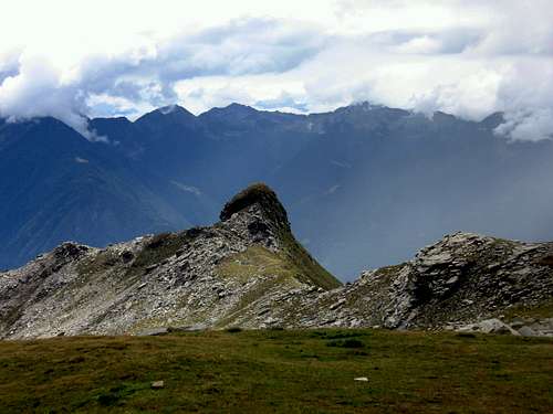
Poncione Rosso and Pizzo di Claro from Poncione d'Alnasca
Routes Overview

There are multiple hiking routes up to the summit of Pizzo di Claro. From every side of the mountain are approach routes. In the sections below is described how to rech Pizzo di Claro from each side of the mountain.
Also see the 2 route pages here on SP:
Normal Route Pizzo di Claro
Brogoldone Route Pizzo di Claro
I Routes from the West (Leventina)
On trail: Alpe Motto - Alpe Gagern
Option 1: Moncrino - Guer - Bens - Alpe Peurett - Lago di Canee - Pizzo di Claro (T3)
Option 2: Maruso - Alpe Domas - Alpe Forcarid - Alpe Peurett - Lago di Canee - Pizzo di Claro (T3)
It is also an option to use the public (paved) road from Claro to Maruso at 1030 meters. This saves some 750 vertical meters of altitude gain. The locals like to climb the mountain starting from Maruso. At the end of the road is a parking place where the hiking trail starts. There is also a third variant for Climbing the mountain from Claro or Maruso:
Option 3: Maruso - Alpe Domas - Alpe di Motto - Alpe di Gagern - Passo di Mem - Point 2280 - Pizzo di Claro. (T3)
This last option includes the crossing of the ridge at passo di Mem and ascend the summit block from the eastern side of the mountain.
A last option is the unusual and quite wild access is from Cresciano through the Valle Cresciano. The route is as follows:
Option 4: Alpe di Simidi - Pian Belasc - P. 2558. Nice for a swift descent in early summer, if there's snow left. This route is seldom ascended and difficult (rope, ice axe etc are needed)
II Routes from the East
East side ascent of Pizzo di Claro
Option 1: Alp di Stabveder - Sella P 2270 - East Flank - Pizzo di Claro (T3)
It is also possible to start from Selma. A small cableway goes up to Landarenca (1230m)
Option 2: Landarenca -Alp di Rossiglion - Sella P 2270 - East Flank - Pizzo di Claro (T3)
From San Vittore (next to Roveredo) a paved road goes up to Prepianto (1438m)
Option 3: Prepianto - Cascin Nov - Alpe di Mem - P 2280 - East Flank - Pizzo di Claro (T3)
III Routes from the South
Bellinzona and Capanna Brogoldone
Option 1: Monti di Saurú - Alpe Domas -Alpe Forcarid - Alpe Peurett - Lago di Canee - Pizzo di Claro (T3)
Option 2: Monti di Saurú - Capanna Brogoldone - Passo di Mem - Point 2280 - Pizzo di Claro (T3)
IV Via Lumino
Via Lumino goes up the face directly in front
How to get there
A route (Google Maps) planner to Lumino (valley station of the Funivia/cableway) can be found HERE.
A route (Google Maps) planner to Claro / Cresciano can be found HERE.
A route (Google Maps) planner to Arvigo / Selma can be found HERE.
When To Climb
The best period for climbing Pizzo di Claro are the summer months (May until Oktober) when there is no snow present on the mountain.Camping
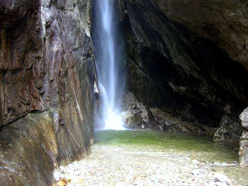
Censo Waterfall
more info:
camping Al Censo
Mountain Huts

I Rifugio's
 | Rifugio alpe di Motto Elevation: 1864m Internet Page: Here |
 | Rifugio Alpe Domas Elevation: 1666m Internet Page: Here |
 | Alpe di Gágern Elevation: 1997m Internet Page: / |
 | Rifugio Alp de Martum Elevation: 1845m Internet Page: Here |
 | Rifugio Garerescio Elevation: 1783m Internet Page: Here |
 | Rifugio Alpe di Peu Elevation: 1725m Internet Page: Here |
 | Rifugio Alpe Peurett Elevation: 1745m Internet Page: Here |
 | Rifugio Alp de Palazi Elevation: 1572m Internet Page: Here |
 | Rifugio Alp de Carnac Elevation: 1953m Internet Page: Here |
II Capanna Brogoldone

Maps
 | Kompass map No. 110 Verzasca - Maggia Scale: 1:50.000 ISBN/EAN: 9783850269100 |
External Links
Pizzo di Claro & Claro from Gaggio
Webcam Pizzo di Claro from Bellinzona
Pizzo di Claro Weather Forecast by Mountain Forecast
Pizzo di Claro on Hikr.org (in English)
Camping al Censo - a beautiful campsite in nearby Claro