
|
|
Mountain/Rock |
|---|---|
|
|
39.35000°N / 73.08000°E |
|
|
Mountaineering, Skiing |
|
|
Summer |
|
|
21732 ft / 6624 m |
|
|
Overview
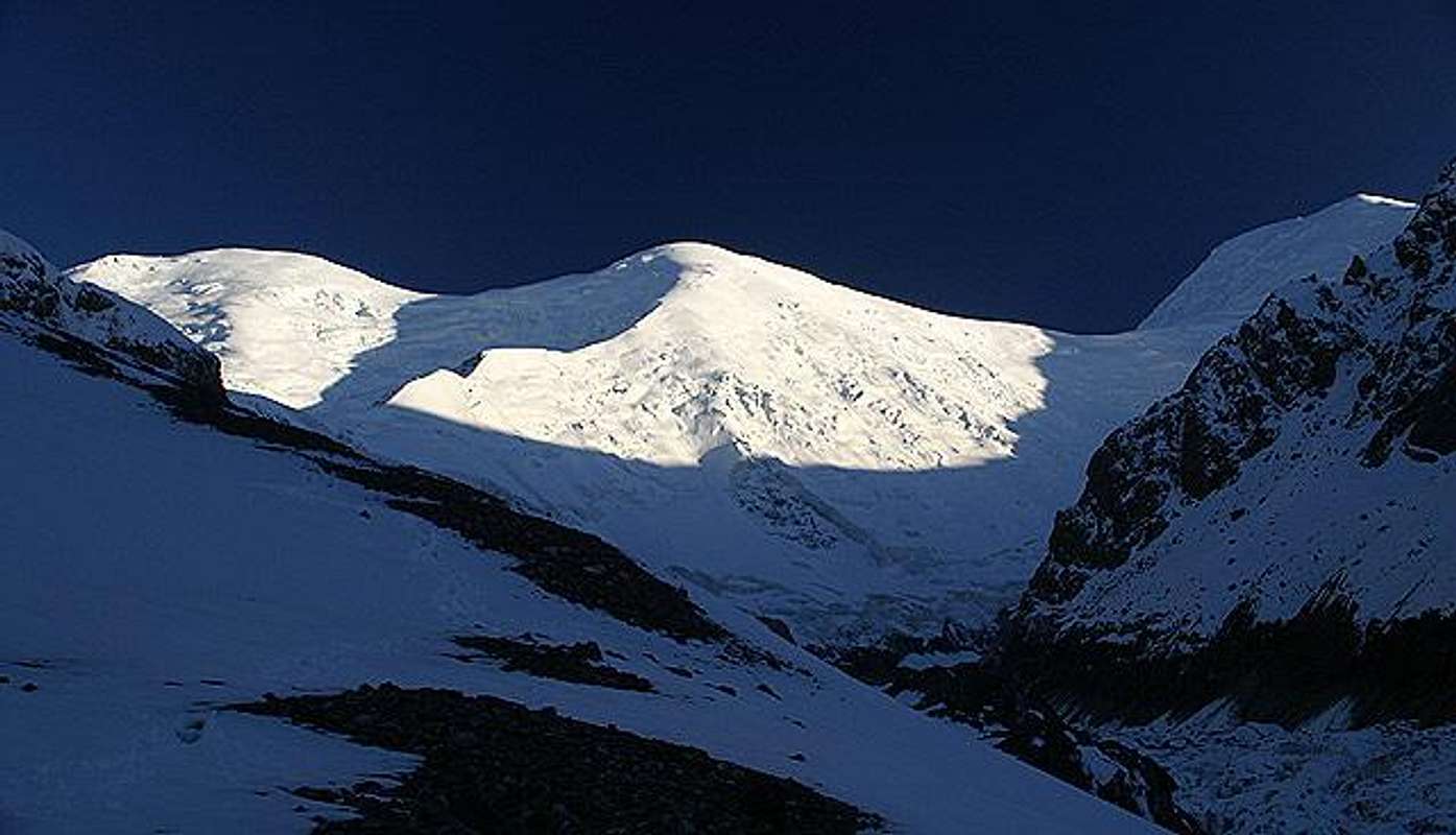
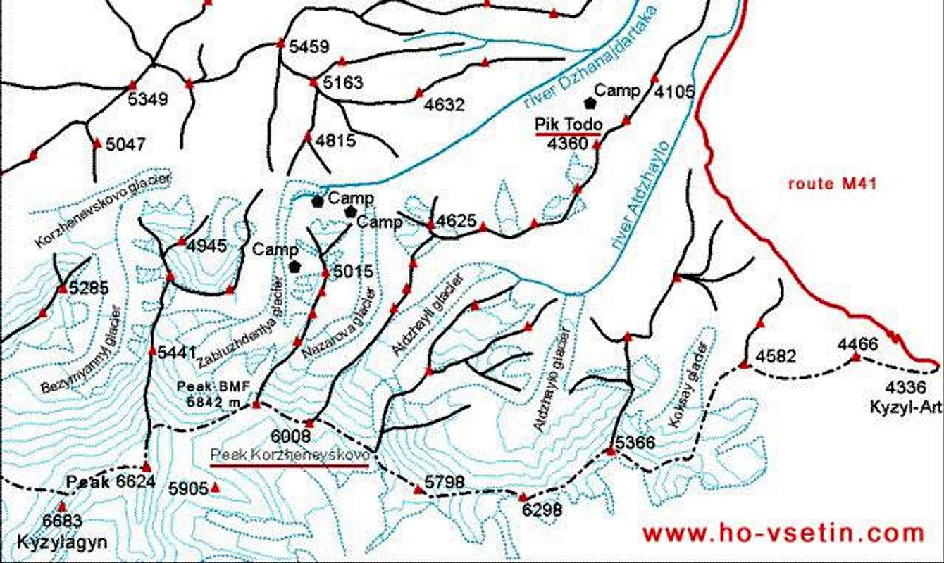
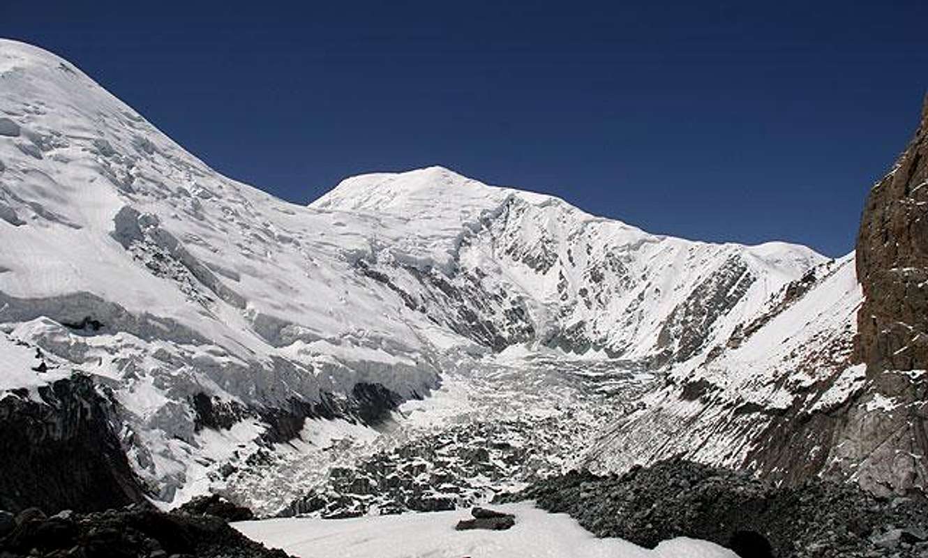
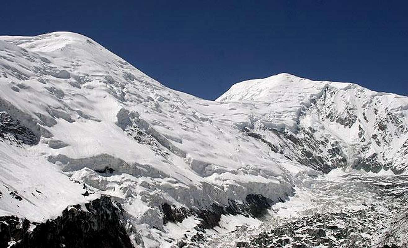
Pik 6624 is named simply by its height as in all the available maps it is unnamed. It lies between Pik BMF (5482 m) and Kyzylagin (6684 m) and clossenes of Kyzylagin on the west probably causes nameless of this peak. Pik 6624 is composed similarly like Kyzylagin - narrow alongated top oriented north-south. All his slopes are covered by inhomogeneous glacier.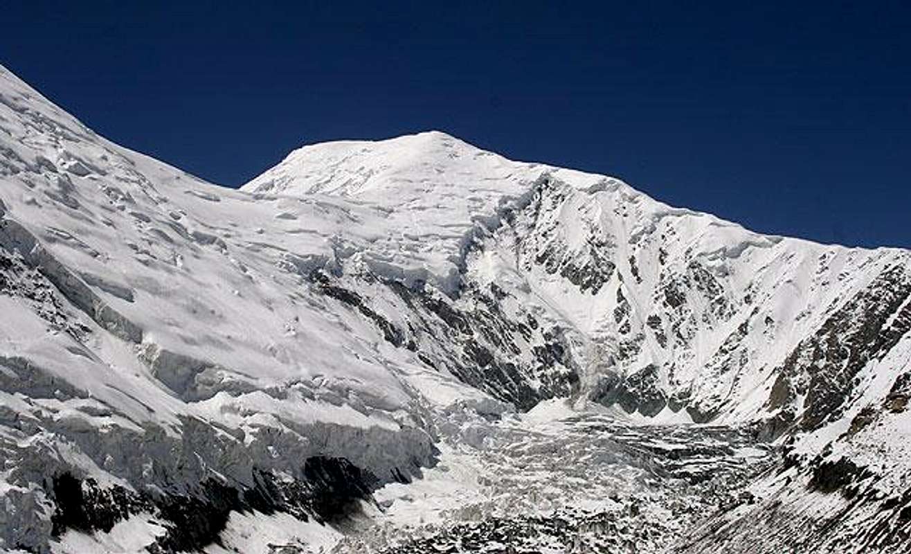
The area of Dzanajdartaka river, which Nazarova rivers and valley enters, and surrounding peaks are completely out of focus of climbers and trekkers. In comparison with hundreds of climbers and trekkers in the Pik Lenina area you do not find a human here. The reason is simple, Pik Lenin is located just several tens of kilometres to the west. Thus, as Pik Lenina is over 7000 m, none is interested in peaks between 6000 and 6684 meters lying nearby. There are many peaks, most of them believed unclimbed, that are suitable for routes of different grade.
The wide valley of Dzanajdartaka river is fullfilled with stones transported to the lower parts by the river during the spring months. However, similar to Pik Lenina Lukova poljana (Onion field) a lot of onion and incredible amount of types of mountain flowers can be found here.
Getting There
Kyrgyzstan can be simple reached from many European airports with companies like Russians Aeroflot (via Moscow) and Air Pulkovo (via St. Peterburg), KLM, British Airways (from London), Kyrgyz airlines (from Munchen directly to Bishkek), Turkish Airlines (via Istanbul), and other.When leaving the Manas airport back to your home country do not be surprised, that for several companies the leaving cost USD 10 is included in the price of air ticket, but for many others you have to pay this fee before registration to flight. Be also very careful with the weight of your luggage, as clerks weigh ALL YOUR luggage at once! And you have to pay at least USD 8 per kilogram exceeding over 20 kilograms.
From Bishkek you can use domestic airlines – Kyrgyz airlines or Altyn Air to fly from Bishkek to Osh. It takes about 50 minutes by Jak-40 jet plane. Prices for 2005 season are:
Kyrgyz airlines return ticket USD 80, one way ticket USD 60
Altyn airlines return ticket approximately USD 100
Tickets are available in advance by your order realized through the local travel agency or just after your arrive at Manas airport. Only for cheaper Kyrgyz airlines tickets can be sold out for the first flights.
Another possibility is bus or taxi for about 800 kilometres long route to the second biggest city Osh. Asking for a taxi is the simplest at Osh bazaar in Bishkek.
From Osh use any of travel agency transport support or ask for a „taxi“ UAZ, gazik (Russian version of a jeep). In fact, you can also use any of robust cars like the famous Soviet car Volha, because the above mentioned are able to win over the dirty road from Osh via the city Gulcha over the passes Cidcik (2400 m) and Taldyk (3615 m).
However, you can also use a local bus Osh – Sary-Tash and then take a car for Bardobo border control. Or you can simple hitchike after leaving Osh.
Red Tape
Except of 28 countries citizens of all other countries need a valid Kyrgzyz visa to enter the country. They are easily obtained at your local Kyrgyz Embassy for about USD 45 per person. Sometimes you need a letter of invitation by Kyrgyz travel agency to get visas. The letter can be easily obtained by several travel agencies in Bishkek ans Osh, some of them are mentioned LOWER. Moreover, citizens of over twenty countries are also free from OVIR (police department of foreign affairs) registration in Osh and border zone permit (both cost for about USD 20 per person). The border control is at Bardobo.There are NO CLIMBING OR TREKKING permits in Kyrgyzstan since the beginning of season 2003. The situation can be changed for next year, but now you do not have to pay any money for climbs or treks!
IRKESHTAMTOUR Osh and south Kyrgyzstan
http://www.irkeshtamtour.com/
No. 1, Say Kucha str, Osh, Republic of Kyrgizstan
tel/fax: +996(3222) 551 74
e-mail: irkeshtamturosh@yahoo.com
AK SAI Bishkek and around
http://www.ak-sai.com/
No. 65, Sovetskaya str., 720005 Bishkek, Republic of Kyrgizstan
tel.: +996 (312) 54 42 77
fax: +996 (312) 54 42 19
e-mail:info@ak-sai.com
When To Climb
The mountain is probably climbable during all the year . However, the best weather conditions are from mid July to mid August.During the winter months one can expect similar temperatures as in the area around Pik Lenina. More interesting can be spring months, as there remains snow cover and access from the M41 route from Bardobo border control can be very easy.
Helmet is quite recommendable. All avalanche safety items are welcome during winter and spring. In the main climbing season - mid of summer - you also crampoons, ice-axe, ice-screws, etc.
The weather can be pretty unstable all over the year. According to our experience in summer 2005, there was majority of days with sunshine in the early morning. Around 10 a.m. clouds and fog appeared, and in the afternoon rain and storms continued. Finally, in the evening clear heaven covered with stars appeared. Snow storms caused about 40 cm thick snow cover in the valley and many avalanches of different size on slopes.
Mountain Conditions
First ascent: unknown, probably unclimbed peak. If you know something about possible first ascends feel free to add it!UPDATE ABOUT FIRST CLIMBS!!! SP member Rybakov have declared, that this peak is NOT UNCLIMBED! Hopefully, he will be able to add details about first climbs and traverses via this peak as soon as possible.
Earth Observatory - Kara-Kul Structure - satellite photo of the Kara-Kul lake and its surrounds. The valley of Dzanajdartaka river is on the left upper corner.
The only route to Pik 6624 from the north is via the lateral range starting at Pik Nazarova reaching Pik BMF and continuing via the main ridge to the summit.
Camping
You can camp anywhere in the area. The only trouble is the lack of clean water for cooking and drinking. All streams starting on north sides of the range are polluted by sediments and they are brown. Higher in the valley you can find remains after old camps. One of the highest concentrations of old rusty cans we found at the beginning of Nazarova glacier moraines. The camp was set up in the summer 1989 by a team of Soviet geologists measuring data for geological map of this area in the scale 1:50 000.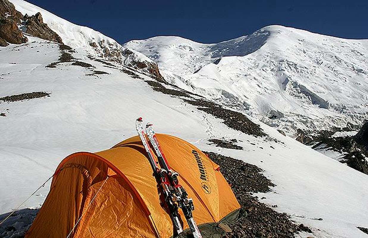
External Links
- Kyrgyzstan skiing 2005
our trip to the border zone Kyrgyzstan-Tajikistan