|
|
Mountain/Rock |
|---|---|
|
|
49.19923°N / 20.21946°E |
|
|
Mountaineering, Trad Climbing, Sport Climbing, Ice Climbing, Scrambling |
|
|
Spring, Summer, Fall, Winter |
|
|
8389 ft / 2557 m |
|
|
The page was created anew in November 2023.
Overview
|
Glossary
štít (š=sh) = peak
sedlo = saddle/pass
štrbina = col
hrebeň = crest/ridge
dolina = valley
pleso = tarn
chata (ch=kh) = hut
Kežmarský štít (Slovak) Kieżmarski Szczyt (Polish) 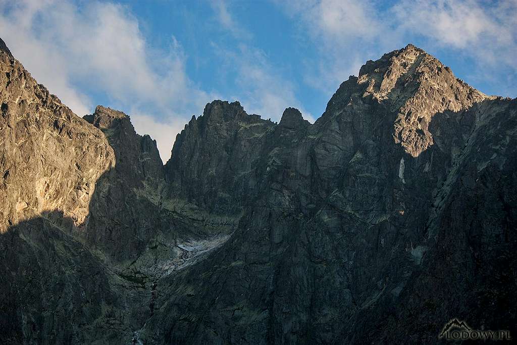
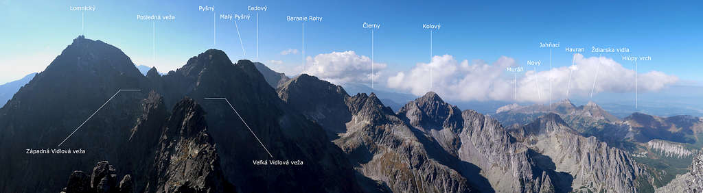
Késmárki-csúc (Hungarian) Kesmarker Spitze (German) If the summits with less than a hundred metres of prominence do not count, Kežmarský štít (whose prominence is 143m) is the sixth highest peak in all of the Carpathians. It sits on a grand lateral ridge, which branches off from the main ridge of the Tatras at Vyšná Barania Stražnicá and runs southeast to such Tatra giants as Baranié Rohy, Pyšný Štit and Lomnický Štit. 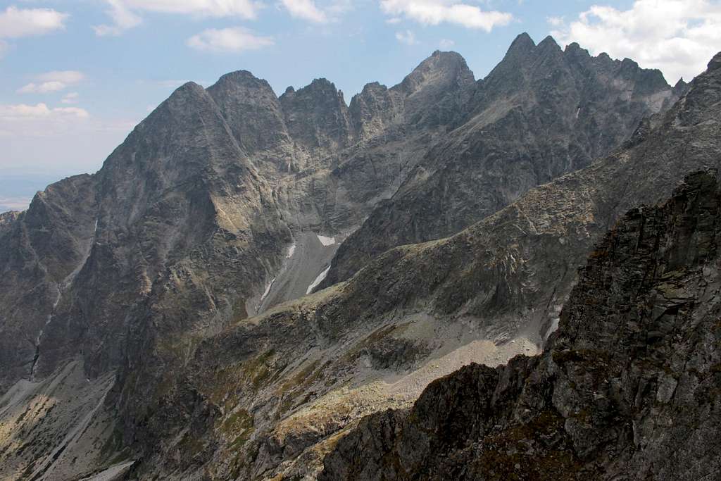
At Lomnický štít this ridge forks into Lomnický hrebeň, which trends in the SSE direction, and the northeast ridge running to Kežmarský štít and Veľká Svišťovka. The part of the ridge between Lomnický and Kežmarský peaks, known as Vidly, is regarded by many climbers as the most beautiful ridge in the Tatras. 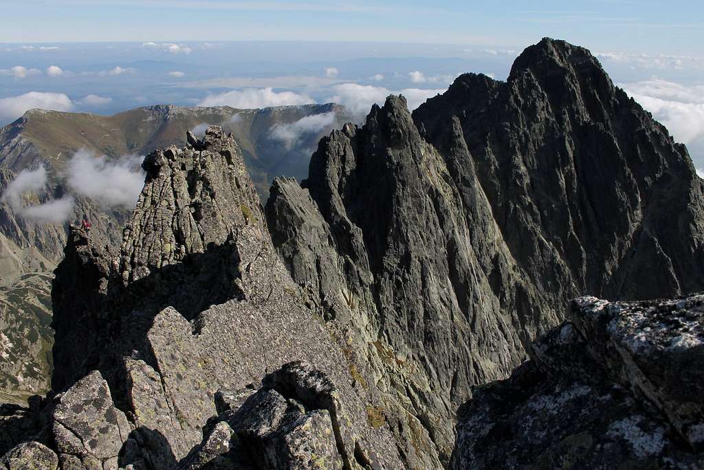
About 150 metres to the NNE from the summit of Kežmarský štít, past the saddle at 2463m called Vyšná Kežmarská štrbina, is the summit of a foresummit of Kežmarský štít at 2513m, named Malý (Little) Kežmarský štít. (Until the 1950s the peak was known as Weber štít.) Beyond that point, our ridge, covered with talus, drops rapidly to Kežmarská kopa (2233 m), then to Nižné sedlo pod Svišťovkou (saddle at 1995m) to finally climb Veľká Svišťovka (2038m). 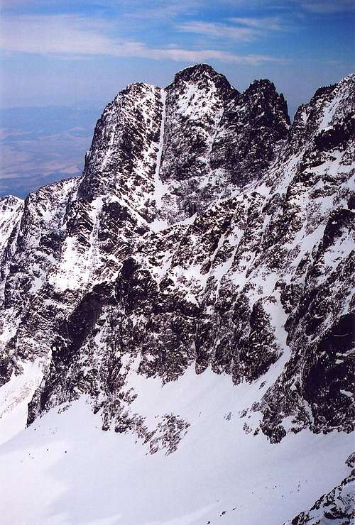
Kežmarský štít sends another ridge to the ESE. This is a fairly short spur with Huncovský štít at 2352m at its end. 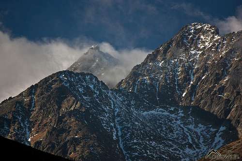
Kežmarský means belonging/related to Kežmarok, a historic town lying about ten miles southeast of Kežmarský štít. A few centuries ago the locals called the peak Mother. (The Father was Lomnický štít.) The first winter ascent was accomplished by Günter Dyhrenfurth and Alfred Martin in 1906. 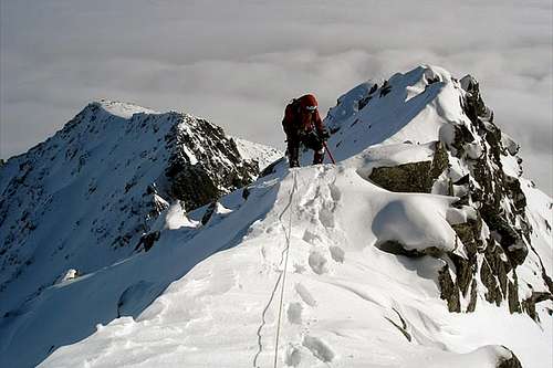
|
Summit Views
|
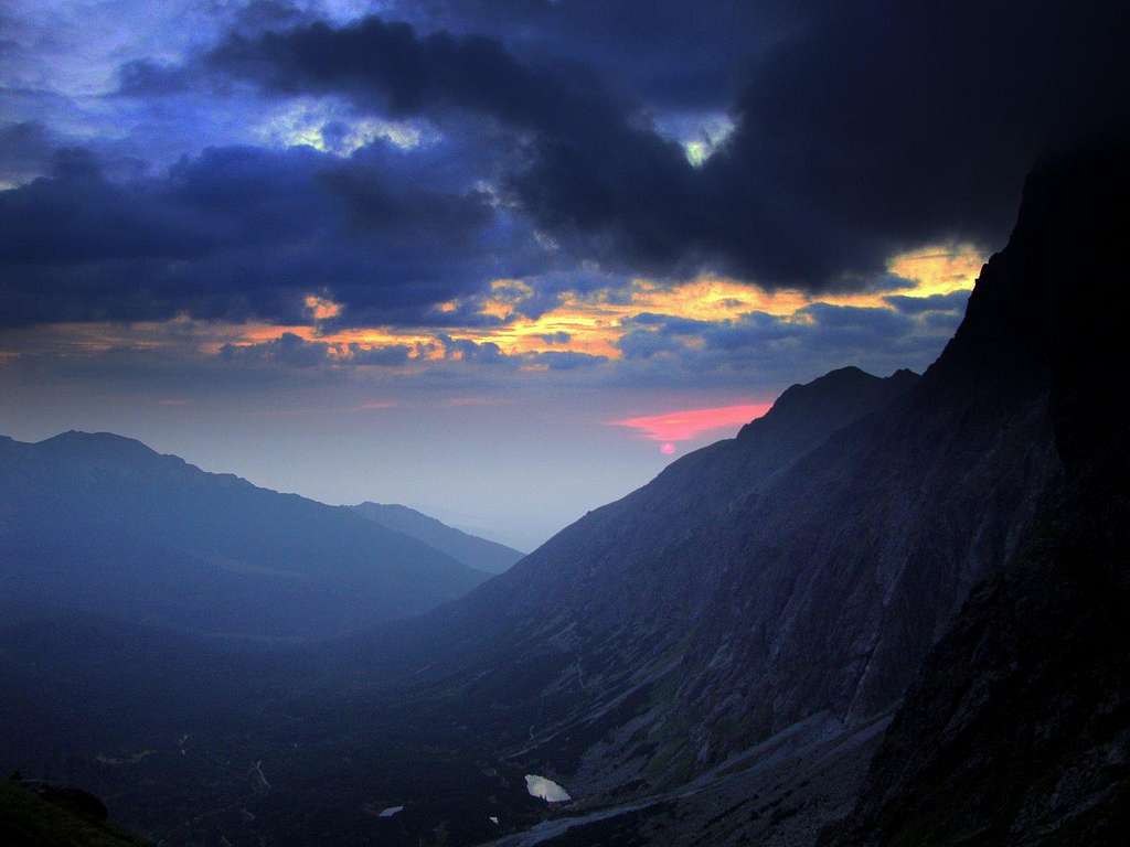
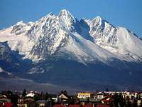
Kežmarský štít is not the best viewpoint in the Tatras. Westerly and southerly views from the summit are limited since some of the highest Tatra peaks obscure everything that lies behind them. These peaks themselves are a pleasure to look at though. In the north the north end of the High Tatras' main ridge and beyond it the Belianske Tatry the can be seen. 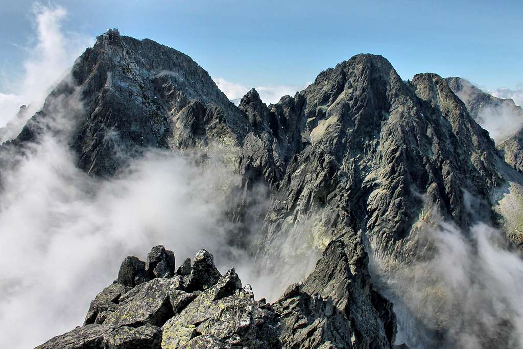
|
Technical Climbing
|
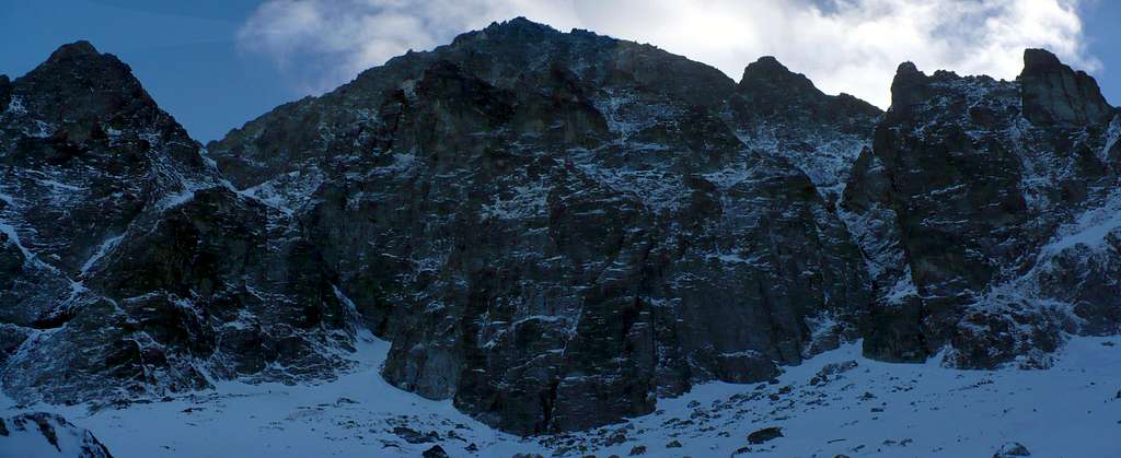
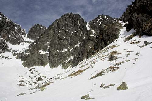
Reference: Vysoké tatry – Horolezecký Sprievodca The most popular route to the summit of Kežmarský štít is Vidly, i.e. the ridge connecting it to Lomnický štít. As for the walls, both the northwest wall, which Kežmarský štít shares with Veľká Vidlová veža, and the south wall are about 500 metres tall. Climbers find the latter, especially its upper part with impressive steep plates, more attractive. 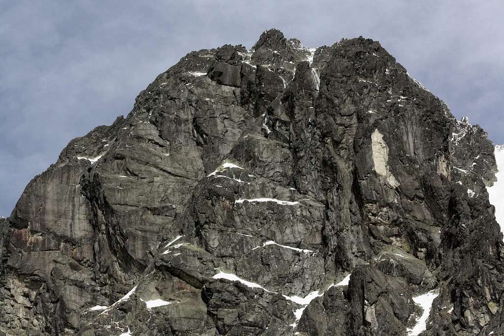
But neither face of Kežmarský štít can compete with the north face of Malý Kežmarský štít. With a height of 900 metres it is the tallest wall in the Tatras. It is one of the largest Tatra walls as well, which boasts over a hundred routes (up to UIAA grade VIII+). The wall has two tiers separated by Nemecký rebrík (German Ladder), a ledge covered with grass and scree. The lower part of the wall is steeper and made up of huge pillars and chimneys. The base of the wall is readily available (half an hour’s walk up) from Chata pri Zelenom plese (the mountain hut by Zelené pleso). 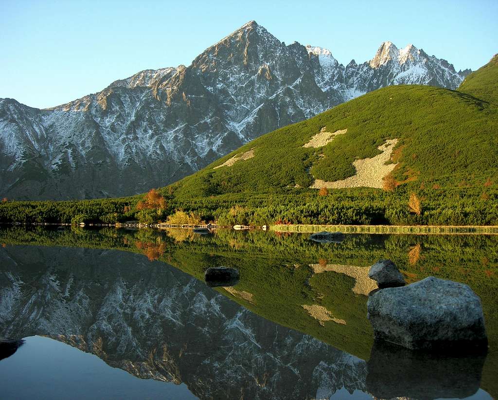
|
Scrambling Routes
The following routes run through Huncovské sedlo located just northwest of the summit of Huncovský štít.
From Huncovské sedlo the route runs up the ESE ridge of Kežmarský štít (UIAA grade I/YDS class 3, approx. time of ascent 1h). The most comfortable variant generally, especially at the beginning, keeps to the northern side of the ridge although it does get onto the crest at times. Sticking to the crest is more interesting but a bit more demanding and will slow you down. 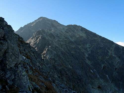
Another route which starts at or near Sedlo pod Svišťovkou runs along the NE ridge of Kežmarský štít, via Malý Kežmarský štít. Rock difficulty of the crux of this route is UIAA grade II/YDS class 4; approx. time of ascent 2h 15min (plus ascent from Skalnaté pleso 1h or from Zelené pleso 1.5h). 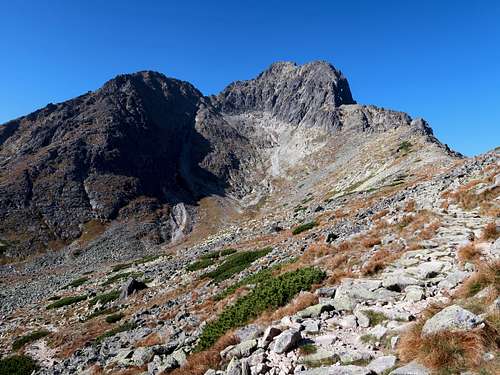
|
Maps
As for the analog maps, there are plenty of options. I would recommend the plastic 1:25,000 map of the Polish and Slovak Tatras by WiT. It is waterproof, durable and cheap. |
Getting There & Accommodation
From Tatranská Lomnica you can go by cable car or on foot (green marks, 6km, approx. 900m of ascent) to Skalnaté pleso. By the tarn there are the top station of the cable car you may have taken, the base station of the cable car to the summit of Lomnický štít, a restaurant and a weather station. (Whereas it seems impossible to get a place on the latter without booking in advance, this is not necessary for the line to Skalnaté pleso although it may save you some time.) Two hundred metres SE of the cable car stations, at an elevation of 1725m, sits Skalnatá chata. 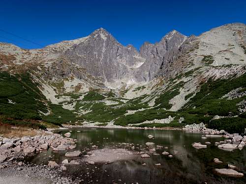
Another mountain hut near Kežmarský štít is Chata pri Zelenom plese (also known as Brnčalka) situated at 1550m by a beautiful tarn at the north foot of Kežmarský and Malý Kežmarský peaks. The trailhead for Zelené pleso is at the bus stop named 'Biela voda' located 3.5km north of Tatranská Lomnica. The hike via yellow marks is nearly 8km long, the elevation gain is over 600m. 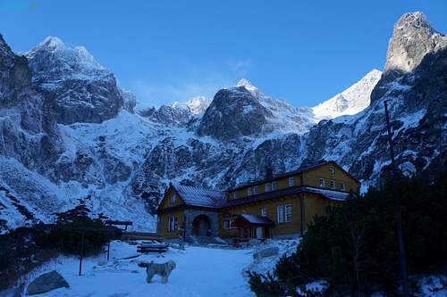
Skalnatá chata and Chata pri Zelenom plese are linked by a red hiking trail which can take you to the starting points of the scrambling routes to the summit of Kežmarský štít. When it comes to accommodation, there are plenty of options outside the Tatras, many of which can be found on the Internet. Those in the town of Vysoké Tatry are rather expensive. Reasonable offers can be found just a bit farther away in settlements such as Nová Lesná, Stará Lesná or the still quaint village of Ždiar. |

Red Tape
HikingYou must keep to the waymarked trails. Bivouacking is not permitted. You are not supposed to hike during the night. The trails above huts are closed for hikers from 1 November to 15 June. ClimbingYou must be a member of a rock climbing club. Just before your climb, you should write it into the register kept in a nearby mountain hut/your hotel. (Make sure you sign it on return too!) During the approach you must stick to the traditionally used routes described in rock climbing guidebooks. Bivouacking on the wall is only allowed in an emergency. Except for winter, you must not do a route that is easier than UIAA grade III (approx. YDS grade 5.3) unless on the descent. The funny thing is that the last rule does not apply to those hiking/scrambling with a licensed guide whom they have paid €200-300 for looking after them. 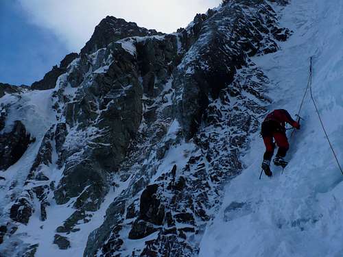
|
Mountain Conditions & Rescue
The best season to go is summer and often early autumn, the best month seems to be September providing it isn't rainy. In high season and at weekends expect crowds on the approach trails.
|
Acknowledgements
A special thanks to all the photographers, especially gorzi, Tomek Lodowy and Ivona.