
|
|
Mountain/Rock |
|---|---|
|
|
40.20280°N / 105.6772°W |
|
|
13118 ft / 3998 m |
|
|
My thoughts on Isolation Peak
Residing far away from just about everywhere, the well-named Isolation Peak (13,118-ft) occupies some prime terrain at the southern end of the great Rocky Mountain National Park. Maybe there’s good reason this mountain is the last prestigious 13er residing within the Parks boundaries to be submitted to Summitpost. Maybe it's best to leave her identity isolated from the internet, as the name suggests, or maybe it’s just best to introduce the mountain and let the 17-mile, 5000-ft climb speak for itself.
For now at least, Isolation's vast summit view will stay her own, reserved for enduring souls that love solitude and long for even the obscure summits of Rocky Mountain National Park. So, if you like sacred places, then see for yourself the unique views Longs Peak, Mount Alice, Paradise Park and the pristine Fifth Lake area of East Inlet Basin. Most of all, go get Isolated!
Isolation Peak
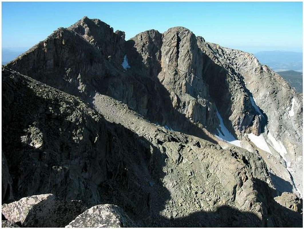
The officially named Isolation Peak resides directly on the Continental Divide, a few miles south of Mount Alice and a few miles north of Ogalalla Peak. Its rocky summit towers over four different drainages, two west facing watersheds, (East Inlet & Paradise Park) and another two that face east (Thunder Lake & Frigid Lake.)
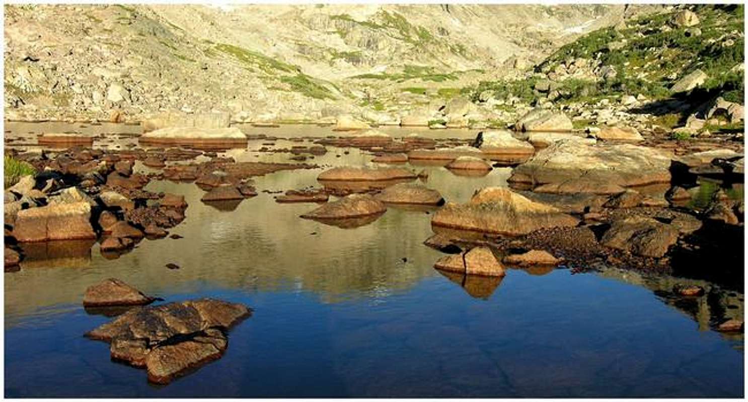
The west side of Isolation Peak harbors some of Colorado's most pristine land. Paradise Park is a designated Research Natural Area that is used for scientific investigations that require the area to be unaltered by human intervention. Day hiking is allowed, but there are no maintained trails and camping is not allowed. The reclusive Fifth Lake area is another distant place protected by another long 8-mile approach.
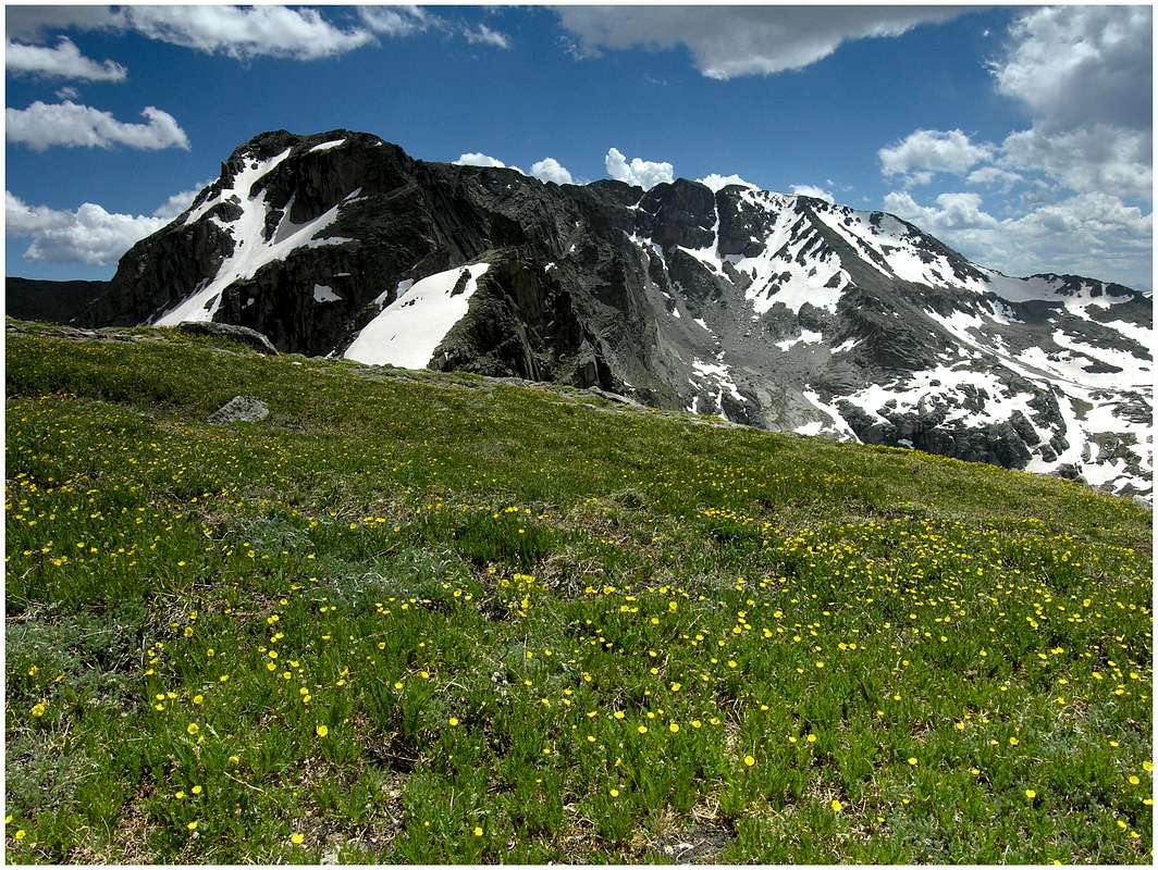
From the Divide, the eastern aspects of Isolation Peak are named Wild Basin. Logistically, one can argue that Wild Basin is no more spectacular than the western aspects of East Inlet or Paradise Park. However, Wild Basin's proximity to Denver makes for a familiar, and well-named place. Protected by National Park status, the vast Wild Basin is known for its long approaches and extensive trail system. Many beautiful alpine lakes reside here, protected by miles of tree-laden landscape. Even further away and beyond those lakes resides obscure mountainous terrain. Peaks like Copeland Mountain, Ouzel Peak, Mount Alice, Tanima Peak and Chiefs Head, make up a natural boundary for Wild Basin.
Don’t forget that Wild Basin is within RMNP boundaries, if interested, you will need a camping permit to split your 17-mile adventure into two days. Attaining Wild Basin camping permits is not as difficult as you may think; just stay away from weekend crowds.
Wild Basin Trailhead
Getting there provided by Brenta
The two most common approaches to Ouzel Peak are from the Wild Basin Ranger Station trailhead and from the Finch Lake trailhead, both located in Wild Basin, Rocky Mountain National Park. The Wild Basin entrance to the Park is located on Colorado Highway 7, between Allenspark to the south and Meeker Park to the north. After turning west from Colorado 7, go for less than half a mile until you turn right at a sign indicating the Wild Basin entrance station. The Wild Basin Ranger Station trailhead (8480 ft) is located at the end of the dirt road that starts at the entrance station. The Finch Lake trailhead (8460 ft) is along the same dirt road, about a quarter of a mile from its end. The trailhead is on the left (south) side of the road, indicated by a sign that is well visible. If you reach the bridge on the St. Vrain Creek you have gone too far. The dirt road is passable by passenger cars.
Mountain Conditions
- Colorado Avalanche Information Center (CAIC)
Click here for a 7-day forecast for 11,500-ft in Wild Basin
Camping
- Camping within the boundaries of Rocky Mountain National Park is permitted only in designated campsites, with a permit. These campsites vary in popularity so reserving in advance is recommended. For example, the one spot to camp up in Glacier Gorge is booked for every day of the summer on the first day they allow reservations. In contrast, there are campsites in Wild Basin that may be available that night. The cost is $20.00. Here are a few good links showing the designated campsites within the Park. Designated campsites #1 Designated campsites #2 You can get a backcountry bivy permit if you are doing technical climbing. Your technical climb must be on a written list of technical climbs within the Park. If your climb is obscure, and potentially not on that list, the Park most likely will not allow you to bivy.
- Campgrounds in the area include Aspenglen, Timber Creek and Longs Peak and are on a first-come, first-served basis and cost $20 per night. In summer campgrounds usually fill to capacity early each day. Moraine Park (247 sites) and Glacier Basin (150 sites) require reservations and cost $20. Moraine Park, Timber Creek and Longs Peak campgrounds are open year-round; Glacier Basin closes Sept. 7. Aspenglen is open until Sept. 20 and offers 54 sites. Longs Peak campground, the main access point for climbing 14,255-foot Longs Peak, is four miles north of Wild Basin on Colorado Highway 7 and offers 26 tent-only sites with a 3-night limit.
- Here is a good link for lodging in Estes Park
RMNP-Red Tape
(per Jon Bradford)
Isolation Peak is contained by Rocky Mountain National Park and therefore under the administration of the National Park Service, part of the Department of the Interior. This is a rather different jurisdiction for those used to climbing on National Forest Service lands administered by the Department of Agriculture. The most immediate difference is that the park costs a bit of change: daily admittance is $15 dollars, camping is $20 and limited by a permit system. In addition, the park has a remarkable trail system. So the price does provide some amenities. - Camping, as stated above, is limited to permits. To find out more information from the Park Service contact the listed below or see “Camping.”
Rocky Mountain National Park
1000 Highway 36
Estes Park, CO 80517-8397
-Visitor Information
970-586-1206
-Visitor Information Recorded Message
970-586-1333
-Backcountry
970-586-1242
-Campground Reservations
800-365-226