-
 15521 Hits
-
 81.18% Score
-
 13 Votes
|
|
Mountain/Rock |
|---|---|
|
|
45.84744°N / 114.40412°W |
|
|
Download GPX » View Route on Map |
|
|
Ravalli |
|
|
Mountaineering, Scrambling |
|
|
Spring, Summer, Fall |
|
|
9459 ft / 2883 m |
|
|
Overview
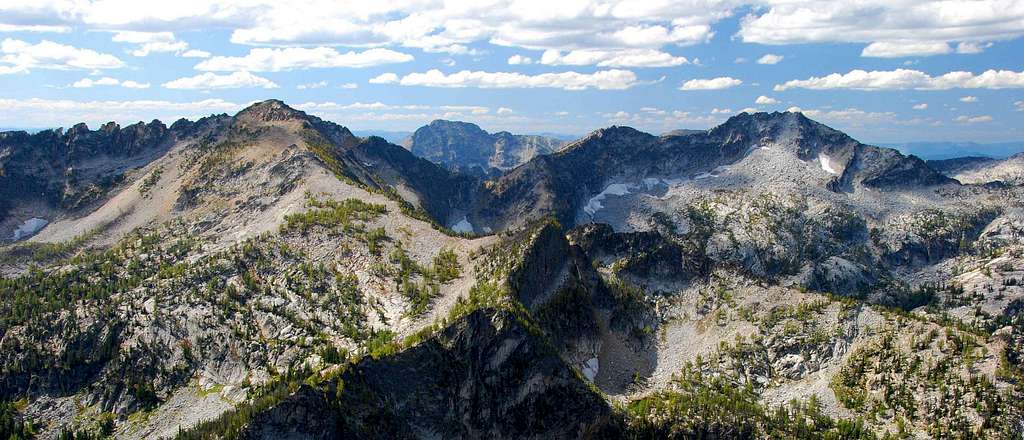
Another Bitterroot Mountain ridge with much of its real estate above 9,000 feet – located between the Nelson Creek Drainage to the north and the Soda Springs Creek Drainage to the south – this mountain ridge and its four highpoints are accessed only by those willing to expend an above-average amount of energy.
Most recent topographical maps appear to have given the name Bare Peak to the middle (and lowest) of the three highpoints toward the west end of the ridge. Why? I can’t say. Some older maps assign the name to the three western-most highpoints. I prefer the old way and refer to those three highpoints as Bare Peak and differentiate between them by speaking of them as East, Middle, and West.
The fourth and eastern-most highpoint is separated from the other three by a string of impressive arêtes (technical climbing only). I call this summit block Nelson Point because of its location high above Nelson Lake.
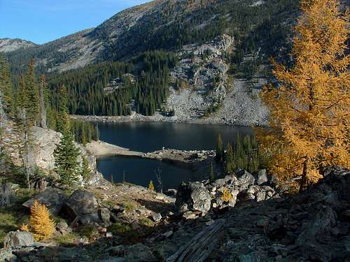
The east summit of Bare Peak is the highest point on the ridgeline southwest of the Soda Peak ridge. This seldom-visited, remote highpoint is closer to the western end of the ridge than it is to the eastern end. Mostly within a designated Wilderness Area, this and the other highpoints of the ridge offer the true wilderness experience to those who visit.
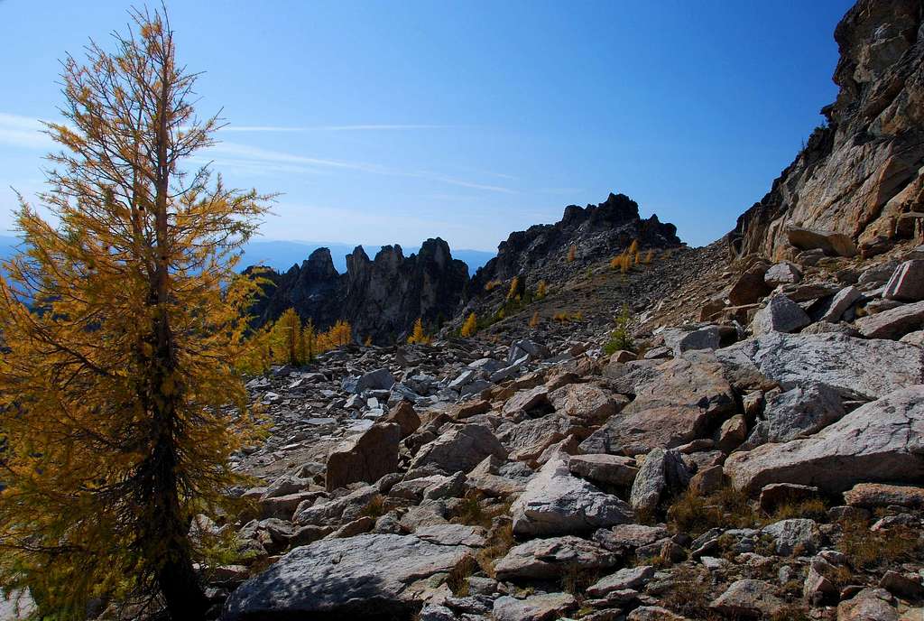
The impressive arêtes just below the summit on the southeast ridge make an approach from that direction problematic. Having studied both sides (north and south) of the crest from fairly close range, I confident that climbing aids would be required to travel the western portion of the crest as it nears the summit. Even if no aids are required, the extreme exposure would certainly keep me (for one) from making a solo attempt.
The middle summit of Bare Peak – designated on many recent maps as being Bare Peak – is the lowest of the three summits which comprise this ridge. In spite of its stature in relation to that of its siblings, it is certainly worth visiting. For it is from this summit that you receive a prospective which allows for a true appreciation of the two higher summits.
The most difficult to reach, the west summit of Bare Peak is also the most craggy and requires slightly more climbing ability to reach than the other summits. I find it the most intriguing of the three Bare Peak highpoints.
Sitting directly on the Montana/Idaho state line, one of the summit blocks holds a marker typical for mountainous regions, a vertical large-diameter iron pipe. Whether this pipe sits on the highest point of this summit, I’m unwilling to say. After clambering around on the summit trying to ascertain which of the several rock outcrops was the highest, I could reach no definitive conclusion. It seemed that no matter upon which outcrop I sat (or stood), at least one other seemed to have a higher elevation. Even after visiting each outcrop several times, I was unwilling to say which might be higher. Even my GPS was no help. When you visit, maybe you’ll have better luck.
Getting There
From Hwy 93 take Montana Hwy 473 (West Fork Road) west for 14.3 miles to the junction with Nez Perce Road (468).
Turn right (south-southwest) onto Nez Perce Road and drive almost 3 miles to the Nelson-Gemmel Road (5633).
Turn right (west) onto the fairly good gravel road.
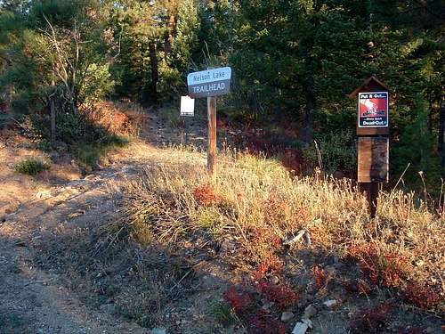
Drive about 2.7 miles and turn right (west) at the junction as directed by the sign for Nelson Lake Trailhead.
In spite of the fact that the sign shows 3 mile to the trailhead, it is only 2.5 miles to the pullout.
There is parking for five or six vehicles but no restroom facilities.
The trail leaves the parking area in a north-northwest direction.
For those who are interested in such things...
Nelson Creek was named for Jake Nelson, a blacksmith, who had a timber claim near the mouth of the creek in 1896. The lake was later named after the creek.
Area Restrictions (Red tape)
You pass into official wilderness area, The Selway-Bitterroot, a little over 2.75 miles in, just before you reach Nelson Lake. All wilderness rules and regulations apply.
There are no “use” fees to be paid. Some places are still free – if you don’t count taxes – especially in the Bitterroots!
Camping
The best area to camp for any of these routes is at one of the sites near Nelson Lake. There is also a meadow slightly west of the lake where you could camp, but it’s quite damp there much of the year and definitely full of mosquitoes. I’d pick the lake for camping – every time!
Routes
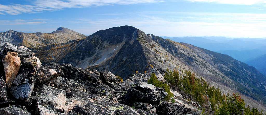
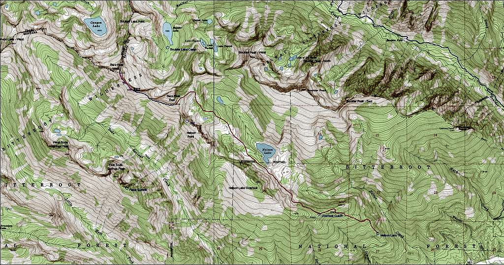
The route follows an established trail to the area immediately south of Nelson Lake before going off trail. There is some bushwhacking soon after leaving the trail – part of it through a fairly thick woods -- but it’s not difficult. Route finding on the remainder of this route is fairly easy because of the wide open views through the sparse woods. The climb up the ridge is Class 2 and 3 with no serious exposure. Views of the surrounding wilderness from the ridge and summit are terrific.
Approach – Nelson Lake Trailhead to Nelson Lake
Route Type – Scramble
Effort Required – Very Strenuous
Class Level – Class 3
Summit Elevation – 9,469’
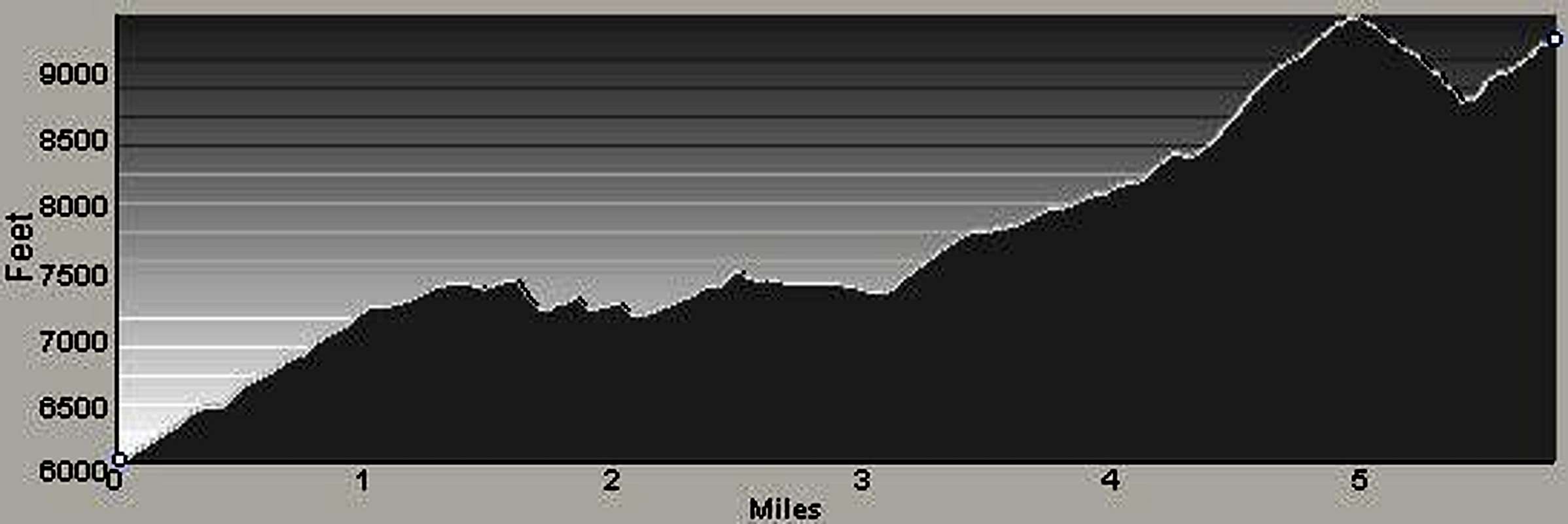
Elevation Gain – 4,603’ (rt - trailhead to summit)
Distance – 10.1 Miles (rt - trailhead to summit))
At the trailhead, if you get the feeling this trail is going to have as steep an initial ascent as many, if not most, others in the Bitterroot Mountains, you’d be correct. For at least 20 minutes, you climb on a good trail (old roadbed) directly up the crest of the ridge where you reach a small grassy area which allows a glimpse of Boulder Peak’s ridgeline a couple of miles to the north.
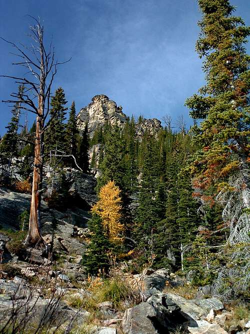
From there the trail traverses southwest as it attempts to keep close to the ridge-crest. Soon the trail turns again northwest as you climb through a woods that never gets extremely dense and allows periodic views north and south.
When the steepness of the trail lessens after turning once again, this time to the west-southwest, you reach a fork in the trail marked with a single small cairn (45.81624 N / 114.33728 W – elevation 7,400’). The left fork (currently abandoned by the Forest Service) goes toward the Bare Peak Overlook and on toward Nelson Point. Follow the right track west-northwest toward Nelson Lake if you plan to climb any or all of Bare Peak’s three summits.
For the next .25 mile the trail continues to gain elevation, though at a much reduced rate from the portions of trail you have already covered. From this point (just over 1.5 miles from the trailhead) the trail begins to descend as it traverses along the steep side of the ridge toward Nelson Lake. Fortunately, the total amount of descent is only a couple of hundred feet and happens quite gradually. During your return trip you’ll barely notice the elevation gain.
The slope being traversed is very steep, making the trail narrow and exposed in spots. Be thankful this trail exists because side-hilling on such a steep slope is torture for feet and ankles. On this section of trail I saw fewer and fewer signs of stock animals, until finally, they disappeared altogether just before an especially narrow spot on the route. Obviously, the animals’ intelligence had overruled (or is that surpassed?) that of their owners’.
A short distance later, the trail leaves the confines of the forest’s trees, as it approaches fields of talus which have flowed down the slopes of the ridge. From here on, the trail is sometimes difficult to follow over and around the mixture of talus and brush. Periodically you will see cairns marking the way, especially over areas of talus. In spite of the sparsely spaced cairns, the trail is braided in several places as it ascends slightly while continuing to traverse along the side of the ridge toward the lake.
Note: Nelson Lake is not manmade or “improved”, as are many of the lakes in the Bitterroot Mountains. This lake was formed when, centuries ago, a huge landslide poured from the side of Boulder Peak and blocked the drainage. Interestingly enough, it at first appears there is no outlet for the water from the lake; however the water from the lake resurfaces about one mile downhill from the lake to form Nelson Creek. There are several other old landslides in this area of the Wilderness (though not in the same drainage), but no others appear to have impounded bodies of water in a way similar to Nelson Lake.
Climbers’ Route – Nelson Lake to the East Summit
A trail seems to exist for a short distance after passing the lake – no doubt the route to the west side of the lake. But from this point on, don’t worry about a trail, rather concentrate on keeping your line of travel progressing to the northwest.
Just past the lake, the forest thickens substantially, but only for a short distance. I was unable to find a man-made trail of any sort through the forest or beyond. I did find game trails which happened to coincide with my route at spots, but that was all, nothing convincingly human.
After emerging from the dense woods, you will cross an open meadow that is bog-like during wet periods of the year. There is a small stream passing through it toward the southeast. (This stream does not appear on any maps I have at my disposal. But I mention it as a landmark.) This is a spot where some may wish to camp, but I don’t recommend it.
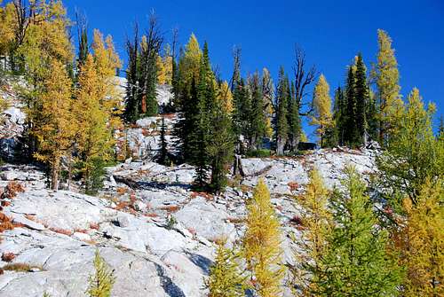
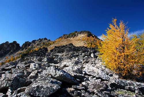
Continue hiking northwest. Try to stay on the crest of what is a long and wide gently-sloped buttress leading to the northeast ridge of Bare Peak. Follow this wide crest for approximately one mile to an area on the buttress which is almost level.
From here, proceed northwest toward an area of huge boulders. I was able to find an easy access point through the boulders which allowed me to pass with almost no (boulder or rock) climbing. If you don’t happen upon the same spot, you may have to do a bit of scrambling over and around some really big pieces of rock. There are many passages through, so don’t be too concerned with finding the “perfect” track.
Soon after passing the boulders, you will see one final section of talus that must climbed to reach the crest of Bare Peak’s northeast ridge. This is a short Class 2 climb. As you ascend, gradually turn to the left (northwest).
Once on the crest, you will be greeted by outstanding views of Bare Peak East’s rough southeast ridge and the surrounding peaks. Continue to climb up the crest of the ridge in a southwesterly direction. It’s only about a half mile to the summit.
With about a quarter mile to cover before the summit, you will reach an uplift of rock, almost a cliff, on the ridge-crest. The summit is on this uplift. You can either immediately climb onto the uplift (go up the right side), or, if you prefer, proceed along the left (southeast) side until you reach a point close to a saddle in the southeast ridge before climbing up to the summit.
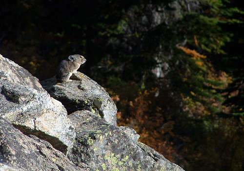
The summit has no human-made marks that I could find, no survey marks, no cairns, and no summit register. What I did find were some of the best views of the surrounding area one can imagine and, the lasts time I visited, the largest chipmunk I had ever seen – if only he would have held still long enough for me to take a picture!
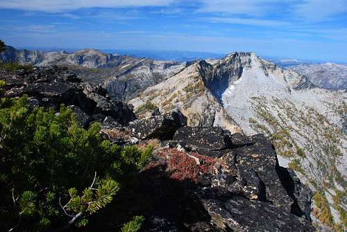
Descend by reversing this route or continue to the middle summit.
East Ridge to the Middle Summit
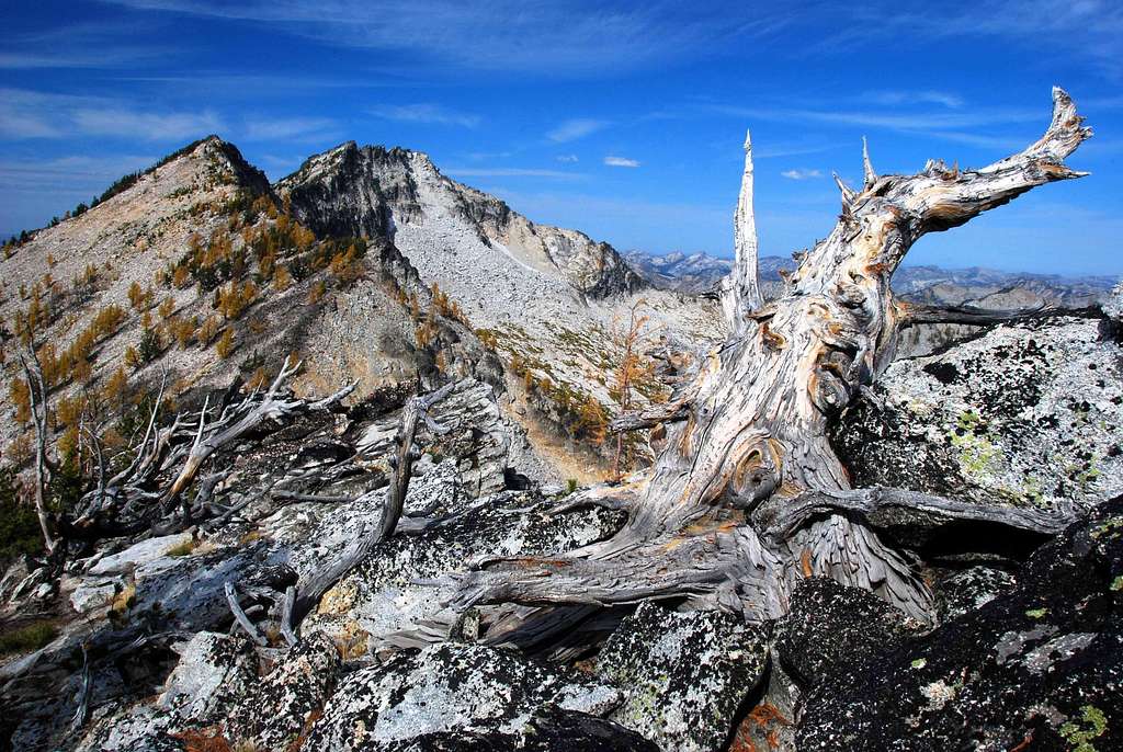
After reaching the east summit of Bare Peak, continuing the trek to the middle summit requires only moderate additional effort. Climbing is Class 2+ between the east and middle summits.
Climbers’ Route – Nelson Lake to the Middle Summit
Route Type – Scramble
Effort Required – Moderate
Class Level – Class 3
Highest Elevation – 9,289’
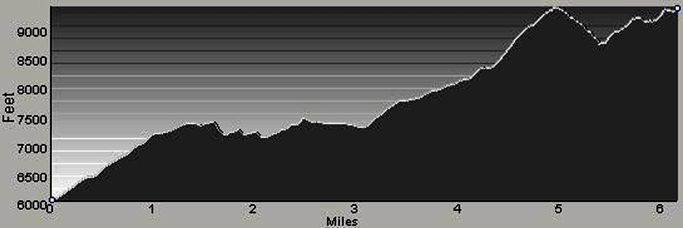
Elevation Gain – 5,711’ (rt - trailhead to summit)
Distance – 11.8 Miles (rt - trailhead to summit)
Follow the previously described climbers’ route to the east summit of Bare Peak’s east summit.
The route along the connecting ridge between the east and middle summits of Bare Peak is very straightforward. There are no surprises or spots where you can get lost because most of the route is visible during the trek.
From the east summit descend west, staying close to the ridge-crest as you lose elevation. During the descent the ridge makes a slow swing to the west-northwest. The crest of the ridge is guarded in spots by gendarmes, so drop a short distance left (south) from the crest to avoid them, just not too far.
When you reaching the saddle, begin a climbing traverse to the northwest along the south side of the ridge. There is no need to make the steep climb directly to the crest of the ridge. The path of your traverse will place you on the ridge at a point with less of an incline. Once on the ridge-crest, climb along the crest to the summit.
Descend by reversing this route to the trailhead or better yet, continue to Bare Peak’s west summit.
South Ridge to the West Summit
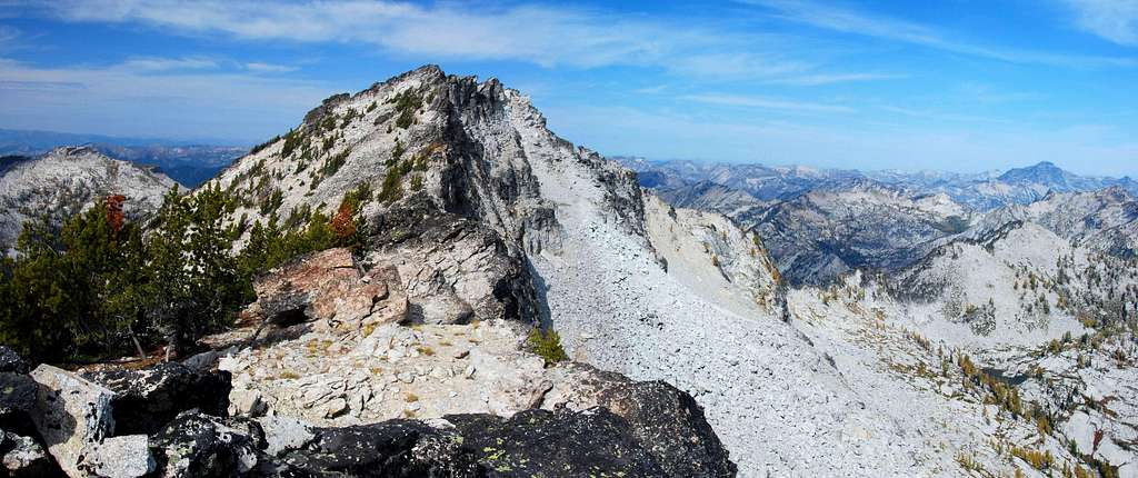
The craggy summit ridge of this summit provides the most interesting climbing of the three Bare Peak summits. However, reaching the summit area is more technically difficult than climbing the other highpoints, but just barely.
This summit, the highest in the Idaho section of the Bitterroots, offers some of the best views into Idaho available anywhere.
Climbers’ Route – Nelson Lake to the West Summit
Route Type – Scramble
Effort Required – Moderate
Class Level – Class 3
Highest Elevation – 9,439’
Elevation Gain – 6,158’ (rt - trailhead to summit)
Distance – 12.6 Miles (rt - trailhead to summit)
Follow the previously described climbers’ route to the middle summit of Bare Peak.
From Bare Peak’s middle summit head northwest toward the saddle. As you descend you’re likely to find the going easier if you stay a little west of the ridge-crest to avoid the small groups of trees and a few rock outcrops.
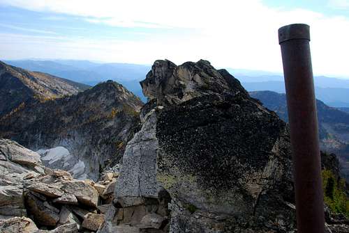
From the saddle follow the crest of the ridge to the northwest and the obvious end of the ridge which is comprised of various summit blocks.
Once at the summit ridge, traverse along its left (west) side as you proceed toward the state line marker near the northern end of the summit area. There are a few small cairns marking the path others have taken. It’s up to you to determine if that path is better than one you find on your own (I have my doubts).
I do not believe the state line maker on the summit is at the highest point, but I’ll leave that for you to determine.
Descend by reversing this route to the trailhead.
When To Go
The east and middle summits could be visited at almost anytime of year, even on well-consolidated snow – I’m not so sure that’s true for the west summit. The terrain along the ridge-crest is steeper near the west summit plus snow on the summit blocks would be very treacherous.
You should also keep in mind that the trailhead is difficult to reach if snow is present on the access road. In addition there are several spots along the route to the east summit which are prone to avalanche.
In my opinion, it’s best to only visit these summits when the snow has melted off the routes, usually by mid-July.
Essential Gear
Unless you’re attempting to reach these summits on snow, all you need is a pair of good hiking boots and plenty of stamina.
Route Statistics
Gain – 4,603’
(rt – northeast ridge)
Distance – 10.1 Miles
(rt – northeast ridge)
Middle Summit – 9,289’
Gain – 5,711’
(rt – east ridge)
Distance – 11.8 Miles
(rt – east ridge)
West Summit – 9,439’
Gain – 6,158’
(rt – south ridge)
Distance – 12.6 Miles
(rt – south ridge)


