Overview
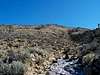
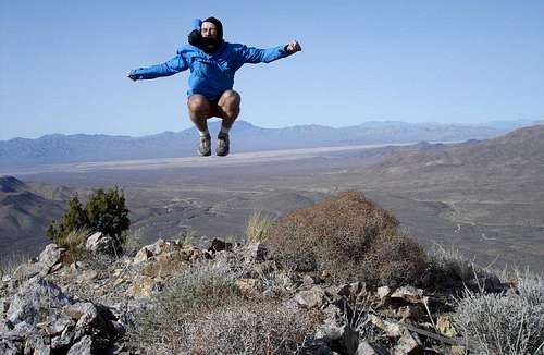
Crescent peak is the prominent pyramid shaped peak on the south side of Nipton Road in southern Nevada just East of the town of Nipton, CA. This rarely visited peak provides stunning views in all directions. Some of the peaks visible from the summit are
McCullough Mountain,
Hart Peak,
Castle Peak,
Clark Mountain,
Kingston Peak, and
Spirit Mountain. This is a rugged desert peak that should not be overlooked.
Getting There
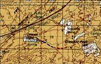
![Crescent Peak BLM Map]()
From Las Vegas drive south on I-15 to the State Line. Continue South on I-15 exiting on Exit 284 (in California) on Nipton Road heading East. Once you reach the state line back into Nevada drive 3.8 miles until you come to North Crescent Peak Rd. on your right. Turn right and drive 0.8 miles and park. You will come to a 3 way fork in the road with a "No Trespassing Sign." This sign is aimed for the two left forks. Take the right fork. Drive straight along this road. (Do not take any of the turnoffs to the left, as they lead to private properties). Drive another 0.5 miles and you will come to a hill. (You will need 4WD most likly from this point on). Drive over this hill. After 0.1 more miles once you reach the top of the hill, be ready to drive in 4WD and there are a lot of narrow openings and you will get scrached by plants and bushes on each side of you. Continue Driving another 0.8 miles and park in a little pull out on the right. (total distance from highway is 2.2 miles). The coordinates for parking is 35º 28.519 N 115º 9.324 W.
Alternatively, you could go down Crescent Peak Road. (The other route off of North Crescent Peak Rd. is more scenic). This turnoff is 2.5 miles from the state line heading South. Drive about 3.5 miles or so parking off any pullout you find. There is mining in this area as well as some private properties. Just be vigilant. Once you park start hiking East along the ridge heading towards the summit.
Red Tape
Just be careful of off-roading and trespassing onto mines and private properties. Crescent Peak Road has lots of mining now near the end of it and there are some private properties just off the road.
When to climb
Crescent Peak can be hiked year round. The best season though is from October-May since the summer months can be soaring well into the 100s.
Routes
There are a variety of starting points. All routes will work as long as you find a way to get some where close legally. Once you park just aim for the West Ridge and hike up to the summit. I have a nice scenic route posted in the routes section. However, the last part requires 4WD.
Weather for nearby Nipton, CA

External Links
An avid hikers trip to Crescent and Hart Peaks
View of the Ivanpah Valley with Crescent Peak
Crescent Peak and a Full Moon

 16514 Hits
 83.69% Score
 17 Votes


