
|
|
Mountain/Rock |
|---|---|
|
|
39.31278°N / 119.88278°W |
|
|
Washoe |
|
|
Hiking, Skiing |
|
|
Spring, Summer, Fall, Winter |
|
|
9698 ft / 2956 m |
|
|
Overview
Slide Mountain dominates the Reno skyline, standing 5,000 feet above the city just to the south of its larger neighbor Mount Rose. Slide Mountain is a far less celebrated peak than Mount Rose, not just because of its lower height, but because its summit is used for electrical/radio towers, making it a far less attractive to visit. In addition, there are no major hiking trails that lead to the summit. The only way to reach the top is to take a dirt road or to bushwhack.Slide Mountain is well known for its rock slides. The timing of the name of the peak is unclear. It had already been named Slide Mountain prior to a destructive rock slide from its southeast face on May 30th, 1983 that sent massive debris down the Ophir Creek and onto the valley below. The event cataloged here destroyed homes and even caused a fatality. However, it was named after previous rock slides years earlier, and was named based on those events.
 Close up view of the steep southeast face of Slide Mountain, obviously different than the face that existed before the massive rock slide.
I originally thought the mountain was called Slide Mountain due to the ski runs on its northeast face that begin about 1,500 below the summit. However, I only recently learned that the catastrophic rock slides are the true namesake.
It is possible to hike/climb Slide Mountain from the ski areas on the northeast side, but this is usually not done because there are many better trails and hikes to do in the area. In truth, Slide Mountain is best considered as a lookout point rather than a hiking destination. It is very accessible from Reno, with the trailhead just over 30 minutes from downtown.
From the summit, there are outstanding views towards Lake Tahoe to the west, the Virginia Range to the east, Mount Rose and the Carson Range to the north, and the Northern Sierras to the south. The standard approach requires about 1.5 miles and 790 feet of elevation gain with great views the whole way. This is probably the best way to the summit, because it is gives the hiker/climber an opportunity to do other hiking during the day.
 Slide Mountain in early-May 2007 - still with lots of snow after the late-April storms
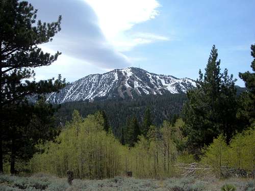 Slide Mountain in mid-May 2007
Getting There
Getting to Slide Mountain is easy. From Reno take 395 to the Mount Rose Highway (431). The route to the summit starts across the main road, about 100 yards west of the Mount Rose Summit Parking Area (8,911'). During much of the year you need to park at the Mount Rose Summit Parking Area to reach the summit. During late spring, summer, and early fall, cars can take the paved access road and cut off about 1/3rd of a mile and a tiny bit of elevation. When I hiked Slide Mountain, I parked at the Mount Rose Summit, crossed Highway 431 and hiked the paved access road until I hit the dirt road which led to the summit.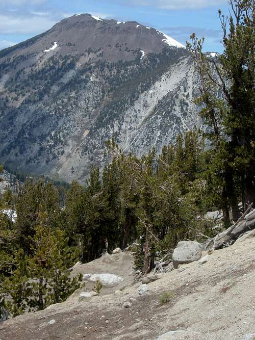 Mount Rose from the Slide Mountain Trail
The dirt road itself doesn't go all the way to the true summit. Simple route-finding is required to scramble over rocks to get to the summit from fifty feet below. Sometimes, the extra effort to reach a difficult summit isn't worth the effort, but Slide Mountain is an exception. The summit view is far superior than other views on the mountain. That makes it worth the extra effort to get there. The summit is right next to some electrical equipment, but there is a rock that is completely devoid of equipment where the best viewpoint is gained. The location of the true summit is obvious the summit area is reached.
Other routes
Just below the summit are ski lifts and the top of ski routes. It is possible to climb Slide Mountain from the ski areas below. The bottom of the slides can be reached via a road off of Highway 431.
Slide Mountain can also be reached from a road off Highway 431 south of the ski areas which heads to a ridge and requires 2,000 feet of elevation gain.
You can bushwhack up the west side of Slide Mountain from Tahoe Meadows, which offers parking less than a mile past the Mount Rose Summit Parking area, going towards Incline Village. From here, it would be a little more than 1,000 feet to the summit, but views would be solid the entire way. This way also avoids having to navigate through all the electrical equipment and electrical wires, but has the disadvantage of no distinct trail.
If you really want a challenge, Slide Mountain can even be climbed from Washoe Lake, over 4,600' below. I am not certain of the specifics of this hike, but welcome anyone to educate the reader on this option.
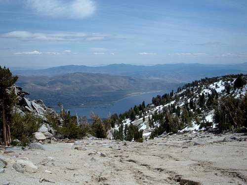 Washoe Lake from the summit