|
|
Mountain/Rock |
|---|---|
|
|
36.05668°N / 51.53848°E |
|
|
Mountaineering |
|
|
Summer |
|
|
13953 ft / 4253 m |
|
|
Overview
Click for Introduction to the Central Alborz Mountains.Click for Introduction to Kholeno Massif.
Click for a detailed map of the Central Alborz Mountains.
Click for a detailed map of the Kholeno Massif.
Khers Chal: 4253 m (13953 ft) (per the 1:50 000 map)
Farakhe No: 4230 m (13878 ft) (per my GPS)
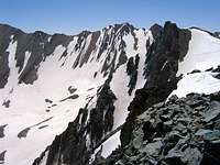
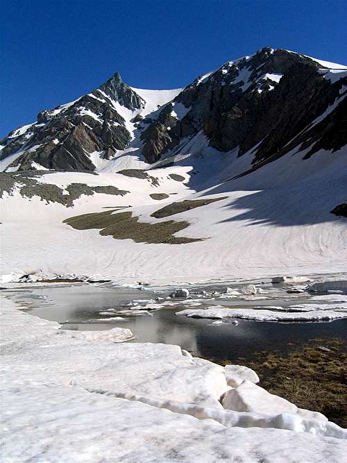 (L) Khers Chal 4253 m & (R) Farakhe No 4230 m
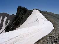
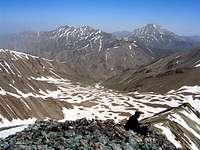
Khers Chal and Farakhe No are a couple of rugged peaks that rise near Mt. Kholeno the Great (4387 m) in the Central Alborz Mountains of northern Iran. Khers Chal & Farakhe No, along with some of their nearby peaks, create a high alpine cirque that houses a small seasonal lake known as Kholeno Lake. The lake sits at an elevation of 3830 m and is formed in the summer months by the gradual melting of the area snow fields.


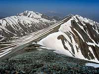
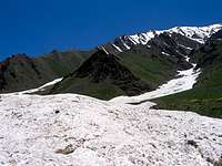
The northern slopes of Khers Chal & Farakhe No are rocky/wall-like and rise to the south of the Kholeno Lake. To the east, Khers chal is connected to the 4268 m Harzeh Khooh Peak and to the west, Farakhe No connects to the 4118 m Bandalkoli Peak (via Peak 4051 m). The southern slopes of Khers Chal & Farakhe No are steep scree fields that go down to the upper portions of the Velayat Rood River Valley (3500-3600 m).
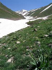
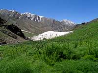
Khers Chal & Farakhe No are a long way from any trailhead. The shortest way to reach the summits of these peaks is to start at the village of Laloon (2400 m), hike to Varzab Pass (3910 m) and then go up the southern slopes to reach the summits. This route can be done in 1-1.5 days (roundtrip) but it misses most of the dramatic scenery. I highly recommend that you approach these mountains via the Varengeh Rood River Valley to the northwest. You will start at the Varengeh Rood Village (2450 m) and then hike 21.5 Km (13.3 miles) along the length of the Varengeh Rood River to reach the Kholeno Lake (3830 m) where you will find a perfect spot to set up your base camp (The hike will take you past the remains of monstrously large winter avalanches and provide you with spectacular views of snow-capped peaks and alpine meadows). From your base camp, you will then be able to access many of the local peaks.
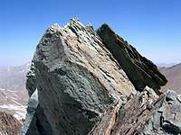
The summit of Khers Chal
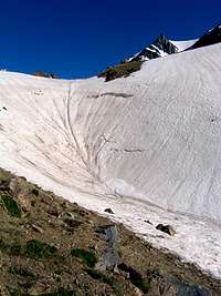 Tip of Khers Chal
 Farakhe No from Khers Chal
From most angles, Khers Chal appears as a peak with a pointy top. The summit of Khers Chal is made of a chimney block that is several meters high. Those who want to reach the true summit, will have to brave crumbling rock and a few hundred meters of near vertical drop on almost all sides.