|
|
Mountain/Rock |
|---|---|
|
|
36.06978°N / 51.50111°E |
|
|
Mountaineering |
|
|
Summer |
|
|
13550 ft / 4130 m |
|
|
Overview
Click for Introduction to the Central Alborz MountainsClick for Introduction to Kholeno Massif.
Click for a detailed map of the Central Alborz Mountains.
Click for a detailed map of the Kholeno Massif.
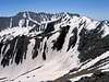
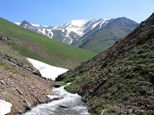
 Looking south from Gavan Poshteh Pass
 Dalkoli
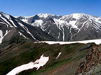 Near Gavan Poshteh
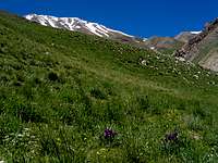
Dalkoli is one of the 4000 m peaks of the Kholeno Massif in the Central Alborz Mountains of northern Iran. It sits on the crest of a long ridgeline that gives rise to many other peaks. To the southeast, Dalkoli connects to the 4118 m Bandalkoli Peak and to the northwest it connects to the 3971 m Nosom Boyder Peak. To the south, the slopes of Dalkoli are steep scree fields that go down to the upper portions of the Velayat Rood River (3400 m). To the north, Dalkoli and Bandalkoli create large snow-filled alpine bowls that eventually drop to the bottom of the Varengeh Rood River Valley (3100 m).
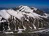
 (L) Bandalkoli 4118 m & (R) Dalkoli 4130 m
 Summit
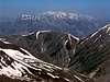
 Dalkoli
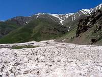
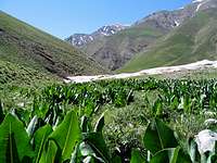
A roundtrip hike to the summit of Dalkoli will probably take longer than one day. The shortest route is to start at the village of Laloon (2400 m) to the southeast and hike to the Varzab Pass (3910 m), Khers Chal summit (4253 m) and then follow the ridgetop to Bandalkoli (4118 m) and then Dalkoli. A southwesterly approach from the bottom of the Dizin ski slopes and the Velayat Rood River Valley is also possible. You will have the best views, however, if you approach Dalkoli from the north via the Varengeh Rood River Valley. You will start at the Varengeh Rood Village (2450 m) and then hike 21.5 Km (13.3 miles) along the length of the Varengeh Rood River to reach the Kholeno Lake (3830 m) where you will find a perfect spot to set up your base camp (The hike will take you past the remains of monstrously large winter avalanches and provide you with spectacular views of snow-capped peaks and alpine meadows). From your base camp, you will then be able to access many of the local peaks.
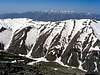
 Dalkoli on the right. From Upper Varengeh Rood Valley
Route Information
This route starts at the summit of the Bandalkoli Peak. Click here to see the Route Page for Bandalkoli. From the summit of Bandalkoli head northwest and follow the ridgetop past a lower false summit down to a 4010 m saddle and then up to the summit of Dalkoli. The hiking distance per my GPS is 1.7 Km.
Views from the summit of Dalkoli