


|
|
Mountain/Rock |
|---|---|
|
|
49.19720°N / 20.04000°E |
|
|
Hiking, Scrambling |
|
|
Spring, Summer, Fall, Winter |
|
|
7126 ft / 2172 m |
|
|
Names & Glossary
|
Szpiglasowy Wierch (Polish) introduced in the second half o the 20th century, derived from the German word Spießglas; it is a reference to stibnite (antimonite) that was once mined nearby Hrubý štít (Slovak) can be translated as Mighty Peak; do not confuse it with Hrubý vrch Liptauer Grenzberg (German) / Liptói-határhegy (Hungarian) means a mountain on the border of the region of Liptov
|
Overview
|

Szpiglasowy Wierch rises from the main ridge of the Tatras to a height of 2172 m where the lateral ridge of Miedziane, separating Morskie Oko (Sea Eye) tarn and Pięć Stawów Polskich (Five Polish Tarns), connects to it around two kilometers west of Morskie Oko. The peak is the highest on the main ridge between Cubryna/Čubrina and Świnica/Svinica and is easily accessible from Szpiglasowa Przełęcz at 2110 m, which divides Szpiglasowy Wierch from the massif of Miedziane and is crossed by the more demanding (waymarked with yellow stripes) of the two hiking trails linking Morskie Oko and Dolina Pięciu Stawów.
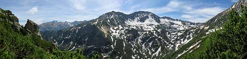
 Szpiglasowy Wierch seen from Szpiglasowa Przełęcz in summer Szpiglasowy Wierch seen from Szpiglasowa Przełęcz in summer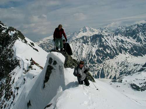 Nearing the summit in May - photo by badyl Nearing the summit in May - photo by badyl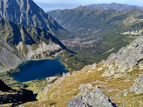 Nižné Temnosmrečinské pleso and Kôprová dolina from Szpiglasowy Wierch Nižné Temnosmrečinské pleso and Kôprová dolina from Szpiglasowy Wierch |
Getting There (to Nearest Huts)
 On the tarmac road On the tarmac road Wodogrzmoty Mickiewicza Wodogrzmoty Mickiewicza Polana Włosienica Polana WłosienicaIn Zakopane, minibuses to Polana Palenica (car park and bus/minibus terminus) leave from in front of the entrance to the railway station. Polana Palenica sits in the valley of River Białka, at about 990 m. On sunny summer days the pay car park there (parking cost an equivalent of €6 per day in 2017; entry fee to the national park a little more than €1 per person) fills up very quickly, so unless you go at dawn it is a good idea to use public transport.
From Polana Palenica you walk up the valley along the same tarmac road for 3 km until you get to the falls named, after a famous Polish poet, Wodogrzmoty Mickiewicza. From the falls you either continue along the tarmac road to Morskie Oko or turn right to follow green marks up the Roztoka Valley, whose uppermost part cradles the Five Polish Tarns and takes its name from them. The walk from Polana Palenica up the tarmac road (later with several shortcuts marked with red stripes) to the hut that sits by Morskie Oko is 8 km long, which translates to about 1 hr 45 min of walking, the elevation gain being 420 m. (About 25 min before Morskie Oko is Polana Włosienica, where you can also get by horse-drawn wagon (or sleigh in winter). A few hundred meters past the place is a restaurant with decent toilets next to it.) The hike from Polana Palenica to the Five Polish Tarns Hut takes about 2 hr 45 min (the distance is about 8 km with 670 m of ascent).
 Valley of Roztoka & Five Polish Tarns - by Konrad Sus Valley of Roztoka & Five Polish Tarns - by Konrad Sus |
Huts & Camping
|


Maps
Routes (from nearest huts) & Maps
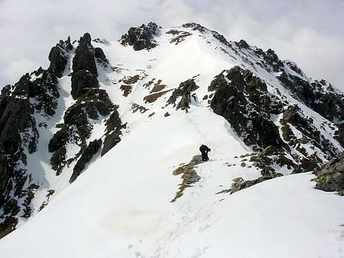
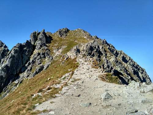
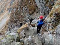
Szpiglasowy Wierch can only be legally climbed via Szpiglasowa Przełęcz, which is crossed by the yellow trail connecting Morskie Oko to Pięć Stawów. From the pass an unmarked path, of which the last several meters are a bit exposed, will take you to the summit in less than a quarter of an hour. The yellow trail from Morskie Oko goes at YDS Class 1, whereas on the other side of the pass its highest stretch is a chain-assisted Class 3. The trail is usually crowded from the end of June to the end of August and on sunny Autumn weekends, unless you are there at dawn.
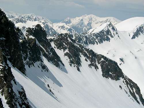
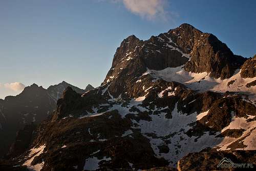 Cubryna and Mięguszowiecki from Szpiglasowa Przełęcz - by Tomek Lodowy Cubryna and Mięguszowiecki from Szpiglasowa Przełęcz - by Tomek Lodowy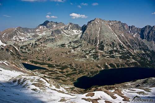 Dolina Pięciu Stawów Polskich from the pass - by Tomek Lodowy Dolina Pięciu Stawów Polskich from the pass - by Tomek LodowyStatistics (Way Up)
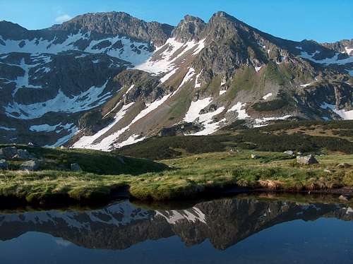 l Szpiglasowy Wierch left of center (the pass further left, the Tatras' main ridge with Wyżni Kostur at 2083 m and Niżni Kostur at 2055 m to the right) and the yellow trail from Dolina Pięciu Stawów in early June - photo by visentin l Szpiglasowy Wierch left of center (the pass further left, the Tatras' main ridge with Wyżni Kostur at 2083 m and Niżni Kostur at 2055 m to the right) and the yellow trail from Dolina Pięciu Stawów in early June - photo by visentinWinterWinter routes do not always follow the yellow marks, especially the section between the Pięć Stawów Hut and the final ascent of Szpiglasowa Pass is in fact completely different and traverses the lower slopes of the Miedziane ridge. Avalanche risk is often considerable.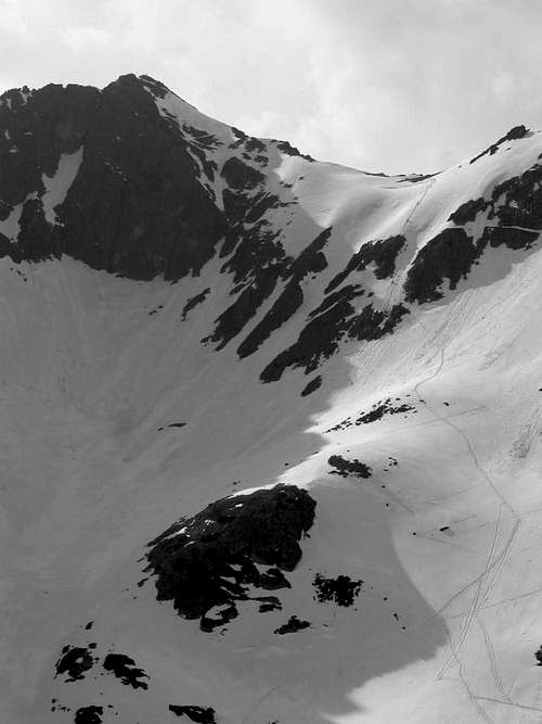 SE side of Szpiglasowa Przełęcz in May - by badyl SE side of Szpiglasowa Przełęcz in May - by badyl |


Red Tape
The Tatra Mountains are a national park in which you must keep to waymarked trails. Bivouacking is not permitted. In theory, after dark you are supposed to leave the national park or stay in a mountain hut. Rock climbing is not permitted in the vicinity of Szpiglasowy Wierch, which means that you are not allowed to hike/climb along the adjacent sections of the main ridge of the Tatras. This is a pity, because the section of the ridge between Szpiglasowy Wierch and Przełęcz Chałubińskiego (Chałubiński's Pass, accessible via red marks from Dolina za Mnichem - please see the map above), named Szpiglasowa Grań, offers a fine scramble of an easy YDS Class 4 (if you traverse the pinnacles).
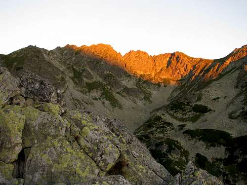 Eastern face of Szpiglasowa Grań at dawn Eastern face of Szpiglasowa Grań at dawn |
Mountain Conditions & Rescue
 Westerly view from very near the summit - by badyl Westerly view from very near the summit - by badyl
|