
-
 14903 Hits
-
 84.27% Score
-
 18 Votes
|
|
Mountain/Rock |
|---|---|
|
|
35.72505°N / 83.19981°W |
|
|
Hiking |
|
|
Spring, Summer, Fall, Winter |
|
|
5200 ft / 1585 m |
|
|
Overview
Cosby Knob, Ross Knob, and Camel Hump Knobs all lie on the Appalachian Trail, or trivially just off to the side of the trail. Only Cosby Knob requires any bushwhacking to the top, and you’ll hit the other two whether you know it or not. Cosby Knob is 5028 feet, Ross Knob about the same, and Camel Hump Knob closer to 5200 feet.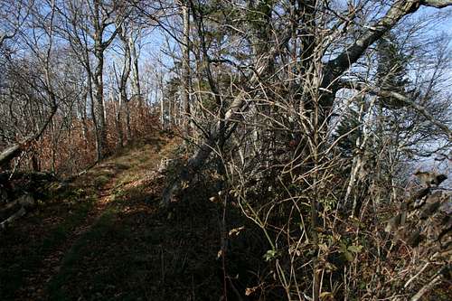 Summit of Ross Knob
They lie between Yellow Creek Gap/Inadu Knob to the west (“south” on the AT) and Low Gap to the east (“north”). They’re all named points but they might be a bit hard to distinguish. Cosby Knob and Ross Knobs are just round bumps on the ridge that the AT follows, which is pretty much a part of the Mount Guyot massif. However, Camel Hump Knob is officially the summit of Camel Hump Mountain, and the end of this stretch at Inadu Knob is the summit of Inadu Mountain.
It’s only 4.7 miles from Yellow Creek Gap to Low Gap, so this stretch of the AT makes a reasonable part of a larger loop from either side of the park. It’s much closer to Tennessee trailheads, though (see below).
Route
 Hitting the AT
You can hit these summits either from the west (AT “south”) at Inadu Knob or from the east (AT “north”) at Low Gap. Starting this trip at the Inadu Knob side requires a steeper approach, especially if you use Snake Den Ridge. For that reason, I’ll provide access information from the Low Gap direction.
First, you have to ascend to Low Gap from Cosby, which ascends over 2000 feet in 2.9 miles. It doesn’t look that steep when you’re on it, but compare that to some other trail you know. It’s steeper and longer than the hike to the top of Nevada Falls in Yosemite, for example.
From there, you have to ascend some more - - after all, they call it “Low Gap” because it’s lower than the other gaps. Turn to the right and start to go south on the AT. It’s essentially uphill all the way from Low Gap (4242 feet) to Inadu Knob (5925), but it’s less steep than the ascent to Low Gap.
Just past the Cosby Knob shelter, you’ll see the knob ahead and on your right. Pick a likely spot and bushwhack up if you want.
After that, it doesn’t take long to reach Ross Knob, a little over half a mile from the left-turn in the trail that marks your departure from Cosby Knob. It’s marked by a slight ascent and narrowing of the trail, followed by one of the few descents on this stretch of the AT.
About a mile after Ross Knob you’ll his the Camel Gap Trail down the North Carolina side of the park. It’s about 12-13 miles to the nearest trailhead in that direction. Less than a mile from this junction the trail does another little extra ascent/descent, and that’s Camel Hump Knob.
From there it’s a pretty straight but steady uphill stretch to Inadu Knob and the junction with the Snake Den Ridge Trail. Look for the wreckage of an F-4 downslope.
From Inadu Knob, take either the Snake Ridge Den Trail or Maddron Bald and Gabes Mountain trails back to Cosby. Snake Den Ridge is all downhill, while the other route has a small climb of a few hundred feet after the junction of the two trails.
Distance is 13 miles via Snake Den Ridge, plus a few tenths of a mile to get to your car. There’s only one campsite on this route, at Cosby Knob Shelter (reservations required).
The distance is 21.5 miles if you take the Maddron Bald/Gabes Mountain route, with the Albright Grove loop (which adds 0.4 miles). There are three camping options here: Cosby Knob Shelter and Otter Creek #29 (both require reservations) and Sugar Cove #34 (no reservations needed, but free permit required).
 View from Camel Hump Knob
Getting There
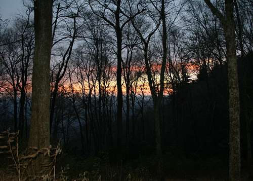 Sunrise Comes to North Carolina
This route starts at the Cosby Campground in the eastern part of Great Smoky Mountain National Park. From Gatlinburg, take Highway 321 “north” (mostly east) for 15.4 miles; from I-40, take the exit to the town of Cosby and continue for 2.9 miles south of town to the junction of 32 and 321. Follow the sign south on Laurel Springs Road to the park’s Cosby Campground, including a right turn off Highway 32 where you see a Park Entrance Store.
The hikers’ parking area is left just after the entrance gate to the campground. That’s also where you fill out your backcountry permit.
We didn’t have any problems but this area supposedly sees a lot of auto break-ins. Rumor has it that nearby businesses will allow you to park in their lots.
Camping
 Cosby Knob Shelter
The newly-refurbished Cosby Knob Shelter makes for luxurious backcountry living on the slopes of Cosby Knob.