
-
 18535 Hits
-
 88.61% Score
-
 27 Votes
|
|
Mountain/Rock |
|---|---|
|
|
36.38370°N / 117.2285°W |
|
|
Inyo |
|
|
Hiking |
|
|
Spring, Summer, Fall, Winter |
|
|
7508 ft / 2288 m |
|
|
Overview
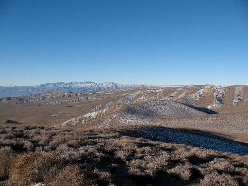
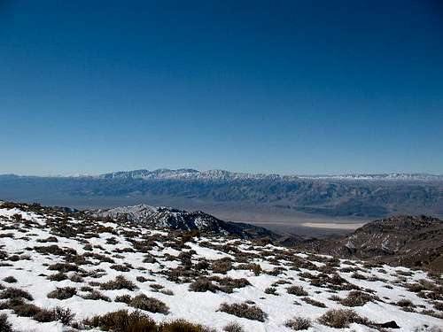
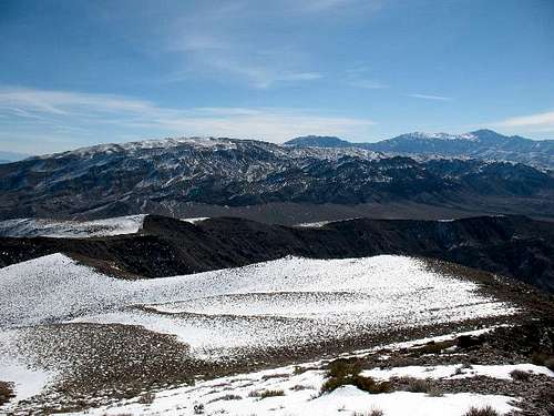
Pinto Peak is located on the west side of Death Valley National Park,on the south side of Hwy 190, and is in the Panamint Range. Pinto Peak is ranked number 129 on the list of prominence peaks in California with a prominence of 2,190 ft. Telescope Peak is located about 17 miles southeast of Pinto Peak.
There is lots of great information about Death Valley Area, the Panamint Range, and California Desert Peaks on other pages in Summit Post. It would be a duplication of efforts to repeat all that information here.
The route I choose to climb Pinto Peak is from Emigrant Pass on Wildrose Canyon Road. This route is not technical. The primary danger is the weather with heat and lightning in the summer and the occasional snow storm and high winds in the winter. There are other routes to the summit of Pinto Peak. It is often climbed from the north from Towne Pass. The Towne Pass route is considerably shorter but it is rougher with no trail. Some route finding is required to climb from the north.
Getting There

The trailhead that I used is easy to find. It is on Wildrose Canyon Road on the west side of Death Valley National Park. Emigrant Pass is located between Hwy 190 in Death Valley and Hwy 178 in Panamint Valley. This is the same road to access the normal trailhead for Telescope Peak. Elevation of Emigrant Pass is 5,318 ft and there it is signed on Wildrose Canyon Road. The occasional winter snowstorm will dump several inches of snow at this elevation.

If you are approaching Pinto Peak from the west on Hwy 190 or Hwy 178, you will be in the National Park and you will need to have paid the $30 (as of 2021) entry fee to enter the National Park. The first pay station is located east of here in Stovepipe Wells. There are automated fee machines at several locations throughout the park if you enter a different direction, and you can also pay at Furnace Creek Visitor Center.
There is room to pull off the road at Emigrant Pass for a few cars on both sides of the road.
Red Tape

There is no red tape for hiking in Death Valley National Park. Check with the park headquarters if you have any questions.
Camping

Camping in Death Valley is a list of Death Valley National Park provided campgrounds.
More info on Commercial Death Valley activities
Folks must camp in legal camping locations. The National Park Service recently (in 2021) updated the Death Valley Park website Backcountry Camping - Death Valley National Park (U.S. National Park Service) (nps.gov) which shows where people can backcountry camp, if you choose to sleep in your car, or if you choose to backpack. Parking on the side of the road at Emigrant Pass is not a legal place to camp. You need to camp in the backcountry wilderness as indicated on the wilderness map.
There is no water available along the route from Emigrant Pass.
Each year the park visitation increases, and with that increase, sadly comes more resource damage. With folks following the park rules and regulations, it will decrease potential damage. The hope is to keep the park in pristine shape for future generations to enjoy, and to ensure visitors have a fun and safe experience.
When to Climb

Pinto Peak can be climbed at any time of the year. You just have to be conscious of the Weather. After a snowstorm, the snow will add to the difficulty of the hike. In the summer the heat can kill you. It is best to climb the peak in the winter when it isn’t unbearably hot.
Mountain Conditions
This is a link to more Death Valley weather info.
From the main Home page Death Valley National Park the Morning Report has good info on weather and roads.
Acknowledgments
Dennis Poulin was the original creator of this page and has asked me to take care of it. Thanks for all your contributions to the peak-bagging world Dennis!
I intend to make updates to the page in the near future. If you have any pressing information that needs mention, please let me know.