|
|
Mountain/Rock |
|---|---|
|
|
42.06176°N / 74.50926°W |
|
|
Ulster |
|
|
Hiking |
|
|
Spring, Summer, Fall, Winter |
|
|
3610 ft / 1100 m |
|
|
Overview
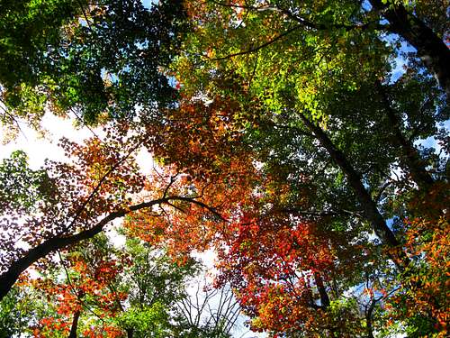 The Catskills in the fall
Eagle Mountain, in the Catskill Range of New York, is one of the 35 peaks that rise above 3500 feet in that range. Therefore many people will go to Eagle because they are pursuing a goal to reach all those peaks to be a member of the Catskill 3500 club. The mountain is located in the Big Indian Wilderness of Catskill Park, which is a more remote area of the Catskills, but an area that has many hiking trails, and many opportunities for a great single day in the mountains, or multiple day adventures. Eagle can be approached basically from all four directions.
The summit of Eagle is slightly off the Pine Hill-West Branch trail. There's a very short side path off the trail that leads to a small clearing area, that has a small cairn. The side path leaves the trail as the trail is making a curve. Going north on the Pine Hill-West Branch trail you could walk right to the cairn, and then realize you went off the trail.
 3500 marker
The Pine Hill-West Branch trail is a 15 mile trail that runs from Pine Hill to the west bank of the Neversink River. Besides Eagle, two other Catskill 3500 peaks are on, or slightly off the trail, and they are Balsam and Big Indian. Many hikers will combine one of those two mountains with a trip to Eagle. The more intrepid hiker will go for the hat trick, and try to get all 3 on one hike. There are many lean-tos in the area, so the opportunity is there to spend a couple of days by the mountain.
Eagle is located almost at the halfway point of the Pine Hill-West Branch trail. So it is a long hike if one is just using that trail from either the north or south direction. The Pine Hill-West Branch trail is not particularly a pleasant trail to hike on for a long period of time. There are hardly any views from the trail, it doesn't receive a lot of traffic or attention, and the forest is overtaking the trail back. You have to fight your way through tree branches, shrub, and weeds on the trail. For those reasons most hikers will approach Eagle from two other trails that lead to the Pine Hill-West Branch trail.
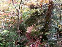 Pine Hill-West Branch trail
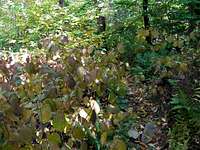 Pine Hill-West Branch trail
One trail that leads to the Pine Hill-West Branch trail is the Seager-Big Indian trail. This trail comes in from the west, where it terminates at the Pine Hill-West Branch trail. You would turn left and head north for a little over a mile to reach the summit of Eagle. The Seager-Big Indian trail is 3.1 miles. There are numerous water crossings on this trail, and some of them can be damn tricky. The Shandaken Creek lean-to is located on this trail as well.
 Seager-Big Indian crossing
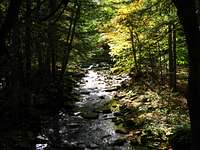 Seager-Big Indian trailside
The other trail that leads to the Pine Hill-West Branch trail is the Oliverea-Mapledale trail. This trail crosses the Pine Hill-West Branch trail, so you have a choice of which direction you want to take. You can come in from the northwest from Rider Hollow, or you can come in from the southeast from McKinley Hollow. From either direction it is 1.8 miles to the Pine Hill-West Branch trail. It is very steep if you decide to come in from McKinley Hollow, and there are some tricky water crossings to be dealt with. The trail itself can become dangerous if it is icy, or really wet. Once you reach the Pine Hill-West Branch trail it is 2.15 miles to the summit of Eagle Mountain. You go over the summit of Haynes Mountain on the way to Eagle. Also there are two lean-tos on the Oliverea-Mapledale trail, one on each end, close to the trailheads on both sides.
Getting There
If you are taking the Seager-Big Indian trail you would drive on Dry Brook Valley Road (CR 49), off NY 28 from Arkville until its end where you would locate the trailhead.Dry Brook Valley Road also will take you to the western end of the Oliverea-Mapledale trail. You would turn off Dry Brook Valley Road on to Galli Curci Road (CR 49A), and then turn on to Rider Hollow Road. You would follow Rider Hollow Road until its end.
The other end of the Oliverea-Mapledale trail is off McKinley Hollow Road in Oliverea. You would take CR 47 from NY 28 in Big Indian to reach McKinley Hollow Road which leads to the trailhead, located across from the Mountain Gate Indian restaurant.
The north end of the Pine Hill-West Branch trail is located off Woodchuck Hollow Road in Pine Hill.
The south end of the Pine Hill-West Branch trail is located on CR 47 (called West Branch Road where the trailhead is located), 12.5 miles south of NY 28.
Red Tape
There's no red tape to deal with. Some areas off the Seager-Big Indian trail are private property. There are signs marking this.Camping
There are many lean-tos in the area for camping. There is the Biscuit Brook lean-to, 1.9 miles from the start of the Pine Hill-West Branch trail from West Branch Road (CR 47).On the Seager-Big Indian trail there is the Shandaken Creek lean to, 2.1 miles from the start of the trail.
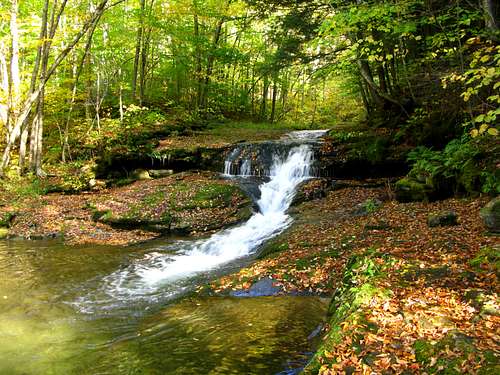
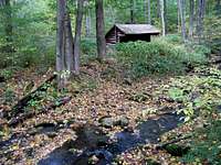 Shandaken Creek
On the Oliverea-Mapledale trail there is the Rider Hollow lean-to, 0.5 miles from Rider Hollow Road. There is also a lean-to 0.6 miles from the McKinley Hollow start of the trail.
On the northern side of the Pine Hill-West Branch trail there are two lean-tos. One is on the Belleayre Ridge trail, which runs into the Pine Hill-West Branch trail on Belleayre Mountain. There is another on the Pine Hill-West Branch trail itself before Belleayre Mountain, if you're coming from Pine Hill.
External Links
For weather information I usually head to: NOAAWeather Underground
Two sites I like to check out for Catskill info are: Catskill-3500 Club
Catskill Hiker
The guidebook I always recommend for the Catskills is : Catskill Mountain Guide
Two good mountain clubs in the Northeast which occasionally go to the Catskills are: Appalachian Mountain Club
Adirondack Mountain Club
A site that has lattitude and longitude information is: Peakbagger