
|
|
Mountain/Rock |
|---|---|
|
|
45.43853°N / 110.99099°W |
|
|
Gallatin |
|
|
Hiking, Scrambling, Skiing |
|
|
Spring, Summer, Fall, Winter |
|
|
10085 ft / 3074 m |
|
|
Overview
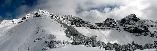 Elephant on the left, from the saddle.
Elephant Mountain is located in the Hyalite portion of the northern Gallatin range. Elephant sits at 10,085 ft according the Fridley Peak USGS quad. Although it doesn't have a trail leading all the way to its summit, it is an easy scramble from the trail leading to Mount Blackmore once the trail reaches a col where Blackmore is further northwest up the ridgeline, and Elephant being directly east around 1/5 mile of easy scrambling (~400 feet of vertical from this point).
Total hike is right around 9 miles round-trip, with about 3,350 of vertical feet. Hiking/skiing time should be around 4-7 hours for someone in decent athletic shape. The trail follows Blackmore Creek for the majority of the lower section before climbing up to a saddle. I recommend bringing the Fridley Peak and Mount Blackmore quad sheets if interested in looking around on top and pinpointing the different peaks around Elephant. Quads can be bought in Bozeman at the Forest Service office off Huffine, Barrel Mountaineering on Main, or Northern Lights on Babcock.
Getting There
 Topo with route
 Northeast face of Elephant
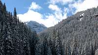 From Blackmore Lake
 Gallatin Peak (19 miles away)
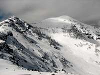 View of Mount Blackmore from saddle
 Alex Lowe Peak from saddle
Drive south out of Bozeman on 19th for about six miles. The road will bend right towards the west. Go about a mile after this turn, and turn left (will be a sign for Hyalite Canyon Road). Follow this all the way to the reservoir, at which point you will need to park in the large Blackmore parking area near the restroom facilities on the west end, which is right next to the trailhead for Mount Blackmore. Follow this trail up around 1.3 miles to Blackmore 'Lake' (more of a pond/marsh). As a side-note, this trail receives quite a bit of traffic normally; Blackmore is a popular hike for Bozeman families and implants to the area. When you arrive at the lake, you can get a glimpse of Elephant by walking towards the lake and meadow... The trail will continue up, and starting climbing a slightly tougher gradient, rolling in and out the trees.
Soon there will be a few meadow openings and you should be able to easily see the side of Elephant with many of its steep rock walls to the left of the main Blackmore trail. After a total of 3.5 miles, there will be several longer switchbacks to be ascended leading to the obvious saddle above. Upon reaching this col, the trail forks; to the right ridgeline leads 3/4 mile up to Mount Blackmore(which could also be added when scrambling Elephant), and another trail that goes off the backside of the the saddle which eventually leads to the South Cottonwood trail.
In the winter, as of this season (2008-09) the USFS has graciously - more or less - worked with many recreation groups (notably the ice-climbers and skiers) and has since been able to secure funds and they are currently plowing the Hyalite Canyon road all the way to the Grotto Falls parking area. This has been a huge achievement, allowing almost everyone full winter access to this area... I have seen a ton of people using the road this winter, and I'm happy to see that, because the amount of use should help keep this access open to us in the future and help the FS realize that it's worth their while.
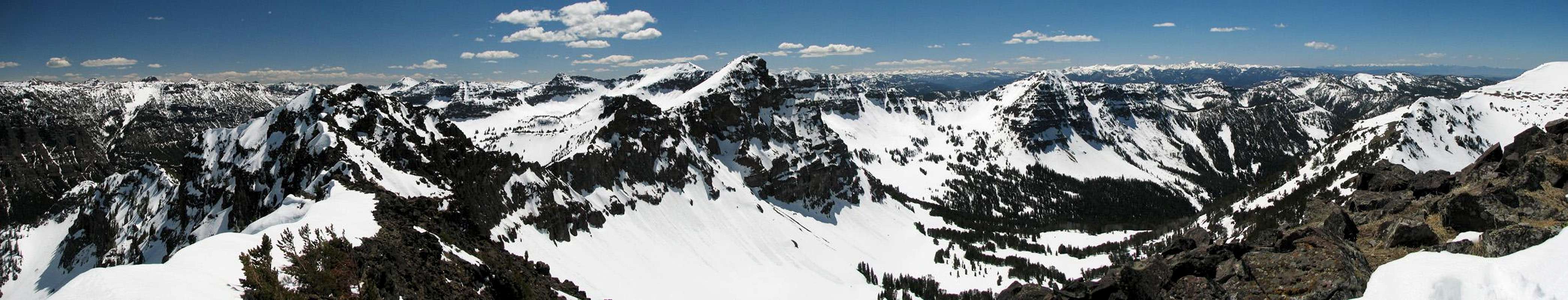
From the top of Elephant there are great views all around. Across the drainage below and the saddle ascended earlier is Mount Blackmore, a popular ski or hike for locals. Towards the southwest is Alex Lowe Peak with some very interesting features. South is Hyalite Peak with its very conical shape and craggy cliffs to the east. Depending on conditions you can easily see the Madison range to the west, with the unique shape of the Sphinx really sticking out. To the north is Gallatin Valley and the Bridger range is visible. Northeast are the impressive Crazy Mountains, usually holding snow well into late-July. Due east, the Absaroka Range is clearly visible, dominating the horizon with sharp peaks - Mt. Cowen prominently sticks out especially.
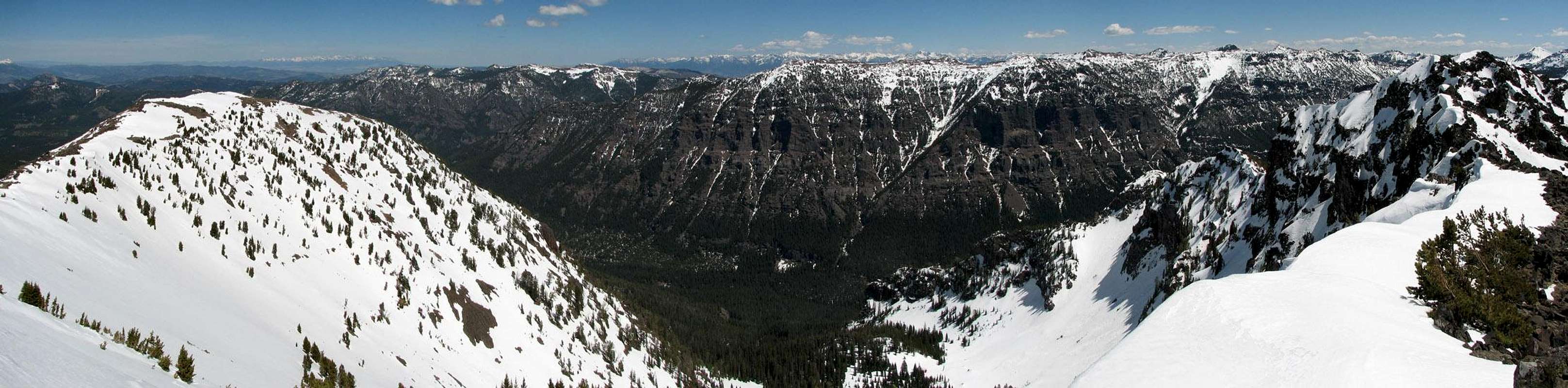
Summit Views
At some point I will annotate a version of this panorama with all the peaks I can identify...
 |
|
Red Tape
 Hyalite peaks
Hyalite Canyon is all Gallatin National Forest... no wilderness, park, or recreation area regulations or special fees apply here. Check out the Gallatin Forest website and the MT Avalanche Center website for some great info and avy reports and forecasts. Use sustainable and low-impact trail practices; tread lightly, protect the watershed, and pack out everything you take in. Get ahold of Gallatin National Forest at 406-522-2520 or visit their website for more details. Help keep access open for everyone, as this area is heavily used - at least by Montana standards.
Camping
Hyalite Canyon has many designated campsites to accommodate different size groups and vehicles. These are located on the main canyon road both before and after the Blackmore trailhead. Camping is permitted as well within the forest, but do not set up camp right next to the trails, and keep a reasonably distance from streams and lakes. Contact the Bozeman District FS Office for more details about camping at 406-522-2520.External Links
Gear in Bozeman:Prolite Gear, website, 406-582-0508, 421 West Griffin Drive, Suite 1, Bozeman
Barrel Mountaineering, 406-582-1335, 240 East Main, Bozeman
Northern Lights (and Barn), 406-586-2225, 1716 W. Babcock, Bozeman
Chalet Sports, 406-587-4595, 108 W. Main, Bozeman
Forest Service Office:
Bozeman District Office, 406-522-2520, 3710 Fallon St., Suite C, Bozeman