
-
 10027 Hits
-
 83.1% Score
-
 16 Votes
|
|
Mountain/Rock |
|---|---|
|
|
48.35760°N / 114.7582°W |
|
|
Flathead |
|
|
Hiking |
|
|
Spring, Summer, Fall |
|
|
6125 ft / 1867 m |
|
|
Overview
 Ingalls Mountain from Star Meadows Road
Ingalls Mountain stands in the Salish Range at 6,125 feet. It is the 25th tallest mountain in the Salish Range. Ingalls Mountain is a fairly easy mountain to climb. The Salish Range lies west of the town of Whitefish. Ingalls refers to a surname of Scottish origin and a placename, but the person it was named after is unknown to me.
History
 Burned vegetation along the trail
Getting There
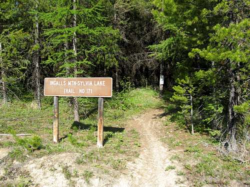 The trailhead
Travel on the Farm-to-Market Road for about 2 miles and make a right onto the Star Meadows Road. Travel on the paved Star Meadows Road for 17 miles{the road is paved, but there are lots of potholes}. After you travel the 17 miles you come to Road #538 also known as the Griffin Creek Road. Turn left onto the dirt road.
Cross over the bridge and continue on Road #538 up the hill for 2 miles until you come to a sign that indicates the Sylvia Lake turnoff. Immediately turn right after the sign and park after turning. The Ingalls Mountain trailhead is at the right and is marked by a sign that says Trail #171.
Red Tape
Ingalls Mountain is located in the Salish Range. This is bear country, so hike with bear spray and make lots of noise.Another warning is to stay on the trail at least until you get to the 2nd clear cut where you have to go straight up. There is a poisonous plant called the Ragwort. The tansy ragwort was first reported in 1922 in Oregon, its a Eurasian weed that primarily spreads by seed. One can produce up to 150,000 seeds and can remain viable up to 15 years. It causes liver damage to both cattle and horses. Due to this noxious root the roads and campgrounds were closed because people were afraid it would've spread. Click at the link above to find more about the ragwort. The Tally Lake Ranger Station is working on a control project for the root.
Ridge Views
 SP Member Rebelgrizz enjoying the views from the ridge
 The summit
Route Information
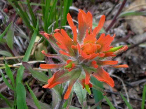 An Indian Paint Brush seen along the trail
 Looking through the clear cut at the false summit
Equipment
Bring bear spray, water, insect repellent for the hundreds of mosquitos that follow you throughout the whole hike, and good foot gear for the numerous rocks on the trail.Weather
Camping
You can camp at the Tally Lake Campgroundor the Sylvia Lake Campground.