-
 17289 Hits
-
 89.01% Score
-
 28 Votes
|
|
Mountain/Rock |
|---|---|
|
|
44.01339°N / 113.58181°W |
|
|
Custer |
|
|
Hiking, Mountaineering, Mixed, Scrambling |
|
|
Spring, Summer, Fall |
|
|
11982 ft / 3652 m |
|
|
Overview
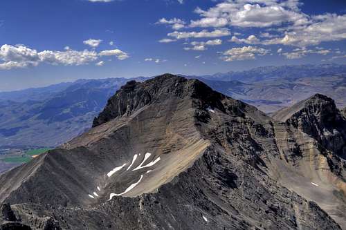
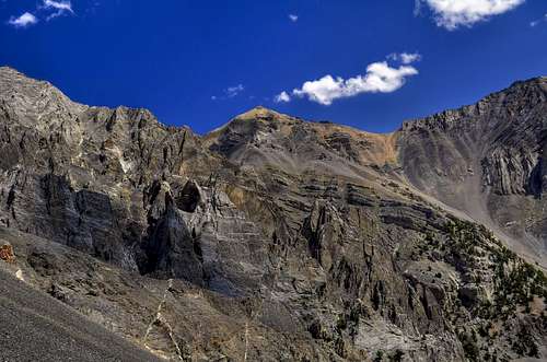
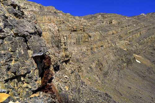
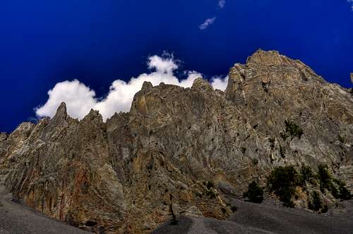
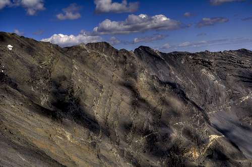
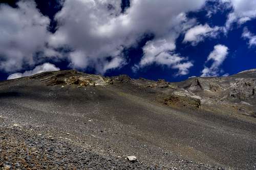
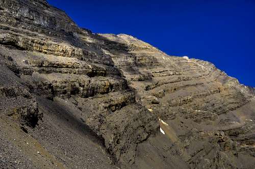
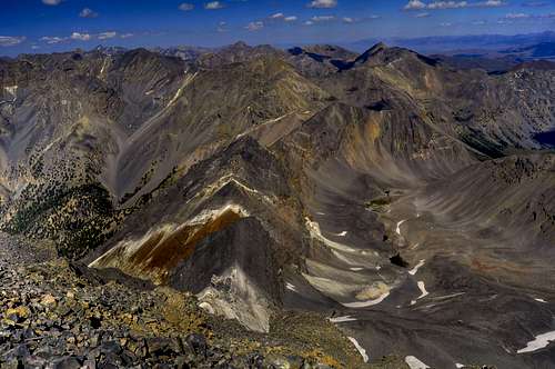
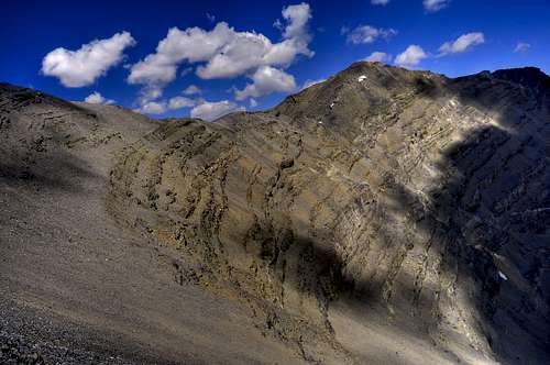
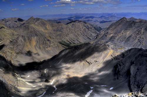
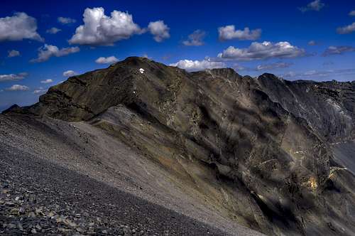
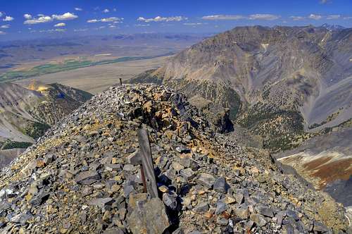
As Idaho's 10th highest mountain, USGS Peak offers a challenging and remote mountain scramble or snow climb. The peak is not easily seen from the main roads, and despite being the highest mountain in Idaho that isn't a 12er, it sees a limited number of ascents. This mountain offers a remote and rugged ascent over heavily layered bands of sedimentary limestone. This geology creates interesting navigational challenges as one must ascend these bands. Most often, they have breaks and weaknesses in the rock that allow for relatively straight forward Class 3 climbing. Still, with the relatively long and rugged approach (5.1 miles / 5511 feet gain) over mostly trail-less terrain, USGS Peak is arguably as difficult a climb as any of it's neighboring 12ers.
USGS is named after the United States Geological Survey, which in the early 1900's measured USGS Peak as 12,000 feet. For a portion of climbing history, this peak had the esteemed 12er status. Later in the century, the US Coast & Geodetic Survey came in and did a more accurate measure of it's current elevation of 11,982 feet. They used flares in their measurements for the triangulation station and named the point McCaleb, which ironically is shown on the USGS map still. The flares, as of 2009, can still be found near the summit. Early accounts by local farmers indicate that this peak was seldom if ever climbed. More recent indications (2009) indicate that the last summit register signature was from 1992 and nothing before that. Regardless of the exact amount of ascents, it's very clear from the lack of any cairns, paths, and summit presence in general, that this peak is seldom climbed.
As of August 2009, The Montana Conservation Corps was installing a new trail up Lower Cedar Creek from the parking area. It appeared that this trail will be approximately 1 mile to the old dam area, and it will provide a route generally above the high water mark.
To read more on the history of USGS Peak see the Rick Baugher article on ClimbingIdaho.com
To view a trip report of a North Face climb, and possibly the 2nd ascent overall, see the Tom Lopez site.
Routes
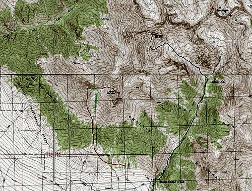
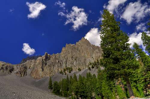
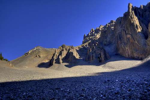
South Ridge / SE Slopes via Lower Cedar Creek (Class 3)- from the obvious parking area at the end of the road, cross the canal and follow the trail for approximately 1 mile past the old dam site. Along this area you will find old irrigation remnants, primarily coils of metal. Past here the trail thins out and at mile 1.2 you'll pass on the right the primary water source, Hole in the Rock, an impressive gusher of water cascading down the steep side canyon. Past here, follow lower Cedar Creek while alternating sides of the creek for ease of travel. Avoid the open rocky slopes and find the forested edges for easiest travel. At approximately 2.7 miles and 8400 feet, find the steep side canyon to the left (to the NW) and ascend the small sized boulder field and follow the side canyon as you ascend. Avoid vertical limestone bands by staying mostly on the east side as the grade eases toward the upper part of the valley. On the left you'll notice a sandy slope. Go beyond this area and look for the hidden east slope that starts at around 10,800 feet. Ascend this area either taking the snow fields (lingers into Sept), or climb the cliff bands. Angle your way to the prominent south ridge. Once on the south ridge, stay primarily on top with brief visits to the east, then west sides before the obvious summit ridge. Ascend the final 400 feet by zig-zagging back and forth over loose rocks.
From the Lower Cedar Creek Parking Area: 5.1miles and 5511 feet gain (one way)
Round Trip Time Estimate: 7-10 hours
North Face Snow Climb - this highly regarded route starts in Long Lost Creek and provides late season snow access on moderate terrain. The first ascent was by Tom Lopez and D. Hanson. See Tom Lopez's "Idaho: A Climbing Guide" for more information.
Getting There
Directions for the Lower Cedar Creek Route is similar to the Approach for McCaleb and Little Mac
From Mackay Idaho off US Highway 93, turn right on Main Street (toward NE) and drive toward the hills. After .4 miles, the road curves to the right and you’ll pass Mount McCaleb cemetery shortly after that. At about 1.9 miles, look for Lower Cedar Creek Road on the left heading north. From here, follow a decent (summer months) gravel road that follows Cedar Creek to the base of the canyon. There are many intersecting roads and branches. You should pass on your left a gated off farming / hay collection area.
Check the road conditions at: Idaho Transportation Department

Conditions and Season
Conditions may vary greatly. There are periods of very dry and cold weather in the winter.
Nearby Mackay, Idaho Climate Data:
| Jan | Feb | Mar | Apr | May | Jun | Jul | Aug | Sep | Oct | Nov | Dec | Annual | |
| Average Max. Temperature (F) | 29.2 | 34.2 | 43.0 | 55.2 | 65.2 | 74.1 | 84.1 | 82.7 | 73.3 | 60.1 | 42.1 | 31.3 | 56.2 |
| Average Min. Temperature (F) | 5.6 | 10.1 | 18.9 | 28.1 | 35.9 | 42.3 | 48.4 | 46.3 | 38.3 | 30.0 | 18.7 | 8.9 | 27.6 |
| Average Total Precipitation (in.) | 0.78 | 0.61 | 0.61 | 0.68 | 1.09 | 1.34 | 0.93 | 0.80 | 0.67 | 0.57 | 0.59 | 0.78 | 9.43 |
| Average Total SnowFall (in.) | 7.5 | 5.9 | 2.4 | 0.5 | 0.1 | 0.0 | 0.0 | 0.0 | 0.1 | 0.2 | 2.0 | 7.3 | 26.1 |
| Average Snow Depth (in.) | 5 | 4 | 1 | 0 | 0 | 0 | 0 | 0 | 0 | 0 | 0 | 3 | 1 |
For general comparison, the Lost River Valley is much drier (climatologically a desert) in the winter than some of the ranges to the west in Idaho. Yet in the summer, the Lost River Valley receives more precipitation. Periods of dry, cold, and windy weather may give opportunities to climb nearly year round.

Salmon-Challis National Forest Info
http://www.fs.fed.us/r4/sc/lostriver/maptravelplanaerialphotos.shtml
National Weather Service Current Forecast for Mackay:
http://newweb.wrh.noaa.gov/total_forecast/index.php?zone=idz032&county=idc037&wfo=pih&dgtl=1&lat=43.91472&lon=-113.6125