
|
|
Mountain/Rock |
|---|---|
|
|
39.06145°N / 106.53325°W |
|
|
Lake |
|
|
Mountaineering |
|
|
Summer |
|
|
12941 ft / 3944 m |
|
|
Overview
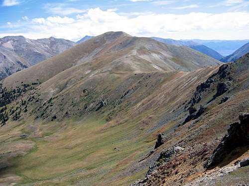
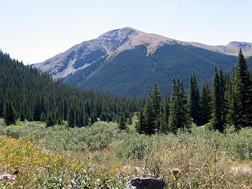 North Face of Star Mountain as seen from Route 82
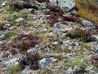 Ptarmigan
Star Mountain rises above Route 82 in the Sawatch Mountains of Central Colorado. Along with the famous Fourteener La Plata, Star Mountain is well visible from the switchbacks on Route 82 east of Independence Pass.
Like the tip of a peninsula, Star Mountain is surrounded by valleys on three sides. Its only connection to the other mountains is via a ridgeline to the southwest. This ridgeline gives rise to a series of three unnamed high points with elevations in the 12000 ft range before connecting to the 12957 ft Ouray Peak (and ultimately Grizzly Peak).
Star Mountain can be accessed from Mc Nasser Gulch to the southwest. The USGS Map shows a trail that goes from the Mc Nasser Gulch Trail to the top of the mentioned ridgeline (see map). This trail is also referenced in some of the guidebooks. In August of 2009, however, I was not able to see any sign of this trail. If such a trail ever existed, it has now most likely faded away. Reaching the top of the ridgeline, therefore, requires hiking up steep grassy slopes.
From the summit of Star Mountain you will have good views of much of the northern Sawatch Mountains including Colorado’s highest and fifth highest peaks Mt. Elbert & La Plata Peak. Portions of Route 82 and Twin Lakes will also be visible.
 East face of Star Mountain as seen from Route 82
Views from the Summit of Star Mountain:
 Independence Pass Independence Pass | 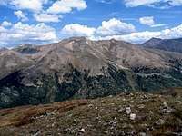 Lackawanna Peak Lackawanna Peak |  Elbert/Twin Lakes Elbert/Twin Lakes |  La Plata La Plata |
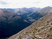 Sayres Gulch Sayres Gulch | 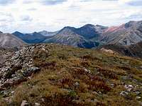 Peekaboo Gulch Peekaboo Gulch | 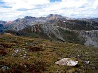 Grizzly Peak Grizzly Peak | 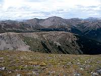 Mtn Boy Park Mtn Boy Park |
Getting There
 Southwest Face of Star Mountain as seen from near Point 12743 ft
Directions to Mc Nasser Gulch Trailhead:
From Independence Pass on Route 82, drive 9.3 miles east (or 14.5 miles west from junction of Routes 82 and 24) to the “South Fork of Lake Creek Road” (FR 391) (the parking area for La Plata Peak Trail is in the same area). This is a dirt road that is rough with many pot holes but is technically a 2WD road.
Turn south onto the South Fork of Lake Creek Road. At 2.8 miles go straight (right). After 3.3 miles you will reach the junction of “Mc Nasser Gulch Road” (FR 394). This is your trailhead (10760 ft)
4WD can continue another 1.1 miles to road closure at 11360 ft.
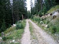 Mc Nasser Gulch Rd Mc Nasser Gulch Rd |  Mc Nasser Gulch Rd Mc Nasser Gulch Rd |
Red Tape
No fees or permits for day hiking.For other regulations, see the site for San Isabel National Forest.
 Grassy Slopes Grassy Slopes |  View from Grassy Slopes View from Grassy Slopes | 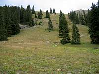 Grassy Slopes Grassy Slopes |
Weather
See the forecast for the nearby town of Leadville, CO.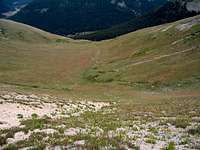 Bowl Bowl |  Bowl Bowl |
Map
