
-
 26724 Hits
-
 84.27% Score
-
 18 Votes
|
|
Mountain/Rock |
|---|---|
|
|
37.85429°N / 119.45035°W |
|
|
Mariposa |
|
|
Hiking, Sport Climbing, Scrambling |
|
|
Summer |
|
|
9806 ft / 2989 m |
|
|
Overview
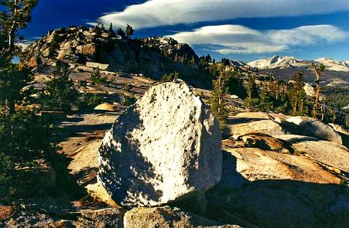
Northeast to Mt. Conness. Polly Dome summit above big white rock.
Getting There
Northeast from Polly Dome summit
Take the trail north about 1 mile where it comes to open granite and rocks and break off to the right (east) up slabs (more forested on the left) to the crest of the dome. Traverse northeast across slabs to the summit at the northeast end.
FROM THE EAST: OFF HIGHWAY 120, Class 2, 1,350' el. gain: From Tioga Pass go 12.5 miles west on HWY. 120 to the Mariposa/Tuolumne county line (2 miles northeast of Tenaya Lake).
Hike southwest up through forest for .8 miles, continue up open slabs another half mile staying to the left and turn right to the summit.
CLIMBING ROUTES: These first 3 routes are on the southeast face of Polly Dome between the north end of Tenaya Lake and Pywiack Dome.
1-THE BLOCK- 5.8
2- THE COOLER- 5.9
3- DEIMOS- 5.8
4- THE STAIRS OF CIRITH UNGOL- 5.7 This route is hidden from the road on the northwest side.
Descriptions of these routes can be found in THE CLIMBERS GUIDE TO THE HIGH SIERRA by Steve Roper, Sierra Club Books
Red Tape
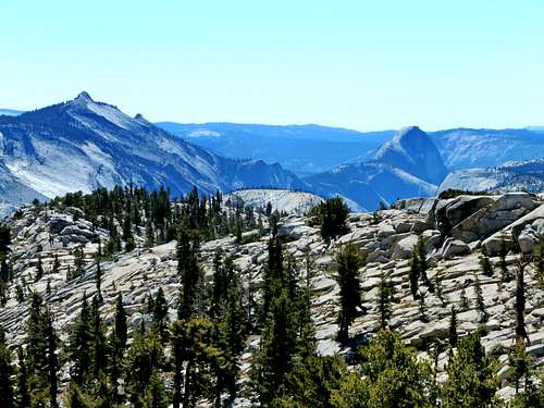
Clouds Rest and Half Dome from Polly Dome
This is a day hike.
For camping permits in Yosemite National Park contact: Call Yosemite National Park 209 372-0200.
Camping
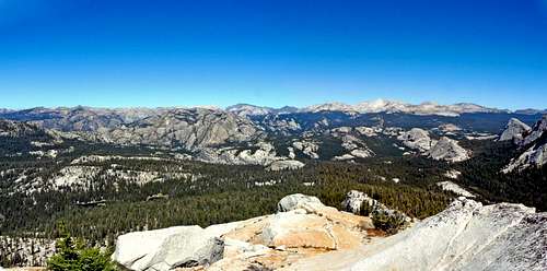
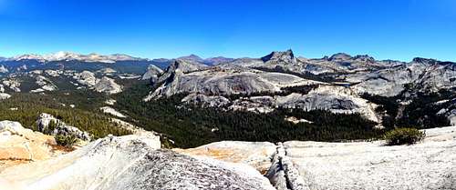
Northwest from Polly Dome summit
PORCUPINE FLAT: 8,100', Next to Hwy. 120, 23.3 miles from the junction to Tioga Pass from the west.
WHITE WOLF: 7,875, 14 miles from the junction to Tioga Pass from the west on Hwy. 120, then turn left (north) 1 mile to the campground.
TUOLUMNE MEADOWS: 8,700', 7.5 miles west on Hwy. 120 from Tioga Pass from the east on the south side of the road.
Etymology
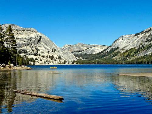
Polly Dome, left, from Tenaya Lake
Named by R.B. Marshall, USGS, for Mrs. Polly McCabe, a daughter of Col. W. W. Forsyth and the wife of Lt. McCabe. (Farquhar: Forsyth. See McCabe Lakes.) The name was applied to the lakes because it was in common use. (USGS.) (YNP) - Place Names of the Sierra Nevada by Peter Browning, Wilderness Press.