
-
 6491 Hits
-
 80.49% Score
-
 12 Votes
|
|
Mountain/Rock |
|---|---|
|
|
47.45615°N / 12.92855°E |
|
|
Hiking |
|
|
Spring, Summer, Fall |
|
|
8041 ft / 2451 m |
|
|
Overview
 Karst plateau near Riemannhaus on the trail to Schönfeldspitze and Wurmkopf
Standing east of Schönfeldspitze, Wurmkopf is a minor summit between the “Matterhorn of Steinernes Meer” and Breithorn in the west. The connecting ridge Breithorn - Schönfeldspitze, being the southern ridge crest of Steinernes Meer, is bearing four minor summits and Wurmkopf is one of them.
The highest point of Wurmkopf is a sort of rock and meadow crest which can be summited easily off-trail from the trail Riemannhaus - Schöneck - Schönfeldspitze.
Together with Breithorn, Sommerstein and Schöneck, Wurmkopf is one of the easy afternoon summits after having hiked to Riemannhaus.
The ascent or descent to / from Schönfeldspitze can easily be combined with the traverse Wurmkopf and Schöneck thus beeing a more than satisfying round trip where Steinernes Meer is at it´s best.
Getting There
 Schönfeldspitze and Wurmkopf (right)
The main valley trailhead for Wurmkopf is Maria Alm on the south side of Steinernes Meer.
You reach Maria Alm from
You reach Saalfelden near Maria Alm by train, too, from Kufstein - Wörgl - Kitzbühel or from Salzburg - Bischofshofen.
For the schedules please refer to the ÖBB homepage.
For the Maria Alm trailhead follow the road leading from the village into Griesbachwinkl and Sandten valley. After some kilometers the road changes into a dirt road which climbs up steeply to the parking area at about 1.200 m. After the parking area the road is closed for public traffic.
Red Tape
 Wurmkopf below Schönfeldspitze, as seen from Breithorn
Wurmkopf is not part of the Nationalpark Berchtesgaden.
There are no special restrictions as far as I know.
Main Routes Overview
 Wurmkopf summit
Ascent to Riemannhaus
From the parking area follow the dirt road / trail number 425 up to the supply cableway valley station for Riemannhaus. A trail starts there leading up the steep, chute – like valley called Schaflöcher under the impressive Sommerstein southface. After some rock scramble and impressive views you reach Ramseider Scharte and Riemannhaus.
Schöneck trail (easy hike)
From Riemannhaus follow the trail in the direction to Sommerstein. Halfway up a trail branches off to the left. Follow this trail up to the east – west running ridge between Sommerstein and Schönfeldspitze. Arriving at the ridge, the summit of Schöneck can be reached in three minutes to the west (right).
For Wurmkopf follow the trail on the ridge to the east (left). The trail traverses the north slopes of Streichenbeil and arrives at a col southwest of Wurmkopf. Follow now offtrail the southwest ridge up to the summit.
Schönfeldspitze trail (partly UIAA grade I)
Follow the trail from Riemannhaus to Schönfeldspitze. After the more or less level traverse of the upper karst plateau below Schöneck and Wurmkopf the trail ascends steeply in the direction of the west ridge of Schönfeldspitze. This route involves some easy rock scramble (UIAA grade I).
 Wurmkopf (near center)as seen from Schönfeldspitze
After this “rocky part” a marked trail branches off to the right, traversing the northwest slopes under the west ridge of Schönfeldspitze and arriving the connecting ridge Schönfeldspitze – Wurmkopf at Niederzink. Follow the trail up to the Wurmkopf east ridge. You may follow this ridge – off trail in its upper parts - to the summit (some very easy rock scramble again) or traverse the south slope of Wurmkopf level until you reach the col southwest of Wurmkopf. Follow this ridge up to the summit.
Both trails can be easily combined to a nice loop. With Schönfeldspitze, Schöneck and Sommerstein you have a strenuous extended loop.
Accomodations
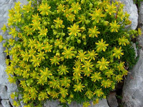 A bunch of flowers near the summit
Accomodations of all kind - hotels, bed & breakfast, campgrounds - can be found in all major villages around Steinernes Meer:
The following adjacent mountain huts offer overnight stays:
Mountain Conditions & Gear
 Rock scramble on the route to Schönfeldspitze / Wurmkopf
Mountain Conditions
Wurmkopf as a minor summit is mainly a summer and autumn hike. It can be summited in winter, too, but I think there are more attractive ski aims in the surroundings of Riemannhaus.
The route via Schönfeldspitze trail needs some rock scramble ability up to UIAA grade I.
Gear
You need normal hiking gear with good boots. The last bit to the summit is a quite steep off trail ascent on a steep meadow with some rocks.
Bring enough to drink in autumn when nearby Riemanhaus is closed. A a karst plateau, Steinernes Meer nearly has no water for resupply.
Maps
The following topo maps are recommended:
Alpenvereinskarte scale 1 : 25.000
Blatt 10/1, Steinernes Meer, 2006
Topografische Karte von Österreich, scale 1 : 50.000
Blatt 124