
-
 28278 Hits
-
 85.36% Score
-
 20 Votes
|
|
Mountain/Rock |
|---|---|
|
|
44.80760°N / 107.3604°W |
|
|
Sheridan |
|
|
Hiking |
|
|
Spring, Summer, Fall, Winter |
|
|
7877 ft / 2401 m |
|
|
Overview
 Just below the summit
The vast majority of places in Wyoming that have the name "Point" in their title are unranked peaks with little prominence that are simply just not big enough to merit a more grandiose moniker like "Mountain" or "Peak." However, Steamboat Point in the northern part of the Big Horn Range is a notable exception, as its southwest-facing rock wall rises up over 600 feet above the surrounding area and the nearby highway.
While this rock face looks like a somewhat formidable climb from below, there is actually fairly easy Class 1 trail that leads around it to the summit. This peak makes for a nice and quick jaunt if you are driving through the area and would like to bag a summit and take in some nice views without having to venture out onto any of the Forest Roads.
This formation received its name because it looks like the prow of a steamboat when viewed from the south or southeast. Black Mountain, which is one of the Big Horn peaks with a fire lookout, is a prominent feature to the south, while many of the big peaks of the Cloud Peak Wilderness can be seen as well. The views to the east are very expansive, as there are no more visible mountain ranges in that direction.
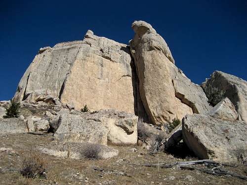 Steamboat Point
Getting There
 Trail
Trail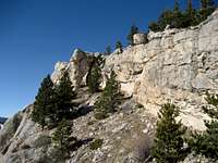 Band of rock
From Dayton, Wyoming at the eastern base of the Big Horns, take Highway 14 west for 12.5 miles and park at the closed 4X4 road that turns north off of the highway near Steamboat Point. In 2009, this area of the highway was under a multi-year reconstruction project, so check the site in the external links section for more information, as delays of up to an hour may be encountered in the near future.
Hike on this faint road as it climbs steeply towards the base of the rock face. After it becomes a single-track trail, it follows the bottom of the cliffs east and ascends through a small break in the rocks. As can be seen on the topo map, the trail forks soon after this point, so head left and walk the easy trail through the sparse forest to the top. There is a lot of exposure looking out over the wall, and it is a good thing that the prevailing winds blow from the west! When I was on the summit, the wind was blowing at 60+ mph, and it was very difficult to stand up.
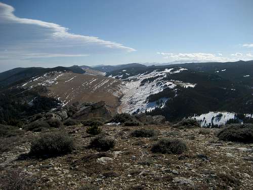 Summit view south towards Black Tooth Mountain
The round trip hike of Steamboat Point is about 1.7 miles with out 700 feet of elevation gain on a Class 1 trail; it is easily done in an hour or less.
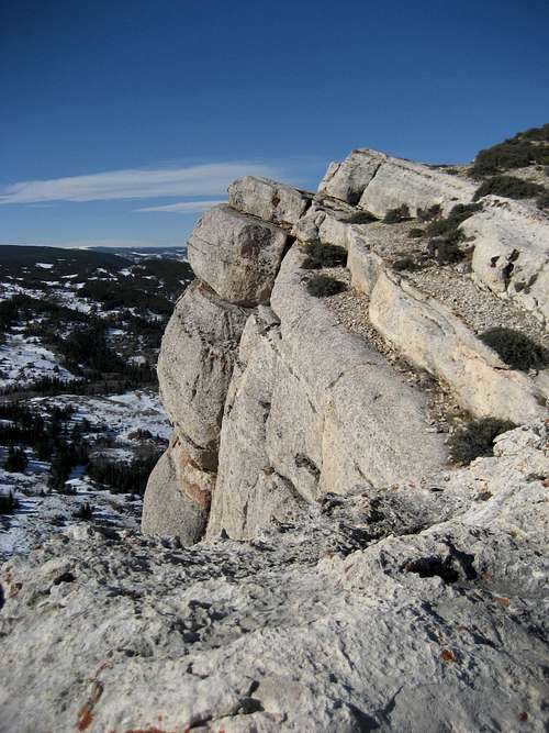
 Rock formation
Red Tape and Camping
There are no fees or permits to hike in this area. There is always the chance of encountering wildlife in the forest near the summit, and black bears and mountain lions are found in this area.While places to camp in the Big Horns are easy to find, it is not really applicable to this peak. However, if you are really wanting to spend the night here, know that camping is not allowed within 100 feet of lakes or streams, or within 1/4 mile of major roads. For complete rules and regulations, visit: http://www.fs.fed.us/r2/bighorn/recreation/camping/.
 Summit view east