
-
 14529 Hits
-
 81.84% Score
-
 14 Votes
|
|
Mountain/Rock |
|---|---|
|
|
44.14950°N / 107.2025°W |
|
|
Washakie |
|
|
Hiking |
|
|
Spring, Summer, Fall, Winter |
|
|
9477 ft / 2889 m |
|
|
Overview
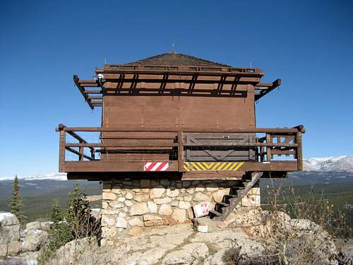 High Park Lookout
Fire lookouts were constructed in the Big Horn Range of Wyoming in the 1920's and 1930's by the Civilian Conservation Corps. In today's world of satellite imaging, these are rarely used and only three of them are left in the range. One of these is located near Meadowlark Lake on a peak that is known only as High Park Lookout.
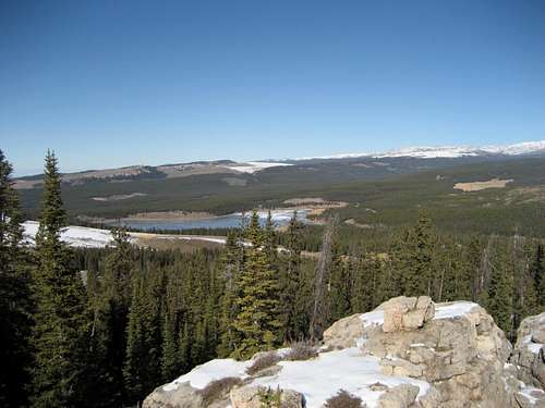
Located just south of the Cloud Scenic Byway (Highway 16), this is an easily accessible mountain with beautiful views of the Cloud Peak Wilderness and the gentler peaks of of the south Big Horns; even though it doesn't like much from the highway, it has almost 500 feet of prominence. The Southeast Absarokas can be seen to the west, and the Wind River Range is barely visible to the southwest in the extreme distance. A short Class 1 trail provides a route to the top through the forest on the north and west sides of the peak, which has lots of nice rock formations if you are looking to do some scrambling.
 Meadowlark Lake
Getting There
 Lookout trail
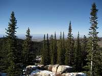 Summit view west
From Ten Sleep, Wyoming, travel east on Highway 16 (also known as the Cloud Peak Scenic Byway) for just over 22 miles. After passing Meadowlark Lake, turn south on High Park Road and keep to the left fork. Follow the signs directing you to the Lookout and park at the trail head, which has two signs detailing the trail and the history of fire lookouts in the Big Horns.
Follow the trail through the forest around to the west side of the peak, where it weaves through some rock blocks and ascends a staircase just below the summit. There are several small structures on the summit in addition to the two-story tower.
A round trip hike of High Park Lookout is just under 1.5 miles with 250 feet of elevation gain on a Class 1 trail.
 Darton Peak
Red Tape & Camping
There are no fees or permits required to hike in this area, and the road to the base of High Park Lookout is drivable in 2WD unless it is very muddy. Fast-developing storms are common throughout the Big Horns, so keep an eye on the weather; however, this hike is so short that this shouldn't be a problem.Black bears, moose, and mountain lions can encountered at any time in this area, so be prepared with bear spray and know how to deal the situation if you happen to meet one of these animals.
Places to camp in the Big Horns are numerous, with the majority of the range being open to dispersed camping. Camping is not allowed within 100 feet of lakes or streams, or within 1/4 mile of major roads. Camping is limited to fourteen days at a site. For complete rules and regulations, visit: http://www.fs.fed.us/r2/bighorn/recreation/camping/
 Rock formation near the summit
External Links
http://www.firelookout.com/wy/highpark.htmlGeocache site