
|
|
Mountain/Rock |
|---|---|
|
|
47.87720°N / 121.1873°W |
|
|
Snohomish |
|
|
5903 ft / 1799 m |
|
|
Overview
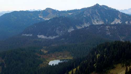
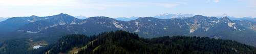
Fortune Mountain from Fall Mountain. Top Lake at bottom of photo, SE tip of Pear Lake barely visible in center of photo.
Fortune Mountain does not see as many visitors as one might expect, mostly due to the fact that approaches to the mountain are fairly long. Having said that, there are no shortage of approach options, with at least six different trailheads to choose from. For this reason, access to this area works particularly well for hikers who can arrange car shuttles and through-hikes.
It is unlikely that most visitors will come to this area just to visit Fortune Mountain. Many will come to visit one or more of the beautiful lakes that lie to the north or west. Others will find Fortune Mountain to be an interesting diversion while through-hiking sections of the nearby Pacific Crest Trail. Regardless of what brings hikers to this region, most will find the rewarding vistas from Fortune Mountain to be well worth the modest time and effort invested.
Getting There
From the west: Follow US2 for 4.0 miles east from Stevens Pass, and turn left (north) onto the Smith Brook Road (FR6700). Follow FR6700 for 12.5 miles, then turn left onto FR6701. Follow FR6701 for 5.6 miles, then turn left onto Road 500. Follow Road 500 to its end in 3.3 miles, where it terminates as a large gravel parking lot (N47 52.878 W121 04.623 Elev. 3700').
From the east: From Leavenworth, follow US2 east for 14.5 miles to 'Coles Corner', then turn right onto the Lake Wenatchee Highway (Hwy 207). Follow Highway 207 for 10.6 miles, then turn left onto the Little Wenatchee River Road (FR65). Follow FR65 for 6.0 miles, then turn left onto FR6700. Follow FR6700 for 0.4 miles, then turn right onto FR6701. Follow FR6701 for 5.6 miles, then turn left onto Road 500. Follow Road 500 to its end in 3.3 miles, where it terminates as a large gravel parking lot (N47 52.878 W121 04.623 Elev. 3700').
Update: It has just been pointed out to me that the Rapid River approach is a very viable option for approaching Fortune Mountain relative to the Top Lake approach. My apologies for the oversight - the Rapid River Road was closed the last time I had checked. I would now consider this approach to be the most ideal for 'west-siders' who are specifically interested in Fortune Mountain, as the drive to the trailhead is significantly shorter. Distance and elevation gain will be just slightly higher than the Top Lake approach.
Directions for the Meadow Creek approach: Follow US2 0.8 miles east from the town of Skykomish, and turn left onto the Beckler River Road (FR65). Follow FR65 north for 6.9 miles, then turn right onto the Rapid River Road (FR6530). Follow FR6530 east for 4.4 miles to the Meadow Lake trailhead (Trail #1507). From here, it is a seven mile hike to join the Top Lake route near Frozen Finger Gap. I have also been advised that it is possible to ascend directly up the northwest ridge from the trail, but this route is untested by yours truly.
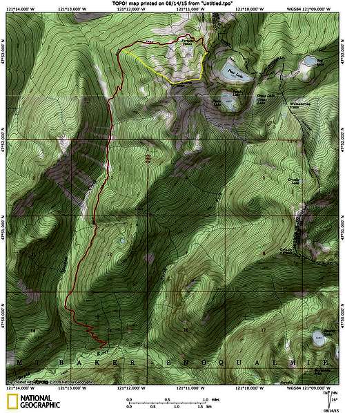
Fortune Mountain route from Meadow Creek Trail #1507
Route
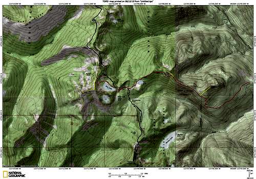
Fortune Mountain route map. Blue line shows the PCT. Please note that the PCT route north of Pear Lake has changed substantially since the USGS map was printed. I have done my best to approximate it - please don't use my scribblings for precise navigation.

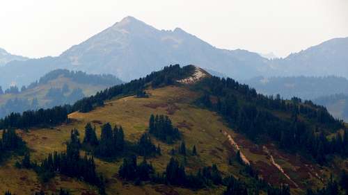
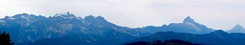
Top Lake, Fall Mountain (center), and Shoofly Mountain (right)
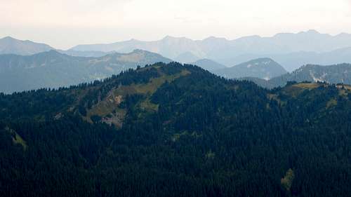
Along the way, you may want to visit Shoofly Mountain and Fall Mountain, short easy scrambles with no special difficulties (routes shown in yellow on map above). Shoofly Mountain's summit area was recently burned up in a forest fire, so Fall Mountain is by far the more pleasant of the two (Fall Mountain is also quicker and easier). From just west of Fall Mountain's summit, you will be able to get a good look at Fortune Mountain to the west.
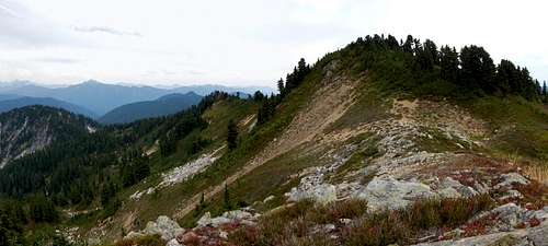
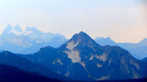
Fortune Mountain (left) and vicinity from Fall Mountain. Top Lake at bottom left.
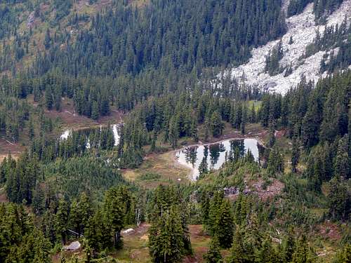
At the PCT junction, turn right (north), and continue for 0.7 miles to the Meadow Creek Trail (#1507) junction. Turn left onto Trail 1507, which will very quickly arrive at Pear Lake. This is the logical place to camp if you are staying overnight in this area, with no shortage of camp sites. From Pear Lake, continue on Trail 1507, which will climb up to a 5240' saddle (Frozen Finger Gap) between Fortune Mountain and Point 5548 in just over one-half mile. Along the way, you'll get a pretty good look at Pear Lake from the talus slopes above.
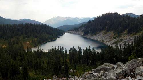
Pear Lake from Fortune Mountain. Labyrinth Mountain in the background, Mount Howard and Rock Mountain in the distant background.
From the saddle, stay on the trail downhill through a couple of short switchbacks, until arriving in a small basin about 100' below the saddle on its west side. (It is possible to traverse from just below the saddle, but it's more work.) From this point, your job is to head straight uphill, directly south, for about 600' of elevation gain. The terrain is open and brush free. You will notice that you will be paralleling a creek drainage as you ascend - it makes little difference if you stay on the left or right side as you climb. After 600' of climbing, you will join Fortune Mountain's east ridge at an altitude of about 5700'.
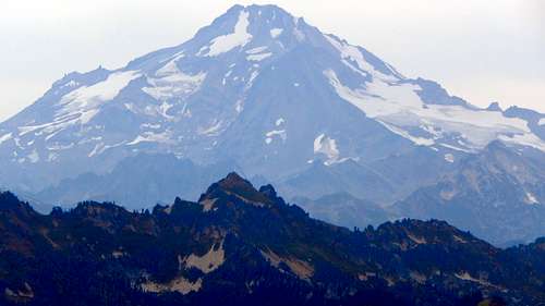
Looking down Fortune Mountain route from 5700'. Point 5548 in right third of photo, Glacier Peak in the distance.
Follow the ridge west towards the summit- cross over to the left (south) side of the ridge at your earliest convenience for easier travel. From the south side of the ridge, you'll have a nice view down to Peach Lake.
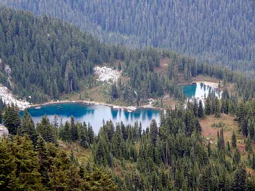
Peach Lake from Fortune Mountain
The final scramble to the top will be easy meadow, with game trails available if you prefer. Upon arriving at the true summit, you may be disappointed to discover that the views to the west are obscured by small trees.
Fortune Mountain true summit from NW summit
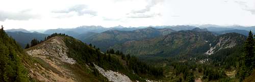
Looking east from Fortune Mountain
No need to despair, the best views on Fortune Mountain can actually be found on its false NW summit, just 500' away.
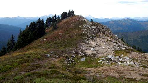
Fortune Mountain's false NW summit
My apologies for the quality of these photos - I cleaned them up the best I could. At the time they were taken, the Lake Chelan/Wolverine Fire was raging, resulting in a smokey, hazy view.
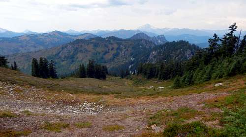
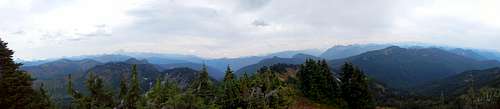
Northwest view from Fortune Mountain
Fortune Ponds from Fortune Mountain