
|
|
Mountain/Rock |
|---|---|
|
|
48.14950°N / 120.95546°W |
|
|
Snohomish/Chelan |
|
|
7420 ft / 2262 m |
|
|
Overview
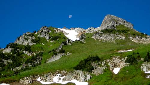
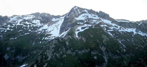
Helmet Butte from Pass No Pass
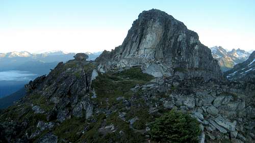
Helmet Butte summit block from south summit
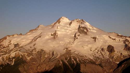
While hopelessly outclassed by the aforementioned peaks in terms of elevation and prominence, Helmet Butte still has something to offer backpackers and peakbaggers alike. Easy scrambling routes offer the casual hiker stunning vistas without the level of commitment required by the higher peaks. For the more accomplished climber, Helmet Butte offers the chance to study the SW Face of Fortress Mountain, and makes an excellent '2fer' peak when approaching from Pass No Pass.
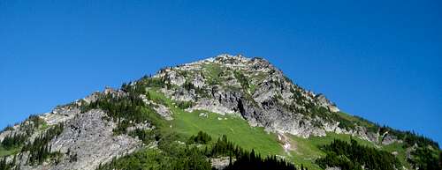
Helmet Butte from SE on Buck Creek Pass Trail
Regardless of the motivation for scrambling Helmet Butte, climbers of all experience levels will enjoy its meadowy slopes and well-defined summit block. Whether approaching from Pass No Pass or Buck Creek Pass, it is well worth the one or two hours required to round-trip this peak.
Getting There
Follow US2 to Coles Corner, located about 20 miles east of Stevens Pass, and about 15 miles 'west' (mostly north, actually) of Leavenworth. Follow Highway 207 north from Coles Corner for 4.4 miles. Shortly after crossing the Wenatchee River, turn right onto the Chiwawa Loop Road. Follow Chiwawa Loop Road for 1.3 miles to the Chiwawa River Road. Turn left onto the Chiwawa River Road, and follow it to the Buck Creek Pass Trailhead at Trinity (effectively the end of the road) in 23 miles. The first 11 miles of the Chiwawa River Road will be paved, and the last 12 miles are gravel.
Route
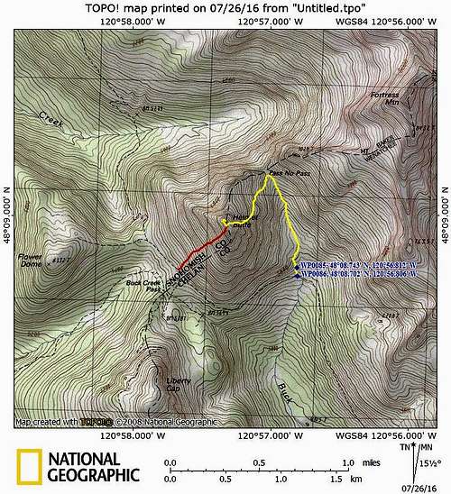
Helmet Butte route map. Route 1 in yellow, Route 2 in red.
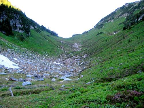
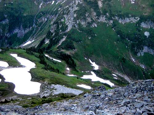
From the trailhead at Trinity (elev. 2772'), hike the Buck Creek Pass Trail (FS#1513) for 8.8 miles, to a point approximately 0.8 miles from Buck Creek Pass. The trail is well maintained for hikers and stock, and has a relatively gentle grade. From here, you will have two options for approaching Helmet Butte.
Route Option 1: This route has a gentler grade, and is easier overall. It also positions you within easy striking distance of Fortress Mountain's SW Face. From the aforementioned point at 5600' on the Buck Creek Pass Trail (shown as Waypoint 86 on the route map), turn right, and follow a well-defined path towards Pass No Pass. At Waypoint 85, ignore spurs turning left and right, and continue straight uphill (the path will momentarily be poorly defined in this area). As you continue above 5800', the trail will split in several locations. Generally speaking, as long as you are heading uphill and north, any of these paths will get you where you need to go. Eventually, the paths will consolidate, and lead you to Pass No Pass (elev. 6380').
Pass No Pass on the way to Helmet Butte
At Pass No Pass (or shortly before it), make a sharp left, and begin an uphill traverse toward the southwest. As you ascend, Helmet Butte's summit block will be plainly seen. For the easiest scramble, aim for the left (south) side of Helmet Butte's summit block.
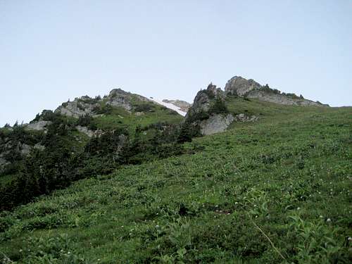
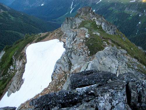
Helmet Butte from east at 6800'. Summit block is the point on the right.
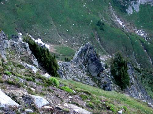
At roughly 7200', you will pass through a small notch in the short ridge just southeast of Helmet Butte's summit. From this point, ascend straight up steep grassy slopes to the left (south) side of the summit block.

Summit block from the 7200' notch on Helmet Butte
Looking back at the 7200' notch on Helmet Butte. Our camp (just below Pass No Pass) can be seen through the notch at the base of the snow patch.
Upon arriving at the base of the summit block, make a short, clockwise traverse to the west, then the north side. From here, a simple, low-exposure class 3 scramble on good-quality rock will lead to the summit.
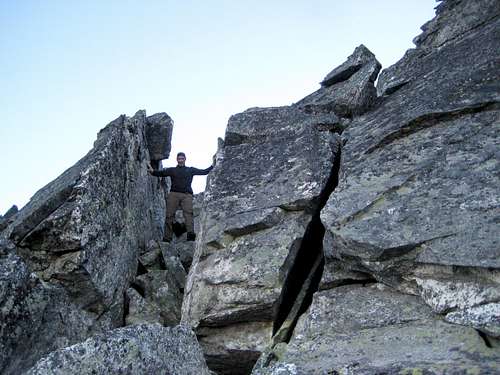
Final scramble on Helmet Butte
Route Option 2: Continue from Waypoint 86 another 0.8 miles up the main trail to Buck Creek Pass. From Buck Creek Pass, ascend very steep grass and heather slopes to the west side of Helmet Butte's summit block, then finish with the short class 3 scramble described above. Please note that this route would probably be somewhat dangerous in wet conditions. A very experienced climber friend told me it was the steepest grass slope she had ever climbed.
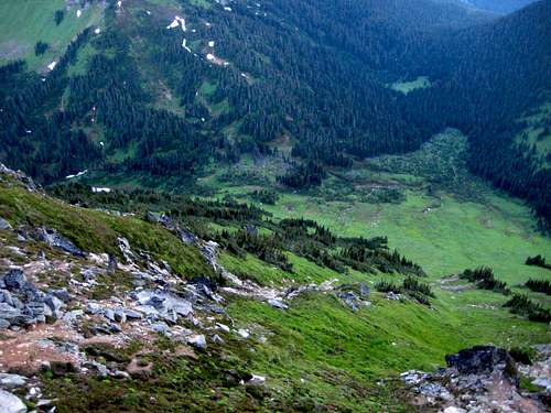
Buck Creek Pass from Helmet Butte
Views from Helmet Butte are spectacular. Unfortunately, my cheap camera did not play very well with the varying contrasts at sunrise, so I will apologize in advance for some of the photos to follow.
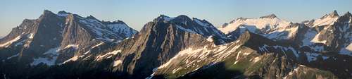
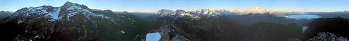
Helmet Butte pano
Red Tape
When to Climb
Camping
Pass No Pass from Helmet Butte
Another interesting possibility would be to camp near the summit of Helmet Butte. There is a nice flat spot between the summit block and the false south summit that would be just about perfect for a two-man tent.
Helmet Butte south summit from true summit