
|
|
Mountain/Rock |
|---|---|
|
|
46.71705°N / 122.22662°W |
|
|
Lewis |
|
|
Hiking |
|
|
Spring, Summer, Fall, Winter |
|
|
2707 ft / 825 m |
|
|
Overview
Disclaimer: It should be noted that as of December 15th, 2013 there is now active logging going on on Spiraltop. There are still no signs stopping one from entering and leaving but there is machines up on the ridge and the road does have logs blocking it which create some an artificial scramble over logs. Please be aware of this if you plan on hiking up Spiraltop.
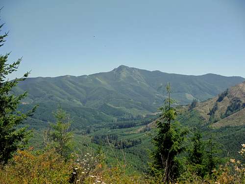 Mount Storm King from the summit area | 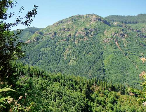 Ladd Peak from on the way up |
Spiraltop located just south of Lake Alder and Elbe, Washington. The peak has earned its name because of the logging that is used to climb to the official summit. From what I saw there is no official summit register on the peak. The peak is also a legal hiking peak with there being no literature at the gate of the road. Despite this summit being less than 3000 feet of elevation, this summit has 1143 feet of prominence. The peak, despite its low elevation also contains good views especially of Mount Rainier. The other summits that can be view are also another Mount Storm King, Stahl Mountain and Double Top. The views start to go on and off from the 2000 foot level of the mountain. The summit does not contain a 360 panorama; however it does have good shots of Mount Rainier and even better views to the south as well.
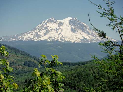 The beautiful, legendary Tahoma | 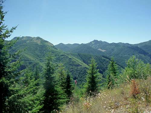 More views from the summit. |
Route
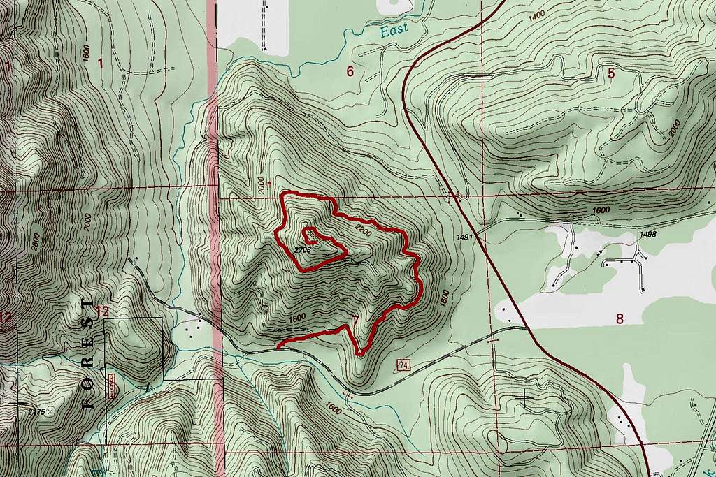
Map of the Route
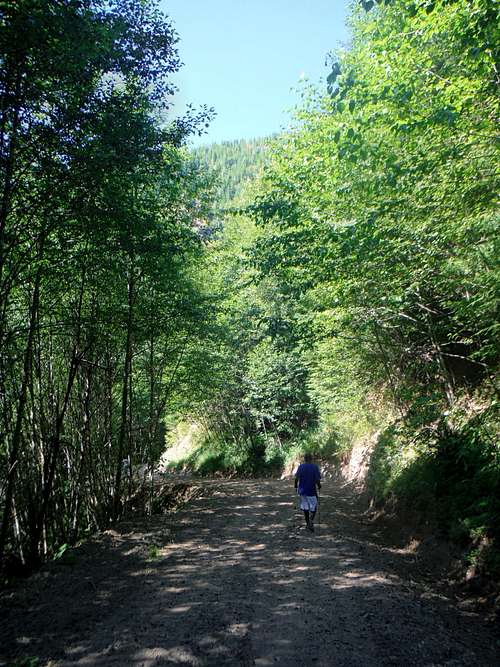
The route is doable for most novice hikers, and peak baggers. At 5 miles roundtrip and roughly 1200 feet of elevation gain to steady road walk up the mountain go up at a good gradual pace. In summer, nothing more is needed to go up but leg power. The road just continues to spiral up the mountain until it reaches the summit. The road is gated, but in the first mile it is in good condition and very doable in a bike. Past that has the road goes higher it quickly becomes overgrown. The good road conditions give way to some shrubs at first and then as you go higher some thicker brush. By the time you start nearing the summit the road becomes fairly thick with shrubs. It is still navigable but in the next ten years or so it will become much harder to use this route to the summit unless more people start to hike up this mountain. The actual summit area is mostly forested with a decent view of Mount Rainier. Literally just feet from the summit lays a good open field though with great views to the south.
 The road down from the summit | 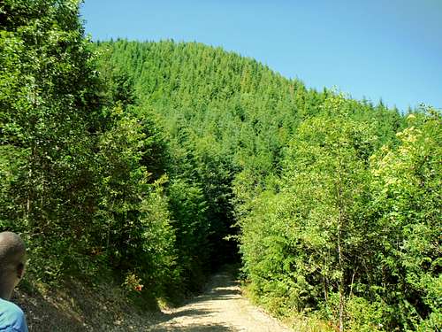 Spiraltop from the road up |
In winter provided Forest Road 74 is navigable, Spiraltop might make a decent snowshoe mountain. The steady gradual way up would be great for snowshoeing. The avalanche danger here would be moderate with only one open area that I saw that would cause potential issues. The only major issue is that higher up on the road the vegetation is beginning to get thick which might cause some problems with people in snowshoes. Outside of those issues this peak does have strong potential for being a good snowshoe destination.
Getting There
VIA THE SPIRALTOP ROAD: From route 512 just west of Pullayup you want to take Route 7. Twenty miles down the road there is a detour which send you through the town of Eatonville. From there follow the detour all of the way to Lake Alder where you will pick back up Route 7 and take it to Elbe. From Elbe Washington take Route 7 South roughly five miles south. Take a right (west) onto Forest Road 74 and take that about one mile. To your right across the way from a pond and wetland will be a gated road. Park along the side so that potential trucks can get through if needed.Red Tape
From what I saw on the trailhead area none. Hard to say if this is public or private land but there is no literature at the trailhead.When to Climb
It is definitely an all season mountain. Unless you are specifically going with people who have never hiked up a mountain before I would recommend winter provided Forest Road 74 is open. There are some brushy area that might cause some snowshoe problem bt as of right now it seems very doable in snowshoes. Fall might be pretty on this mountain because there are a lot decidious trees on the way up and there is potential for good fall color here.Camping
There is no sign banning it but I personally would not have any desire to camp there. It five miles roundtrip and can be done in 4 hours or less.External Links
Spiraltop Peakbagger PageA great page by SP member Eric Willhite about this peak and neighboring summits