
-
 7091 Hits
-
 84.82% Score
-
 19 Votes
|
|
Mountain/Rock |
|---|---|
|
|
47.53076°N / 15.91370°E |
|
|
Hiking, Skiing |
|
|
Spring, Summer, Fall, Winter |
|
|
5718 ft / 1743 m |
|
|
Topographic isolation: 10 km
Nearest higher peak: Stuhleck, 1782 m
Prominence: 445 m
![Hochwechsel summit cross]()
Hochwechsel Summit cross![The summit of Niederwechsel]()
The summit of Niederwechsel![Schöberlriegel summit cairn]()
Schöberlriegel summit cairn![Kampstein (1467 m) in Wechsel]()
KampsteinThe main ridge of Wechsel is 16 km long, in western-eastern direction. This main ridge forms the border between the province of Styria and Lower-Austria. This ridge is also the watershed between the catchment areas of the rivers Leitha and Raab. All water from the northern slopes of the mountain get into the river Leitha, while all water from the southern side get into the river Raab. The source of two rivers are on the southern slopes of Wechsel; both Feistritz (115 km long) and Pinka (94 km long) are on the cathment area of Raab. The water of Raab and Leitha confluences at city Györ, in Hungary, in a distance of 130 air kilometers from Wechsel.
The most important peaks of the main western-eastern ridge are
- Hochwechsel (1743 m), earlier called Hoher Umschuss
- Umschussriegel (1720 m)
- Schöberlriegel (1704 m)
- Niederwechsel (1669 m).
The most important summits of the northern side-ridge are Arabichl (1595 m), Alpl (1499 m) and Kampstein (1467 m). The highest summit of the southern flanks is Irrbühel (1423 m).
The mountain is mainly built from gneiss, but many other minerals have been identified in the last decades, too. The highest ridge of the mountain is covered only by grass, and here – due to the limited soil – the building rock of the mountain can be seen well.
![The ridge between Niederwechsel and Hochwechsel]()
The ridge between Niederwechsel and HochwechselFrom Vienna take the A2 highway to southern direction. Change to the old route Nr. 54 at the junction Edlitz. Drive further 3 km south on route Nr. 54 and you reach the valley of Feistritz (please note that this is the river Feistritz on the northern side of Wechsel – there is another river called Feistritz on the souther slopes, too). Here you can decide if you turn right (west) and drive up to the saddle called Feistritzsattel (1298 m) to start your hiking from here, or you keep driving on route Nr. 54 further 15 km to south, till the saddle Wechsel (980 m), and you start from hiking here. And there are many other trailheads, too.![Castle Feistritz]()
Castle FeistritzFirst of all, hiking. There are many marked hiking paths on the mountain. Most of them recommended also for families. From touristic aspect the following villages are the most important around Wechsel: Aspang, Feistritz am Wechsel, Kirchberg am Wechsel, Mönichkirchen, Mönichwald, Pinggau, Trattenbach, Sankt Corona am Wechsel, Sankt Jakob im Walde, Waldbach. And the tourist paths are so many that from all of them you find way up to the peaks. Without describing all them, I would mention only two important marked routes that crosses here on Wechsel:
1. The “Österreichisches Weitwanderweg 02”, also called as Central Alpic Route. This route crosses Austria between Feldkirch (Voralberg) and Hainburg (Lower-Austria), in 1270 km.
2. The “Österreichisches Weitwanderweg 07”, also called as East-Austrian Borderland Route. This route crosses Austria between Nebelstein (Lower-Austria) and Bad Radkersburg (Styria), in 700 km.
There are also some minor ski areas here: Mönichkirchen-Mariensee, Trattenbach, Sankt Corona am Wechsel, Kirchberg am Wechsel, Mönichwald, Sankt Jakob im Walde and Wenigzell.
Mountain biking and cross-country skiing is possible, too.
There are a few nice old castles on the slopes of Wechsel - you can visit them:
- Castle Feistritz, in Feistritz am Wechsel. First mentioned in 1136, as owned by Adalbert von Viustritze. On 520 m a.s.l.
- Castle Thalberg at the village Schlag b. Thalberg. The castle was founded around 1180 by Leopold von Erlach Pitten. On 530 m a.s.l.
- Castel Festenburg, at the village Demmeldorf. The castle was founded around 1200 by the Lords of Stubenberg. On 743 m. a.s.l.![Vorauer Schweig]()
Vorauer SchweigWetterkogler Haus
On 1743 m a.s.l. Opened between 1st May and 31st October, as well as between 27 December and 7th January. 36 beds.
Phone: +43/33364224 or +43/6642636186
Hallerhaus
On 1350 m a.s.l. Opened in whole year around. 55 beds.
Phone: +43 /(0)2649/230
Vorauer Schwaig
On 1509 m a.s.l. Opened between 1st June and beginning of September
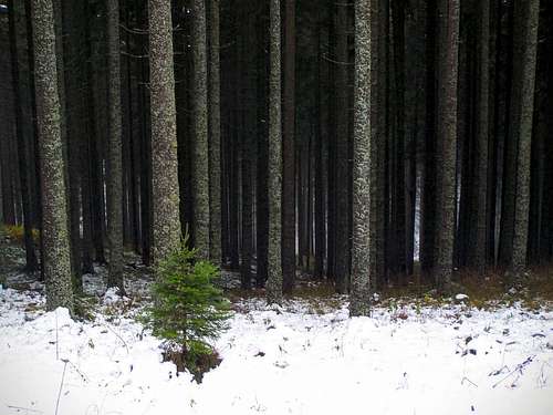
![A really dark forest]()
Find the right way...Best online map here
Nearest higher peak: Stuhleck, 1782 m
Prominence: 445 m
Overview
Wechsel can be considered as a small mountain range or a larger mountain. Very likely it would be not the first destination of a mountaineer who travels to Austria. It’s not too high – highest point is 1743 m. There are no special natural formations on it: no sharp rocks, no waterfalls or other attractions. Still it is a popular tourist destination, due to its proximity to Vienna. The Vienna – Mönichkirchen distance is only 98 km. What makes Wechsel special is that it is the easternmost mountain of the Alps that is higher than 1500 m. It also means that for tourist arriving from east - from Hungary - this is the first mountain giving some feeling of the Alps. And there is another factor making this mountain popular: the easy access from the 1298 m high saddle called Feistritzsattel. As there are no sharp forms on this mountain but many pleasant walkways, it offers good opportunity for hiking in winter, too. Winter hiking is not so safe on many other mountains in Austria.  |  |  |  |  |  |  |  |
Geography
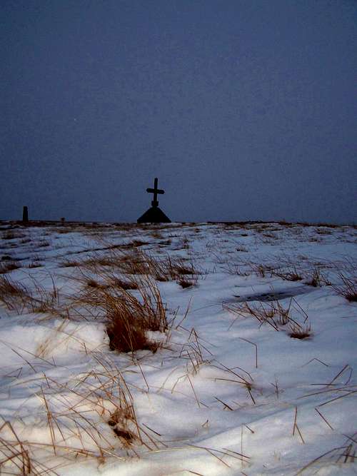
Hochwechsel Summit cross
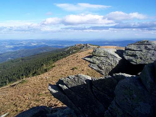
The summit of Niederwechsel
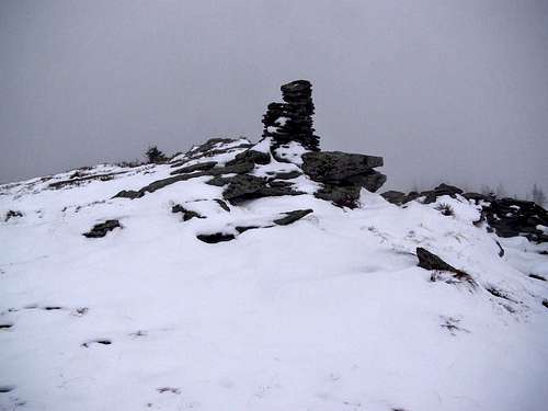
Schöberlriegel summit cairn
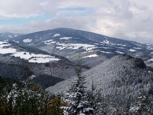
Kampstein
The most important peaks of the main western-eastern ridge are
- Hochwechsel (1743 m), earlier called Hoher Umschuss
- Umschussriegel (1720 m)
- Schöberlriegel (1704 m)
- Niederwechsel (1669 m).
The most important summits of the northern side-ridge are Arabichl (1595 m), Alpl (1499 m) and Kampstein (1467 m). The highest summit of the southern flanks is Irrbühel (1423 m).
The mountain is mainly built from gneiss, but many other minerals have been identified in the last decades, too. The highest ridge of the mountain is covered only by grass, and here – due to the limited soil – the building rock of the mountain can be seen well.
Getting There
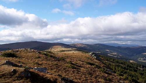
The ridge between Niederwechsel and Hochwechsel
Activities
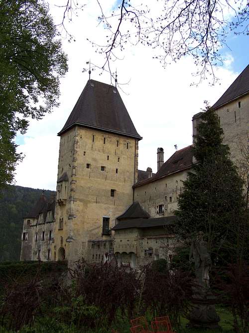
Castle Feistritz
1. The “Österreichisches Weitwanderweg 02”, also called as Central Alpic Route. This route crosses Austria between Feldkirch (Voralberg) and Hainburg (Lower-Austria), in 1270 km.
2. The “Österreichisches Weitwanderweg 07”, also called as East-Austrian Borderland Route. This route crosses Austria between Nebelstein (Lower-Austria) and Bad Radkersburg (Styria), in 700 km.
There are also some minor ski areas here: Mönichkirchen-Mariensee, Trattenbach, Sankt Corona am Wechsel, Kirchberg am Wechsel, Mönichwald, Sankt Jakob im Walde and Wenigzell.
Mountain biking and cross-country skiing is possible, too.
There are a few nice old castles on the slopes of Wechsel - you can visit them:
- Castle Feistritz, in Feistritz am Wechsel. First mentioned in 1136, as owned by Adalbert von Viustritze. On 520 m a.s.l.
- Castle Thalberg at the village Schlag b. Thalberg. The castle was founded around 1180 by Leopold von Erlach Pitten. On 530 m a.s.l.
- Castel Festenburg, at the village Demmeldorf. The castle was founded around 1200 by the Lords of Stubenberg. On 743 m. a.s.l.
Mountain Huts
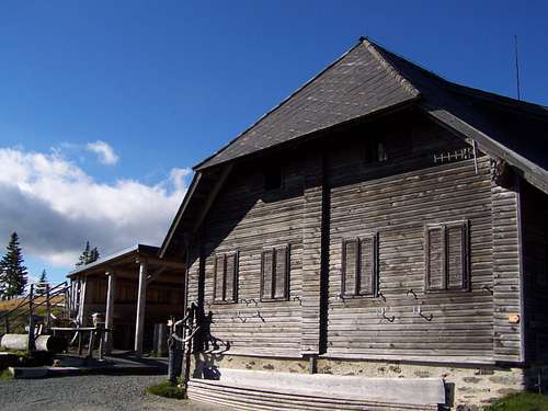
Vorauer Schweig
On 1743 m a.s.l. Opened between 1st May and 31st October, as well as between 27 December and 7th January. 36 beds.
Phone: +43/33364224 or +43/6642636186
Hallerhaus
On 1350 m a.s.l. Opened in whole year around. 55 beds.
Phone: +43 /(0)2649/230
Vorauer Schwaig
On 1509 m a.s.l. Opened between 1st June and beginning of September
Map
Find the right way...