The northern Appalachian Mountains were an alluring trip possibility to me for some time. Though the autumn color season is probably the most conventional time for a scenic trip there, I always envisioned myself visiting in the spring, with the forests bursting into life and the sun shining warmly on them. At a time when I was fortunately blessed with an ample six-day vacation opportunity, everything lined up for a venture to New England.
After gaining my usual head start late the night before, I left an eastern Ohio interstate rest area on an ordinary Friday morning with a lot of driving still to do. As I entered Pennsylvania, I was resigned to the fact that I would spend all of daylight just getting to my destinations in the northeast. Since I would be in the car all day anyway, I decided to go ahead and devote this day to experiencing the major cities along the eastern seaboard. It was an area I had never visited before and likely would not visit again soon. A detour on the National Freeway through Maryland led me first to America’s capital city, Washington. I drove the George Washington Parkway alongside the Potomac River, crossed the Arlington Memorial Bridge, and entered the heart of the city. My quick auto tour passed directly beside the Lincoln Memorial and Washington Monument, and also somewhat near the capitol building, though the streets within a block or two of it were barricaded. From here, I undertook the usually simple task of going north. However, it is next to impossible for a first-time visitor to navigate these Washington streets. Only those who have been there can probably appreciate this. The confusing city street maze took me southeast over the Anacostia River when I expected to go northeast, but I eventually corrected my route toward Baltimore.
My afternoon was a whirlwind tour of the eastern megalopolis through Baltimore, Wilmington, Philadelphia, and toward New York. Getting lost in Washington was not good, but worse was getting censured for attempting to pump gasoline in New Jersey. By law, I could not refuel the car myself, rather I had to stand and watch a station attendant do it. In New York, my progress completely ground to a halt. Traffic here was simply stagnant. Crossing the George Washington Bridge over the Hudson River took closer to an hour than a minute. Traversing the interstate through the Bronx could only be done at walking speed. Once I finally broke through the chains to reach open road in Connecticut, it was well into the night. I had spent almost the entire day in the driver’s seat of my car, and I would spend rest of the night sleeping in the back seat at a Connecticut interstate rest area.
Acadia National Park, Maine
Rhode Island's Arcadia Management Area was worth a quick stop.
Needless to say, I was pretty eager to get out of the car and enjoy some outdoor recreation. Soon after waking, I crossed into Rhode Island and visited the Arcadia Management Area (different from Maine's Acadia) for some gentle hiking. Early in the morning, the forest along the Brook Trail was peaceful and the spring colors were just as bright and lively as I had envisioned. Vibrant light green grasses of spring growth sprawled underneath a canopy of richly red-tinted pines. The terrain held some light hills and a few exposed rocks, and the air within a dozen miles of the coast seemed to have that slight taste of the ocean. Along the trail, I found a small granite souvenir rock that I felt was symbolic of this nation’s smallest state.
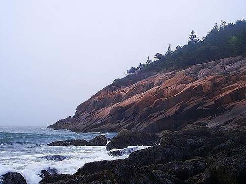
Rocky Maine coastline.
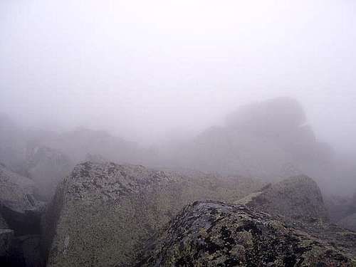
Foggy Maine maritime conditions.
I left Rhode Island late that morning through Providence, and around noon I passed through the last major eastern city of my route at Boston. Like in the previous cities, I took only passing glances without stopping. Today, I wanted to make sure I would reach eastern Maine before nightfall to set up camp, even at the cost of another lengthy day inside the car. By the afternoon, I was winding my way along the rugged coastline that makes the state unique. It is a submergent coast, in other words, a hilly area that has met sea level, leaving infinite islands, inlets, and rocky coasts. The miles come slowly here as the roads often twist and turn with the shore.
By the time I crossed onto Mount Desert Island to access Acadia National Park, the air had acquired a biting chill to it, an influence from the north Atlantic. I first stopped at Sand Beach, on the eastern shore of the island, to climb the shore rocks and breathe the foggy sea air. A blustery wind escalated from time to time, and the fog blended perfectly into the ocean a short distance away from shore. The limited views had no effect in diminishing the natural beauty of the scene, in fact, the fog seemed like it belonged there.
The beach was fairly crowded so I sought some solitude by climbing the rocks perched above the sea toward the southwest. My curiosity steered me to a tiny chasm in the rock, from which emanated a recurring thunderclap sound. I climbed down a slippery - and frankly dangerous - descent to a small ledge midway between the sea level and the roof of the cliffs. Here I could just barely lean out far enough to see the source of the thunderous noise, the waves battering the rock face within the sea cave below. I was about forty feet above the ocean, as a rough estimate. The climb out of the notch required careful attention because the slick, angled rock would funnel me off the cliff and into the ocean in the event of any slip. The danger never really occurred to me as I was descending, but I recognized it now.
The waves boomed in steady rhythm below as I searched for the safest way out. I actually needed a few minutes to determine a suitable route, but I found one, and just as I was climbing out, I broke my watch band on a protruding rock. My faithful digital watch tumbled down to that water-soaked ledge I just left, and there it stayed. It was one bounce away from the ocean. I needed my watch back, but since getting out of the notch was so troublesome, I had to deliberate before returning to the ledge. Eventually, in much the same time-consuming manner, I retrieved my watch and escaped back up to the safe surface above. I suppose it was a neat experience, but also a pretty taxing situation that I could have avoided with a more discerning eye toward the conditions.
Sand Beach at Acadia National Park.
My activities on the beach and in the notch lasted almost until the light began to diminish, at which time I searched for a campsite. After a roundabout drive farther southwest, I secured one at the Seawall Campground. A friendly group of fellow adventurers arrived just after me, and they tried their best to convince me to relinquish my site altogether. I listened attentively, empathized with their cause, and then flatly denied their request. With the precious site still under my custody, I set up my tent and walked out to the rocky shore, where I watched the last few waves illuminated by the gray twilight.
Baxter State Park, Maine
The air maintained that same chill through the night, no worse, and the fog relented enough to yield good visibility in the morning. I checked out the ocean sightlines for a moment, and then packed my tent to head inland. My next destination was the primary focus of my trip, the mountains of Baxter State Park. Viewing the scenery on the journey between ocean and peaks was a treat. The rocky terrain near the ocean transformed into a dense forest, of which white pines are most common in the southern part of the state. It contains a higher density of spruces and firs northward. The forest is almost unbroken over the entire state of Maine; I have not seen such a large expanse of trees since I visited Michigan’s upper peninsula. It stretches on forever, not just in one sweeping view, but for hundreds of miles. By afternoon, the mountain ridges eventually appeared on the horizon and reintroduced rock to the scenes unfolding before me.
Abol Trail.
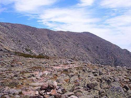
At the entrance station to Baxter State Park, I reserved my campsite and left the paved roads behind. The attending park ranger had an intense northern accent; I had to make a concerted effort not to laugh. I am sure the accent is normal here but it is very new to me. He gave me directions to the Abol Campground six miles ahead, and I made it there in short time over the mostly smooth dirt roads. I quickly set up my tent in a cloud of flies. Then, I momentarily took refuge inside that tent to escape the insects. But I did not venture here just to hide inside my tent. The Abol Slide Trail to Katahdin, the most magnificent mountain for hundreds of miles around, was beckoning to me. I grabbed my backpack and, since it was already early afternoon, hurried to the trailhead on the edge of the campground.
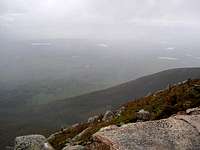
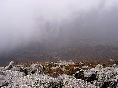
Before setting out, I did not consult the weather forecast posted at the campground’s ranger office. The idea never crossed my mind. I was only conscious of the minimal remaining daylight, so I started briskly in the hope that I could summit Katahdin and return to camp without using my flashlight. The trail was mildly soggy in most areas, and undeniably wet in other sections that traversed tiny stream beds. I had to do a lot of rock hopping to stay out of the standing water. Many of the rocks and lower tree trunks were covered with damp moss, and some of the birches were shedding soft, water-logged strips of bark. An hour or so later, I escaped the forest canopy and reached the open spaces of the Abol Slide. The weather conditions began to deteriorate here and a light sprinkle started to fall for the first time. I continued ahead without too much concern, figuring that if I got a little damp, I could handle it. The scale of the rock slide is immense, even intimidating. After a solid hour of ascent, I may have cleared half of it. Early in the climb, the rim of the summit table was almost always visible far ahead, but the weather began to obscure it as I ascended.
The weather grew worse behind me, but each time I looked forward, I was spurred ahead.
I pressed onward blindly, until I turned around once to admire the sweeping view of the forest below me. The clouds had suddenly blocked that view, and a wall of fog was advancing on me. To make matters more ominous, the diminishing visibility now hampered my ability to see the blue trail markers. I still tried to trek onward, but in doing so, I was beginning to put myself in a corner.
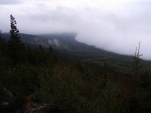
Looking east, it seems okay.
Looking east a little later, here comes the front.
The weather front fully arrived, bringing heavy fog along with steady rain and wind. I searched for a trail marker anywhere nearby, but my search failed. When I finally stopped and huddled under a boulder to stay dry - an effort in vain - I conceded that I was lost. For the next half-hour, I curled up and tried to wait things out. The water soon soaked through my clothes, which left me shivering. I started to feel anxious about my predicament, although at this time, I was finally taking the proper action for the situation. I obviously should have turned back earlier. Once I had abandoned my rash pursuit of the summit and rested stationary for a while, I applied some rational thought to my situation. The trail may be difficult to follow, but I could not be that far from it. The slide as a whole is a contiguous treeless area. It would be easy to navigate once the visibility improved, so I was not really lost. I just needed clearer conditions to return for a moment. Luckily for me, they subsequently did, and I glimpsed a general heading down.
My visibility while lost in the large boulders.
The fog lifts and I see my way down.
I trudged my way down the slide toward its junction with the forest, and along the way, I re-discovered the trail markers. I shamefully hiked the last couple of miles back to my campsite, which I reached near dark. I was thoroughly drenched and just as thoroughly disappointed in myself for acting so foolishly. I should know not to challenge the outdoors in unfavorable conditions. In my tent, I changed clothes and lied down for the night, lesson learned.
The air was pretty crisp the next morning, and the sky was abundantly clear. My reservation within Baxter State Park was only for the previous night, as part of an ambitious personal itinerary covering several areas of the northeast. But the inviting weather conditions made me reconsider. Without a doubt, Katahdin would be a great climb today. Was it worth sacrificing one of the remaining days of my trip to make another attempt? I eventually decided that the mountain was worth it. I felt like I could make things right by scaling the mountain properly, and also bury the bad memories of the previous day. I made it a point to still check the weather forecast at the ranger station, and that forecast was more than accommodating.
Millinocket Lake.
Limitless lakes and forest.
Pemadumcook Lake.
Last push to the table.
I embarked on another brisk pace, hoping to save myself enough daylight to reach New Hampshire before dark. I had no reasonable expectation for how long the round-trip would take, but I just tried to maintain steady progress. From the campground to the summit at Baxter Peak, the trail distance is only 3.8 miles. That would be an easy two hours on a gentle ascent or level trail, but the pitch of this rock slide is steep and relentless. In numerous places, especially just below the table, the size of the boulders changes the hike from an uphill march to a rock scramble. But despite the physical difficulty, or perhaps partially because of it, I really found this to be a fun hike.
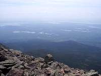
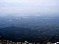
I was so focused on steady progress over the path ahead that a wonderful view to the south sort of snuck up on me. The spruce-dominated forest, so enshrouded in gray clouds yesterday, now clearly made itself apparent as a terrific carpet of green stretching to the horizon. Light and dark green sections of the forests webbed together as a beautiful mosaic, broken exclusively by the numerous lakes and ponds dotting the area. Millinocket Lake to the southeast and Pemadumcook Lake to the south are the largest bodies of water in this view, and they are fronted by so many smaller ones. There is such a large breadth of wilderness visible here at the top of Maine. It is the way nature should be. The views only grew more expansive as I continued to climb higher. When my adrenaline was showing signs of fading, I reached a set of familiar boulders, gigantic in size and speckled by pale green and almost-black lichens. This was the area of my greatest advance yesterday, and now in unfailing sunshine, I discovered how close it was to the summit table.
Looking down after conquering the Abol Slide.
The ridge of Baxter Peak and the knife edge.
I initially lamented how close I had come yesterday, but later I realized how the wonders of today’s hike were only visible because of my failed attempt yesterday. All in all, things turned out pretty well. I soon stepped on the mostly-level summit table, which is a large field of pink-tinted granite stones above patches of alpine grasses and mosses. Small patches of snow were also now visible to me on adjacent slopes. All paths led to Baxter Peak, the absolute summit of Katahdin, whose designation as the northern Appalachian Trail terminus creates increased hiker traffic. I may have encountered a dozen or so hikers during my abbreviated time on the table. At the summit, I took time for a nice break to admire the gorgeous basins now visible to the north, where Chimney Pond was dwarfed by the formidable heights of Hamlin Peak and Turner Mountain.
Appalachian Trail end at Baxter Peak.
Chimney Pond far down below.
Looking west at Hamlin Peak.
From the Summit of Katahdin
Forests, lakes, mountains to the north.
Summit table to the west
The views and experiences of this successful hike were certainly worth the effort getting there. I was relieved knowing I made the right choice to spend a second day here. Going down, I found a nice souvenir rock lower on the table and from there, I descended very quickly. The climb took between three and four hours, while the descent was a little over two hours. I believe I only slipped and fell once on the rapid descent, while sustaining injury only to my pride. Once I was back to my car, I started west on the two-lane highways across Maine, through limitless forest and sporadic developed areas. My body really stiffened up as I sat motionless in the driver’s seat, and I had difficulty walking around at my roadside stops. In the twilight of the evening, I crossed into the White Mountain National Forest of New Hampshire. I hastily set up my tent within the Dolly Copp Campground, just east of Mount Washington. It was dark quickly, and I slowly lied down to rest my aching body.
White Mountain & Green Mountain National Forests, New Hampshire & Vermont
For some reason, I was slightly anxious about camping in these New Hampshire woods through the night. It just seemed eerily silent and dark to me when I had arrived the previous evening. But as a rational mind would expect, any concerns were unnecessary, and I woke up eager to start my next-to-last day of this trip. Mount Washington, the highest point of the northern Appalachians, was within sight of me. It was also one of my initial ideas at the start of the trip, along with some other places in Vermont and New York’s Adirondacks. Because of the second day I spent in Baxter State Park, I reluctantly chose to sacrifice any climb of Mount Washington. I was still feeling pretty stiff from my climbs of Katahdin, and the elevation gains within the Presidential Range would have posed the same level of challenge. I took some good looks at the mammoth mountain, but ultimately continued west through the White Mountain National Forest.
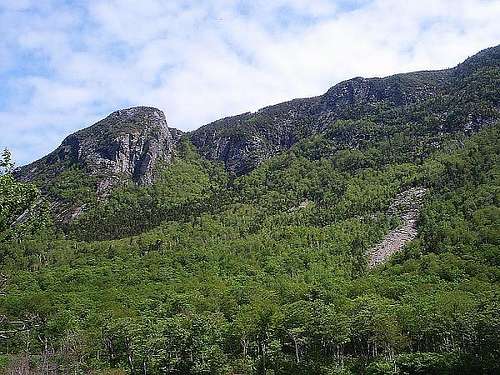
A short distance west, there was a neat landmark that was too significant to pass up. The Old Man of the Mountain is a state icon of New Hampshire. Its profile is part of all the state’s highway signs. It was featured on the state quarter. And when I visited it for a live look, I ultimately found out that it no longer exists. A few years ago, the rock formation, which was eerily shaped like the profile of a human face, collapsed due to natural erosion. In its place, construction crews were busy creating a monument that sort of replicated the shape through various stone walls. Needless to say, it was a big disappointment, but the other rock formations there within the Franconia Notch were very picturesque.
Old Man of the Mountain site.
Eagle Cliffs across the notch.
Cannon Mountain from south of notch.
Profile Lake in Franconia Notch.
Eagle Cliffs in Franconia Notch.
White Rocks NRA Ice Beds Trail.
White Rocks NRA Ice Beds Trail.
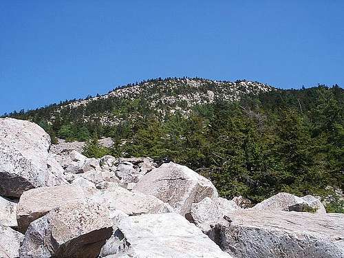
In spite of the striking rock features, I did not linger for long. I decided to hurry into Vermont to enjoy the remainder of the day within the Green Mountain National Forest. I drove south and west through abundant northern forests of conifers, mostly spruce and fir here as well, mixed with deciduous species, most commonly maple and birch. At mid-afternoon in southern Vermont, I eventually discovered the route to White Rocks National Recreation Area. Of the two available trails, the Ice Beds Trail was the most intriguing and conveniently the shortest. A decided inconvenience, however, was the navigation of this trail. The trail forked after a short trek to an open ridge top, which provided pleasing views in one direction of blue skies, green forested valleys, and the namesake white rocks of the area. The continuing fork of the trail, leading presumably to the ice beds, was very difficult to follow. The tree blazes were infrequent, and the trail was indistinguishable from the bare ground of the forest floor. The trail went generally southwest, but because of numerous short-term twists and turns, I had to follow a tedious process of exploration to find my way from marker to marker. It sort of sapped the enjoyment from the hike. Rather than charge ahead on an uncertain heading to save time, however, I stayed patient and surely moved from marker to marker. That first attempt on Katahdin was still fresh in my mind.
Happily, I did eventually reach the giant talus rock pile harboring the ice beds, and it was a wonderful oddity to experience first-hand. While the late afternoon air was a little stuffy throughout the forest, a stiff wind blew from the heart of this rock pile, carrying with it a startling and refreshing chill. It was a true natural air conditioner, unlike anything I had seen before, caused by seasonal ice hiding inside the pile. I was so pleased that I could find it. While I was there, I scrambled to the top of the rock pile, where many of the white and pale gray boulders were bigger than me. I took some terrific pictures of the surrounding Green Mountain National Forest before returning to the trail to grab a Vermont souvenir rock back at the first overlook.
Second overlook on Ice Beds Trail.
Tree trunk growing sideways from the rock.
At the top of the rockpile.
The base of the ice beds rockpile, a cool wind blows from within.
After a good climb, the view from the top of the ice beds rockpile.
My navigation issues, mostly on the outbound hike, had exhausted most of the remaining daylight, so I had to quickly secure a place to camp. The pleasant attendant at Lake Shaftsbury State Park could not provide camping, but she directed me east to Woodford State Park, where I set up my tent all alone in the camping area. Here on the day after the Memorial Day holiday, the rest of the world had apparently all gone back home, except for me. I had the full state park to myself. In the pink skies of twilight, I hiked around the south shore of Adams Reservoir, and then I lied down to sleep in my silent campground.
Daylight's parting gift at Woodford State Park.
On the next day, there was only time for work behind the wheel. From Woodford, Vermont, I had to cover almost a thousand miles to get home. I hurriedly packed my tent at the first light, which was exceptionally early. Using the local time, it was 4:30 in the morning and daylight! The solstice was still three weeks away. That means the eastern coast of Maine on the solstice must receive light before 4:00, which is crazy. On my drive, I was slowed first by heavy school bus traffic in Rome, New York, and then by a lengthy interstate detour near Chautauqua Lake, New York. The worst development by far, however, was in the Cleveland suburbs. After purchasing a Taco Bell dinner, highlighted by a delicious chalupa, I quickly got back on the road to save time. While trying to dig into my chalupa, I managed to dump the contents entirely upon my shirt. The clumsiness made me furious, but I managed to keep my car in its lane and avoid further calamity. A total of twenty hours later, with food stains scattered upon my shirt, I finally reached home and fell into bed.
Parents refers to a larger category under which an object falls. For example, theAconcagua mountain page has the 'Aconcagua Group' and the 'Seven Summits' asparents and is a parent itself to many routes, photos, and Trip Reports.


Comments
Post a Comment