
|
|
Mountain/Rock |
|---|---|
|
|
39.43440°N / 106.1139°W |
|
|
Hiking, Mountaineering, Skiing |
|
|
Spring, Summer, Fall, Winter |
|
|
13852 ft / 4222 m |
|
|
Overview

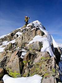
Crystal Peak
Crystal Peak is a high Colorado Thirteener and one of the 100 highest peaks of Colorado, also known as "Centennial." Crystal falls in the 100 highest at #82. It is in the Tenmile Range, which extends from Peak 1 near Breckenridge south to the Continental Divide, where the same range becomes known as the "Mosquito" Range.
Crystal Peak can be climbed in all seasons. It sees little traffic compared to it's neighboring 14ers, but is definitely worth a trip. The most popular route goes through the beautiful Crystal Creek drainage and past Lower and Upper Crystal Lakes. This basin is worth the trip alone. Crystal also has several other routes from all directions, offering a wide variety of terrain. The standard route is a Class 2 hike. (See the "Routes" section below for an overview of the routes available so far on summitpost).
Crystal Peak is in a wonderful area of the Tenmile Range that boasts many high peaks. Pacific Peak, "Atlantic" Peak", Peak 10, Father Dyer Peak, Quandary Peak, Fletcher Mountain, and Drift Peak are just some of the mountains in close proximity. Not far to the south are the popular 14ers Mount Lincoln, Mount Bross, Mount Democrat, and Cameron Point.
Getting There


CRYSTAL LAKES: East Side
From Hoosier Pass, south of Breckenridge on Colorado 9, go 7.6 miles north to the well-marked Spruce Creek Road. Turn onto the Spruce Creek Road, and follow it for approximately 2 miles to an obvious parking area.
4 wheel drive vehicles with high clearance can proceed much further. Go past the obvious parking area, and come to a Y in the road. Take the right of the Y. Soon you will come to another Y, and again, you should veer right. When you make this right turn, you will be passing through an open forest service gate. Go past the turn for Francie's Cabin, one of the 10th Mountain Association Huts, and continue up the road past treeline. After 2.3 miles, you will arrive at the Lower Crystal Lake. This is as far as you can drive.
There are several pullouts along this 4x4 road if you decide to bail out and walk the rest of the way. The worst section is near the middle where a number of large rocks line the roadway. A standard 4x4 should be fine for the road, but I wouldn't try it without skid plates.
MAYFLOWER GULCH: West Side
At 10,980 feet, this trailhead provides access to the west sides of Pacific, Crystal, Atlantic and Drift Peaks. The trailhead is on Colorado 91 and can be approached from either the north or the south.
From the north, go 6.1 mile south on 91 from the junction of Interstate 70 and 91 to a pull-off on the left at Clinton Reservoir. Approaching from the south, go 4.1 miles north on 91 from the summit of Freemont Pass and turn right into the parking area. There is plenty of parking here.
SPRUCE CREEK: East Side
From Breckenridge, drive south on Colorado Highway 9 for approximately 2.5 miles. On your left will be a lake (Goose Pasture Tarn on topo maps). Just past the lake is a right turn onto Spruce Creek Drive (County Road 800). This road is marked with a blue, common sized street sign, so watch carefully for it. Take this road through a development. The road is maintained and smooth, but is somewhat winding and goes through a number of intersections. Stay on the road, and if in doubt, check the street signs as you proceed.
The road gets a tad rougher as it passes through a parking area for trailheads. Proceed through this area. The next stretch is covered in loose rock and gets rougher, but high clearance vehicles will do fine. A spur road to the right invites investigation, but it dead ends quickly. Stay to your left. The road drops down into a draw, and in some conditions, this stretch may require 4WD. The last stretch is rougher and 4WD or at least low gear is recommended. Climbing out of the draw, you’ll arrive at a water diversion facility, where you can park, or park just beyond at the trailhead. Distance from Highway 9 to the road’s end is 3 miles.
NOTE: 4WD or high clearance is recommended to get to the end of the road and the Spruce Creek trailhead. Depending on your vehicle’s abilities, you may have to park earlier and walk some of the road.
Routes
RED= Crystal Lakes Route.
YELLOW= Crystal Lakes Route Variation.
BLUE= Spruce Creek Route.
PURPLE= Southwest Ridge

Red Tape
There are no fees for anything on this route. As always, obey private property postings.
When To Climb
Camping
As mentioned above, Francie's Hut, a 10th Mountain Association Hut, is along the route.
There are no formal campsites in the area.
Weather
Click here for a high altitude NOAA forecast.