
-
 55289 Hits
-
 97.85% Score
-
 76 Votes
|
|
Area/Range |
|---|---|
|
|
49.13000°N / 7.80000°E |
|
|
Hiking, Trad Climbing, Sport Climbing, Toprope, Bouldering, Scrambling |
|
|
Spring, Summer, Fall |
|
|
1988 ft / 606 m |
|
|
Intention of this page
The area of Südpfalz (Southern Palatinate) is one of the most important climbing areas of Germany. However, if you are looking for guidebooks you will stay empty handed: though there are a small number of excellent guidebooks they all have been printed privately and are available only at book- and climbing shops of the region itself. Moreover, the most important guidebooks are out of print now and you'll have to hunt high and low to obtain one of the rare copies. If you are talking about web pages, there are a couple of excellent sites, the best being the site of the Association of Palatinate Climbers (Vereinigung der Pfälzer Kletterer). Here you can find huge lists of all major regions, crags and boulders. The info on routes, however, remains very short. Also, the site is in German and since many US soldiers are located in Kaiserslautern, some 30km to the north, it is worthwhile to have a page in English.When hiking in the heart of the area, at the town of Dahn, I "conceived" this project: similarly to what Moni has done with the Sächsische Schweiz Page I want to start an area guide on Summitpost. My hope obviously is that the many climbers out there will start posting their route beta about the routes they have done in the area. I am aware that this task can become Herculean: there are 120 towers and 200 "massifs" in the Südpfalz region. If all ran well, we could expect up to 500+ routes on this page (In which case a subdivision into smaller areas surely would be opportune). But for the time being there is a white spot on the SP landscape which now will be filled.
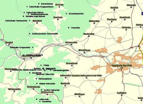
Overview
 Theoturm on Lämmerfelsen Theoturm on Lämmerfelsen |
And this area is huge. To the north the boundary can be assumed being B10, the road between Pirmasens in the west and Landau in the east. To the south the boundary is the French - German border. All in all this adds up to an area of 500 square km. There are roughly 120 towers, 200 massifs (think of them as sandstone ridges) and uncountable numbers of boulders. They all are distributed over the whole area so that finding them is certainly a major logistical problem. Moreover, many of the crags are hidden in pine and beech forests or can be seen only from one specific direction. I therefore plan to include the exact topo coordinates for the various crags and additionally (very) short getting there descriptions. I'm not sure how to handle the boulders, though, since they are not shown on any map.
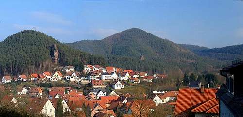
The most impressive and best known rocks, however, don't fall in this category. This is particularly true about Teufelstisch (the Devil's Table, see signature picture) which looms high above the village of Hinterweidental and can be even seen from B10, the main access road. Some other crags crop out of the forest directly above the villages. Jungfernsprung in Dahn, Kreuzfels in Hauenstein and Herrenstein in Erfweiler are a few examples. Moreover there are quite a number of castles in the area, all located on one of the sandstone ridges and offering great views and good hiking and climbing possibilities.
The sandstone is what we call "Buntsandstein" in German, a colourful (mostly red) variation. The character of the rock is quite similar to the on of Sächsische Schweiz in Saxony, but shows more difference in quality. "Solid as a rock" on one hand, "sand heaps and rubble" on the other. Almost all of the crags and boulders are overgrown with vegetation. You will barely find a rock which doesn't sport a little tree on its shoulder; all the north faces are covered with moss and lichen. Though the rock "has good grip", be careful on wet surfaces. Though generally as "grippy" as the dry rock, you'll often encounter spots where lichen has started to grow - and these spots can be astonishingly slippery! You will encounter the same problem, wherever magnesia has been used. It closes the pores in the sandstone and forms smeary surfaces when wet. For the restrictions on the use of magnesia see the Red Tape Section.
And for all the climbing you shouldn't forget the hiking possibilities of the area. A well kept net of hiking trails connects the villages with each other as well as with the rock outcroppings. You'll never know what you encounter on your hike - suddenly - seemingly out of nowhere there will be a huge boulder or two or even a large cliff barely visible through the trees. In sunny weather the play of shadow and light among the pine trees causes great effects, which unfortunately cannot be caught in pictures very well. The bright red sandstone contrasts beautifully with the blue sky, the light sandy underground and the red (also) bark of the pines. If you come across one of these hidden treasures by all means try to climb them - the "back way" (from the ridge / slope in the back) usually is manageable for everybody who can take exposure. Head along the ridge of the sandstone cliff - and suddenly everything else drops back. Especially during sunset this can become magical.
Climbing History
The history of climbing in the Südpfalz Region dates byck to the beginning of the 20th century. There had been ascents before but they had been using ladders, planks and whole tree trunks. In 1903 the first "free" ascent of Rödelstein was recorded by Karl and Oscar Mugler. Shortly afterwards a veritable climbing boom broke loose and most of the crags had been ascended by 1910 - 1920.From then on the hunt for ever more difficult routes started, culminating in a XI- Route, Gambaxplosion on Retschenfels. Over the years there have been quite heated discussions about climbing ethics in the area, which by now have been settled by Climbing Guidelines, which have been generally accepted. The web page of the Pfalz Climbers Association lists them (in German) on this page. I will post a short transcript in the future in the Red Tape section.
Speaking of the Pfalz Climbers Association or "Vereinigung der Pfälzer-Kletterer" as it is known in German (also PK by its abbreviation), it has been founded in October 1919. After several disputes in the 1980s it now again is the generally accepted representative for all climbing related activities and all contacts with authorities and nature conservation agencies.
Its address is
Vereinigung der Pfälzer-Kletterer
Lindelbrunnstr. 40,
76855 Annweiler
History, the Castles of the area
 Lindelbrunn Castle
Already mentioned in the overview section, there are a lot of castles in the area. By some accounts in the greater Pfalz region there were more than 500 of them. Most nowadays are ruins, often hidden in the forests and here, in the climbing area of Südpfalz they always have been built on sandstone rocks. In may cases they follow the ridgeline of the sandstone massifs all the way, which can be seen in the case of the three castles of Dahn in the picture above. Most of the castles were built between the 12th and 14th centuries, many got destroyed during the 30 Years War or the preceeding Peasant Uprising. Those which were left standing later got destroyed by French troops, an interesting example how an old technique (fortified castles) could not withstand progress (artillery).
As with the climbing rocks the castles don't stop at the French - German border. Landscape and culture still are very similar. The French Alsace as well as the German Pfalz have a chequered history, always having been at the centre of wars between the two countries. Still (or luckily) nowadays cross-border relations are very friendly.
The Cliffs, Südpfalz on SP
  |
There are so many sandstone cliffs in the Wasgau area that a subdivision into regions is necessary. I follow the subdivision as given by the PK on their web site. I also follow their principal listings of crags though - for copyright reasons - won't give the specifics of the routes. Just go to their web site for this information. You will, however only get (very) short route characteristics. For more information see the book by U. Daiger and H.-J. Cron (see last section), where the PK data are coming from.
For me the main problem is to identify the crags, how to get there and what to expect in the vicinity. I therefore have studied the maps and made extensive hikes in the area. Together with the aforementioned book I could identify about 99% of the crags. These are listed in the tables below for each region together with a map, which shows the approximate location of the identified cliffs.
For identification I used the maps and topo CDs I have listed in the Maps & Books Section below. I always used elevations as stated on the maps. In case the cliffs didn't have an elevation label attached to them I used the 1:50000 CD for approximate data. Topo coordinates are accurate within 20m except for a few cases in which I had to do "intelligent guesses". The coordinates are given in WGS84 format and thus can be used together with Google Maps.
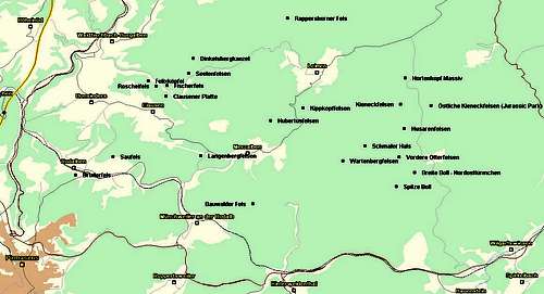
The regions are listed west to east. According to the schematic map above you'll find the following regions:
- Eppenbrunn and Surroundings
- Region Leimen / Merzalben
- Hinterweidenthal Area
- Region Schönau / Fischbach
- Bruchweiler / Budenthal Region
- Dahner Felsenland
- Bärenbrunner Tal
- Busenberg and Surroundings
- Erfweiler Area
- Hauenstein Region
- Region Rinnthal / Wilgartswiesen
- Lug and Surrounding Area
- Vorderweidenthal and Surrounding Area
- The Annweiler Region
1 - Eppenbrunn and Surroundings
 Eppenbrunn Area
The area around Eppenbrunn is the south-westernmost part of the Südpfalz climbing region. It touches the French-German border as well as the border between the German states Rheinland Pfalz and Saarland. The area is compact with few climbing destinations, all close to each other. It sports a Teufelstisch, not quite as impressive as the one near Hinterweidenthal, which you can admire in the sig pic.
| Rock / Massif | Height | Latitude | Longitude | Thumbnail |
| Stephanstürmchen | 336m | 49,1361 | 7,62526 | |
| Hübelfelsen | 355m | 49,1291 | 7,62748 | |
| Lattenteichfelsen | 316m | 49,12866 | 7,63248 | |
| Fleckstein | 2398m | 49,13363 | 7,65845 | |
| Eppenbrunner Christkindelsfels | 357m | 49,11088 | 7,61274 | |
| Eppenbrunner Krappenfelsen | 350m | 49,10882 | 7,61193 |  |
| Eulenfels | 407m | 49,10885 | 7,58488 | |
| Rotenrumer Eck | 401m | 49,10794 | 7,54027 | |
| Hohle Felsen | 356m | 49,11018 | 7,55124 | |
| Eppenbrunner Altschloßfelsen | 377m | 49,10435 | 7,53975 |  |
| Eppenbrunner Teufelstisch | 358m | 49,11709 | 7,54461 | |
| Rotzollwand | 377m | 49,11155 | 7,53083 |
2 - Region Leimen / Merzalben
 Leimen Merzalben Area
The north-westernmost part of the Südfalz Climbing area is the region around the villages of Merzalben and Leimen. The crags are distributed evenly but many are very close to the villages. Zigeunerfels and Bruderfels are very close to the city of Pirmasens.
| Rock / Massif | Height | Latitude | Longitude | Thumbnail |
| Breite Boll – Nordostturm | 525m | 49,2372 | 7,8244 | |
| Spitze Boll | 540m | 49,23205 | 7,8142 | |
| Otterfelsen | 537m | 49,24281 | 7,81579 |  |
| Husarenfelsen | 544m | 49,25323 | 7,81873 |  |
| Schmaler Hals | 518m | 49,24698 | 7,79668 | |
| Kieneckfelsen | 527m | 49,26211 | 7,81648 | |
| Östl. Kieneck Massiv (Jurassic Park) | 523m | 49,26175 | 7,83348 |  |
| Hortenkopf Massif | 520m | 49,27184 | 7,81906 | |
| Wartenbergfelsen | 440m | 49,24148 | 7,78418 | |
| Kippkopffelsen (Geißenfelsen) | 522m | 49,26086 | 7,76205 | |
| Hubertusfels | 522m | 49,25614 | 7,74385 | |
| Langenbergfels | 320m | 49,24328 | 7,70483 | |
| Rappersborner Fels | 402 | 49,29375 | 7,75327 | |
| Seelenfelsen | 364m | 49,27347 | 7,69803 |  |
| Heidelsburg | 340m | 49,26656 | 7,69144 |  |
| Rumbergfelsen | 338m | 49,27887 | 7,70059 | |
| Fischerfels | 336m | 49,26902 | 7,68599 | |
| Spitzfelsplatte | n.a. | n.a. | n.a. | |
| Felixköpfel | 331m | 49,27075 | 7,67545 | |
| Roschelfels | 305m | 49,26886 | 7,67988 | |
| Clausener Platte | 387m | 49,26503 | 7,68558 | |
| Saufels | 360m | 49,24298 | 7,65573 | |
| Bruderfels | 353m | 49,23635 | 7,63473 | |
| Zigeunerfelsen | n.a. | n.a. | n.a. |
3 - Hinterweidenthal Area
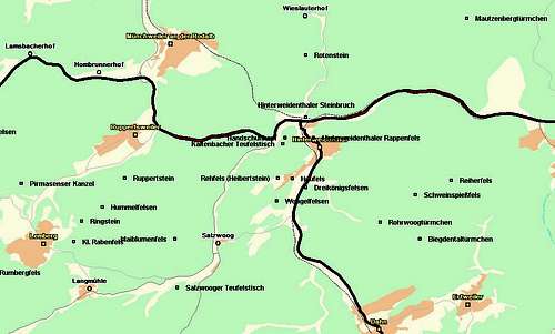 Hinterweidenthal Area
Famous for the Teufelstisch (Devil’s Table) between Kaltenbach and Hinterweidenthal this region offers more than one of these bizarre formations. Near Salzwoog there is a second Devil’s Table and there are a number of impressive cliffs directly in Hinterweidenthal. Most of the other crags are hidden in the forests, however.
| Rock / Massif | Height | Latitude | Longitude | |
| Mautzenbergtürmchen | 370m | 49,22481 | 7,81052 | |
| Rotenstein | 423m | 49,21604 | 7,75188 | |
| Bauwalder Fels | 473m | 49,22573 | 7,73402 | |
| Hinterweidenthaler Steinbruch | 230m | 49,20118 | 7,75185 | |
| Handschuhkopf | 324m | 49,19623 | 7,74449 | |
| Kaltenbacher Teufelstisch | 277m | 49,19487 | 7,74352 |  |
| Hinterweidenthaler Rappenfels | 240m | 49,19634 | 7,75482 | 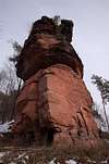 |
| Rehfels (Heibertsstein) | 249m | 49,18676 | 7,74185 | |
| Heufelsen | 232m | 49,18654 | 7,74699 |  |
| Dreikönigsfelsen | 244m | 49,18451 | 7,75205 | 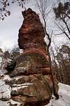 |
| Schweinsspießfels | 351m | 49,18271 | 7,7919 | |
| Reiherfels | 299m | 49,18621 | 7,80482 | |
| Rohrwoogtürmchen | 270m | 49,18064 | 7,7939 | |
| Biegdentaltürmchen | 275m | 49,17214 | 7,79343 | |
| Woogelfelsen | 266m | 49,18126 | 7,74144 | |
| Maiblumenfels | 453m | 49,17223 | 7,7043 |  |
| Salzwooger Teufelstisch | 320m | 49,16065 | 7,70508 |  |
| Rumbergfels | 340m | 49,16419 | 7,63725 | |
| Kleiner Rabenfels | 448m | 49,17157 | 7,66753 | |
| Ringstein | 449m | 49,1764 | 7,67028 | |
| Hummelfelsen | 459m | 49,17976 | 7,67789 | |
| Ruppertstein | 452m | 49,18676 | 7,68592 |  |
| Pirmasenser Kanzel | 420m | 49,18532 | 7,64834 | |
| Kugelfelsen Kanzel | 355m | 49,19779 | 7,62962 |
4 - Region Schönau / Fischbach
 Schönau / Fischbach Area
The region around the villages of Fischbach an Schönau extends across the border onto French soil (Alsace). Some of the more interesting rocks are located across the border underneath the castles (or ruins) Löwenstein, Hohenburg and Wegelnburg.
| Rock / Massif | Height | Latitude | Longitude | Thumbnail |
| Rumbacher Christkindelsfels | 325m | 49,08858 | 7,77782 | |
| Rückkorbfelsen | 314m | 49,07537 | 7,78194 | |
| Schlüsselfelsen | 512m | 49,07125 | 7,7761 | |
| Kastellfels | 302m | 49,08316 | 7,76219 | |
| Kleine Rumbachtalplatte | 255m | 49,08386 | 7,75841 | |
| Rumbachtalfelsen | 286m | 49,08386 | 7,75499 | |
| Nördliches Rumbachtalmassiv | 297m | 49,08758 | 7,75777 | |
| Adelsfelsen | 284m | 49,07888 | 7,75052 |  |
| Dachsbergtürmchen | 427m | 49,05614 | 7,72167 | |
| Schönauer Pfaffenfels | 328m | 49,05705 | 7,74622 | |
| Schönauer Hirtsfels | 358m | 49,05142 | 7,7658 |  |
| Langer Fels | 428m | 49,06561 | 7,78677 | |
| Wegelnburgfelsen | 571m | 49,06078 | 7,78591 | 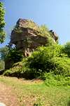 |
| Löwenstein (F) | 515m | 49,05366 | 7,78621 |  |
| Krappenfels (F) | 451m | 49,05155 | 7,7868 | 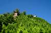 |
| Fleckensteiner Felsen (F) | 358m | 49,04805 | 7,7758 |  |
| Große Hinzenfelsen | 300m | 49,08024 | 7,70944 | |
| Mittlere Hinzenfelsen | 277m | 49,08069 | 7,70445 | |
| Kleine Hinzenfelsen (Kilpenstein) | 226m | 49,08372 | 7,70156 | |
| Florenbergtürmchen (D/F) | 366m | 49,06333 | 7,69014 | |
| Ostersäule | 345m | 49,05164 | 7,68695 | |
| Höchstturm | 305m | 49,08069 | 7,65812 | |
| Simter Türmchen | 290m | 49,07266 | 7,64645 | |
| Krähenstein | 334m | 49,06425 | 7,67723 | |
| Guckenbühlfelsen | 330m | 49,0636 | 7,65515 | |
| Spitzer Fels | 330m | 49,055 | 7,65254 | |
| Rumbergfelsen | 331m | 49,05345 | 7,65828 | |
| Adelsbergfels | 395m | 49,05436 | 7,64629 | |
| Biesenfels (Horbach-Kanzel) | 308m | 49,09241 | 7,6622 |
5 - Bruchweiler / Budenthal Region
 Bruchweiler / Budenthal Area
The village of Bruchweiler – Bärenbach is the centre for the climbing activities in the Südpfalz Region. This are is rather small but consists of quite a number of crags, located very close to each other. All can be reached from the village in no more than a 30min hike. Also, the Dahn and Erfweiler Regions with their fascinating towers are close by so you have the choice among a lot of sandstone crags.
| Rock / Massif | Height | Latitude | Longitude | Thumbnails |
| Mühlengrundtürmchen | 250m | 49,06111 | 7,83968 | |
| Bobenthaler Rappenfels | 225m | 49,06764 | 7,84962 | |
| Fladensteine | 373m | 49,10206 | 7,81729 | |
| Jüngstbergfelsen | 491m | 49,11221 | 7,82265 | |
| Kastellfels | 310m | 49,1093 | 7,81887 | |
| Bruchweiler Geierstein | 309m | 49,12437 | 7,808 | 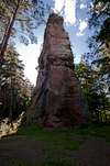 |
| Retschelfelsen | 290m | 49,12269 | 7,79277 | 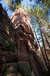 |
| Eisenbahnfelsen | 357m | 49,12563 | 7,79178 | |
| Bruchweiler Rauhfelsen | 332m | 49,12542 | 7,78403 | |
| Dürrensteine (Maria und Friedrich) | 409m | 49,12788 | 7,7768 | 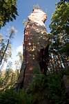 |
| Napoleon | 336m | 49,12179 | 7,77047 | 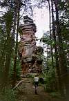 |
| Dretschbergfelsen | 460m | 49,11726 | 7,76789 | |
| Bruchweiler Turm (Zwicksteine) | 270m | 49,11582 | 7,7701 | |
| Käskammerfelsen | 269m | 49,1146 | 7,77391 | |
| Beutelstein | 312m | 49,10863 | 7,77374 | |
| Birkelfelsen | 352m | 49,09938 | 7,78246 | |
| Hühnerfelsen | 485m | 49,08386 | 7,906 |
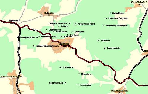
6 - Dahner Felsenland
 Dahn Area
Dahn is the “capital of the Südpfalz climbing region. Located in its middle, Dahn is surrounded by the most beautiful cliffs you can find. The distances to Erfweiler and Hinterweidenthal are short and you have the choice of so many climbing routes. Moreover with Jungfernsprung in the north, Hochstein in the south and the three impressive castle ruins of Altendahn the town is a tourist hotspot. There are also the fourth castle Neu Dahn and the twin towers of Braut und Bräutigam (Bride and Bridegroom) which add to the fascination of the place.
| Rock / Massif | Height | Latitude | Longitude | |
| Fischfelsen | 278m | 49,1451 | 7,8029 | |
| Schützenberg-Ostpfeiler | 304m | 49,14927 | 7,7986 | |
| Schützenwand | 305m | 49,14746 | 7,79913 | |
| Östlicher Schützenturm | 300m | 49,14821 | 7,79501 |  |
| Schützenliesel | 290m | 49,14754 | 7,7926 | |
| Östliches Hochsteinmassiv | 345m | 49,14543 | 7,79379 | |
| Hochstein | 296m | 49,14532 | 7,78974 |  |
| Jungfernsprung | 259m | 49,15321 | 7,77438 |  |
| Vogelsbergturm | 262m | 49,15435 | 7,78091 | |
| Dahner Kuckucksfelsen | 294m | 49,15502 | 7,78349 |  |
| Lachbergtürmchen | 324m | 49,15613 | 7,78727 | |
| Burgblickfels | 305m | 49,16176 | 7,79276 | |
| Römerfels | 376m | 49,16424 | 7,7914 |  |
| Haseneckfels | 271m | 49,16221 | 7,7816 | |
| Bubenfels | 270m | 49,15638 | 7,7718 |  |
| Oberer Galgenfelsen | 261m | 49,15815 | 7,77077 | |
| Nördlicher Galgenfelsen | 263m | 49,15996 | 7,76888 | |
| Mauchendellfels | 264m | 49,16317 | 7,76649 | |
| Weigelfels | 229m | 49,16401 | 7,76494 |  |
| Rabensteine (Taub und Falk) | 307m | 49,16379 | 7,76924 |  |
| Kreuzteichfels | 298m | 49,16762 | 7,75807 | |
| Kauertfelsen | 307m | 49,15793 | 7,76055 | |
| Waidmannsruhe | 240m | 49,15579 | 7,76099 | |
| Wolfsdellfelsen | 233m | 49,15388 | 7,75708 | |
| Nördlicher Schwalbenfelsen | 235m | 49,15174 | 7,75755 | |
| Südlicher Schwalbenfelsen | 235m | 49,1496 | 7,75755 | |
| Hirschfels | 235m | 49,14477 | 7,75566 | |
| Hohle Felsen | 440m | 49,1253 | 7,71753 |  |
| Sängerfels | 238m | 49,15388 | 7,76888 |  |
| Schillerfelsen | 231m | 49,14893 | 7,77232 |  |
| Dahner Wachtfelsen | 279m | 49,14577 | 7,77491 | |
| Braut und Bräutigam | 237m | 49,14624 | 7,77318 |  |
| Klammpfeiler | 250m | 49,14624 | 7,77096 | |
| Rotgraue Wand | 257m | 49,14521 | 7,76957 | |
| Blitzfels | 238m | 49,1451 | 7,76924 | |
| Pfaffdellfelsen | 254m | 49,14727 | 7,76993 | |
| Büttelwoogfelsen | 249m | 49,14285 | 7,7658 |  |
| Büttelfels | 276m | 49,14091 | 7,77232 |  |
| Lämmerfelsen | 271m | 49,13777 | 7,77441 | 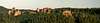 |
| Durstigfelsen | 275m | 49,1343 | 7,77852 |  |
| Durstigfelsen | 275m | 49,13158 | 7,77495 |
7 - Bärenbrunn Valley
 Bärenbrunn Valley
The Bärenbrunn Valley is the smallest of the climbing regions, wedged between Erfweiler, Busenberg and Bruchweiler / Budenthal. In effect all of the crags form a circle around Bärenbrunner Hof, which makes this farm the centre of all climbing activities in the Südpfalz region. The distances between the crags are minimal and the elevations are all between 250 and 450m. Bärenbrunner Hof is located at
- Elevation: 276m
- Lat: 49.1550N
- Lon: 7.8528E
| Rock / Massif | Height | Latitude | Longitude | Thumbnails |
| Pferchfeldfelsen | 345m | 49,14443 | 7,84079 |  |
| Mondfels | 385m | 49,14643 | 7,85158 | |
| Saarbrücker Türmchen | 385m | 49,14668 | 7,85362 | |
| Sternfelsen | 370m | 49,15299 | 7,85428 | 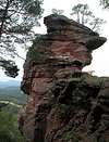 |
| Honigfelsen | 350m | 49,15613 | 7,85739 |  |
| Bärenbrunner Schandariefelsen | 340m | 49,15793 | 7,85428 | |
| Nonnenfels | 340m | 49,15682 | 7,85084 | |
| Klosterfels | 340m | 49,15479 | 7,84798 | |
| Bärenbrunner Pfaffenfels | 320m | 49,15546 | 7,84554 | |
| Bärenbrunner Kesselfels | 370m | 49,15171 | 7,83454 | |
| Kuckucksfelsen | 270m | 49,14377 | 7,82437 | |
| Kapellenfels | 270m | 49,14399 | 7,81579 | |
| Kahles Türmchen | 300m | 49,14521 | 7,81357 | |
| Kahles Wändchen (Geländerfels) | 320m | 49,14532 | 7,81218 |
8 - Busenberg and Surroundings
 Busenberg Area
| Rock / Massif | Height | Latitude | Longitude | Thumbnail |
| Schulerturm | 350m | 49,12213 | 7,82712 | 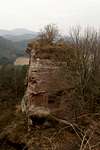 |
| Heidenturm | 420m | 49,11966 | 7,83798 | 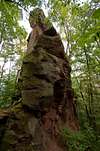 |
| Heidenpfeiler | 359m | 49,11552 | 7,83695 | 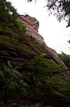 |
| Heidenkammern | 352m | 49,11627 | 7,83023 |  |
| Buhlsteinpfeiler | 387m | 49,12935 | 7,85292 |  |
| Buhlsteine | 446m | 49,13227 | 7,84912 | |
| Löffelsberg-Ostgratfels | 448m | 49,1406 | 7,85359 | |
| Löffelsberg-Südhangfels | 379m | 49,13791 | 7,8524 | |
| Busenberger Galgenfelsen | 355m | 49,1426 | 7,85587 | |
| Bärenbrunner Nadel | 359m | 49,13857 | 7,83573 | |
| Eichelsbergtürmchen | 327m | 49,13879 | 7,83245 | |
| Eichelturm | 348m | 49,13555 | 7,83418 | |
| Drei Steine | 320m | 49,1343 | 7,83132 | 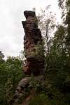 |
| Kreuzfels | 320m | 49,13374 | 7,82782 |  |
| Strackfelsen | 300m | 49,13566 | 7,82318 |  |
| Eckturm | 347m | 49,13768 | 7,82626 | 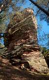 |
| Eilöchelfelsen | 315m | 49,13632 | 7,81923 |  |
| Dickenbergwand | 356m | 49,13385 | 7,81496 | |
| Dickenbergtürmchen | 283m | 49,13341 | 7,81379 | |
| Sprinzel (Dickenbergturm) | 297m | 49,13024 | 7,81185 |  |
9 - Erfweiler Area
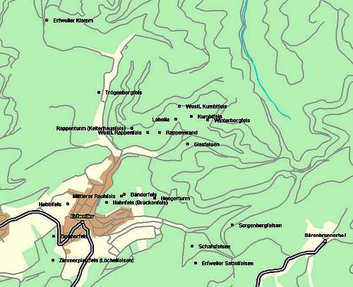 Erfweiler Area
| Rock / Massif | Height | Latitude | Longitude | Thumbnail |
| Zimmerplatzfels (Löchelfelsen) | 308m | 49,15225 | 7,80583 | |
| Zimmerfelsen | 293m | 49,15494 | 7,806 |  |
| Hebelfels | 245m | 49,15858 | 7,80839 |  |
| Hahnfels (Brückenfels) | 290m | 49,15878 | 7,81511 | 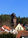 |
| Mittlerer Rauhfels | 270m | 49,15947 | 7,81769 | |
| Bänderfels | 270m | 49,15969 | 7,81814 | |
| Heegerturm | 260m | 49,15922 | 7,82336 | |
| Sorgenbergfelsen | 296m | 49,15619 | 7,83678 | |
| Schafsfelsen | 374m | 49,15228 | 7,82567 | 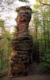 |
| Erfweiler Sattelfelsen | 330m | 49,15098 | 7,83032 | |
| Kelterhausfels | 300m | 49,16711 | 7,81942 | |
| Trögenbergfels | 270m | 49,17117 | 7,81378 | |
| Erfweiler Klamm | 280m | 49,1758 | 7,80483 | |
| Westlicher Rappenfels | 287m | 49,16667 | 7,82217 |  |
| Rappenwand | 298m | 49,16667 | 7,82422 |  |
| Lobelia | 280m | 49,16814 | 7,82697 | |
| Westlicher Kumbtfels | 280m | 49,16958 | 7,82767 | |
| Kumbtfels | 270m | 49,16847 | 7,82972 |  |
| Winterbergfelsen | 300m | 49,16803 | 7,8325 |  |
| Glasfelsen | 270m | 49,16531 | 7,82903 |  |
10 - Hauenstein Region
 Hauenstein Area
| Rock / Massif | Height | Latitude | Longitude | Thumbnail |
| Neufeldtürmchen | 245m | 49,20051 | 7,84728 | |
| Nedingfelsen | 336m | 49,19793 | 7,85356 |  |
| Neding-Ostgratfelsen | 294m | 49,19815 | 7,85912 | |
| Spirkelbacher Rauhfels | 371m | 49,19693 | 7,87164 |  |
| Rauhbergtürmchen (Krappenfels) | 340m | 49,19921 | 7,87359 |  |
| Rauhbergpfeiler | 340m | 49,19693 | 7,87442 |  |
| Hülsenfelsen | 360m | 49,18126 | 7,87234 | |
| Kreuzelfelsen | 329m | 49,1879 | 7,85309 |  |
| Kahler Fels | 335m | 49,18654 | 7,85326 |  |
| Dörreinfelsen | 305m | 49,18407 | 7,85153 |  |
| Backelstein | 279m | 49,18226 | 7,85395 |  |
| Säulenfels | 350m | 49,1774 | 7,85703 | |
| Birkenfels | 330m | 49,17615 | 7,85773 | |
| Hühnerstein | 456m | 49,17013 | 7,86567 |  |
| Hoher-Kopf-Turm | 443m | 49,1774 | 7,85084 | |
| Lanzenfahrter Felsen | 285m | 49,18057 | 7,84912 |  |
| Burghaldefels | 303m | 49,18635 | 7,84626 |  |
| Benztürme | 320m | 49,1791 | 7,8447 | |
| Hauensteiner Turm | 300m | 49,18101 | 7,8409 | |
| Stephanstürme | 306m | 49,17082 | 7,84523 |  |
| Sattelfelsen (Dümpfelturm) | 316m | 49,17196 | 7,85015 |  |
| Platzturm | 320m | 49,16924 | 7,84712 | |
| Wolfsfelsen | 270m | 49,16921 | 7,84601 | 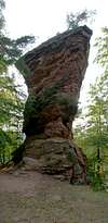 |
| Zimmerbergfelsen | 370m | 49,18984 | 7,83695 | |
| Lauberstalfels | 250m | 49,20696 | 7,80275 |
11 - Region Rinnthal / Wilgartswiesen
 Rinnthal / Wilgartswiesen Area
| Rock / Massif | Height | Latitude | Longitude | |
| Buchholzfelsen | 385m | 49,21087 | 7,93077 | |
| Rinnthaler Falkenturm | 353m | 49,21334 | 7,92855 | |
| Mühlfelsen | 332m | 49,2164 | 7,92438 | |
| Schmalbühler Felsen | 367m | 49,21604 | 7,94108 | |
| Dingentalturm | 369m | 49,21818 | 7,93469 | |
| Haubenthaler Fels | 290m | 49,22123 | 7,92802 | |
| Kostenfels | 327m | 49,22076 | 7,92302 |  |
| Brodfels | 290m | 49,22484 | 7,91913 | |
| Dachsfels | 296m | 49,21662 | 7,91066 | |
| Langenfelsen | 271m | 49,22798 | 7,91716 |  |
| Langentaltürmchen | 280m | 49,2379 | 7,92855 | |
| Frohndellpfeiler | 311m | 49,23056 | 7,91577 |  |
| Frohndelltürmchen | 292m | 49,23226 | 7,9143 | |
| Wellbachtalfelsen | 247m | 49,23748 | 7,90433 | |
| Göckelsbergtürmchen | 270m | 49,22609 | 7,9083 | |
| Göckelsbergeck | 377m | 49,22651 | 7,91205 | |
| Drei Felsen | 282m | 49,22551 | 7,90805 |  |
| Wilgartisplatte | 274m | 49,22529 | 7,90358 |  |
| Wilgartisburg | 247m | 49,22529 | 7,89997 | 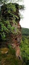 |
| Göckelsbergmassiv | 279m | 49,22079 | 7,89728 | |
| Mittlerer Göckelsbergfelsen | 259m | 49,21954 | 7.8951E | |
| Westlicher Göckelsbergfelsen | 269m | 49,21859 | 7,89294 | |
| Darstein | 220m | 49,2184 | 7,8998 | |
| Finsterbergfels | 259m | 49,21259 | 7,89311 | |
| Wilgartswieser Puppe | 292m | 49,21109 | 7,89331 | |
| Kalmeckfelsen | 292m | 49,2077 | 7,88831 | |
| Prälatenkammern | 270m | 49,20701 | 7,89108 | |
| Bavariafels (Wilgartswieser Rauhfels) | 320m | 49,20457 | 7,87439 |  |
| Wilgartswieser Rauhberg-Südostpfeiler | 338m | 49,2023 | 7,87267 | |
| Wilgartswieser Rauhbergpfeiler | 328m | 49,20207 | 7,86873 | 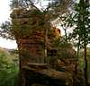 |
| Aufels | 220m | 49,21201 | 7,88331 |  |
| Freischbachwand | 243m | 49,2219 | 7,86534 | |
| Freischbachtürmchen | 281m | 49,22279 | 7,8777 | |
| Eselsfels | 290m | 49,20951 | 7,87164 |  |
| Kuhfels | 300m | 49,20995 | 7,87061 |  |
| Kuhplatte | 270m | 49,2104 | 7,86786 | |
| Vordere Deichenwand | 270m | 49,20843 | 7,86517 | |
| Mittlere Deichenwand | 270m | 49,20976 | 7,85948 |  |
| Hintere Deichenwand | 260m | 49,21082 | 7,85553 | |
| Eselsturm | 300m | 49,21095 | 7,85189 | |
| Falkenburgfels | 337m | 49,20523 | 7,8605 | |
| Östl. Schloßbergturm | 305m | 49,20576 | 7,86217 | |
| Östl. Gratturm | 270m | 49,20782 | 7,85467 |
12 - Lug and Surrounding Area
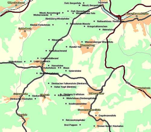 Lug Area
The Lug region is one of the most popular climbing areas in the whole Südpfalz region. The most important climbing crags are directly accessible from the village centre which is located at the intersection of two important side roads through the region. The most important crags are Luger Friedrich – one of the first cliffs to be climbed and the Geiersteine, three high towers to the east of the village. There are less important crags nearby so in case of overcrowding (which easily happens here) you can turn to other destinations.
| Rock / Massif | Height | Latitude | Longitude | Thumbnails |
| Weidenthaler Fels | 242m | 49,20545 | 7,91786 | |
| Östl. Kesselwand | 260m | 49,20645 | 7,91427 |  |
| Westl. Kesselwand | 260m | 49,20568 | 7,91066 | |
| Rindsberg-Westpfeiler | 292m | 49,20501 | 7,90689 |  |
| Östl. Bergerfels | 310m | 49,21012 | 7,92519 | |
| Westl. Bergerfels | 290m | 49,20907 | 7,92216 | |
| Weiherwände | 358m | 49,20476 | 7,90255 |  |
| Ferkelstein Massiv | 320m | 49,20073 | 7,91361 | |
| Kleiner Ferkelstein | 310m | 49,20015 | 7,90383 | |
| Rothenfelsen (Rödelstein) | 362m | 49,20184 | 7,93244 |  |
| Kriegstaltürmchen | 246m | 49,19948 | 7,92563 | |
| Heimelstein | 462m | 49,19804 | 7,93624 | |
| Wernersberger Wachtfels (Kanzel) | 386m | 49,19237 | 7,924 | |
| Klingelfels (Kisselbachwändchen) | 360m | 49,19337 | 7,90114 | |
| Kisselbachwand | 284m | 49,18835 | 7,89911 | |
| Laubendöllwand | 290m | 49,18498 | 7,89331 | |
| Luger Friedrich | 310m | 49,18362 | 7,88847 | 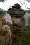 |
| Höllenfelsen | 414m | 49,1834 | 7,88417 |  |
| Runder Hut (Heischfels) | 348m | 49,19021 | 7,91325 | |
| Hornsteine | 402m | 49,1816 | 7,90083 |  |
| Maus | 400m | 49,1806 | 7,90911 |  |
| Katerfelsen | 400m | 49,18057 | 7,90775 |  |
| Wernersberger Geiersteine | 378m | 49,17921 | 7,91291 |  |
| Nesselbergfelsen | 300m | 49,1781 | 7,89272 | |
| Dimbergpfeiler | 370m | 49,16671 | 7,91119 |  |
| Kaftenstein | 350m | 49,16807 | 7,90533 | |
| Dimturm | 330m | 49,17349 | 7,90083 | |
| Hoher Kopf (Dimfels) | 360m | 49,17191 | 7,90262 | |
| Dimberg-Nördliche Gratfelsen | 376m | 49,17140 | 7,90322 | |
| Dimberg-Südliche Gratfelsen | 400m | 49,16857 | 7,90921 | |
| Dimbacher Käshafen | 350m | 49,16649 | 7,89158 | |
| Hockerstein (Wachtfels) | 333m | 49,16785 | 7,88728 | |
| Isselmannsteine | 371m | 49,16429 | 7,91286 | |
| Engelmannsfels | 357m | 49,15885 | 7,93363 |  |
| Drei Puppen | 339m | 49,15457 | 7,92266 |  |
| Rötzensteinpfeiler | 392m | 49,15682 | 7,91083 |  |
| Steiner Nadel (Käshafen) | 372m | 49,1541 | 7,93244 |
13 - Vorderweidenthal and Surrounding Area
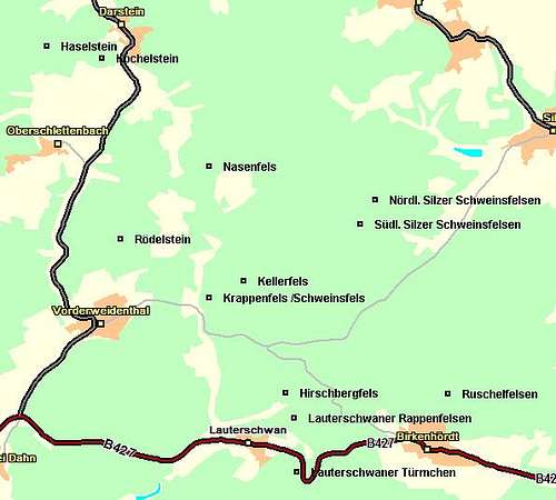 Vorderweidenthal Area
| Rock / Massif | Height | Latitude | Longitude | Thumbnails |
| Haselstein | 393m | 49,15577 | 7,87095 | |
| Kochelstein | 350m | 49,15457 | 7,87959 | |
| Schanzenturm | 360m | 49,13818 | 7,87959 | 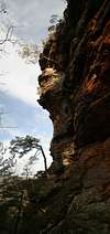 |
| Rödelstein | 423m | 49,1361 | 7,88245 | 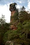 |
| Nasenfels | 400m | 49,14352 | 7,89633 | |
| Kellerfels | 320m | 49,13182 | 7,90169 | |
| Krappenfels (Schweinsfels) | 310m | 49,1301 | 7,89625 | |
| Nördl. Silzer Schweinsfelsen | 360m | 49,14016 | 7,92216 | |
| Südl. Silzer Schweinsfelsen | 390m | 49,1377 | 7,91988 | |
| Hirschbergfels | 331m | 49,12045 | 7,90825 | |
| Lauterschwaner Rappenfelsen | 338m | 49,11785 | 7,90947 |  |
| Roschelfelsen | 410m | 49,12038 | 7,93347 | |
| Lauterschwaner Türmchen | 290m | 49,11241 | 7,90993 |
14 - The Annweiler Region
 Annweiler Area
| Rock / Massif | Height | Latitude | Longitude | Thumbnails |
| Katzenfelsen | 497m | 49,26345 | 7,9749 | |
| Eußerthaler Krappenfelsen | 330m | 49,2602 | 7,95532 | |
| Scharfeneckfels | 502m | 49,25253 | 8,02073 | |
| Orensfels | 565m | 49,23717 | 8,02479 | |
| Behälter-Kopf Massif | 354m | 49,24962 | 7,9491 | |
| Eußerthaler Blöcke | 354m | 49,25387 | 7,95049 | |
| Beutelsbergmassiv | 377m | 49,25187 | 7,95771 | |
| Eußerthaler Sommerfels | 387m | 49,24498 | 7,95946 | |
| Gräfenhausener Sommerfelsen | 373m | 49,23073 | 7,95955 | |
| Annweiler Krappenfels | 389m | 49,21559 | 7,96446 | |
| Adelsberg | 452m | 49,20748 | 7,9498 | |
| Trifels | 497m | 49,19621 | 7,97843 |  |
| Anebos | 482m | 49,19276 | 7,98168 |  |
| Kiefernfels | 425m | 49,19271 | 7,98277 | 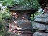 |
| Brockel | 425m | 49,1921 | 7,9826 | |
| Fensterfels | 425m | 49,1911 | 7,98382 |  |
| Bindersbacher Turm | 425m | 49,1911 | 7,98382 |  |
| Jungturm | 425m | 49,19023 | 7,98504 |  |
| Münzfels | 488m | 49,19023 | 7,98504 |  |
| Asselstein | 406m | 49,1879 | 7,95963 | 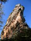 |
| Rehbergfelsen | 576m | 49,18146 | 7,97074 | |
| Föhrlenbergpfeiler | 450m | 49,19065 | 7,99415 |  |
| Kleiner Hahnstein | 451m | 49,17615 | 7,97163 |  |
| Großer Hahnstein | 411m | 49,16913 | 7,97946 |  |
| Lebersteine | 391m | 49,15907 | 7,9713 |  |
| Hundsfels | 386m | 49,1566 | 7,97663 |
Boulders
There are endless numbers of boulders in the area and I still have no idea how to pinpoint them. For the time being I'll refer you to the site of the PK. You'll find hundreds of bouldering problems there, however without the exact getting there info. There is a pdf-version of the main bouldering guide up for download available. Get it here!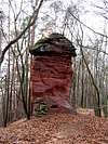 |  |  |  | 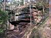 |
Getting There
The easiest access road to Südpfalz is B10, which runs along directly to the north of the region. In can be reached from the surrounding larger cities as follows:From Frankfurt (airport) via Ludwigshafen
Take motorway A5 southward in direction Karlsruhe. At Darmstadt switch to A65 (also southward). At the intersection"Viernheimer Dreieck" switch to A6 west. At the intersection "Kreuz Frankenthal" switch to A61 southward, which you have to leave two intersections later ("Kreuz Mutterstadt") onto A65 south. At the exit Landau-Nord leave the motorway and take B10 westwards.
From Mainz, Cologne (north)
Take motorway A63 from Mainz (or from the Intersection "Kreuz Alzey" if you come from Cologne) to Kaiserslautern. There turn briefly onto A6 west, which you leave three exits later ("Kreuz Landstuhl) onto A62 south. This motorway takes you to Pirmasens, where you switch to B10 east.
From Stuttgart via Karlsruhe
Take motorway A8 to Karlsruhe. Here take motorway A5 northward for one exit and leave for A65, direction Landau. At the exit Landau-Nord leave onto B10 west.
When To Climb
The whole area of the Natural Park is open all year. Several of the crags are closed for the first half of the year due to breeding peregrine facons and eagle owls (see red tape).Red Tape
Yes, there is red tape and lots of it. The sandstone of Südpfalz forms lots of caves and overhangs. Though this makes it most interesting for climbers, two species of birds of prey compete for this habitat: the peregrine falcons and the eagle owls. Both are endangered and wherever there is a eagle owl pair found nesting in the sandstone the crag will immediately be closed. Generally this closure lasts from the beginning of each year through Aug. 1st. If breeding is not successful the closures will be cancelled even before that date. For a list of closures see the Closure List of PK.The use of magnesia is not allowed in the whole Südpfalz region. This is rather a directive or an arrangement than an outright law. Thus you probably will get away with using it but do so only when absolutely necessary. Magnesia closes the pores which you find in the sandstone and together they form a smooth surface which will get very slippery in wet conditions. The rule of thumb is to use magnesia in the highest difficulty sections and only extremely sparingly.
A transcript of the rules as set by the PK will follow here in the future.
Accommodation, Food and Wine
 Erfweiler
Let me state first, that of course there are campgrounds in the region, However I can see no reason why one should camp out. In all villages you can find inns, hotels and apartments. And you can be sure to get excellent food out there. I know quite a lot of people who come a long way each year explicitly to dine in the region. In its eastern part, where the mountains suddenly drop into the wide Rhine River Valley you find the so called Weinstrasse (Wine Road), which stretches for 100km through vineyards. It should be obvious, why it got its name.
Camping
There is no shortage of campgrounds, some of which are used for youth clubs. Here is a list of and towns with campgrounds listed east to west:
Dörrenbach, Annweiler, Hauenstein, Erlenbach, Bobental (youth campground), Dahn, Bruchweiler-Bärenbach, Fischbach (youth campground), Lemberg, Ludwigswinkel, Stürzelbronn, Schweix.
You can find Youth Hostels in Dahn and Annweiler.
Accommodation Sites
This is certainly not a complete list. I suppose that each village has a page somewhere. I put up the most informative pages about villages at the heart of the climbing region of Südpfalz:
Weather Conditions
Lookup the weather conditions for the nearest cities, Pirmasens and Landau:Maps, Books & Web Pages - The Reference
MapsAs for maps there is a good overview map (1:50000) by Kompass Verlag but the best ones are the official topographic maps by the state government of Rheinland Pfalz, scaled 1:50000, 1:25000 and 1:5000. All official maps can be found on the web page of Landesvermessungsamt Rheinland Pfalz
1:50000
- Naturpark Pfälzer Wald
Kompass Map WK766
ISBN: 3-85491-523-3
- Annweiler am Trifels
LVA RLP Map L6712
ISBN: 3-89637-191-6
- Bad Bergzabern
LVA RLP Map L6912
ISBN: 3-89637-194-0
- Pirmasens Süd
LVA RLP Map L6910
ISBN: 3-89637-193-2
1:25000
- Pirmasens Nord, 6711, ISBN: 3-89637-139-8
- Merzalben, 6712, ISBN: 3-89637-140-1
- Annweiler am Trifels, 6713, ISBN: 3-89637-141-X
- Pirmasens Süd, 6811, ISBN: 3-89637-146-0
- Dahn, 6812, ISBN: 3-89637-147-9
- Bad Bergzabern, 6813, ISBN: 3-89637-148-7
- Ludwigswinkel, 6911, ISBN: 3-89637-151-7
- Fischbach bei Dahn, 6912, ISBN: 3-89637-152-5
- Oberotterbach, 6913, 3-89637-153-3
1:5000
There are endless numbers of maps, please look them up on the web page given above if you feel you need them.
Maps on CD
You can also get the official 50k and 25k maps as software CDs. Also to be found on the web page of Landesvermessungsamt Rheinland Pfalz.
- CD-ROM 1:50 000 Rheinland- Pfalz/Saarland 4.0
1:50000
ISBN: 3-89637-336-6
- CD-ROM 1:25 000 Nr. 4 Saarl.-Hochwald-Pfälzer B.
1:25000
ISBN: 3-89637-347-1
Books
As said in the introductory section there are a number of climbing guidebooks on the region of Südpfalz. The best ones, however, have been published privately and are sold only in selected bookshops of the region.
- Hiking
- Pfälzerwald
B. & J.-Th. Titz
Rother Verlag
ISBN: 3-7633-4268-0 - Klettern im Buntsandstein
U. Daigger, H.-J. Cron
Westpfälzische Verlagsdruckerei St. Ingbert
ISBN: 3-00-015457-4
- Kletterführer Mittelgebirge Pfalz: Klettern im Buntsandstein des Pfälzer Felsenlands
by Jens Richter , Sabine Tittel
Verlag: Panico Alpinverlag
ISBN: 978-3936740417
- Pfalz ++, Klettern im Buntsandstein
R. Burkard, P. Weinrich
Published privately
- Klettern im Naturpark Pfälzerwald
Naturfreunde Lambrecht
Published privately - Bouldern im Pfälzer Wald
P. Weinrich
Published privately and out of print
PDF-Version
- Pfalz & Nordvogesen en bloc
A. Wenner, Y. Corby, I. Bald
Panico Verlag
ISBN: 3-936740-19-4 - Radwanderführer Pfalz / Rheinhessen
H.-E. Rösch
Kompass Verlag
ISBN: 3-8134-0189-8
Climbing
Bouldering
Bike Touring
Web Pages
There are also a couple of (German) web pages, which give excellent overviews but which stop short when it comes to route descriptions.
godisgreat82 - Feb 25, 2010 12:56 pm - Hasn't voted
Koordinates correctionsSome "intelligent matching" on the location of some rocks is wrong, so here are the correct coordinates for two of them: Rohrwoogtürmchen 49.18064,7.7939 Erfweiler Klamm 49.1758, 7.80483
Gangolf Haub - Feb 28, 2010 5:15 am - Hasn't voted
Re: Koordinates correctionsFixed. Thanks!
jochen - Mar 13, 2012 8:46 am - Hasn't voted
New climbing bookThere is an excellent new climbing book für Suedpfalz, much better than the old ones. Excellent topos, descriptions and pictures! Costs 39,90€ Kletterführer Mittelgebirge Pfalz: Klettern im Buntsandstein des Pfälzer Felsenlands by Jens Richter , Sabine Tittel Broschiert: 520 Seiten/pages Verlag: Panico Alpinverlag; Auflage: 3. Auflage. (August 2011) Sprache: Deutsch ISBN-10: 3936740410 ISBN-13: 978-3936740417 Größe und/oder Gewicht: 18,4 x 14,8 x 3,2 cm http://www.amazon.de/Kletterf%C3%BChrer-Mittelgebirge-Pfalz-Buntsandstein-Felsenlands/dp/3936740410/ref=sr_1_1?ie=UTF8&qid=1331642610&sr=8-1
Gangolf Haub - Mar 14, 2012 8:20 am - Hasn't voted
Re: New climbing bookThanks Jochen, I have it on some of my pages but forgot to update this one.