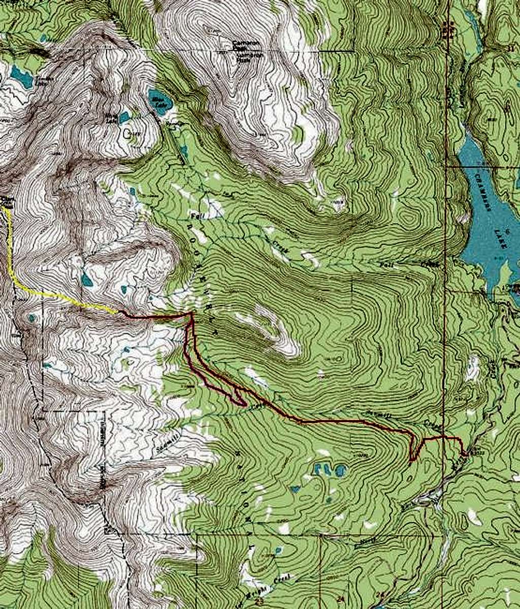
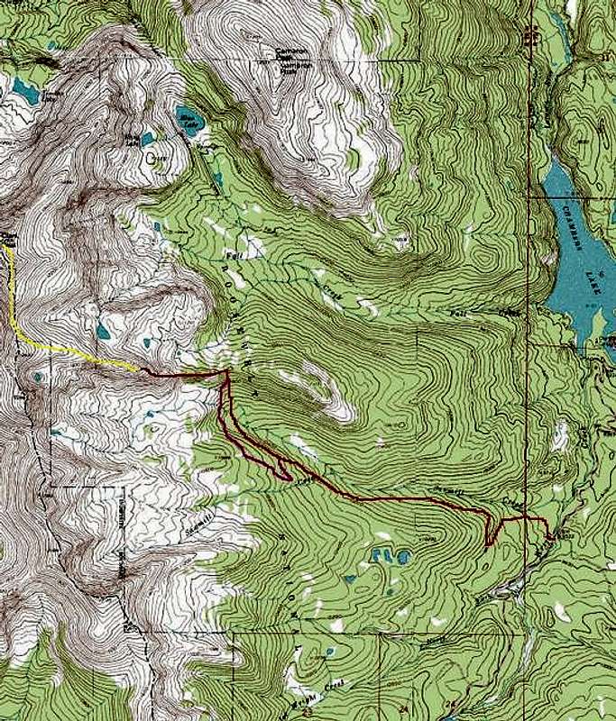
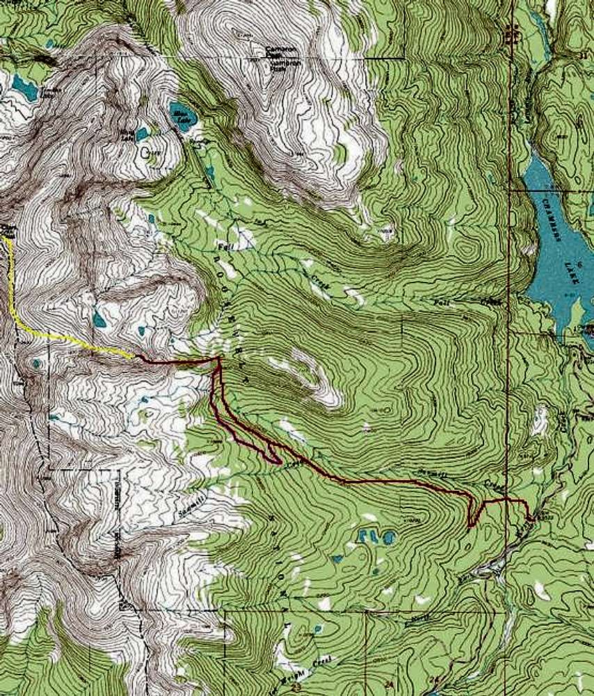
Rough sketch showing Sawmill...
Rough sketch showing Sawmill Creek Trail route up Clark Peak. The red line shows our ascent, along the Sawmill Creek Trail and thus to the saddle in the east ridge leading to pt 12,433. The yellow line shows a possible route to the summit, and the purple shows our detour on the descent, where we found the logging road nearer to treeline and followed its switchbacks on down to the trail along the creek. Note that the turnoff from the main trail to follow the logging road around to the saddle (purple) lies almost directly opposite the bare area on the ridge viewed across the Sawmill basin.


