
-
 11966 Hits
-
 81.84% Score
-
 14 Votes
|
|
Mountain/Rock |
|---|---|
|
|
35.06344°N / 32.32448°E |
|
|
Hiking |
|
|
Spring, Summer, Fall, Winter |
|
|
1214 ft / 370 m |
|
|
Overview
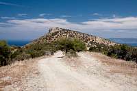
 Moutti tis Sotiras seen from the western fields on Akamas Peninsula Moutti tis Sotiras seen from the western fields on Akamas Peninsula |
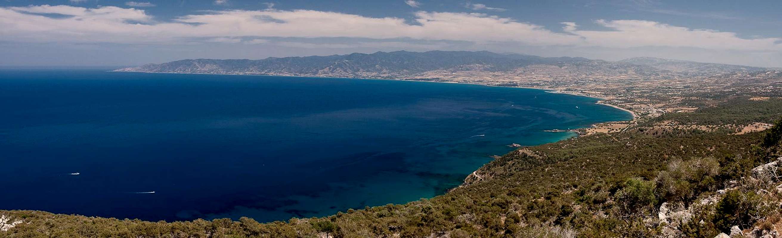
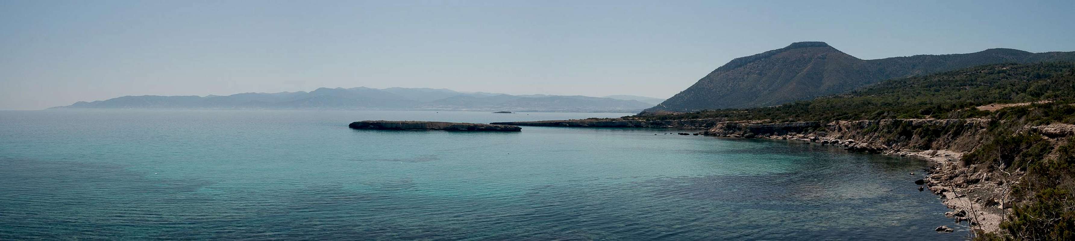
Moutti tis Sotiras is easily the most popular mountain on the Akamas Peninsula in the north-west of Cyprus. As mountains go, it is a very tiny specimen but in terms of views it plays in the big league - and if it only were for Cyprus proportions. With its 370m it rises directly above the north coast of the peninsula which lays the coastal plain around the town of Polis together with Chrysochou Bay at its feet. Across the bay Cyprus highest mountain range, Troodos, gradually rises towards its highpoint, Mount Olympos.
 |  |  |
Like its vicinity, Moutti tis Sotiras is made up from limestone. The whole peninsula used to be a giant karst plain, much of which has been carved away over the millennia. What remains are table-top mountains with football field size summits, bounded by vertical drops of some 50m unto the former scree fields, which now are overgrown with every kind of brushwork. Moutti tis Sotiras is no exception, only that here the summit plateau is tilted to the east. The summit faces are most impressive on the western side, where they drop dramatically down onto the lower portion of the Akamas Peninsula.
 |  |  |  |
On Cyprus the ministry of forestry has developed about 50 nature trails with signs explaining flora, geology and sometimes history of the countryside they lead through. Two of the most popular trails of the island run close by the summit of Moutti tis Sotiras and thus can be used as ascent routes.
- Aphrodite Trail: named after the Greek Goddess of Love, who by legend was surprised bathing in a grotto of the vicinity, is the more scenic of the two trails. It leads from the Baths of Aphrodite (the aforementioned grotto) around the mountain, missing its summit by a mere 40m of altitude. I would recommend to hike it counter-clockwise as the hike up the steep west face of the mountain offers some wonderful views which develop more slowly in that direction. A hundred metre descent leads to the ruined monastery of Pyrgos tis Rigainas where it combines with the Adonis trail (see below) to lead back to the baths of Aphrodite.
- Adonis Trail: Named after Adonis one of Aphrodite's lovers this trail (together with the Aphrodite Trail) heads directly up the eastern slopes of Moutti tis Sotiras towards the ruins of Pyrgos tis Rigainas. To reach the summit you head up a dirt road which leads to a saddle to the south of the summit. From here a trail takes you up to Moutti tis Sotiras. Return to the ruins to complete the counter-clockwise loop, which heads back to the Baths of Aphrodite.
Panoramic View
  |
Getting There
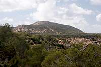
 Moutti tis Sotiras seen from the east
You can reach the Greek (southern) part of Cyprus from any major airport in Europe. The island has two international airports at Larnaka in the east and Pafos in the south-west. Both airports are connected by a motorway.
- From Pafos take highway B7 in direction of Polis.
- In Polis drive westward along the coastal road through Latsi
- At an intersection after Latsi follow the signs to Loutra Aphroditis (Baths of Aphrodite) where you will find a large parking lot.
Red Tape
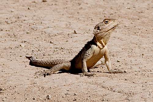 Stellion doing his early morning push-ups
There's no red tape here. There is only one restriction: the roads on the Akamas Peninsula may only be used by authorized persons' cars.
Accommodation
 |
Accommodation of all kinds is easy to find along the coasts of the island. You can book hotels and apartments from any travel office. Moreover, a lot of British expatriates are living on the island part time. You can get lucky to book one of their winter homes in summer.
There is a campground at the Baths of Aphrodite and another one between Polis and Latsi. The whole coast between Polis and the Baths of Aphrodite is one big holiday settlement mainly targeting British visitors. Still you'll be able to find any nationality there.
Weather Conditions
Maps & Books
Maps
I must admit that I didn't find any decent maps of the island, maybe caused by the military nervousness mentioned above. I have used the following street map:
- Cyprus / Chipre / Zypern
1:200 000
Freytag & Berndt
ISBN: 978-3-7079-0478-9
Books
Here the situation is different. An excellent guidebook is available from Rother Verlag, both in German and English. It covers the whole island in 50 daytours.
- Zypern (Süd & Nord) / Cyprus (South & North)
Rolf Goetz
Rother Wanderführer / Rother Walking Guide
Rother Verlag
ISBN (German): 978-3-7633-4271-6
ISBN (English): 978-3-7633-4814-5