
-
 17987 Hits
-
 78.27% Score
-
 9 Votes
|
|
Mountain/Rock |
|---|---|
|
|
49.44568°N / 124.95379°W |
|
|
Hiking |
|
|
Spring, Summer, Fall, Winter |
|
|
5043 ft / 1537 m |
|
|
Overview
Mt Apps N Aspect
Mt Apps has two summits with the higher one lying at the south end of an almost 1 km long connecting ridge. The summit cairn, CDMC plaque and geodetic survey monument all lie, however, on the slightly lower north summit overlooking Georgia Strait and Denman Island.
Longer trips are eminently feasible from Mt Apps. For instance, the members of the range surrounding Roaring Creek: Mts Joan, Curran and Squarehead can be reached from the Mt Apps route via a connecting route to Squarehead, a distance of some 4-5 km.
Although Mt Apps is a very worthwhile destination and offers lovely views from both summits, perhaps the single best feature of a trip up there is a visit to stunning Zella Lake near the true summit.
Like most mountains of the Beaufort Range, Mt Apps is named for a local personality from years gone by. Don Apps was a well know Courtenay mountaineer.
Getting There
Vancouver Island can be reached by air from eg Toronto, Vancouver, Seattle, Calgary or San Francisco to Victoria, Nanaimo, Comox or Campbell River and by ferry from Port Angeles to Victoria on The Coho and on BC Ferries from Vancouver to Victoria or Nanaimo. Public transport on the Island is notoriously poor and anyone arriving by air would be advised to rent a car.There is some gravel road involved in getting to the Appps access spur but, generally, a normal 2WD sedan is fine. High clearance 4WD vehicles can probably progress beyond the nominal start point I’ve indicated for this route
Most visitors will approach the area from the Inland Island Highway 19. Although Apps can be theoretically approached directly off the Island Highway at the Buckley Bay/Denman Island Ferry turnoff, this road is gated and the gate is almost always locked. I will focus, therefore, on the approach from Port Alberni and the so-called “Valley Connector”. The required spur off this approach is also often behind a locked gate although not as often that at Buckley Bay. Check on status before hand by calling Island Timberlands before your trip.
Approach
Approaching from north or south on the Island Highway 19 take the Highway 4 exit from Qualicum Beach and drive to Port Alberni. Once in town go right to the bottom of the hill to the traffic lights and T-junction and turn right towards Tofino/Uclulet. Drive 550 metres and turm right on Beaver Creek Road. Drive Beaver Creek 17.5 km to Somers Road and turn right.Drive Somers Rd 2.3 km and turn left. If you get to a T-junction with Newcastle Road, you’ve gone too far. After 200 metres turn left onto gravel. You’re now on the Valley Connector, known as “Comox Trail” on Garmin maps.
Drive the gravel highway for 8.3 km to a branch road at 10 U 351931 5476798. Turn right. After 900 m you will come to the gate that is periodically locked. Drive through and proceed 1.1 km to branch 113 on the left.
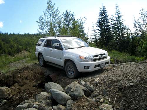 Approach Road Conditions |
Route
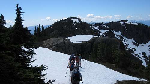
From the start point indicated above take the right hand fork and walk up (or drive if you can) around the toe of the broad ridge. After about 1.5 km on the road find the marked trailhead at 10 U 357205 5478053.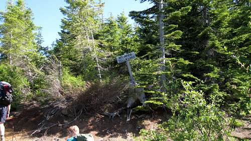 Mt Apps Trailhead | 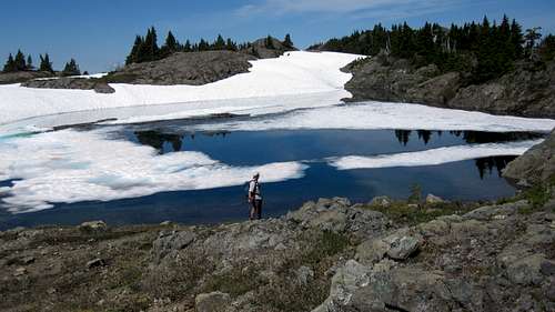 Zella Lake | 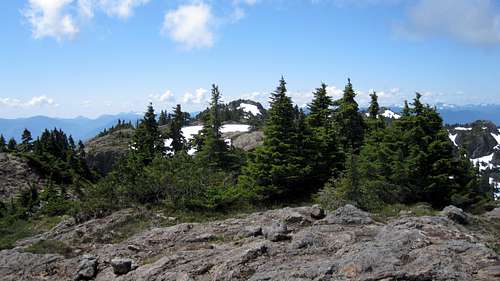 Summit Ridge | 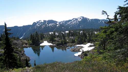 Mt Apps Summit Ridge View S |
Return to the trail and continue about 1 km northeast along the ridge to the north summit with its view down to Georgia Strait.
Return the way you came.
Route Data:
Distance : ~10 km
Net Elevation gain: ~ 500 metres
Net Elevation gain: ~ 500 metres
Gross Elevation gain: ~650 metres
Time: 4-5 hours return
As always, Garmin/MapSource tracklogs for the approach and hiking routes are available for the asking.
Time: 4-5 hours return
As always, Garmin/MapSource tracklogs for the approach and hiking routes are available for the asking.
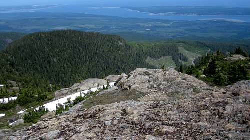 Mt Apps Summit View E |
Red Tape/Safety Considerations
None. Although you should enquire with Island Timberlands beforehand if the gate is open or not and state your intentions.As always, make sure that you have left a detailed trip plan with someone responsible. The RCMP and the appropriate SAR agency will respond in an emergency but it is up to you to have the mechanism in place that will initiate the call-out process if it becomes necessary.
There is full cellular service once on the summit ridge.
Camping
Mt Apps is generally considered a day trip but the parking area indicated above has plenty of room and makes a good spot to car camp if you want an early start.There's certainly no water though, so haul a barrel in with you.
Useful Links
For route information refer to Island Alpine – A Guide to The Mountains of Strathcona Park and Vancouver Island, Philip Stone, Wild Isle Publications, 2003, ISBN 0-9680766-5-3For precise directions get hold of a copy of Backroad Mapbook. Volume 7: Vancouver Island
Weather
Nearest point weather forecast:For winter trips consult the Vancouver Island Avalanche Bulletin
Summit Panorama
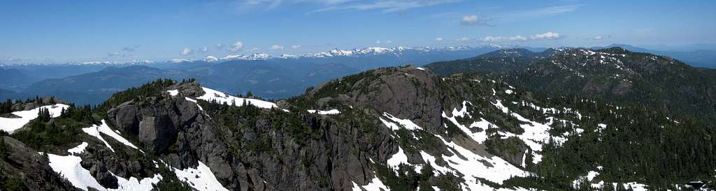
Mt Apps Summit View N