
-
 30792 Hits
-
 74.9% Score
-
 5 Votes
|
|
Route |
|---|---|
|
|
49.22365°N / 124.59442°W |
|
|
Hiking |
|
|
Spring, Summer, Fall, Winter |
|
|
Most of a day |
|
|
Class 3 |
|
|
Getting There
Refer to the Mt Arrowsmith parent page.
Route Description
From the parking spot at km 13.3 on Pass Main walk a few metres back down the road and up the fourth logging road spur. It’s well flagged.
The spur road is getting progressively washed out but if you have a high slung 4x4 and don't mind beating it up a little, the spur can be driven to within ~100 metres of the trailhead. Park at the obvious BIG washout.
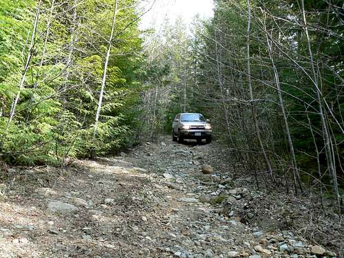 Pass Main Spur to the Judges Route Pass Main Spur to the Judges Route |
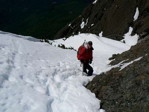 Judges Route in May Judges Route in May |
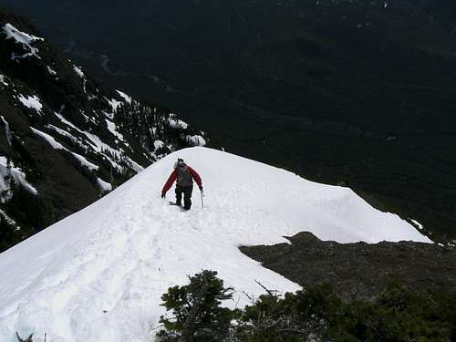 Descending the Judges Route Descending the Judges Route |
An ascent on snow in early season (April/May) or in winter will avoid the loose/scree sections. My vote on route quality above is based upon doing it on snow. On dirt it's down to 2 stars.
The route was named by one of the first ascensionists, Ralph Hutchinson, who was contemplating whether or not to accept a judgeship at the time.
tjholt - Sep 29, 2012 12:20 pm - Hasn't voted
Judges RouteI recommend hiking to the end of the 4th logging road spur and starting the trail at the end of the road. Shortly the trail divides. We took the left fork. Steep but reasonably good route. There is a much steeper and more eroded route taking off from some painted rocks at a gully lower on the road.
Bambi - Aug 22, 2014 8:19 am - Hasn't voted
Getting thereThe logging road where you start the hike in to the trail now had a 2.7km painted on a rock. This road is just before where you park on the left (the parking spot is larger than just the roadside pullouts found all along the main logging road). There is also a branch in this road now ( looks new) and you must stay to the right (there is a cairn).