Toggle navigation
Mountains
Routes
Images
Trip Reports
Forum
What's New
People
Areas & Ranges
Articles
Trailheads
Canyons
Huts & Campgrounds
Albums
Logistical Centers
Fact Sheets
Lists
Custom Objects
Gear
Plans & Partners
WELCOME TO SUMMITPOST
SIGN IN
REGISTER
Mount Garfield
Additional Parents
Image
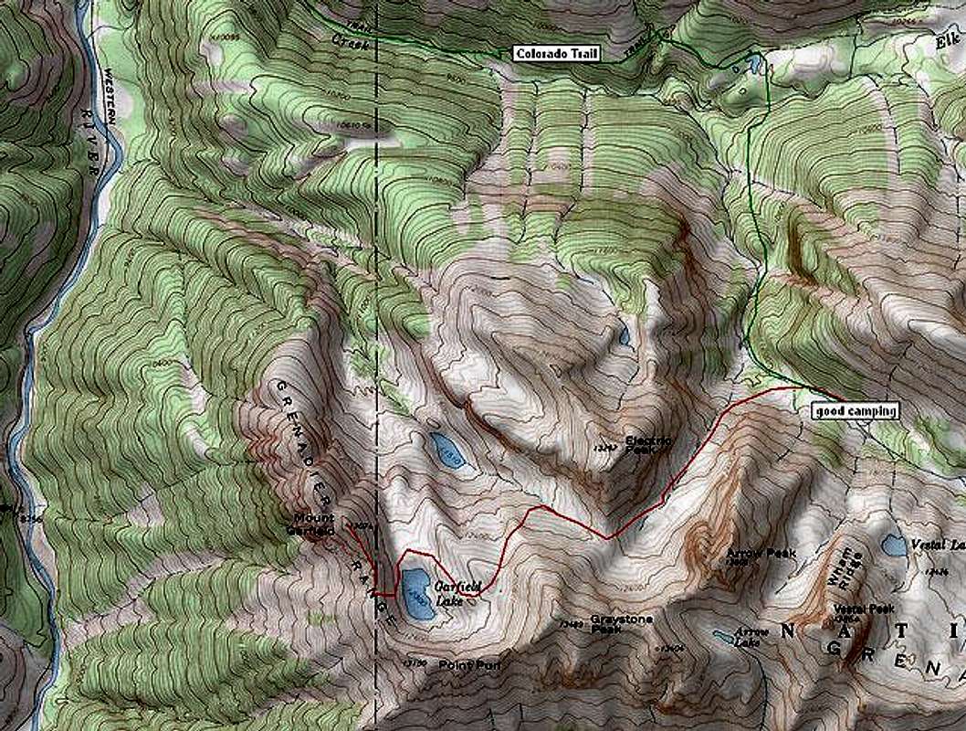
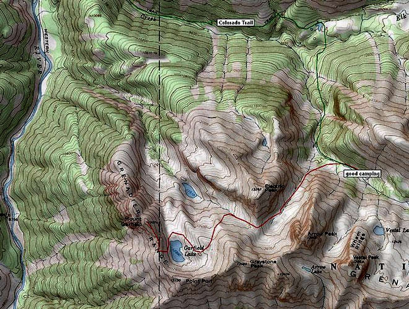
Mt. Garfield topo map
View High-Resolution Image
Mt. Garfield topo map
Mount Garfield's south ridge route. The green line is the Colorado Trail and the Vestal Creek approach. The red line is the south ridge route. Map generated by TOPO!
« PREV
NEXT »
RyanS
on
Oct 10, 2004 10:39 pm
Comments & voting
Other parents
Lat/Lon:
37.69470°N / 107.6357°W
Image Type(s):
Topo/Diagram
Image ID:
73243
6878 Hits
77.48
% Score
8
Votes
Log in to vote
Comments
No comments posted yet.
to post!
Don't have an account?
Mount Garfield
(Mountain/Rock)
« PREV
Viewing
#15 of 38
GALLERY
NEXT »
RyanS's Image Gallery
« PREV
Viewing
#276 of 811
GALLERY
NEXT »
South Ridge
(Route)
Loading....
×
You need to login in order to vote!
User Name
Password
Remember me
Forgot your password?
Log me out when I close my browser.
Keep me logged in all the time.
sign in as a user
Don't have an account?
Register now for FREE
Rating available
Suggested routes for you
People who climb the same things as you
Comments Available
Create Albums
Register Here


