-
 26337 Hits
-
 84.27% Score
-
 18 Votes
|
|
Mountain/Rock |
|---|---|
|
|
43.61928°S / 171.37431°E |
|
|
Hiking, Skiing |
|
|
Spring, Summer, Fall, Winter |
|
|
5538 ft / 1688 m |
|
|
Overview
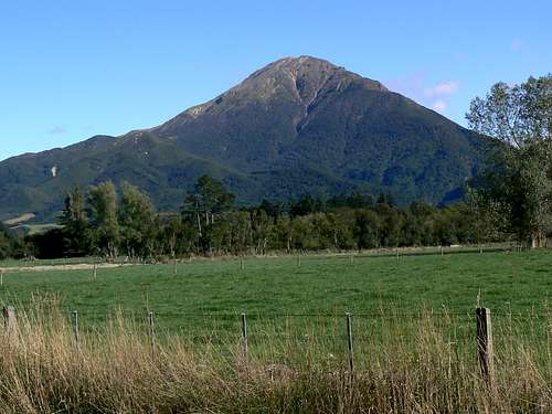 Mt Somers SE Aspect from SH 72 Mt Somers SE Aspect from SH 72 |
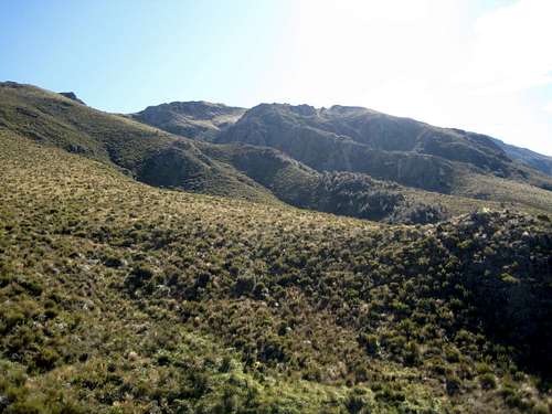
As you approach the area from Christchurch, you hardly notice that the flat farming country in the neighbourhood of the nearby villages of Mt Somers and Staveley has already attained an altitude of some 450 metres. Nevertheless, the mountain and its neighbours rise essentially right out of the plain and present a stark and impressive contrast to the pastoral scenes below.
Not too many tourists head this way and those that do are coming to do the “Mt Somers Sub-Alpine Walkway”. This tramp is in the Lonely Planet guide and therefore on more peoples’ radar than would otherwise be the case. A hike taking in the opposite (south) side of the range to the Walkway offers solitude and is the standard approach for those wishing to bag the summit of the area’s signature peak. If you meet anyone along the way (I didn’t) the chances are it will be a Kiwi.
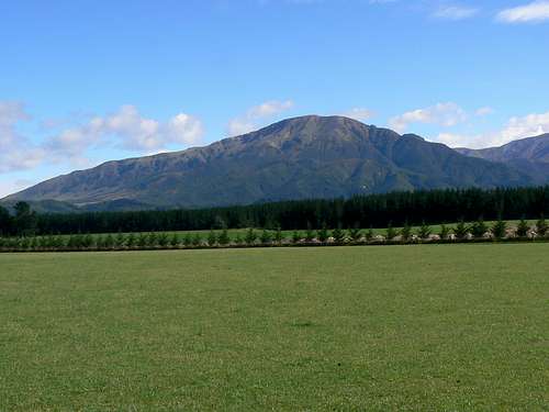
Mt Somers South Face from SH 72
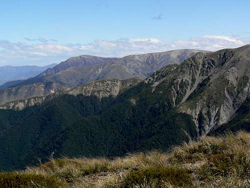
The summit offers a nice contrast in views between the rich agricultural land below to the east and the Southern Alps and their precursors to the west.
Getting There
Approach the area from the south (Mt Cook) or east (Christchurch) and make your way to SH 72 – “The Inland Scenic Highway”. The summit of Mt Somers can be reached from two trailheads: Woolshed Creek to the southwest and Sharplin Falls to the northeast. Reach these points as follows.On SH 72 in the village of Staveley turn west and then right onto Flynns Road following signs for the Sharplin Falls carpark.
Travel a further 8 km south on SH 72 to Mt Somers village and turn right (northwest) onto Ashburton Gorge Road. Proceed 10 km before turning right onto Jig Road (gravel) to the Woolshed Creek carpark 3.5 km from the pavement. If the latter is your approach of choice and you’re coming from Christchurch, I recommend taking SH 1 to Rakaia and then the nice, straight but unnumbered back road directly west to Mt Somers village. It’s well signed from Rakaia.
Approaches
The Mt Somers Track starts at S43 37.807 E171 22.939 just to the north of the sub-peak known as Staveley Hill. Before reaching this point the tramper must decide which of the two approach options best suite the principal aim of the day. The shortest approach is unquestionably from Sharplin Falls. The longer approach from Woolshed Creek, however, is much more scenic.From the East
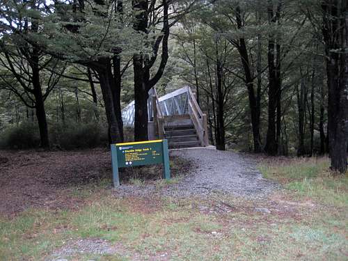
In Sharplin Falls carpark find the trailhead on the south side of the lot signed for Mt Somers South Face Route. This trailhead is not shared with that for the Mt Somers Sub-Alpine Walkway which leaves the lot generally west in the direction of the Falls themselves. Some maps show a trail which does head this way before turning south and up the north ridge of Hookey Knob. This may or may not be an option. My route went steeply south right out of the carpark and then west up the east ridge of Hookey Knob.
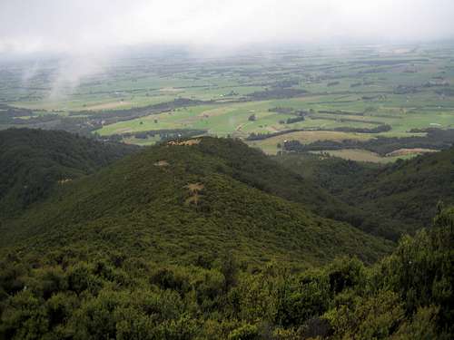 Hookey Knob |
From the West
From the carpark at Woolshed Creek take the signed Rhyolite Ridge track across the bridge over Woolshed Creek and up the hillside beyond. The track soon clears the bush as it makes its way northeast, climbing steadily to the open ridge above and a high point of about 900 metres. From here the track leaves the obvious ridge it’s been following and swings north across open tussock. The angle of ascent lessens considerably as the hiker covers the one remaining kilometre to the junction of the Mt Somers South Face track and that to the Woolshed Creek Hut at 960 metres and about one hour from the car. Coordinates measured at the junction are S43 37.491 E171 19.157. These did not agree with my map which showed the track 200 metres to the west at this point.
 Rhyolite Ridge Trailhead | 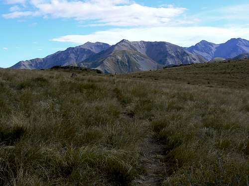 S Face Route Trail Junction | 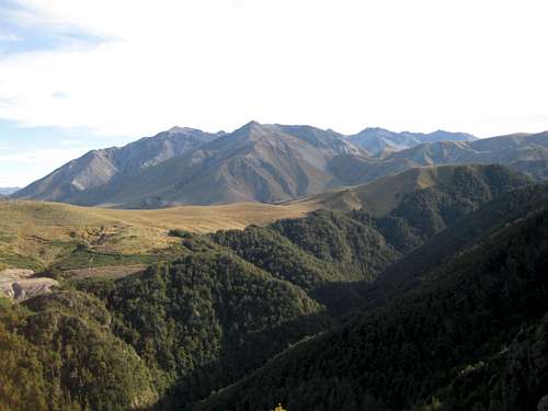 South Face Route view north | 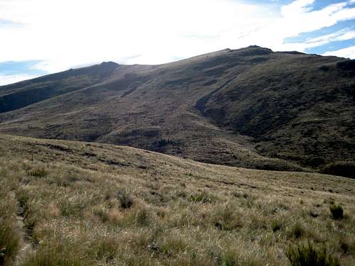 West slopes of Mt Somers |
From the track junction the Mt Somers South Face Route looses an immediate 100 metres of altitude as it heads south to a boggy stream crossing in a thick belt of flax. After regaining 40 or 50 metres of the lost relief, the track begins to contour south and east across open tussock slopes and the south face of Mt Somers begins to loom above the walker. About 1.5 km from the S Face Route junction the track drops down to an old roadbed. The map will confirm that this is the same road noted above.
The route follows the road for 500 metres to S43 38.122 E171 20.171 where it turns abruptly south (right). The south face track stays left and enters a belt of beech forest.
Unlike the approach from the east which is principally a ridge walk, the western approach traverses a face of Mt Somers. And we all know what faces do – they drain mountains. So prepare for no less than nine stream crossings (in addition to the four you’ve already done) with their attendant loss and gain in altitude as the route makes its way across the south face.
This route is much newer than other tracks on Mt Somers and doesn’t see as much traffic. Consequently, it’s quite indistinct in some places especially where the flax and tussock grow thickly in open spots. The marker poles often prove very useful. There’s plenty of worthwhile distraction along the way since the plains below and the jagged rhyolite cliffs above are in more or less continuous view.
1.5 Km after leaving the old road (and after 7 of those 9 crossings) the track arrives at the new DoC Acland day shelter. In March 2009 it still smelled of paint and new plaster. Water is available here and it’s a nice spot for a break before the climb up to the saddle below Staveley Hill.
It’s a steady 200 vertical metres in 1.4 km from the shelter to the saddle and takes about half an hour. If it’s a hot day you’ll be glad of the shade provided by the forest during this phase.
 Rhyolite Cliffs above south face | 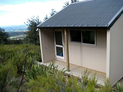 Acland Day Shelter | 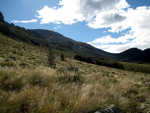 Staveley Hill Saddle |
Summit Route
From the DoC sign the Mt Somers Summit Track is well marked by poles and an established (and rather braided) use-path as it heads almost due north and up to the summit ridge. The last of the flax/tussock vegetation falls behind after 10 minutes or so and thereafter the track runs up broken rock and heather slopes to a large cairn right on the ridge crest. Turn left (west) here and walk along the open ridge for 500 metres to the trig. I’m sure all those vaunted summit views are in sight as soon as you reach the cairn but can’t confirm this since I did Somers in a white-out with about 10 metres visibility.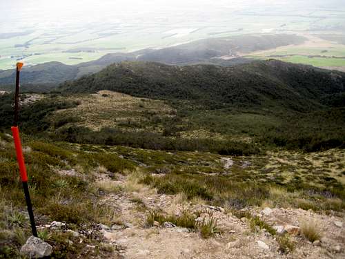 Mt Somers Summit Track Start | 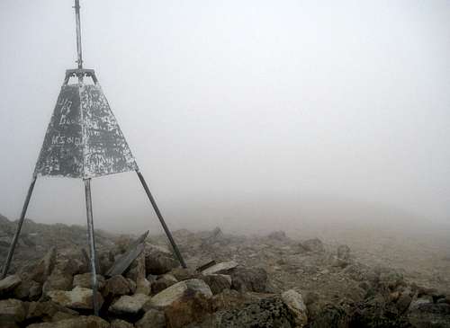 Mt Somers Summit Trig |
Again I have to disagree with DoC’s times on this leg. The sign says 2.5 hours to the summit from the track start. I took 3.25 hours return in a white out. I would say that 4 hours return is more than generous for any reasonably competent party.
It goes without saying that, if you can arrange a ride (see “Accommodation” below) or if you’re part of a multi-vehicle party, you can start at either trailhead and leave by the other.
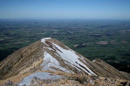 Summit View NE Summit View NE | 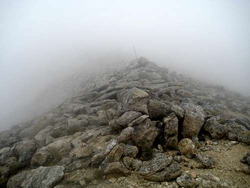 Summit ridge in the clag Summit ridge in the clag |
Other Routes
Looking at the easy west slopes of Mt Somers from the Woolshed Creek Hut/South Face track junction I was struck by what looked to be an obvious route to the summit starting from the end of the old road referred to above. However, since I had no literature on the subject and wanting, above all, to respect local customs in such matters, I followed the established route across and up the mountain. In fact looking up at the west ridge whilst traversing the south face, it certainly appeared that the ridge above may not be continuous.A few minutes with a map following my return and several more on the internet confirms that the ridge is certainly continuous and, although there is no track, that this route “goes”. Some describe it as the best way. Others find the “tussock hopping” up there somewhat irksome. How much more irksome than all those stream crossings will have to wait for someone to make a comparison.
I have also heard that it’s possible to climb up to the summit of Mt Somers from the Pinnacles Hut on the Sub-Alpine Walkway. Perhaps others could add information on this?
Red Tape and Safety Considerations
DoC operates a well-organised intentions system. Particularly if you’re travelling alone, you’d be well advised to complete one of the forms available at any DoC office.I noted cell phone service (vodaphone) from all points at and above the Staveley Hill saddle on the west side and from Hookey Knob upwards on the east side.
New Zealand is notorious for awful mountain weather just a few kilometres from the nearest sunny beach and my trip up Mt Somers was no exception. Clear skies and warm temperatures at the start were replaced by a white-out above the Staveley Hill saddle and by snow on the summit – and this was in high summer! Check the alpine forecast with DoC before you venture onto this and any other mountain in the country. Carry a map and navigational tools – compass AND GPS – and know how to use them. The required map is NZMS 260 K36 “Methven”.
Accommodation etc
Camping is permitted anywhere on the mountain as far as I know – although most will do the above as a day trip.The Sub-Alpine Walkway on the north side of the massif is graced by two DoC huts. Both are of the “serviced” type that currently require (2012) a “three ticket” ($15) charge per person per night. Better value than this is a season pass. A 6 months pass valid for all serviced DoC huts – but not “Great Walk” or alpine huts such as the Muellar Hut – costs $60. This pays for itself after just 4 nights. The choice is a no-brainer in my opinion.
Proximity to the popular ski area on nearby Mt Hutt means that hotel/motel accommodation is readily available in the town of Methven. Don’t miss the “Blue Pub” there.
The area is also noteworthy for B & B’s as well as “Farmstay” accommodation. Of the several on offer I recommend Glenview Farmstay. Besides feeding you to bursting point, regaling you with tales from the pioneering days of the Canterbury High Country and showing you all over their farm, Helen or Mike will run you to either trailhead so that you start at one approach and finish at the other.
Useful Links
It would be well worth visiting DoC’s Mt Somers website before your trip.Weather. The forecast for The Caterbury Plains seems the best of the available sources for weather prediction for Mt Somers.
OR
Get a live view of the weather at altitude from the neighbouring Mt Hutt webcam