Borah
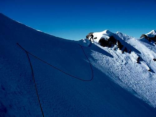
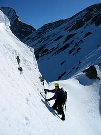
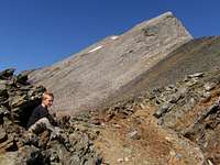
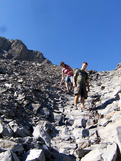
![Borah]() The top of chicken out ridge where you have to downclimb in the summer
The top of chicken out ridge where you have to downclimb in the summer![Borah]()
![Borah]()
![Borah sunrise]()
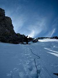
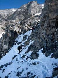
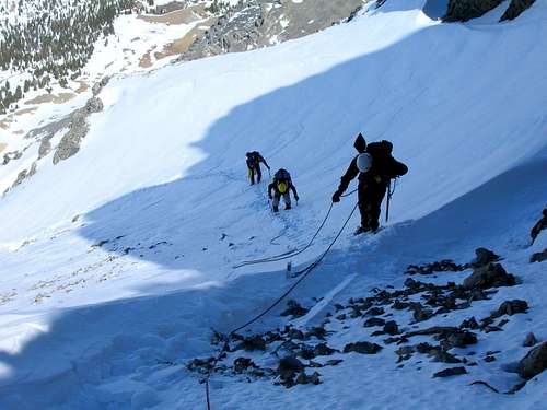
Borah is Idaho's highest summit at 12662 and not high on the technical meter. The trail has a good start but gets quite steep after the first mile and a half. The steep section is unimproved and there are several paths splitting off throughout. At treeline, the trail is once again, a little easier to follow and the summit is in view most of the way. Chickenout Ridge is considered class 3 and easier if you know where you're going. My first time, we got stuck on the north side of the ridge which was much more difficult than staying slightly to the south of the ridge until you get to the top. Several years later, a snow climb left only a couple of steps down to the top of the saddle as seen in the photo. In the summer, the downclimb is a good 20 feet to a usually snow covered saddle. Once across the snow, there is a good trail to the top even though the steep section up Borah's west face is loose.
The view from the top is unrivaled and commonplace for those who often find themselves frequently at these heights. Even in an October snow squall, with the sun above the horizon but dimmed from the thick black clouds, beauty abounds.
![Borah Peak]()
The descent is painful. Remember the steep switchbacks through the trees? The little round rocks that roll through the thick dust as gravity pulls your boot down the mountain with every step? That's why we take photographs. To remember the high sense of splendor we felt at the top when we get to the trail head and feel every step in every muscle fiber. Even more so after the drive home and those muscles have been stiffening for hours. Chalk up another state highpoint and enjoy the memories.
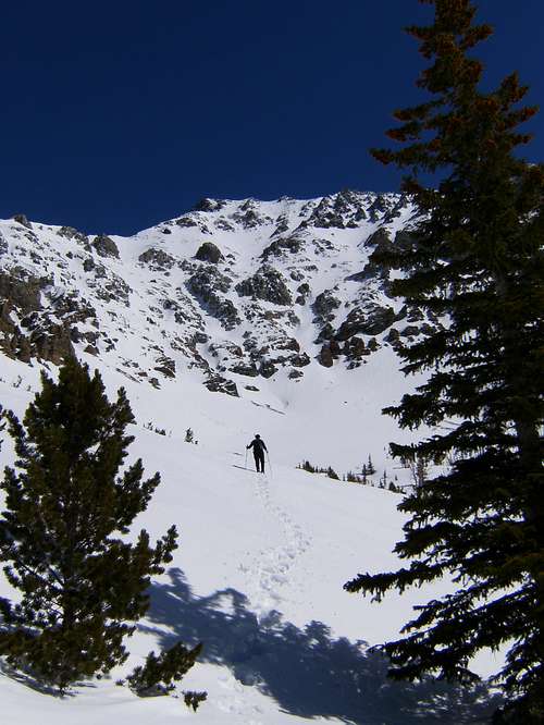
Leatherman
![Leatherman Peak]()
![Leatherman]()
![Leatherman]()
Leatherman is second on Idaho's highest list at 12230. The west ridge is a class 3 in the summer and really quite fun in the snow instead of sliding around on loose rocks. We drove up Sawmill Gulch until we hit snow and hiked from there. The hike wasn't bad except for the half mile boulder field with winter laden packs. The top of Sawmill Gulch is flat and provides an exquisite view of upper Lone Cedar Creek and our approach to the west ridge besides good camping. There was roughly 4 feet of snow at our camp site but we walked mostly on rock to the saddle at the bottom of the west ridge. The snow kept getting deeper as we climbed but ribs of rock were present throughout the ascent. The snow was set up well at first but got softer the higher we climbed. We tried to minimize changes in leads to expedite our summit as we had to return to the truck on summit day. Just when we started running out of gas, finally hit the summit. The summit was capped with snow and a spectacular view of Chickenout Ridge and Borah caught our gaze to the north.
The trip down was uneventful with the exception of a few slips and self-arrests in the softening snow. We broke camp quickly and headed for the truck. The boulder field was even better on descent. At least going up, our hands could help. Gravity seemed to be worse bouncing down the boulders. Before we knew it, the truck was in sight and after a short, rough ride, we were headed south. Back to civilization, cold drinks and warm baths. Another wonderful trip.
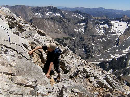
Hyndman
![Hyndman]()
![Hyndman]()
![Hyndman Peak]()
The highest in the Pioneer Range near Kecthum, Hyndman is the lowest of the nine twelve thousand foot peaks, weighing in at 12009. My nine year old son and I hammered out about 5 miles in to a good base camp. It was my son's first big backpacking trip. I tried having him carry his sleeping bag and a change of clothing in my summit pack but I didn't check it out good enough prior to leaving and come to find out, the waist belt didn't fit so I ended up strapping it to my my pack and he carried his Camelbak. If fact, that first half mile was so rough, I had to feed him a Kit Kat about every half mile after that. It was enough to get him going finally. The extra weight of his pack was barely noticed since I wasn't carrying any winter mountaineering equipment. My pack was still lighter than usual. Once camp was set up, he found some red ants to torture (boys will be boys) but was anxious to help filter water for dinner.
We slept in a little too late the next morning and reached the saddle off the southeast ridge of the summit around 11:30. Being his first big trip and the isolation of the area (the only other person we saw was the sheep herder), we dicided to had back to camp. I have to admit, he was a trooper at age nine on his first major expedition. I figured we did about 14 miles in two days as we dicided to head out to the truck after our failed summit attempt and enjoy the sand and water at Red Fish Lake.
I guarantee he will have a kid's pack for next year, and of course a supply of Kit Kat's.
0 for 1 on Mt. Idaho
![Mount Idaho]()
The Slog
Upper Elkhorn Creek basin on a warm spring day.We were originally set to go in March. I don't recall why we had to postpone the trip and reschedule for April. I watched the weather reports continually. What's with the cold, wet spring? The closer we got, the more it looked like we might have a clear day. Neither of us had attempted Mt. Idaho before. Only so much information can be gleaned from guide books, trip reports and the weather.
We left the truck in a frigid but light breeze from the northwest. It didn't take long to warm up lugging 60 pound packs. Patches of snow lay on the ground through the sage, but not enough to ski on. We really didn't want to strap on our skis and hike in our plastic tele boots. After the first fork in the drainage, we headed up the middle ridge, thinking it would keep us out of the snow a little longer. Once on the snow, our packs were slightly ligher but now our feet were heavier with snow shoes. The snow started out crusty. Once in a while, we would break through into large, dry crystals but it got worse with every step. As the snow deepened and the temperature heated up, we knew we were in for the long haul. Off in the distance on the upper mountain, a slide would break loose. We couldn't hear it but seeing was believing. Seven and a half hours later, not even to point 9200' where the drainage splits, we set up camp knowing we wouldn't make an attempt for the summit in the morning.
Sleeping In
Avalanche activity on the steeper slopesIt felt kind of wierd getting up when the sun came up. Every climber has a headlamp for the first portion of every climb in the dark. I believe this might be the first trip I went without using mine. After a hearty breakfast of powdered egg burritos with blackbean salsa, guacamole, salami, and cheese, we decided we should at least snowshoe up further in the basin to get a better view of the summit. Without full packs and good, crusty snow to walk on, it only took us about 30 minutes. What an awesome sight. There were close to 20 small slides off the steeper sections of the mountain on the west and south facing slopes. Needless to say, we were fine with our decision to stay off the mountain. It will still be there when the snow melts. Our primary objective is always to return home, not to summit at all costs. After packing up camp, it only took a few hours to get back to the truck. I guess it's a little easier following a broken trail.
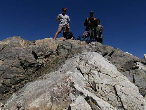
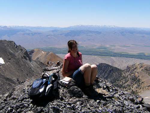
Success on Hyndman
We made it. My son's first big summit at age 11. After a cold night at the trailhead, we were on our way by 6:30. We opted to bike in the firt 3 miles. Andy's son Drew and my son Jared weren't seasond mt bikers so we trailered their bikes to ours with several bike tubes. After a few difficulties, we figured out some communication tools that helped us to keep moving a bit more efficiently. After ditching the bikes, we walked for several hours and finally reached the saddle where we turned around several years earlier. The scrambling seemed to go on forever and I realized I had made the right call by bailing on our first attempt. Jared and I pulled ahead of our group and got to rest an extra half hour on the summit. Descending took even longer as the boys fatigued. Once we got back on a trail, we made much better time and reached the trailhead at seven p.m. A big day for a couple 11 year olds and an even bigger mountain. Congrats boys!
Church and Donaldson
What a memorable first climb with my wife's little sister and her fiance. Memorable in this case is interpreted not as my longest hike ever, but my latest arrival back to the truck. Or should I say my latest
second return to the truck. Church and Donaldson are the third and eighth highest in Idaho and you can't really go all that way with out climbing them both.
It started out well even though there wasn't much of a trail. We crossed the creek a few times, fumbling our way up the bottom of the drainage. There was a fair amount of water coming down that made the creek crossings slow. We were making good time so I thought, but the higher we climbed, the more time clicked off the clock and I started to worry. I tried to end our lunch break at the saddle before we headed across to the bowling alley or the stair case. We passed the lake, climbed the steep scree beside the snow field and started scrambling up the proverbial "solid" rock. Charlie was a climber and Heidi had done a lot of hiking. She had even felt good on Hyndman Peak last year but the loose rock was rattling her nerves and draining her energy reserves.
Still several hundred feet below Donaldson Peak, we decided it was time for Heidi to camp out on an awesome perch and Charlie and I would dash for the summits. After tagging both, we returned about 2 hours later to find Heidi well rested and ready to descend. Here is where the clock sped up and our pace slowed down. Charlie and I both had experience skiing down scree but Heidi was terrified. We finally made it but our daylight was burning out fast and I soon learned that I was the only one with a headlamp.
Descending from the saddle, Heidi's legs and back started giving out. She had to concentrate on every small step. We barely made it down to the creek before the sun went down. When darkness fully enveloped us, I was trying to scout our path then turning around to light the way for my partners in crime. After three agonizing hours, and hardly any distance to show for it, my patience was gone with nothing in my reserve tank. Charlie was amazed to know I had a lighter in my pack. We found a comfy spot for Heidi to sleep and built a fire while I hiked back to the truck for more flashlights. I made it in record time - 25 minutes! Not wasting time (I had to work in the morning, oh yea, it is morning) I started up the drainage again. I had given Charlie the responsibility of keeping the fire going. I didn't want to miss them on my way back up the canyon. About 30 minutes later, I saw the glow - rescued at last! It only took another hour and a half to get back to the truck the second time. We made it!
Thank goodness, we survived the drive home. I drove to around Mackay and pulled over to sleep but when I turned the truck off, Charlie woke up and drove til Blackfoot. I was then able to get us home from there. I slept in the tub for an hour and then went to work. I think Heidi will be ready for the next one and I bet Charlie brings a headlamp. I can't believe I forgot to take a picture of Heidi lying in the dirt next to the fire.
![Donaldson Peak]()
Comments
No comments posted yet.