
Comments
No comments posted yet.
The first explorers of this place were anything but ordinary. They were strident, gritty,and resourceful. This trail is one of the hardest on the NPS map of the Grand Canyon, and the fact that it remains open is because of the gracious maintenance of the National Parks. Those that made this trail have created an accessibility to this National Treasure that adds value to the park.
Had you been looking for a perfectly coiffed ranger and a Visitor Center with postage stamps and picturecards, keep looking. This trail is remote and is well worth the time to make it. This is very much like Bright Angel and Kaibab, another Rim to Rim in a day, without all the traffic up top. I did this hike in a day, solo, both of which are not recommended. Bear in mind, the nature of the canyon is as much challenge as you want. The NPS has been gracious enough to place an advisement of the trail for those that are ready for a more untravelled experience.
The basic facts are:
12,000 feet of vertical change over 26 miles in a day.
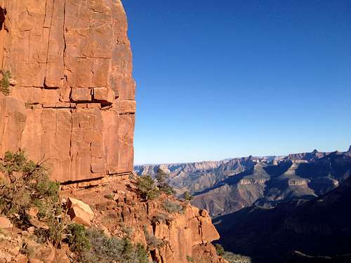
This part of the canyon is facing South, and is exposed to the sun all day is dust and rock, with no vegetation to cool the air, and in going down into the canyon youare committed. This is not a summer vacation destination.
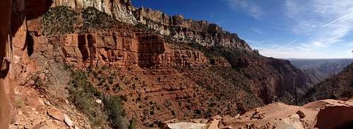
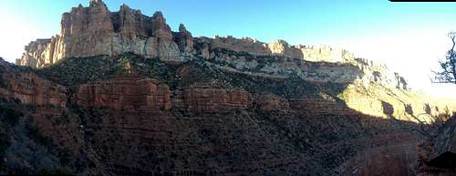
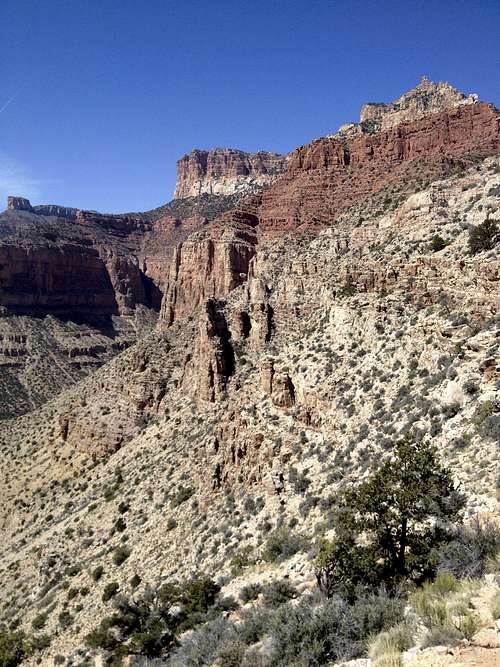
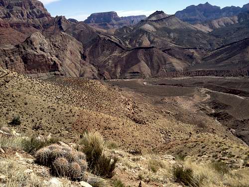
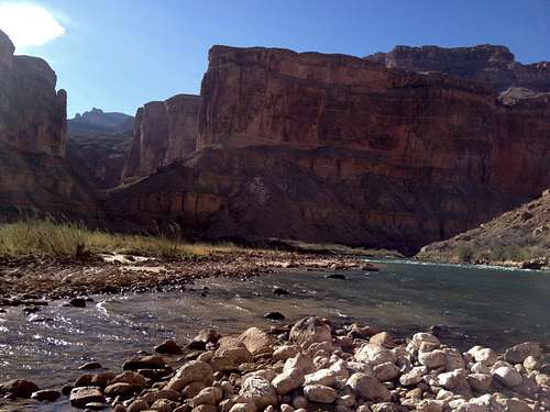
For if you find yourself at the top, you will want to go to the bottom, so awesome is the view. The river goes through layer of Paleolithic rock, making mesas, buttes, and monuments of all kinds. Each layer is a different color, mineral mix, formed in its own way, and some of it highly resistant to erosion. Some places are memorable enough to have been given names, like the Tilted Mesa and Marion Point, and others are just part of a larger backdrop. That being said, there was a debate raging back in the day, as to what to name the canyon. Some thought it should be the Big Canyon, others the Grand Canyon. Well, upon rafting it, Powell decided it was to be Grand.
The view changes around every subpart of the canyon, with each intermittent stream adding to the landscape. The trail begins at the Rim and stays in the highest layer of the Grand Canyon, Esplanade Sandstone, a wall of dark red sandstone 200 meters thick, and follows this for five miles. It covers Marion Point, and onto the Tilted Mesa, and then turns and abruptly descends 4000 feet on a bright yellow shale layer to the Nankoweap Creek and then on to the Colorado River. The only shade is at the very bottom, trees along the creek.
This main features of this trail are distance, elevation gain, and technical challenge. It is strenuous. The elevation gain is done on a layer of shale that is technical: loose, rocky, with no guaranteed footing. I choose to do it in a day to scout it and see if it was worth overnighting in. The hike was 18 hours. The descent from the Upper Rim to the Mesa begins at mile 7 or 8, and as this is a very steep and technical descent, it would be prohibitively difficult with a large pack. It would be easier to camp on the upper rim, and descend with a daypack. If planning on camping at the Colorado river, hiking poles for purchase are recommended.
Directions:
At the time of this writing, 89A out of Page, AZ is impassable at mile 35 heading south. Check here for updates. To get to the trailhead, head towards Kolib, UT and use access 1 or 2.
Access #1: From the Kaibab Plateau Visitor Center go east on US 89A, a paved road, about 20 miles to between milepost 559 and 560 to FR 8910 (House Rock Wildlife Area). Turn right and go 23.5 miles to where FR 8910 forks and take the right fork and go another 4 miles to the trailhead. Note: this is nearly 30 miles on unpaved road. It is 2WD accessible, watch for washouts. Hike approximately 1 mile on the South Canyon Trail #31 to get to the junction of Trail #57. This is accessible year round.
Access #2: From the Kaibab Plateau Visitor Center go south on AZ 67, a paved road, for 27.5 miles (0.6 miles beyond DeMotte park Campground entrance). Turn left onto FR 611. Approximately 1.4 miles turn right onto FR 610 and go 12.3 miles to the end of the road and the trailhead. FR 610 and FR 611 are both suitable for passenger cars. This is closed for the winter.
Know the overall length. Know your limits. Know how fast you are walking, and how many hours it will take.
Be comfortable with what you’re asking of yourself. If its an 18 hour day, or a multi-day backpacking trip on technical trails. Know how to limit your exposure, and carry the essentials.
Deciding to a quick one day trip might simpler than a multi-day trek. If you are not limited by time, spending a day on the canyon floor would be well worth it. However, hiking with a full backpack on thedescent route would be challenging. Apair of hiking sticks would be very helpful. I did it starting at 8 am, and made it back to the Supai formation at dusk. I walked the last upper rim in the moonlight. Due to the technical nature of this hike, I would advise against doing an alpine start without knowing the terrain.
I had about 10 minutes at the bottom, and it was all borrowed. By the time I got to the top of the ridge, it was dusk, and I had to wait two hours for the moon to come out so that I could find my way back to the trail. Unplanned bivy, for a couple hours, and then a light trot back to the car. Its these kind of trips that make you wonder why you do them at all.