
|
|
Route |
|---|---|
|
|
38.60991°N / 109.53376°W |
|
|
Hiking |
|
|
Spring, Summer, Fall, Winter |
|
|
Half a day |
|
|
Hike |
|
|
Overview
This is a very popular short hike near Moab, Utah with a well-established trail.
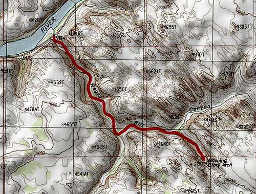
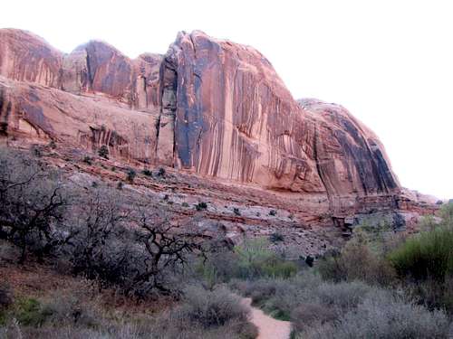
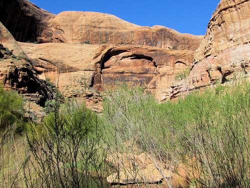
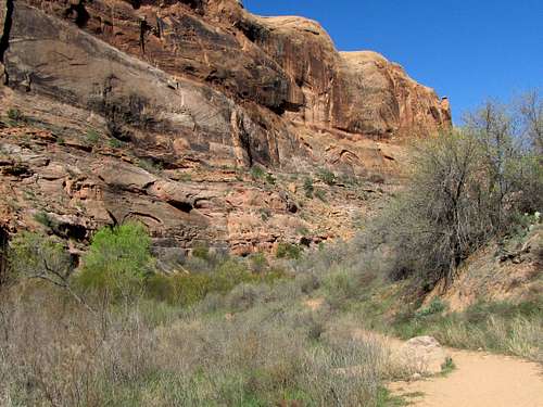
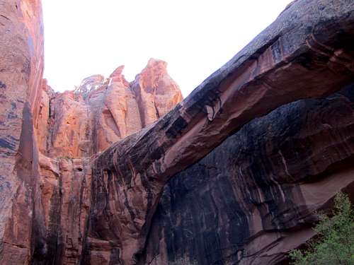
Grandstaff is a 9 mile long canyon that drains into Colorado River to the east of Moab, Utah. A trail starts on Route 128 and goes 1.9 miles up the canyon where it leaves Grandstaff Canyon going into a smaller side canyon to dead end at Morning Glory Natural Bridge. The bridge sits in front of a cliff making it difficult to see from far away. Once you walk under the bridge, you get to appreciate its impressive dimensions. With a length of 243 ft, Morning Glory Natural Bridge is the world’s 5th longest arch/natural bridge (see statistics).
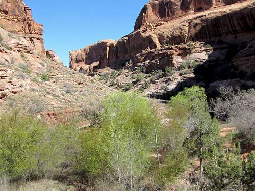
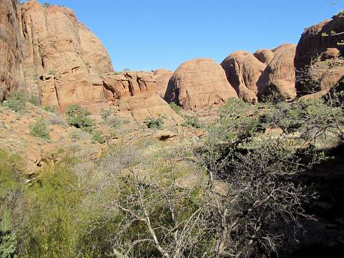
Thanks to a stream, the bottom of the canyon is a lush riparian environment that is in contrast to the surrounding desert.
The trail is for hikers only (no mountain bikers).
Getting There
From the junction of Routes 191 and 128 just north of Moab, Utah, drive 3 miles east on Route 128 to the well signed parking area.
Route Description
Trailhead Elevation: 3980 ft
Elevation at Morning Glory Bridge: 4300 ft
One Way Hiking Distance: 2.2 miles
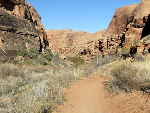
Follow the trail at the bottom of the canyon crossing the stream a few times.
 |
 |
||
 |
 |
 |
 |
 |
 |
||
 |
 |
 |
 |
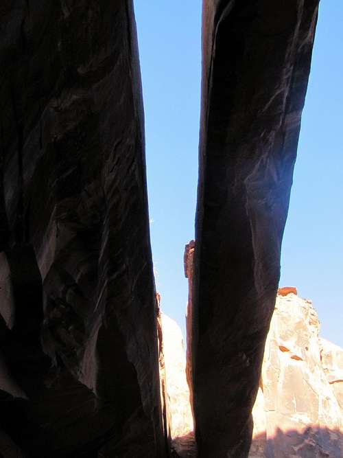
After around 1.9 miles, the trail goes into a side canyon.
 |
 |
Morning Glory Bridge comes to view in the distance.
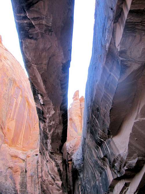
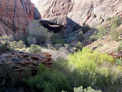 Morning Glory Bridge at the end of the canyon
Under the bridge.
 |
 |
Essential Gear & Red Tape
Hiking equipment.
No fees or permits needed.
External Links
Book: Hiking from here to Wow, Utah Canyon Country by Kathy & Craig Copeland
Map: Latitude 40 Maps, Classic Moab Trails
Bill Reed - May 5, 2015 10:32 am - Voted 10/10
Nice page!Thanks for posting it. One of my favorite hikes in the Moab area. Wondered if it would be worth pointing out that this trail is for hikers only-no mountain bikes?
nader - May 5, 2015 1:29 pm - Hasn't voted
Re: Nice page!Thank you. Done.
Oscar68 - May 16, 2015 11:38 am - Voted 7/10
morning glory bridgeThat looks like a cool trail through Negro Bill Canyon...that's a odd name....although its looks like a great 9 miler with stream...the natural bridge looks impressive with the red rock...you can probably walk across it after you climb up... nice to visit one day....great pictures...
nader - May 16, 2015 4:22 pm - Hasn't voted
Re: morning glory bridgeThanks for the vote and comment. The trail to the bridge is only 2.2 miles long. The canyon, however, goes for 9 miles but going beyond the trail will probably require much bushwhacking.