
-
 17256 Hits
-
 82.82% Score
-
 16 Votes
|
|
Mountain/Rock |
|---|---|
|
|
36.04534°N / 115.46909°W |
|
|
Scrambling |
|
|
Spring, Fall, Winter |
|
|
6300 ft / 1920 m |
|
|
Overview


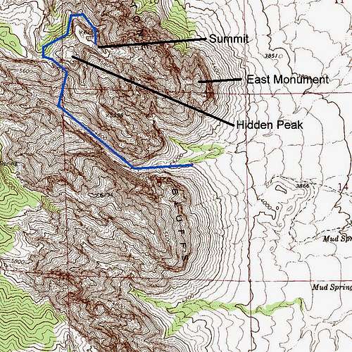
This page originally was posted as a route page and a child to the existing page called "The Monument." Without giving any reason, the owner detached the route page. However, the summit covered on the other page is not the same one this page covers, so I have converted this to a mountain page covering this peak. As there is no way between the peaks short of difficult Class 5 climbing, this should be the page to use if you are interested in the scrambling route to the highpoint of The Monument; that route passes East Peak in the canyon below but does not get close to it for all intents and purposes. If you are interested in the established technical routes on The Monument, then you should refer to the page currently entitled The Monument, 5.8-5.13a.
Round-trip distance is about 10 miles. Elevation gain from trailhead to summit is about 2400', but you need to add around 300' to both going and returning due to dips in the route, so it's more like 3000' on the day. That sounds moderate over 5 miles, but about half the route is through a canyon bottom where there is only a very gradual elevation gain, so the real ascending part of the route is quite steep.
There is a lot of Class 3 scrambling on this route, a bit of Class 4, and some exposure.
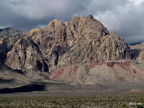
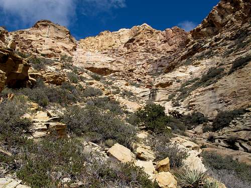
This is a highly scenic route. Black Velvet Canyon, which comprises about half the route, is a spectacular display of boulders, slickrock ramps, waterfalls, pools, and cliffs, including Black Velvet Wall, the highest sandstone wall in RRCNCA. Views get better and better as you climb out of the canyon, and there are sweeping views of the region near and from the summit. But the icing of it all might be the large tinaja located just below the summit. What a sight, and how unexpected!
In winter, watch for icy spots. Summer is a poor time to do this route. Even if you start early, the terrain will slow you down to the point that you will be out in the sun when the heat turns deadly. Spring and fall are best.
Getting There
From the intersection of 159 and 160 (159 is Charleston Boulevard and 160 is a highway leading west out of Vegas over the mountains to Pahrump), drive west for 4.5 miles until you see a large, obvious trailhead and parking area on your right. This is just after a 4wd underpass of 160.
Turn into this parking area and follow the pavement east for 0.2 mi until the pavement ends. From here on out, high clearance is recommended, but I have seen passenger cars make the drive.
2.5 mi of rough driving northward gets you to Black Velvet Canyon Trailhead. There is no sign proclaiming this, but the road ends there, so there's no mistaking it. About 1.5 mi from the end of the pavement, there is an intersection. Stay straight. In 0.2 more mi, the road bends sharply left (straight ahead is a gate closing the road to further northward travel by motor vehicles). Now it is 0.8 mi to the trailhead, and it is here that you encounter the roughest patches of road.
Route Description
From the trailhead, follow the closed road as it narrows to a trail and approaches the mouth of Black Velvet Canyon. Stick to the trail instead of yielding to the temptation to drop into the wash; it is faster to do the former, and it eventually dumps you onto the floor of the canyon, anyway.
It is hard to estimate distance in the canyon. The numerous boulder and ledge obstacles that require you to go up, around, or sometimes under them throw off your sense of pace.
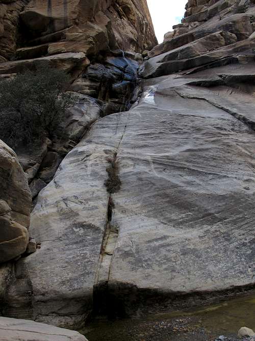
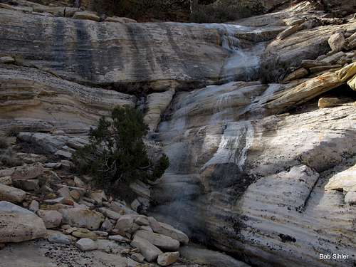
Anyway, about a mile from the trailhead is the first significant obstacle: a waterfall (see picture on left below). There is a fixed line next to this waterfall. I have also seen photos of people scrambling through here in drier conditions. Regardless, there is an exposed Class 3 workaround to the left a little bit back (see picture on right below).
 |  |
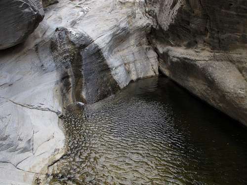
Maybe half a mile beyond the waterfall is an important landmark: another, higher waterfall on the left side of the canyon (see below).
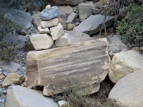
Continue up the canyon. After about another half-mile, the canyon forks. No more than 100 yards before the fork, either look for the cairn pictured below or notice a series of slabs and small cliffs on your right. This large cairn marks where you begin to ascend out of the canyon. Look just beyond it for more cairns marking the easiest route up. Should the cairn not be there when you go, remember that this spot is about half a mile past the large waterfall you passed on your left and no more than 100 yards from the obvious fork near the head of the canyon. You will be heading up the aforementioned slabs and small cliffs; they are the first means providing reasonable access to higher terrain to the north.
Things get a little fuzzy here. Counting both ascending and descending, I was on this route 4 times in three days, and each time, my exact route varied. If you're going to try to stick with the cairns, then look for those ones just past the big one on the canyon floor and follow them as they lead up and left for a short distance before the route veers to the right.
Essentially, work up and right until you cross a drainage not far above a sheer pouroff. When you hit that drainage, something like the scene below will greet you.
Hike and scramble up this steepening drainage to a fork. When it forks, head left and follow the narrowing and ever-steeper gully to the ridge above. You can work your way through brush and boulders in the gully, or you can look for an easier way along the slickrock on the right (north) side of the gully; cairns mark this route.
From the ridge's crest, you can veer right for a short and easy Class 2 ramble to the summit of Hidden Peak.
However, if you want to continue to the Monument's summit, descend a little to the left and reach a saddle. Then work down Class 3 terrain into an obvious drainage below. As you do so, keep an obvious waterfall on your left as a landmark. Although there appears to be a cairned route going past the head of the waterfall and then dropping into the wash, the way I mention is not difficult and is more direct.
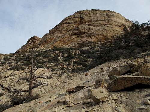
Follow the wash until it starts to drop steeply along a slickrock course and the cliffs of the Monument come into full view to the east.
You are going to want to cross-country east to the base of the cliffs and then traverse around the peak to its northern and northeastern sides. With any luck, you will come across the spot shown below; it is in the wash and is where a cairned route strikes out, and the cairned route will lead you the rest of the way, though it probably isn't really necessary since the terrain will eventually force you in the right direction if you want to keep things under Class 5.
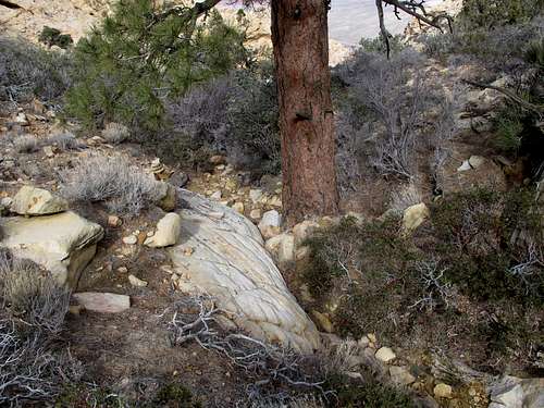
Continue the traverse around the base of the summit cliffs. If you own Rambles and Scrambles by Courtney Purcell, you might be looking for a chute at the base of which is a large Ponderosa pine. I think that spot is pictured below.
 |  |
So keep traversing. Just as it seems you are about to dead-end at sheer cliffs and you begin to wonder if this is a route to nowhere cairned by someone who didn't want to get lost, spot a gully. Scramble up it, work to the left a little bit, and then scramble up another gully until you are at a notch above a highly exposed spot. Study the pictures below; on the left is an outcrop that will be to your left, in the center is a look down from the exposed spot, and on the right is a short (maybe 10') wall that will be on your right.
 |  |  |
 Tinaja Tinaja |  Pool Pool |
It's a special place indeed and doesn't seem to be climbed all that often compared to other Red Rock summits.
Camping and Red Tape
Camping at the trailhead elevation is illegal in RRCNCA, and signs posted at the TH make this very clear. The summit area, which is above 6000', is technically open to camping, but there's little reason to do so unless you are determined to get both sunset and sunrise pictures from the peak.
No red tape involving fees, but obey posted signs and regulations.