

Saintgrizzly - Jul 10, 2006 5:36 pm - Voted 10/10
You've......got them right, Kyle. Very nice picture!

kyledod - Jul 13, 2006 4:17 am - Hasn't voted
Re: You've...Thanks, good to know they are correct. I was recently able to climb Kinnerly Peak, so maybe when I have some time I could do a page for it. For now I just submitted a few new pictures to the Glacier National Park page.

Bob Bolton - Aug 12, 2010 12:50 am - Hasn't voted
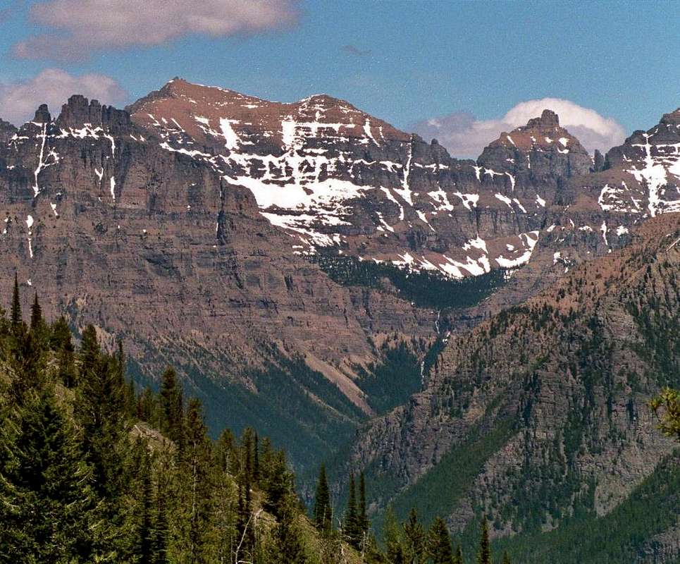
Re: You've...Guys, I can see why Vernon thinks that the right-hand peak in the photo is Kinnerly, but I'm now quite certain that this view is not of Kintla and Kinnerly. The first clue is that the foreground slope is down to the right. From Numa Ridge, if you were looking up the Akokala Creek valley, which you would have to do to be looking at Kintla, the foreground slope would be down to the left. On this evidence I used Google Earth and found that there is indeed a view like this from Numa Ridge, but it is to the northeast, not the north as would be required when looking at Kintla/Kinnerly. The Google Earth image to the NE over Bowman Lake fits this photo perfectly. It even clearly shows the waterfall in front of the V between the apparent Kintla and Kinnerly.
Using Google Earth and Topo! Montana, I identified the two peaks that look like Kintla and Kinnerly. The Kintla look-alike is point 9125 at 48.93338N 114.02473W (WGS84). The Kinnerly look-alike is The Sentinel at 48.92483N 114.01462W.
I'm studying the two potential route options for our attempt on Kintla next week, and just couldn't seem to make any sense of the photo. Now I see why. :-)
When I turned Google Earth toward the north from a point on Numa Ridge far enough down that the upper reaches of Akokala Creek are visible, the view is VERY different. As expected you can see point 9826 and the sharp point south of 9826, but neither of Kintla's nor Kinnerly's summits can be seen. The Peabody/Kintla col is clearly visible. Conclusion: The photo is looking up Bowman Creek, not Akokala Creek.
I did one more exercize with Google Earth. I "flew" to the first peak on Numa Ridge north of the lookout. From there I could barely see the summit of Kintla, and Kinnerly poked above Kintla's SE ridge. The farther up the ridge I went, the two summits became more and more obvious and distinct. But they couldn't be seen from the lookout site. Only the sharp point south of south of 9826 was visible, and it barely so. This is due to higher terrain blocking the view.
Please see the Google Earth image below that is my best attempt at replicating the photo. The summit flags I placed on the identified points don't show from this distance/angle, but they do show when I move in.


Comments
Post a Comment