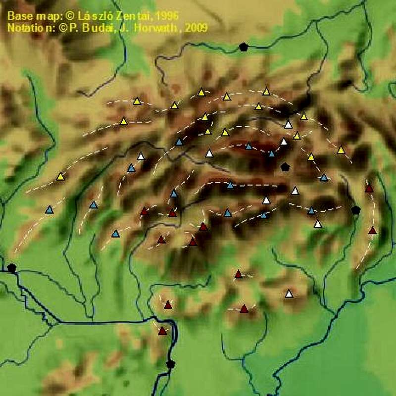
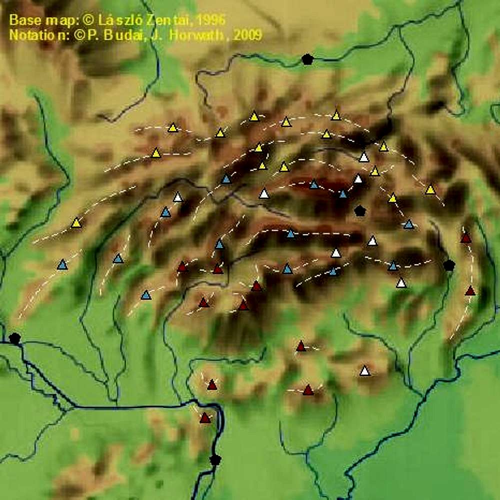
This is an
image map underlay for the
Carpathians page.
Legend:
white dashed lines: mountain ranges
triangles: highest peaks of ranges + limestone plateaus
(red = volcanic, blue = crystalline, yellow = flysh, white = limestone)
black pentagons: cities/towns with small or big airport.


