
-
 5031 Hits
-
 73.06% Score
-
 3 Votes
|
|
Route |
|---|---|
|
|
46.96456°N / 11.40587°E |
|
|
Hiking |
|
|
Spring, Summer, Fall, Winter |
|
|
Half a day |
|
|
Hike |
|
|
Overview
 Obernberger See and Rötenspitze Obernberger See and Rötenspitze |
When the title claims that this route runs both on Italian and Austrian Ground - this is an exaggeration. The route starts at the end of the Obernberg Valley in the north - i.e. Austria and heads for the Portjoch Saddle on the Stubai Alps Main Ridge, which at the same time is the Austrian - Italian border. From the saddle it follows the ridge or (but I wouldn't recommend this) a well trodden path beneath the ridge on Italian Ground. The Risdge is a bit exposed close to Portjoch but stil moderate enough.
Getting There
See the Getting There information on the main page. Look for the itinerary for Obernberg.Route Description
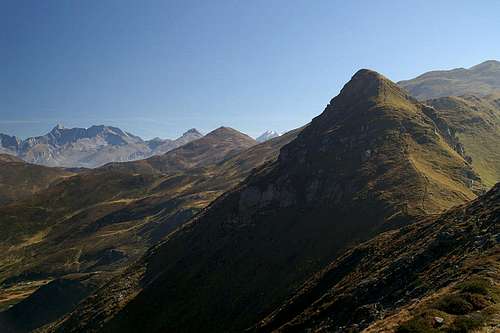 On the ridge between Portjoch and Grubenkopf
- Start altitude: 1438m
- Summit altitude: 2337m
- Prevailing exposure: S
- Type: 4h
- Protection: None
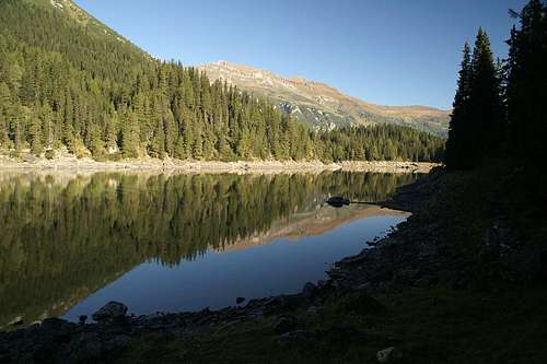
At the parking lot at the end of the Obernberg Valley you will find signs for the Tiroler Höhenweg Trekking Trail, which runs across the main ridges of the state of Tirol (north and south). As the route to Grubenkopf follows the trekking trail, follow the signs. The route at first leads to Obernberger See, a holiday resort, which can be reached either by a mountain road or a foot path. Depending on the time of day (or week) you better stay on the path. Both trails combine, shortly before they reach the lake.
There are paths on both shores of the lake but the eastern one is the more convenient one. They recombine at Seealm from where you can already distinguish the further route to Portjoch. The route is straightforward and the saddle can be reached in about 1h from the lake.
From the saddle two paths lead to Grubenkopf, one on the Italian side of the ridge along a well trodden path, while the other leads directly along the ridge (and border) itself. If you don't have problems with exposure follow the latter path - it is only exposed at its beginning. Part of the border is equipped with cattle fences which you simply have to follow until you reach the Grubenkopf summit. In one or two places you have to climb the fences.