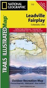
Leadville & Fairplay, Colorado - Trails Illustrated Map # 110
| Page Type | Gear Review |
|---|---|
| Object Title | Leadville & Fairplay, Colorado - Trails Illustrated Map # 110 |
| Manufacturer | National Geographic Maps |
| Page By | redsplashman23 |
| Page Type | Dec 4, 2012 / Dec 4, 2012 |
| Object ID | 8406 |
| Hits | 2836 |
| Vote |
Product Description
Coverage includes the Pike and San Isabel national forests, Buffalo Peaks Wilderness Area, and the cities of Fairplay, Leadville, Malta, and Granite. Also included are the Twin Lakes and Clear Creek reservoirs, Mt Massive Lakes, a segment of the Arkansas River, and Breakneck, Weston and Browns passes. 14ers: Mt Sherman. Portions of the Continental Divide Trail and Colorado Trail are covered on this map. Includes UTM grids for use with your GPS unit.Features
Map: 2 pagesPublisher: Natl Geographic Society Maps; 4 edition (February 1, 2007)
Language: English
ISBN-10: 1566953642
ISBN-13: 978-1566953641
Images
 |