Mountains of Montenegro
Details
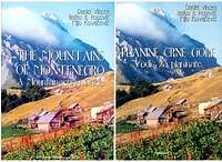
Full book title:
The Mountains of Montenegro A mountaineering
guide
Authors: Daniel Vincek, Ratko R. Popovic, Mijo Kovacevic
Publisher:
MONITOR, Podgorica
Year: 2004.
Language: English (Also available in German
and Serbocroatian)
Size: 14 1/2*21cm, 132 pages with 143 colour photos and
25 topomaps
Binding: Softcover, no dustjacket
Price, availability: limited
number of prints, still, book can be purchased online
at kibuba
mountain bookstore for 18,56 Euros
Synopsis
This is first mountaineering guidebook for Montenegro.
It deals with
the mountains on the Southeast end of the Dinaric Alps range. Out of three authors,
Daniel Vincek perhaps best known out of all - apart from being the mountaineer
for decades, he is also the founder and maintainer of Europe's southernmost
privatly owned Alpine flora bothanical garden in town Kolasin. This is, probably,
also why there are so many flower photos in this guide.
Book is divided
into 15 main chapters:
- Maritime mountains - including heavilly karstified Mt.Orjen, highest mountain group of the maritime Dinaric Alps
- Mountains of central Montenegro - sub 2000m mountains
- High mountains and plateaus area - this is where big guns of Montenegro
are located,
including mt. Bjelasica NP and Durmitor NP(also UNESCO natural heritage site) - Moracke planine - limestone mountain range next to the Sinjavina range
- Komovi - last major mountain group before the Montenegrin part of Prokletije/Bjeshket e Nemuna range
- Prokletije - authors decided to group Montenegrin part of the Prokletije/Bjeshket e Nemuna range into 2 major subgroups, Kuc mountains and mountains surrounding Plav-Gusinje glacial through
- Hajla - very fine mountain group, actually easternmost subgroup of Prokletije range, however, here it was given separate chapter as independent mountain group
- Mountain area of NE Montenegro - actually, this chapter covers only 2 smaller mountains in Andrijevica area
- 9th chapter deals with major Mountain traverse route in Montenegro, CT-1. Traverse is 120km long, and takes round 6 days to complete
- chapter dedicated to canyon, namely the Mrtvica river canyon. Having visited this one myself, gotta say this is much welcomed bonus chapter.
- Another fine canyon, this time Cijevna river canyon
- Description of 3 hours eco-recreational route to the Rijeka Crnojevica riverr source
- List of mountain huts and bivouacs in Montenegro as of year 2004., 18 of them total
- List of abbreviations used in the book
- Note about the autors
Pattern used for individual mountain description is;
a bit of general
info, followed by path with elevation and time required indicated, route GPS waypoints
(in table format), route description, and finally, relevant portion of the topographic
map.
Overall look and feel of the book is very good. Minor notes might be
taken regarding the grouping structure and overall layout, obvious intention
was to throw in as much written and visual information (again, 143
photos + 25 topos on 132 pages) as possible, inside rather limited space of
the almost pocket size guide. For the reather it means it has sometimes to chase
related topomap over several pages, or look at fine photo of the mountain that
does not belong to the chapter it was attached. However, as said, it is a first
edition of much needed book, and given the large number of Montenegro
mountain uploads over at Summitpost, this guidebook may be considered a
worthy reading.
Images
 |  |  |