First Ascent Mystery
Climbing the route
Peacehammer (IV UIAA / 5.6 YDS) I made a possible FA of Maja Shkurt.
When attempting the climb I have not heard of any earlier ascents of Maja Shkurt. At the summit I found no sign of human presence. However while I was climbing, nearby on the same mountain face my friend Gordan (
Dinaric-ZG) found a short rusty piece of steel cable fixed to the rock, with a loop at its end, which looked like a kind of via ferrata-style climbing aid. He did not follow that route further on.
Maja Shkurt is among the highest peaks above Ropojana valley and, while remote, is relatively not too difficult technically. Although climbing was not very popular in Communist Albania, this peak must have still attracted mountaineers’ attention, just like it was tempting for me to climb it now. I know from the SP-er
JohnEly that since 1959 Albanian climbers, initially accompanied by East Germans, have put up a number of routes in this mountain range, so they might have scaled Maja Shkurt just as well. I will do my best to research this subject in the nearest future, but for the time being the matter of first ascent remains a mystery. So far I can only quite certainly claim the FA of my route. At the summit I built a little cairn and put a plastic bottle inside it with the details of my climb.
Maja Shkurt is a beautiful mountain from far away but a heap of moss’n’choss at a closer look. Some better but harder climbing may perhaps be found only at its remote
Stani Koprishtit face. I just looked for an FA possibility along the line of least resistance. The route is therefore more of an ugly scramble than an awe-inspiring or elegant line but it still gave me one hell of adventure and fun.
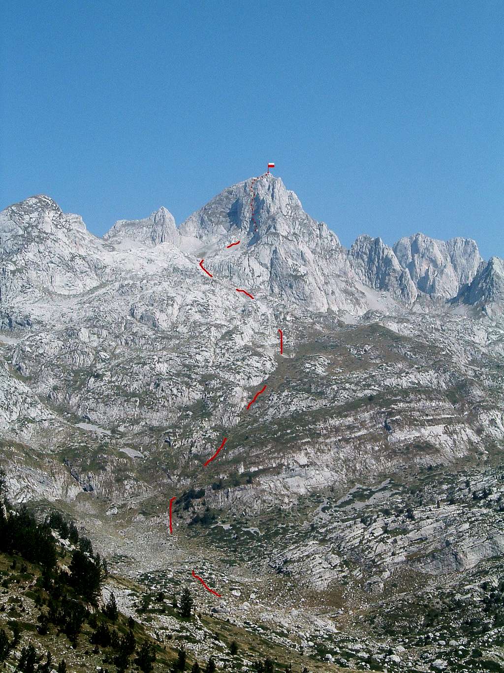
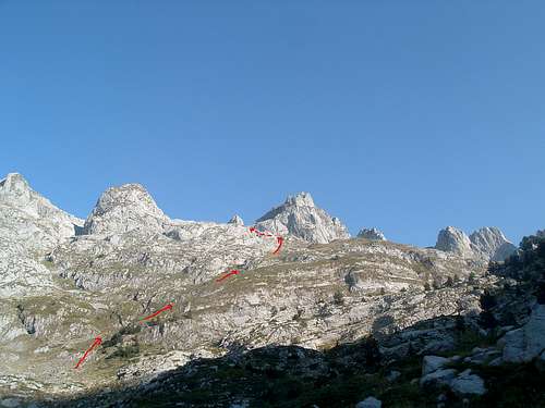
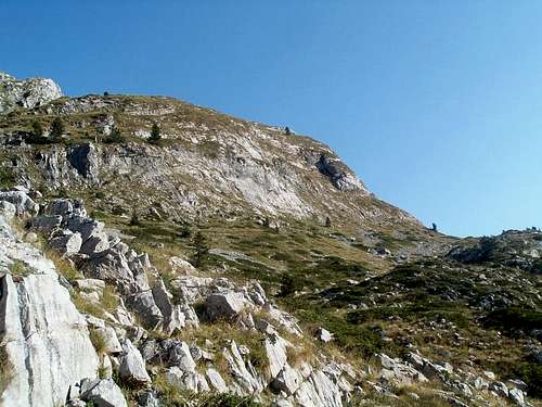
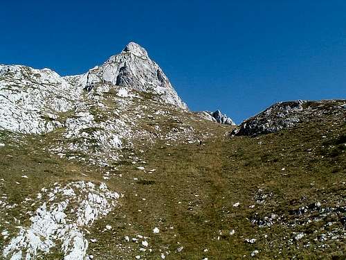
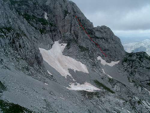
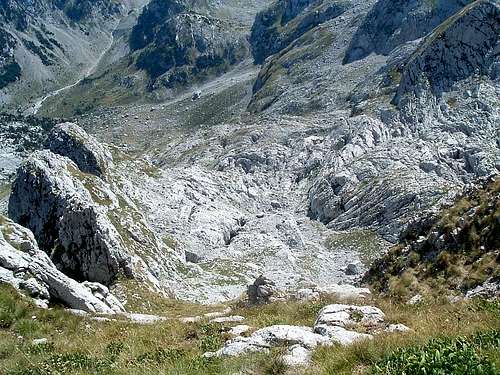
![]()
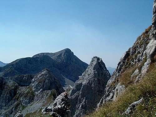
Approach from Ropojana (dashed) and the route (dotted).
The spire on the left is the higher of 2 summits of Maja Koprishtit.
Maja Lagojvet can be seen far right. |
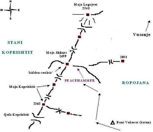
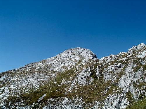
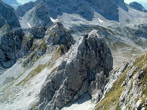
Topography of the Summit Area
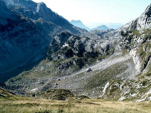
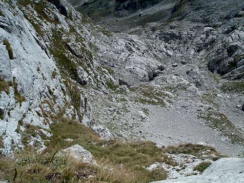
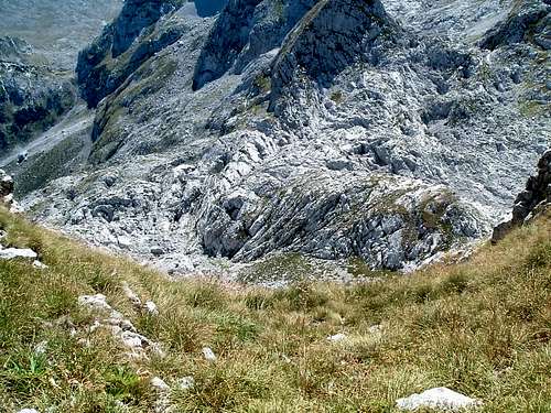
Maja Shkurt rises above two great valleys of Prokletije: Ropojana to its east and the remote enormous glacial cirque of Stani Koprishtit to its west. Topography of the summit area is quite complicated with several shorter side ridges branching off it, especially towards Ropojana.
The distinct NW face of Maja Shkurt towers above Stani Koprishtit, offering a potential of future interesting climbs. To its right, the west side features a hidden steep couloir which might provide an easier option but would probably not make for nice climbing due to very loose rock and near vertical grass. The same concerns the short SW ridge dividing the Stani Koprishtit and Ropojana sides of the mountain. At its opposite side however, the N-NE ridge forms a sheer drop of vertical limestone.
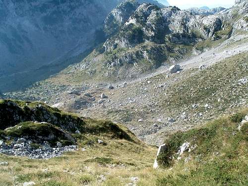
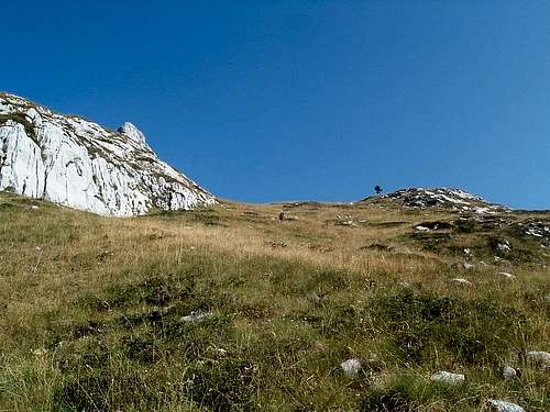
The Ropojana side is way more complicated, consisting of a few side ridges with smaller corries between them. The longest of those ridges features several spires and trends generally eastwards. To its north there is a distinctive corrie squeezed among Maja Shkurt, Maja Lagojvet and one smaller peak in between. Another corrie sits to the south of the summit area, making the top end of the system of smaller valleys branching off Ropojana. It is surrounded by Maja Shkurt itself, two smaller peaks in its SW ridge (which probably share the name Maja Koprishtit) and one peaklet branching off east of that ridge. My route begins in the latter corrie, at the south face of the mountain. Unfortunately for climbing, practically the whole Ropojana side of Maja Shkurt consists of loose rock and steep grass. There may be other possibilities of climbs of similar difficulty on the same face.
![]()
Rough sketch map (click for description) | ![]()
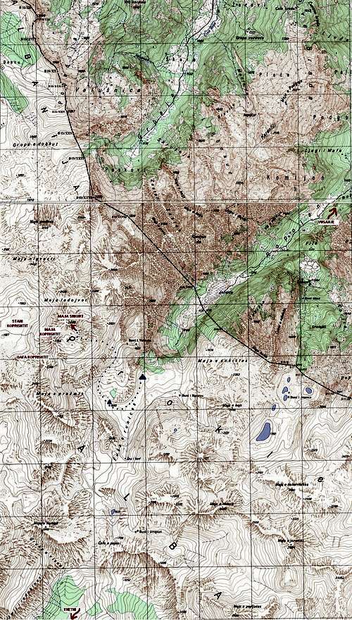
Approach map |
Approach
For details how to reach the towns of Plav and Gusinje in Montenegro see the main page of
Prokletije.
From Gusinje follow the road to Vusanje and leave your car there. We left our cars by the now disused border police station. Walk the dirt road to Ropojana valley. About 2 km further, pass the karstic spring Oko Skakavice on your right – this is a good stop for rest and refreshment and water is great for drinking. As for 2011, further up the valley the dirt road is completely damaged by recent floodings, although some short sections have already been repaired with new gravel. The remains of the road soon end and you follow a trail in the forest, scarcely marked in red, to the periodic lake which is usually dry in summer. Behind the lake, cross the border with Albania and follow the red-marked trail up a steep slope in the forest to the higher terrace of Ropojana valley (8 km, 3-4 h from Vusanje). There are good places for camping there. A water spring can be found by the shepherds’ settlement (katun) Fusha Runices. The shepherds live there in summer, are friendly and will probably not mind you camping nearby but it is always polite to ask first.
Crossing the border outside official crossings is officialy illegal (see the Red Tape section below). In order to stay at the right side of the law, enter Albania via one of official border crossings and go to Ropojana from the south (from Thethi) across the Qafa Peje pass (described e.g.
here). The trail is marked red all the way. From Qafa Peje descend to Ropojana and find the beginning of the approach as described below.
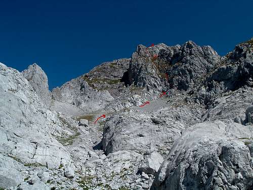
The settlement is situated below a distinctive band of rocks in the western slopes of Ropojana. To reach the base of the route, pass this band, go further up the valley until the meadows become broader and turn right, possibly finding some old faint paths leading to another shepherds’ settlement (Buni Vukoces). This one was used when I was there in 2005 but was abandoned in 2011, its owner (Rasim) now using the one below. Trending right, follow a faint path up the grassy slopes in a system of smaller valleys and depressions (old sheep dung often marks the path). Near the base of Maja Shkurt grass gives way to boulder fields which have to be crossed. Walk up to the corrie between the south slopes of Maja Shkurt, the two peaks of Maja Koprishtit and one smaller peaklet to the south. Cross the scree to the base of the face. The route begins to the right of a small cave. Click the photos below for details.
![]()
View from the corrie |
| ![]()
Start to the right of the cave |
|
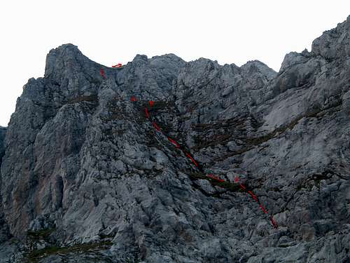
Route Description
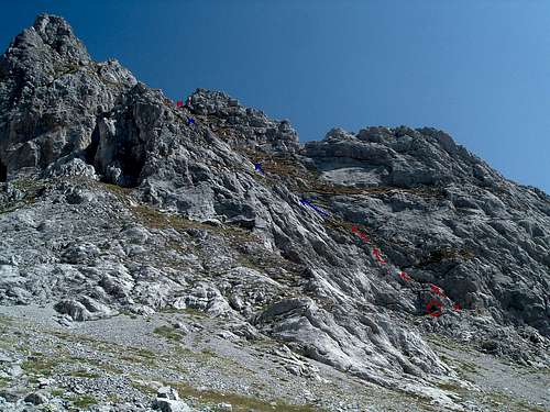
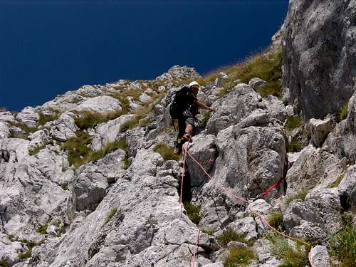
The route climbs the right hand side of the peak's south face. I rope-soloed pitch 1 and then scrambled ropeless the remaining part to the summit. For convenience I will however use the names ‘pitch 2’ and ‘pitch 3’ for the further two distinctive sections of the route. Click the photos below for details.
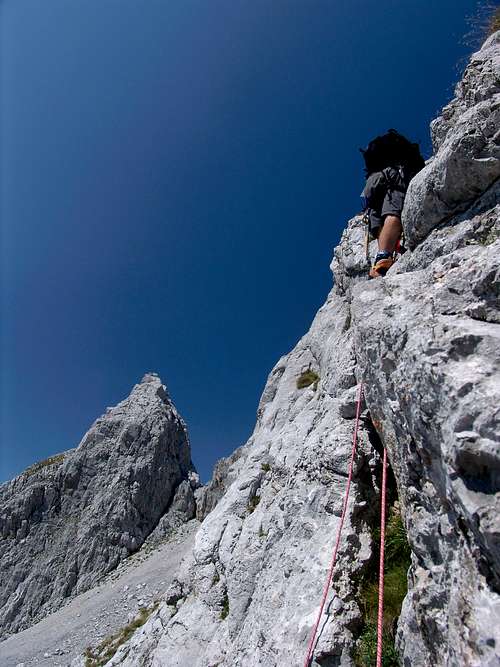
Pitch 1
IV UIAA (5.6 YDS), 45 m
Set up the belay below a small overhang a few metres right of the cave. Negotiate the overhang on good holds with legs bridging wide (IV). Climb several metres up the left-leaning grassy depression (I-II), then negotiate the rocks, bypassing the main depression line slightly to the left (loose rock, IV). Then again scramble on easier grass until another rocky section which you again preferably negotiate on the left (loose rock, big runout, IV). Finally climb the easier grass to the belay anchor.
In the bottom half of the pitch I hammered in 2 pegs and placed 3 small to medium wires, one of which ripped. My last piece was below the 2nd rocky section – I found the upper half quite unprotectable, running it out some 20 m to the belay.
![]()
View down pitch 1... |
| ![]()
... and down 'pitch 2' |
|
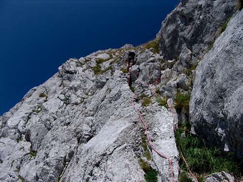
II UIAA (Class 4 YDS), 50 m
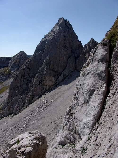
Climb the grassy depression, initially easier then gradually steepening, near vertical towards the end (up to 70 degrees). The rocks are few and far between and cannot be trusted, but the grass is robust and can be most often used as handholds. The ‘pitch’ is practically unprotectable and tops up at a wide grassy notch with a rocky spire to the right.
![]()
At the notch, view at 'pitch 3' |
| ![]()
View down 'pitch 3' |
|
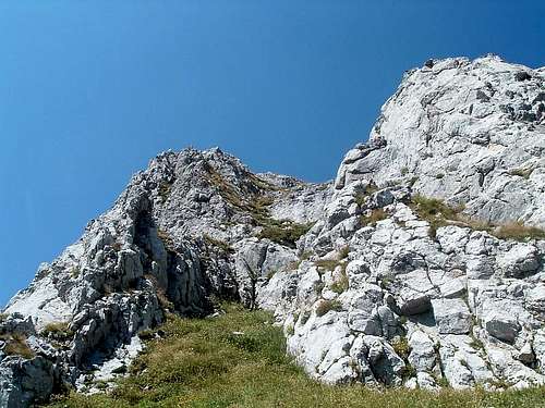
II-III UIAA (Class 4 to low 5 YDS), 50 m
At the notch take a few steps to the left towards a small, several metres high rock wall. Bypass it at the left by climbing up a small chimney. Then cautiously traverse the rocks to the right and climb the steep, in places near vertical grass until you reach the ridge. This ‘pitch’ is also practically unprotectable.
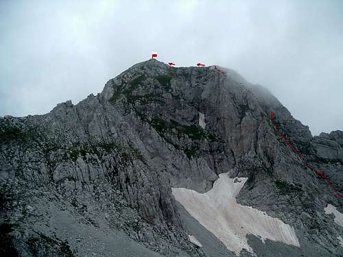
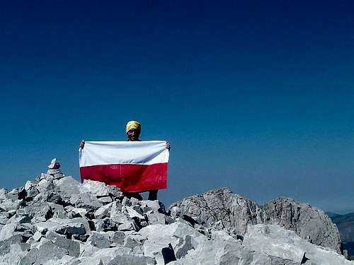
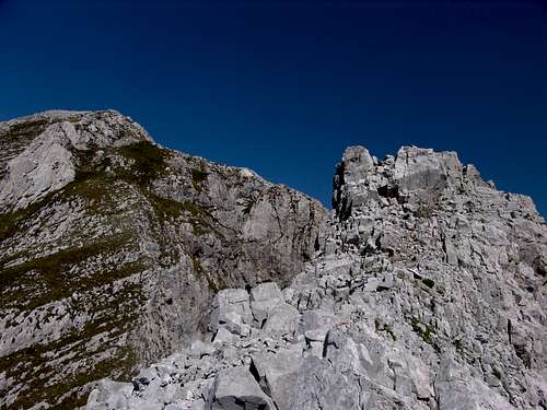
After topping out follow the easy grassy-rocky ridge to the right then left towards the summit.
![]()
Summit ridge |
| ![]()
At the summit |
|
Descent
Follow the same route down. You may be uncomfortable with downclimbing almost vertical grass but good abseil anchors may be hard to find, although being ropeless I have not really looked for them. Abseil pitch 1.
As I only had a 50 m single rope, I abbed down pitch 1, untied the rope from the bottom belay, prusiked up, abbed half the pitch, rigged another anchor and abbed the remaining half to the base. I left behind two abseil anchors, each with two pegs and a few slings.
Very slow and careful downclimbing on the steep grass sections is recommended, so give yourself at least 4 hours for the climb from base to summit and back, together with a well-deserved rest at the summit. With the long approach, it's safe to count a long day tent to summit to tent if you're camping in Ropojana valley.Essential Gear
50 m rope.
50 m cord if you have a single rope and want a single abseil/rappel off pitch 1.
Several pegs (pitons/pins) – blades, V- and U-shaped angles (I left some on pitch 1), and of course a hammer (a peacehammer preferable to a warhammer :-)
Small to medium rack (I placed only nuts/wires), but a larger hex or friend/cam might come in handy in a place or two.
A few long slings to avoid rope drag and for abseiling.
Helmet.
I climbed the whole route in semi-technical trekking boots with good friction soles (Scarpa Charmoz). You can use rock climbing shoes for pitch 1 according to your preferences, but I would recommend solid trekking boots for the rest of the route.
Maja Koprishtit
As far as I know the two smaller peaks between Maja Shkurt and the Qafa Koprishtit pass have a collective name
Maja Koprishtit. The lower, southern one can be reached from Qafa Koprishtit by an easy scramble. We actually slept on the ridge near its top during our 2005 trek, having reached the pass from Stani Koprishtit and descending to Ropojana the following day.
The corrie where my route begins can also be reached from Stani Koprishtit via Qafa Koprishtit and the ridge of the lower peak of Maja Koprishtit, and finally scrambling down the scree slopes from there.
Gordan (
Dinaric-ZG), my partner of the 2011 trip, despite not being a technical climber is an avid, fearless scrambler. Although I did not encourage him to do anything risky, he still free soloed the beginning of the 1st pitch of the route with me, giving me the much needed support during the initial part of my climb. While I was higher up the mountain, he scrambled to the top of the higher of the two Maja Koprishtit peaks. According to him it is ‘quite easy but chossy and dangerous’.
Even if the summit had been visited by local shepherds before, he may still have claimed its first ‘tourist’ ascent.
![]()
Maja Koprishtit higher summit... |
| ![]()
... and both summits... |
| ![]()
... from above |
|
In the meantime Gordan also scouted the lower part of the face I was climbing, to the left of my route. There he found the aforementioned steel cable which leaves the Maja Shkurt FA question open.
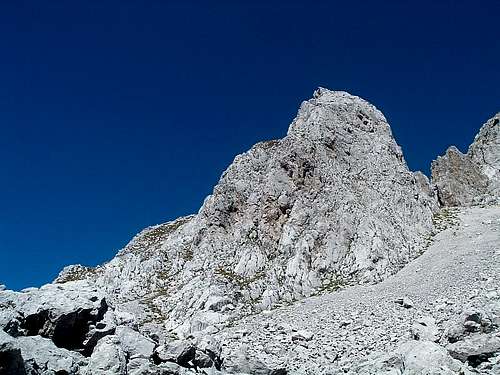
![]()
Maja Shkurt from Maja Koprishtit.
Photo by Dinaric-ZG. |
| |
Name Game
When we made the FA of
Maja Lagojvet in 2009 with
Seba, we named our
route Balkans Peace Park. Along the line, the following summer
John Ely called one of his new routes in Prokletije
Crack of a Peaceful Smuggler, referring to the ancient smuggling trail along the valleys of Ropojana and Thethi. Now I followed this tradition with
Peacehammer and still have on my mind a few ‘peaceful’ names for my routes to come...
Red Tape
Ropojana valley is crossed with the Montenegrin-Albanian border and Maja Shkurt is in Albania. Approaching from the north (from Montenegro), the border must be crossed. Being outside official border crossings this is officially illegal.
Until recently, the Montenegrin border police station at Vusanje served as a semi-official border crossing for hikers going to Ropojana and Maja Jezerce who sometimes registered themselves going to the vague ‘border area’, and crossing the border was most often silently tolerated. As for 2011 the station seems to be abandoned which makes things even easier.
I do not encourage anyone to illegally cross the border as the situation is still unclear and you may be arrested anytime by Montenegrin and Albanian border police if caught. Do it at your own risk if you wish.
In order to stay at the right side of the law, enter Albania via one of official border crossings and go to Ropojana from the south (from Thethi) across the Qafa Peje pass as described in the Approach section.
Acknowledgements
Big thanks to Gordan for his support, encouragement and patience. Without him I would not climb Maja Shkurt. Velika hvala, prijatelju! :-)
In Memory...
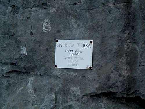
On the descent to Ropojana we took a shortcut and came across a memorial plaque fixed to a rock above an entry to what looked like a large cave. The plaque reads 'Shpella Bubba' (probably 'Bubba Cave' in Albanian) and gives names of two Hungarian cavers, Anna Erdei and Attila Szabó, who died in 2006. I later found out that they died in a caving accident in Italy. It seems that Hungarian cavers who explored Prokletije discovered this cave and named it to commemorate their friends - as far as I understood, 'Bubba' was Attila's nickname.
![]()
Bubba's Cave |
Info from the Hungarian SP-er
peterbud: Anna and Attila died in an avalanche in Italy in 2006. The cross-section of the 'Bubba's cave' in Prokletije can be found
here (as a pdf file). Thanks, Peter!
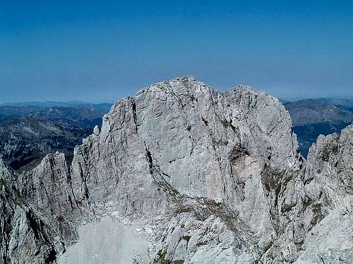
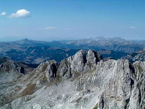
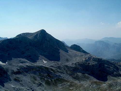
Summit Views
![]()
Maja Lagojvet (view NNE) |
| ![]()
Maja Nigvacit (view NW) |
|
![]()
Maja Shnikut (view SW) |
| ![]()
Maja Jezerce and Maja Popluks (view SE) |
|
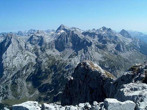
![]()
Panoramic view to the east |
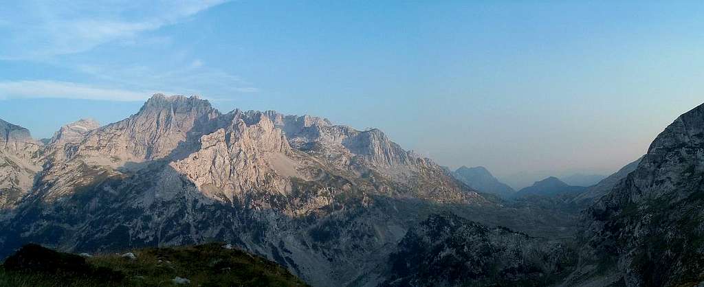
![]()
View from the descent to Ropojana |