It is currently Thu Apr 25, 2024 7:00 am
 News of California
Site map of California » Forum : California
Regional discussion and conditions reports for the Golden State. Please post partners requests and trip plans in the California Climbing Partners forum.Tioga Pass
Does anyone know if Tioga Pass is going to reopen? I notice on the webcam for the entry station it looks like the park service has it plowed out but CalTrans still has it closed at the bottom of the hill.
Read more : Tioga Pass | Views : 2056 | Replies : 2
Snow in SoCal
This photo was taken this morning in the San Gabriel Mountains:
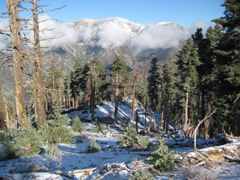
Read more : Snow in SoCal | Views : 12669 | Replies : 50
competent sports medicine MD - Glendale/Pasadena area?
Any recommendations for a good sports medicine MD within 10 miles of Glendale/Pasadena? I've got Aetna PPO so no Kaiser docs pls. thanks
Read more : competent sports medicine MD - Glendale/Pasadena area? | Views : 963 | Replies : 3
Awesome timelapse video from the California mountains
http://www.vimeo.com/6686768
It includes the Sierra, the Whites, and Joshua Tree.
Some of the clips look fake, but he has other videos showing his setup and how he did it, so they're all real, amazingly.
It includes the Sierra, the Whites, and Joshua Tree.
Some of the clips look fake, but he has other videos showing his setup and how he did it, so they're all real, amazingly.
Read more : Awesome timelapse video from the California mountains | Views : 1735 | Replies : 10
Anybody up for Matterhorn, Blacksmith, similar this wkend?
Just moved backed out here after years away. Can't wait til next season to get back in the mtns. I'm in the Bay Area, happy to do the driving, or share gas, or whatever.
Would prefer something with real climbing, albeit easy?, snow and ice fine. N. Arete Matterhorn, Bear Creek Spire, something in Minarets?
Brandon
Would prefer something with real climbing, albeit easy?, snow and ice fine. N. Arete Matterhorn, Bear Creek Spire, something in Minarets?
Brandon
Read more : Anybody up for Matterhorn, Blacksmith, similar this wkend? | Views : 812 | Replies : 2
Idyllwild Climbing History
Is anyone going to Royal Robbins lecture next week? which includes a preview of the climbing exhibit.
Read more : Idyllwild Climbing History | Views : 11936 | Replies : 33
Angeles Crest Highway
I understand that ACH is opening the first weekend of December.
Read more : Angeles Crest Highway | Views : 8640 | Replies : 20
Best Onion Valley map?
What is the best map of the peaks around Onion Valley (Independence, University, Gould, Dragon, Kearsarge, etc.) that can be purchased online? I need it soon . . .
I have Tom Harrison's Sequoia and King's Canyon map, but the Onion Valley region is not covered in sufficient detail.
I have Tom Harrison's Sequoia and King's Canyon map, but the Onion Valley region is not covered in sufficient detail.
Read more : Best Onion Valley map? | Views : 4053 | Replies : 7
Vincent Gap?
Is Vincent Gap open from the east? The SP page for Baden-Powell says that it's closed as of September 30, 2009. It also said that the gap was 5.5 miles west of Big Pine. This page says the ACH is open to 6.5 miles west of Big Pine: http://www.dot.ca.gov/cgi-bin/roads.cgi
Anyone been up there recently?
Anyone been up there recently?
Read more : Vincent Gap? | Views : 1129 | Replies : 4
Last 10 active topics
Statistics
Total posts 557946 • Total topics 55836 • Total members 136398