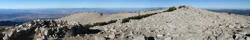
Longest lines of sight photographed.......

Post general questions and discuss issues related to climbing.
User Avatar
Gafoto

 
Posts: 213
Joined: Tue Aug 18, 2009 3:08 am
Thanked: 21 times in 17 posts

by Gafoto » Mon Feb 15, 2010 8:41 pm

Day Hiker wrote:
Gafoto wrote:This second picture I'm not so sure about. This is facing just slightly more northern than the previous shot, looking roughly in the direction of Aspen. These mountains were really far away and I still have no idea exactly which ones these are.

Click for the full size image:
Image

Any Colorado natives able to ID these mountains? Sorry for the poor picture quality, I had to try to increase the visibility with some photo editing.


I generated an image to compare, but the link for the full-size photo is asking for a yahoo login. Do you have another way for me to see it? The other photo worked without this problem.


Sorry, I messed up the link on that one. This should work:

http://farm5.static.flickr.com/4025/435 ... f5d9_o.jpg

User Avatar
wasclywabbit

 
Posts: 30
Joined: Tue Mar 18, 2008 5:31 pm
Thanked: 0 time in 0 post

by wasclywabbit » Tue Feb 16, 2010 12:28 am

Gafoto wrote:
Day Hiker wrote:
Gafoto wrote:This second picture I'm not so sure about. This is facing just slightly more northern than the previous shot, looking roughly in the direction of Aspen. These mountains were really far away and I still have no idea exactly which ones these are.

Click for the full size image:
Image

Any Colorado natives able to ID these mountains? Sorry for the poor picture quality, I had to try to increase the visibility with some photo editing.


I generated an image to compare, but the link for the full-size photo is asking for a yahoo login. Do you have another way for me to see it? The other photo worked without this problem.


Sorry, I messed up the link on that one. This should work:

http://farm5.static.flickr.com/4025/435 ... f5d9_o.jpg


That really looks like Capitol on the far left of the snowy peaks. It's hard to see because it has less snow on it than the surrounding high points. I wouldn't bet money on this btw, but it sure looks like it.

User Avatar
Day Hiker

 
Posts: 3156
Joined: Fri Dec 26, 2003 2:57 am
Thanked: 61 times in 43 posts

by Day Hiker » Tue Feb 16, 2010 8:36 am

wasclywabbit wrote:
Gafoto wrote:
Day Hiker wrote:I generated an image to compare, but the link for the full-size photo is asking for a yahoo login. Do you have another way for me to see it? The other photo worked without this problem.


Sorry, I messed up the link on that one. This should work:

http://farm5.static.flickr.com/4025/435 ... f5d9_o.jpg


That really looks like Capitol on the far left of the snowy peaks. It's hard to see because it has less snow on it than the surrounding high points. I wouldn't bet money on this btw, but it sure looks like it.


You should have bet money.

Image

Photo on top, CGI on bottom, like the previous set. The angle at the top of this one is because I did a slight rotate on the photo to level it.

The mountain elevations may not be the current values. Everything in CO was shifted up a while back. I do not know all these peaks from memory; I just read the elevations from what is shown on the topo map on mytopo.com.

User Avatar
wasclywabbit

 
Posts: 30
Joined: Tue Mar 18, 2008 5:31 pm
Thanked: 0 time in 0 post

by wasclywabbit » Tue Feb 16, 2010 2:34 pm

Is it too late to bet? :D

I didn't notice the Bells peaking up above that ridge. I was trying to find them for reference and didn't see them. I better get new bifocals.

Nice job on this btw. It's very interesting.

User Avatar
Day Hiker

 
Posts: 3156
Joined: Fri Dec 26, 2003 2:57 am
Thanked: 61 times in 43 posts

by Day Hiker » Tue Feb 16, 2010 4:55 pm

wasclywabbit wrote:I didn't notice the Bells peaking up above that ridge. I was trying to find them for reference and didn't see them. I better get new bifocals.


The only reason I caught them is because the CG image indicated they were visible. Just looking at the unedited photo, I doubt I could pick out something like that, unless I were really familiar with the range, which I am not. But once you know where to look and what appearance they should have (from the CG image), they can be barely detected in the actual photo, once contrast enhancement and darkening are applied.

User Avatar
Gafoto

 
Posts: 213
Joined: Tue Aug 18, 2009 3:08 am
Thanked: 21 times in 17 posts

by Gafoto » Tue Feb 16, 2010 5:37 pm

134 miles! Not too shabby at all.

User Avatar
Dan Leonhard

 
Posts: 23
Joined: Wed Sep 28, 2005 7:09 pm
Thanked: 0 time in 0 post

by Dan Leonhard » Wed Feb 17, 2010 6:18 pm

this is a cool thread that sparked curiosity about one of my own photos that I had since forgotten about. This photo was taken from Thunder Mountain in Juneau, AK (N 58.381389 and W -134.524167) looking west toward Glacier Bay:
http://www.summitpost.org/image/597796/176118/chilkat-range-and-fairweather.html

Judging from the size of the peak and direction, I think you can see Mount Fairweather behind the Chilkat Range. About 120 miles line of sight. If this is fairweather, it'd probably be my record to date.

User Avatar
Marmaduke

 
Posts: 1541
Joined: Tue Feb 02, 2010 1:08 am
Thanked: 730 times in 563 posts

by Marmaduke » Wed Feb 17, 2010 7:08 pm

"Steelman" reports on his Dick's Peak page (Desolation Wilderness/South Tahoe) that the Trinity Alps are visable on clear days. Not sure of the distance but looks to be about 175 miles. Troy

User Avatar
calebEOC

 
Posts: 518
Joined: Tue Jun 21, 2005 3:47 pm
Thanked: 0 time in 0 post

by calebEOC » Fri Feb 19, 2010 1:33 am

Adams at 130 miles
Image

Rainier at 150 miles
Image

Stuart at 120+ miles (only 9451 elevation)
Image[/img]
Last edited by calebEOC on Sun Feb 21, 2010 9:47 pm, edited 1 time in total.

User Avatar
simonov

 
Posts: 1395
Joined: Thu Mar 23, 2006 3:07 pm
Thanked: 786 times in 451 posts

by simonov » Fri Feb 19, 2010 4:00 pm

Click on the photo for a larger image:

Image

Visible from the top of Mt San Gorgonio on a clear November morning:

San Clemente Island, 125 miles away.
Sierra Nevada, 185 miles away.
Mt Charleston, about 163 miles away.

User Avatar
Iron Hiker

 
Posts: 42
Joined: Thu Mar 22, 2001 1:00 pm
Thanked: 3 times in 2 posts

Re: Not Rainier

by Iron Hiker » Fri Feb 26, 2010 11:15 pm

billisfree wrote:The sunset picture presented in the first post strongly appears to be Mt. Adams to me.


Image

It's kinda hard to get a really sharp detailed topo pictures... because I need
to back off quite a distance, to make sure the provile is not deformed
by rendering the pictures too close.

Mt Adams has 3 "humps" while Rainier has two.

Plus a few other obvious features.

Remember light bends in the air and can sometimes create mirages... making
a mountain look taller than normal.


Nice observations.....but not quite correct, I think. Your 3D of Rainier is actually too close to the mountain - if you back it off more to better simulate how it looks from that far away in Oregon, Liberty Cap will come into view and thus serve as the "hump" on the right. Point Success, Columbia Crest, and Liberty Cap are the three humps seen on Rainier.

I'm trying to figure out how to post a Google Earth 3D shot of Rainier from the ESE from my computer on here....never done it before. I think I have to save it somewhere on the web first to provide a link? Anyway, if you go to the 3D I think it is reasonably clear that it's Rainier we're talking about......

User Avatar
Iron Hiker

 
Posts: 42
Joined: Thu Mar 22, 2001 1:00 pm
Thanked: 3 times in 2 posts

Re: I can see Colorado from here!

by Iron Hiker » Fri Feb 26, 2010 11:25 pm

seano wrote:San Antonio Mountain from Santa Fe Baldy:
Image
Either Culebra or Blanca (I think) from Santa Fe Baldy (giant original here):
Image


You got a biggie long view here on the bottom shot, I believe! According to the Heywhatsthat.com panorama I generated from Santa Fe Baldy, the Blanca group is on the right side of the photo, 120-125 miles away, and the northern Sangres fade away into the distance at left. The Crestones are visible, and you can see about 165 miles to where the range disappears. That's a pretty good shot!

You can also see 170 miles to the La Plata Mts NW of Durango as well, and the Capitan Mts near Sierra Blanca are just under 160 miles away. Good place for long-range views!

User Avatar
Iron Hiker

 
Posts: 42
Joined: Thu Mar 22, 2001 1:00 pm
Thanked: 3 times in 2 posts

Tough, but I have my theory

by Iron Hiker » Fri Feb 26, 2010 11:45 pm

Dan Leonhard wrote:this is a cool thread that sparked curiosity about one of my own photos that I had since forgotten about. This photo was taken from Thunder Mountain in Juneau, AK (N 58.381389 and W -134.524167) looking west toward Glacier Bay:
http://www.summitpost.org/image/597796/176118/chilkat-range-and-fairweather.html

Judging from the size of the peak and direction, I think you can see Mount Fairweather behind the Chilkat Range. About 120 miles line of sight. If this is fairweather, it'd probably be my record to date.


Neat shot. Unfortunately, thanks to the abysmal terrain data for Fairweather, it doesn't even show up on the Google Earth 3D, so I cannot be as sure of the identification here. That being said, after careful analysis I believe that the sharp peak on the center right background is actually Mount Crillon to the south of Fairweather, and the other point on the photo's far left is Mt. La Perouse. I carefully looked at the terrain in the photo and matched it up with GE to make sure of it. It seems the prominent dark squaretop peak rising right above the water is Mount Golub, and if you line Thunder up with Crillon, the line passes right to the left of Golub, just as the photo shows. Crillon is just short of 100 miles away, so still a respectable view in these stormy SE Alaska environs!

By the way, Fairweather is still in the line of sight from Thunder, I believe - just a bit farther to the right, out of the photo. Maybe if you took plenty of shots there might be one of it?

That was a fun exercise. Let's get some more photos into the mix if we can. I'm glad the thread has been resurrected!

User Avatar
seano

 
Posts: 490
Joined: Tue Mar 11, 2008 4:52 pm
Thanked: 132 times in 110 posts

Re: I can see Colorado from here!

by seano » Sat Feb 27, 2010 1:51 am

Iron Hiker wrote:You got a biggie long view here on the bottom shot, I believe! According to the Heywhatsthat.com panorama I generated from Santa Fe Baldy, the Blanca group is on the right side of the photo, 120-125 miles away, and the northern Sangres fade away into the distance at left. The Crestones are visible, and you can see about 165 miles to where the range disappears.

Sweet! I thought it might be Blanca and the Crestones, but couldn't imagine I could see that far. This was on New Year's, a windless, clear day after a good snowstorm, so it was pretty close to ideal viewing conditions.

PreviousNext

Return to General


  • Related topics
    Replies
    Views
    Last post

Who is online

Users browsing this forum: No registered users and 0 guests