Page 3 of 4

PostPosted: Wed Sep 30, 2009 12:59 am
by seano
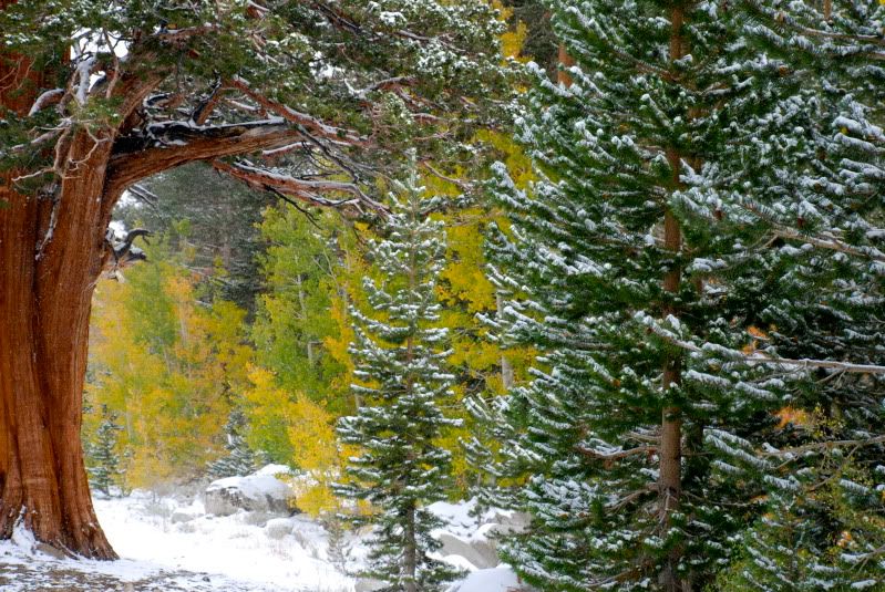
Nice colors below Piute Crags yesterday:
Image

PostPosted: Wed Sep 30, 2009 2:44 am
by QITNL
Exiting TM campground yesterday around noon. Spooky quiet.

Image

Image

Came back to find a new-look Supertaco with a photo upload feature.
Testing here to see if you can crosslink. Answer: you can.

PostPosted: Wed Sep 30, 2009 6:52 pm
by peninsula
Fall color is looking good! I'm looking forward to 20 days in the eastern Sierra. A good article on Sierra Fall colors: http://www.sacbee.com/1232/rich_media/2179852.html

PostPosted: Thu Oct 01, 2009 5:09 am
by EManBevHills
Great link, Peninsula.

Thanks for posting it and have a fab trip!

PostPosted: Thu Oct 01, 2009 4:36 pm
by sierra4mee
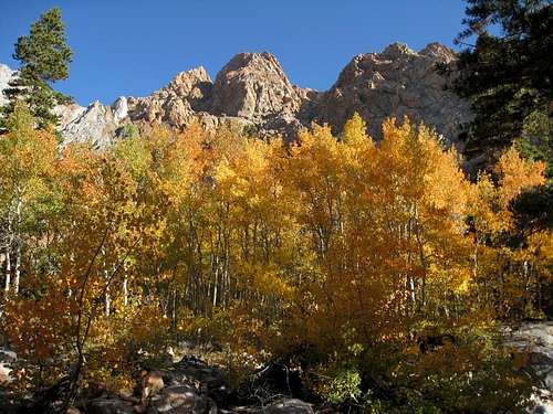
wingding wrote:The fall colors were pretty along the Horton Creek Trail yesterday, but my bright idea of trying to get up to Basin Mountain with a bad cold failed. I got to 10,900' and called it a day, but that gave me more time to enjoy the leaves before heading home.

Fall Colors along the Horton Creek Trail yesterday:

http://kathywing.smugmug.com/California-Hiking-Scrambling/Sierra-Nevada-Hiking/Horton-Creek-Trail-92609/9771456_cmmz2#662459882_cNwrm


I was thinking of going up to shoot the Sunboy Mine and fall colors. How did the aspens look there? Close to peak? thanks for the info!

PostPosted: Thu Oct 01, 2009 5:14 pm
by KathyW
Above 9,000' feet the aspens were starting to peak, but below that there was a lot of green still.

I'll bet it will be beautiful this weekend.

PostPosted: Thu Oct 01, 2009 7:42 pm
by KathyW
Horton Lake is really nice. Be warned - the road is rough as you get close to the locked gate, but do-able with a truck - I only hit bottom once in a stock 4WD Toyota Tacoma and I probably could have avoided that by being more careful.

PostPosted: Fri Oct 02, 2009 12:39 am
by sierra4mee
thanks wingding! I may go up there this weekend to avoid the crowds in the canyon!

PostPosted: Sun Oct 04, 2009 2:58 am
by KathyW
For those of us way down here in the southern end of California, the Aspen Grove in the San Bernardino National Forest was really pretty today:

http://kathywing.smugmug.com/California-Hiking-Scrambling/Southern-California-Mountains/Aspen-Grove-10309/9842107_nfkr5#P-1-15

PostPosted: Sun Oct 04, 2009 6:54 pm
by MCGusto
wingding wrote:For those of us way down here in the southern end of California, the Aspen Grove in the San Bernardino National Forest was really pretty today:

http://kathywing.smugmug.com/California-Hiking-Scrambling/Southern-California-Mountains/Aspen-Grove-10309/9842107_nfkr5#P-1-15


Hey Kathy,

Where is this Aspen Grove found?

Gusto

PostPosted: Mon Oct 05, 2009 3:28 am
by KathyW
Image

Directions to the parking area: Turn right (south) off Highway 38 about 6 miles past the Barton Flats Visitor Center on Forest Service Road 1N02. Follow 1N02 until it forks right to 1N05. Go right up 1N05 (this is a rough unmaintained road but passenger cars can slowly get to the parking area) to the signed Aspen Grove Trail parking (7,400'), 2.6 miles in from Highway 38.

The best part of the grove is found by heading right after you cross the creek the first time (if you go left you'll head toward the Fish Creek Trail). Just keep following the trails that run on either side of the creek and you'll run into a really nice section about 1/2 mile or so from the first creek crossing. There are some old beaver dams in that area too.

There's supposed to be another aspen grove in the Broom Flat area of the San Bernardino National Forest. Sometime I'm going to go look for that second aspen grove. Here's some info on it:

http://www.fs.fed.us/psw/programs/rna/gtr_chapters_pdf/broom_flat_rna.pdf

PostPosted: Mon Oct 05, 2009 6:19 am
by MCGusto
wingding wrote:Image

Directions to the parking area: Turn right (south) off Highway 38 about 6 miles past the Barton Flats Visitor Center on Forest Service Road 1N02. Follow 1N02 until it forks right to 1N05. Go right up 1N05 (this is a rough unmaintained road but passenger cars can slowly get to the parking area) to the signed Aspen Grove Trail parking (7,400'), 2.6 miles in from Highway 38.

The best part of the grove is found by heading right after you cross the creek the first time (if you go left you'll head toward the Fish Creek Trail). Just keep following the trails that run on either side of the creek and you'll run into a really nice section about 1/2 mile or so from the first creek crossing. There are some old beaver dams in that area too.

There's supposed to be another aspen grove in the Broom Flat area of the San Bernardino National Forest. Sometime I'm going to go look for that second aspen grove. Here's some info on it:

http://www.fs.fed.us/psw/programs/rna/gtr_chapters_pdf/broom_flat_rna.pdf


Thanks for the details! I'll definitely check that out this season!

Gusto

Muted and disappointing color in South Fork Drainage

PostPosted: Mon Oct 05, 2009 6:17 pm
by EManBevHills
Mark and I dayhiked Agassiz on Saturday in blustery but clear conditions.
We had a great time in spite of the nasty wind chill.

We also got to meet Richard Piorowski and Sun Nymph @ the Portal Store Sunday morning.
Richard had just completed a double climb of the Mountaineer's Route in a day!
Guess he was looking for an encore after doing 4x on Baldy a while back......
Quite a feat.

Always nice to meet crazy SP'ers in the hills!

Here's a link to a few pix:

http://picasaweb.google.com/EManBevHill ... directlink

PostPosted: Tue Oct 06, 2009 4:28 am
by Say yes to crack
Rock Creek Sunday

Image