Page 1 of 1

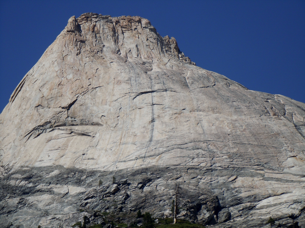
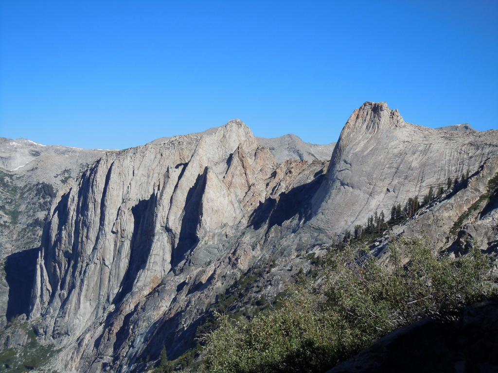
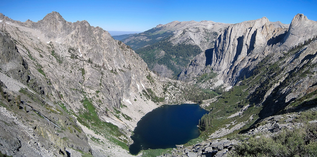
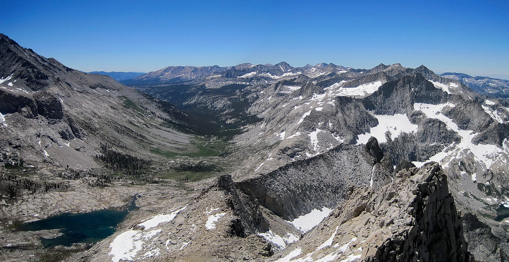
Mount Stewart, Hamilton Lakes and Kaweah Gap Trip Report

PostPosted: Sun Jul 25, 2010 8:34 pm
by Pantilat
Joel Lanz and I climbed 12,205 ft Mount Stewart via Hamilton Lakes and Kaweah Gap on July 22nd. The adventure run was about 46 miles and we started at 4:40 am from the Crescent Meadows Trailhead and finished at 6:50 pm for a 14 hour, 10 minute day. The 21 miles along the High Sierra trail to Kaweah Gap took about 5 hours each way. From the Hamilton Lakes amphitheater to the outstanding summit views, it was some of the best scenery I have seen in the High Sierra.

Complete trip report with many photos and a couple videos here.

Image

Image

PostPosted: Sun Jul 25, 2010 9:02 pm
by thegib
Nice friggin picture!

PostPosted: Mon Jul 26, 2010 8:20 pm
by rochonchis
Great pictures! 46 miles in 14 hours, incredible!!!

you're my hero!

PostPosted: Tue Jul 27, 2010 3:07 am
by mjrangel
We saw you guys on your way in. My wife and I along with my sister were camped at Buck Creek. We thought: man those guys are amazing to be running up here! Plus we saw your packs and knew you weren't planning to stay the night somewhere.

I thought, even to buck creek it would be 20 miles for a return hike and come to find out you were going well beyond that! I very much enjoy the pano of Black K and Eagle Scout. And the pic you took of Lion Rock looks very helpful. You can see the whole 'South Ridge' and 'S Slope' Routes on Lion Rk. You should post these on the Lion Rock page on SP.

PostPosted: Tue Jul 27, 2010 3:53 am
by Sheets
That's Angel Wings in the first photo, right? The dome next to it looks pretty damn sick....what is it? Any route info?

PostPosted: Tue Jul 27, 2010 6:51 am
by Pantilat
Sheets wrote:That's Angel Wings in the first photo, right? The dome next to it looks pretty damn sick....what is it? Any route info?


That's Angel Wings! Indeed, the dome next to it does look sweet. According to Secor it's called "Cherubim Dome" and he has only one route described called "Archangel" - Grade IV, 5.10c. I imagine other routes have been done on such a prominent feature?

Image

Image

PostPosted: Wed Jul 28, 2010 6:57 am
by Sheets
Thanks Leor.

Holy crap--that looks awesome. I've been meaning to go up this way but this trip report really encourages me to get up there this season!

BTW, I'm trying to get back in running shape & do some trail marys later this year.

PostPosted: Wed Jul 28, 2010 10:59 pm
by Pantilat
Sheets wrote:Thanks Leor.

Holy crap--that looks awesome. I've been meaning to go up this way but this trip report really encourages me to get up there this season!

BTW, I'm trying to get back in running shape & do some trail marys later this year.


Sweet, hit me up later this summer and we'll get out on adventure run. Plenty of ideas!